The best running trails around Vaux-Lès-Saint-Claude
4.3
(21)
1,302
runners
125
runs
Jogging around Vaux-Lès-Saint-Claude offers diverse terrain within the Jura Mountains, providing a varied landscape for runners. The region features a network of trails winding through dense forests, along ridges, and beside the Bienne River. Runners can find routes around various lakes and paths leading to viewpoints like Belvédère de la Scia. The terrain ranges from paved sections to more challenging mountainous paths with significant elevation changes, with elevations from 324 to 950 meters.
Best jogging routes around Vaux-Lès-Saint-Claude
- The most popular jogging route is Running loop from Lavans-lès-Saint-Claude, a 6.2 miles (9.9 km) trail that takes 1 hour 9 minutes to complete. This moderate route offers varied terrain starting from Lavans-lès-Saint-Claude.
- Another top favourite among local runners is La Bienne loop from Lavancia-Epercy, a moderate 6.3 miles (10.2 km) path. This route follows the Bienne River, providing scenic riverside running opportunities.
- Local runners also love the Belvédère de la Scia – Cuttura Dam and Lake loop from Lavans-lès-Saint-Claude, a 19.0 miles (30.6 km) trail leading through varied landscapes including a viewpoint and a lake, often completed in about 4 hours 4 minutes.
- Jogging around Vaux-Lès-Saint-Claude is defined by the Jura Mountains, the Bienne River valley, and numerous lakes, with routes offering options for different ability levels.
- The routes in Vaux-Lès-Saint-Claude are highly rated by the komoot community with an average score of 4.0 stars from over 20 reviews. More than 1000 runners have used komoot to explore Vaux-Lès-Saint-Claude's varied terrain.
Last updated: July 11, 2026
10
runners
16.2km
02:07
430m
430m
Hard run. Very good fitness required. Mostly paved surfaces. Suitable for all skill levels.
9
runners
6.54km
00:41
70m
70m
Moderate run. Good fitness required. Mostly paved surfaces. Suitable for all skill levels.

Sign up for free
5
runners
8.33km
00:59
170m
160m
Moderate run. Good fitness required. Mostly paved surfaces. Suitable for all skill levels.
5
runners
15.2km
02:03
410m
410m
Hard run. Very good fitness required. Mostly paved surfaces. Suitable for all skill levels.
5
runners
6.70km
00:43
70m
70m
Moderate run. Good fitness required. Mostly paved surfaces. Suitable for all skill levels.
Get access to more routes and recommendations from other explorers.
Sign up for free
Already have an account?
Our route recommendations are based on thousands of hikes, rides, and runs completed by other people on komoot.
Start today with a free account
Your next adventure awaits.
Login or Signup

Tips from the Community

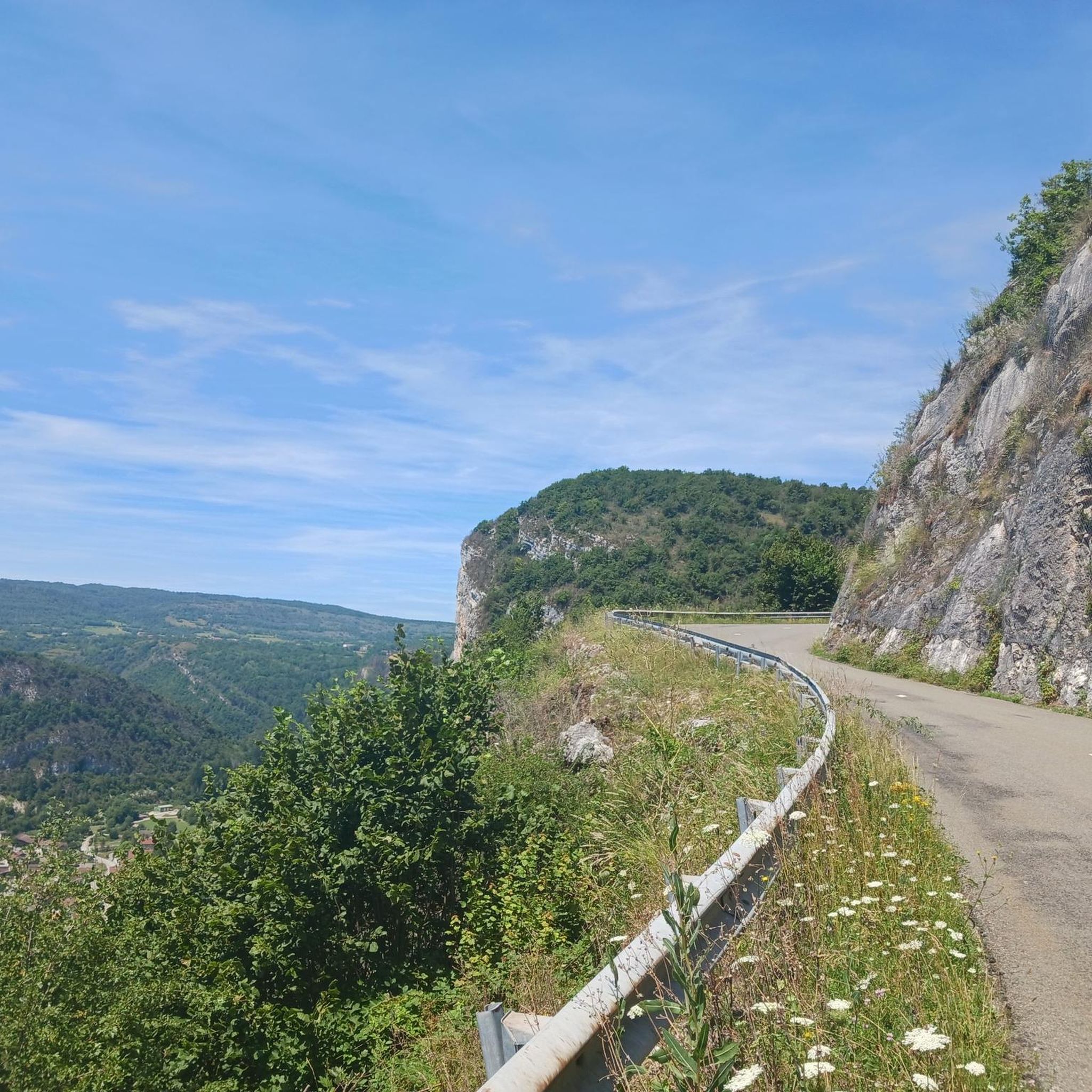
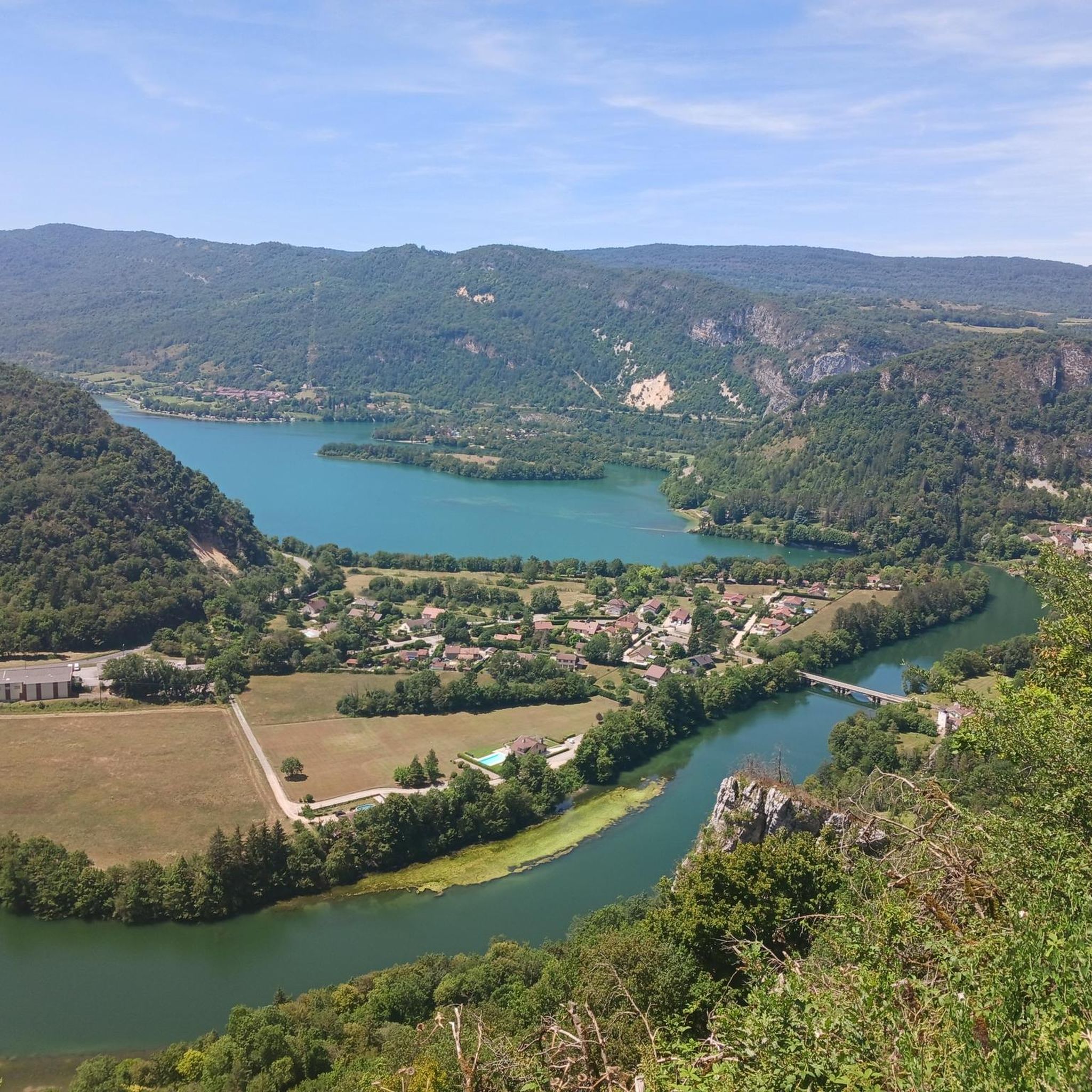
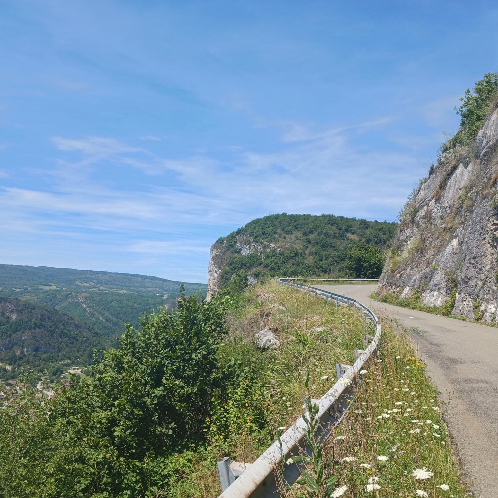
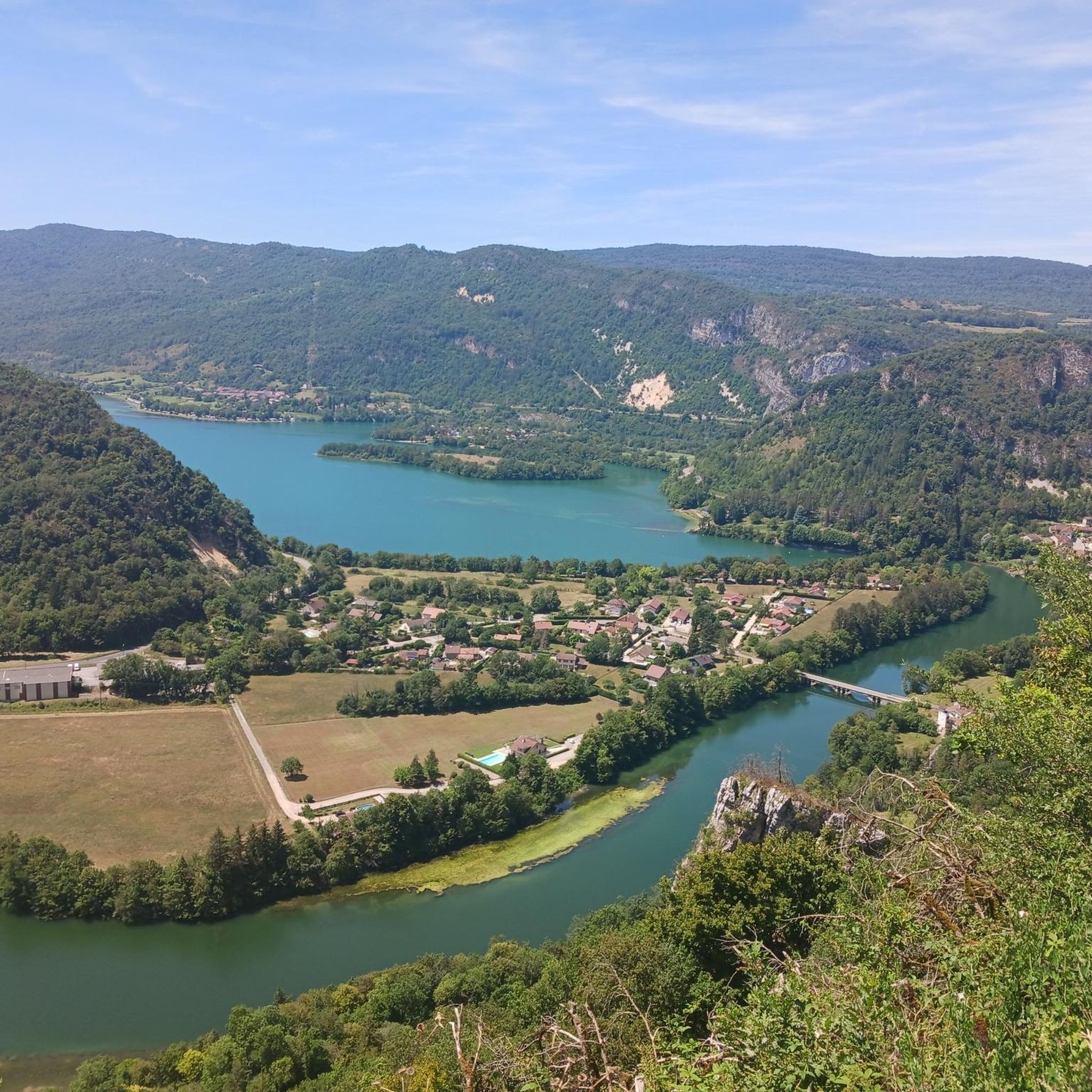
Crossing the Bois de Champois guides you to Saint-Romain-de-Roche. This descent in woods and glades offers you a clear view, sublime in all seasons. The highlight of this segment is the arrival at the Roche de Vaux. At this level, the path marries a very clear balcony on the valley of the Bienne and the small town of Vaux-lès-Saint-Claude.
0
0
Frequently Asked Questions
How many running routes are available in Vaux-Lès-Saint-Claude?
The region around Vaux-Lès-Saint-Claude offers a wide selection of running trails, with over 100 routes available for you to explore. These routes cater to various fitness levels and preferences, winding through the diverse landscapes of the Jura Mountains.
Are there jogging routes suitable for beginners or those looking for an easy run?
Yes, Vaux-Lès-Saint-Claude has routes suitable for all skill levels. While many trails offer significant elevation, there are also easier options, including some with mostly paved surfaces. For example, you can find routes with minimal elevation gain, perfect for a relaxed jog.
Can I find challenging trail running routes in the Jura Mountains around Vaux-Lès-Saint-Claude?
Absolutely. The Jura Mountains provide an excellent backdrop for challenging trail running. With nearly 50 difficult routes, you'll find trails with significant elevation gains and varied terrain, including technical slopes and rocky paths. The Belvédère de la Scia – Cuttura Dam and Lake loop from Lavans-lès-Saint-Claude is a longer, more difficult option, offering a substantial workout.
Are there any running trails that offer scenic views or pass by viewpoints?
Yes, the region is rich in stunning viewpoints. Many running routes will lead you to belvédères offering panoramic vistas. The Belvédère de la Scia, for instance, provides superb views over the Haute Chaîne du Jura. Other highlights like the Chancia Viewpoint and View of Lac de Vouglans also offer breathtaking scenery along your run.
Are there running routes that follow rivers or pass by lakes and waterfalls?
The Bienne River flows through the region, offering scenic riverside running. The La Bienne loop from Lavancia-Epercy is a popular choice for this. You'll also find routes near beautiful lakes like Lac de Cuttura and Lac de Vouglans. For waterfalls, consider trails that lead to natural monuments such as the Moulin de Vulvoz Waterfall, providing picturesque natural sights.
What do other runners enjoy the most about jogging in Vaux-Lès-Saint-Claude?
The running trails in Vaux-Lès-Saint-Claude are highly rated by the komoot community, with an average score of 4.0 stars from over 20 reviews. Runners frequently praise the diverse terrain, the stunning natural beauty of the Jura Mountains, and the variety of routes available, from riverside paths to challenging mountain trails.
Are there any circular running routes around Vaux-Lès-Saint-Claude?
Yes, many of the running routes in the area are designed as loops, allowing you to start and finish at the same point. Examples include the popular Running loop from Lavans-lès-Saint-Claude and the La Bienne loop from Vaux-lès-Saint-Claude, which offer convenient circular options.
Can I bring my dog on the running trails in this region?
The Jura Mountains and Haut-Jura Regional Nature Park are generally dog-friendly, but it's always best to check specific trail regulations. Many trails allow dogs, often requiring them to be on a leash, especially in protected areas or near wildlife. Ensure your dog is well-behaved and that you clean up after them to preserve the natural environment.
What is the best time of year for jogging in Vaux-Lès-Saint-Claude?
The region offers great running opportunities throughout much of the year. Spring and autumn provide pleasant temperatures and beautiful scenery with changing foliage. Summer is also popular, though some higher altitude trails might be warmer. Winter running is possible, especially on lower elevation paths, but be prepared for snow and ice on more challenging mountain trails.
Are there any long-distance running options for experienced athletes?
For those seeking longer distances, the region delivers. The Belvédère de la Scia – Cuttura Dam and Lake loop from Lavans-lès-Saint-Claude is a significant 30.6 km (19.0 miles) route. Additionally, the 'Espace Haut-Jura Trail' offers over 300 kilometers of marked trails across more than 20 mid-mountain routes, perfect for endurance training.
Is public transport available to access running trails around Vaux-Lès-Saint-Claude?
While Vaux-Lès-Saint-Claude is well-suited for outdoor activities, public transport options directly to trailheads can be limited. It's advisable to check local bus schedules or consider driving to access a wider range of starting points for your runs. Many routes, like those starting from Lavans-lès-Saint-Claude or Lavancia-Epercy, are easily accessible by car.
Are there any specific events or festivals for runners in the area?
Yes, the region hosts events that runners might enjoy. The 'Trail des Lacs' is a notable 55km course that allows participants to discover the natural riches of the Jura mountains. Additionally, the annual Saint-Claude Outdoor Festival in July celebrates outdoor adventure, often including organized hikes and activities that align with a runner's interests.
Most popular routes around Vaux-Lès-Saint-Claude
Most popular attractions around Vaux-Lès-Saint-Claude

Get inspired with the komoot mobile app


Explore more
Browse the best Running Trails & Routes in other regions.
