The best road cycling routes around Hirtzbach
4.7
(207)
4,242
riders
260
rides
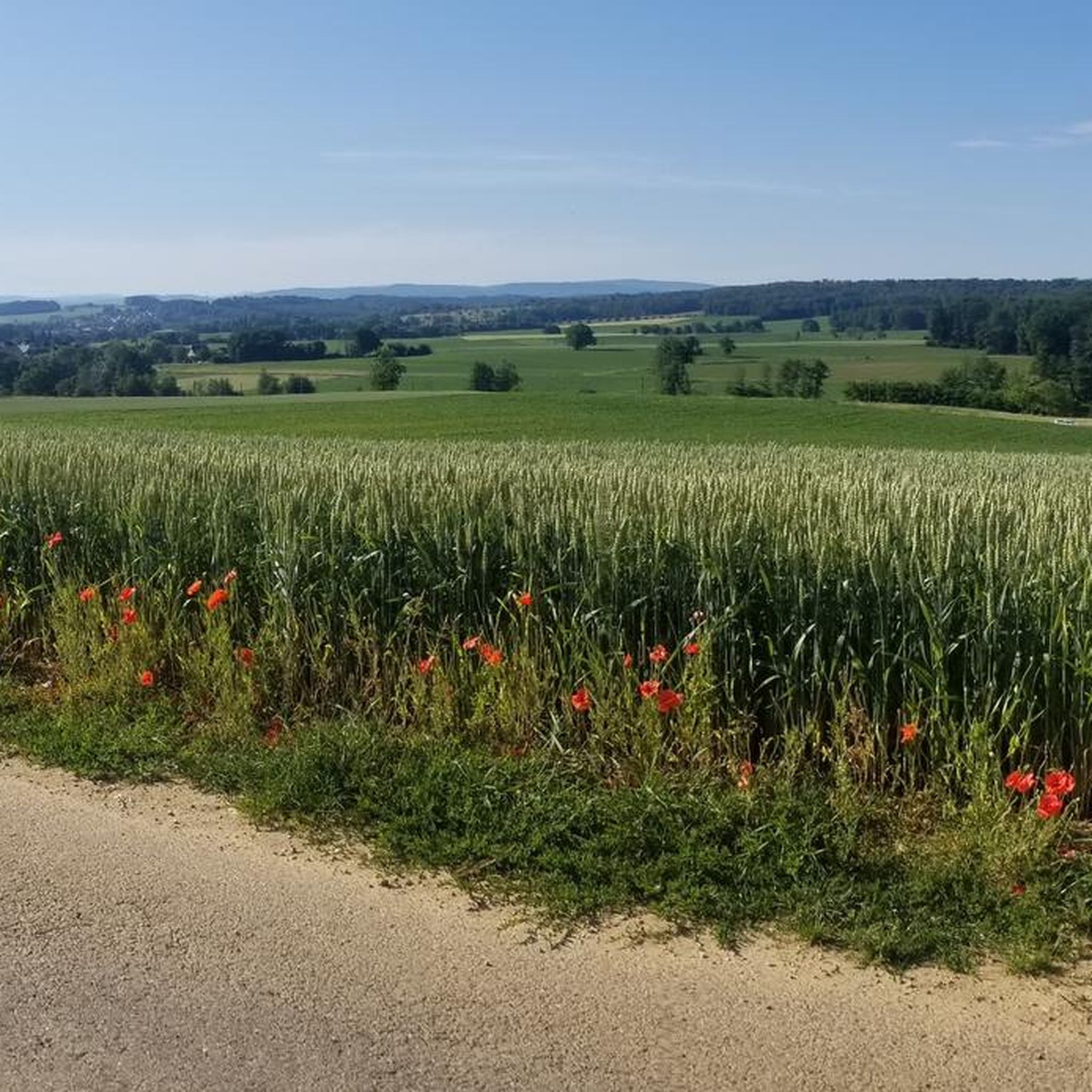
Road cycling routes around Hirtzbach traverse the scenic Sundgau region of southern Alsace, characterized by rolling hills, extensive forests, and tranquil streams. The area features a network of well-maintained secondary roads and cycle paths, offering varied terrain for cyclists. This landscape provides a mix of flatter sections along waterways and more challenging ascents through wooded areas. The region's commitment to preserving its natural beauty contributes to a pleasant cycling experience.
Best road cycling routes around Hirtzbach
- The most popular road cycling route is Pretty village center 🏘 – Knoeringe > Jettingen loop from Altkirch, a 30.8 miles (49.7 km) trail that takes 2 hours 4 minutes to complete. This moderate route offers views of the village center and surrounding countryside.
- Another top favourite among local road cyclists is Altkirch – Porte de Belfort loop from Altkirch, an easy 17.0 miles (27.3 km) path. This route provides a gentle ride through the local landscape, suitable for a relaxed outing.
- Local road cyclists also love the Blochmont Pass – Vue sur Wolschwiller loop from Altkirch, a 45.0 miles (72.3 km) trail leading through the Blochmont Pass, often completed in about 3 hours 34 minutes.
- Road cycling around Hirtzbach is defined by rolling hills, extensive forests, and quiet secondary roads. The network offers options for different ability levels, from easy rides to more challenging ascents.
- The routes in Hirtzbach are highly rated by the komoot community with an average score of 4.6 stars from over 160 reviews. More than 3,500 road cyclists have used komoot to explore Hirtzbach's varied terrain.
Last updated: October 20, 2026
4.7
(3)
50
riders
49.0km
02:02
300m
300m
Moderate road ride. Good fitness required. Mostly well-paved surfaces and easy to ride.
49
riders
27.7km
01:27
280m
280m
Easy road ride. Mostly well-paved surfaces and easy to ride.

4.7
(3)
34
riders
33.2km
01:35
260m
260m
Easy road ride. Mostly well-paved surfaces and easy to ride.
23
riders
55.7km
02:31
540m
540m
Moderate road ride. Good fitness required. Mostly well-paved surfaces and easy to ride.
13
riders
14.5km
00:41
160m
160m
Easy road ride. Mostly well-paved surfaces and easy to ride.
Get access to more routes and recommendations from other explorers.
Already have an account?
Our route recommendations are based on thousands of hikes, rides, and runs completed by other people on komoot.
Start today with a free account
Your next adventure awaits.

Tips from the Community

Altkirch Altkirch is the historic capital of the Sundgau and lies on a striking rocky spur above the valley of the Ill. The town's origins date back to the Middle Ages. The Counts of Ferrette built Altkirch into a fortified town; from 1215 onwards, it was protected by town walls and towers. The characteristic layout, narrow streets, and remnants of the fortifications have been preserved from this medieval town plan to this day. Particularly worth seeing is the Vieille Porte, a former town gate from around 1245. For centuries, Altkirch was an important administrative and commercial center of the Sundgau. After the destructions of the Thirty Years' War, numerous buildings were newly erected. The representative town hall dates from the 18th century, built in 1778 according to plans by the Swabian architect Jean Nissler. In the 19th century, the town continued to develop: alongside its traditional importance as a market and trading place, industrial enterprises emerged, including the well-known Gilardoni brickworks. The 20th century also left its mark. After the First World War, Altkirch became part of the re-Frenchified Alsace. The memory of this period is evident, among other things, at the Vieille Porte, where a Borne Vauthier commemorates the former front line of 1918. The original Altkirch war memorial from 1927 was destroyed during the German occupation in the Second World War; preserved parts were later integrated into a new memorial. Today, Altkirch, with around 6,000 inhabitants, is an important center of the Sundgau. The historic upper town with its old houses, remnants of fortifications, the town hall, and the Sundgau Museum continues to shape the townscape. Source: Ville d’Altkirch – History of the town
0
0
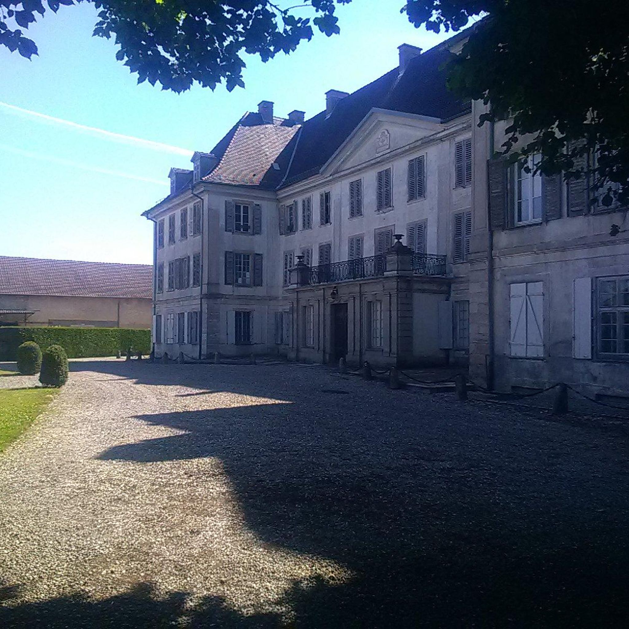
The Altkirch Town Hall stands on the Place de la République in the center of the historic old town. The representative building was erected in 1778/1780 according to the plans of the Swabian architect and surveyor Jean Nissler. The construction work was supervised by the royal engineer Meinrad Stroltz. In contrast, an attribution to the later General Jean-Baptiste Kléber, which was previously widespread, is considered unproven. The building originally had several functions. It simultaneously housed the town court, the court of the bailiwick (Bailliage), and the meeting place of the town council. Thus, the town hall was not only an administrative building but also an important center of public life in Altkirch. Particularly striking is the elaborately designed neoclassical facade. Above the central section is a triangular gable with the coat of arms of the town of Altkirch. The wrought-iron balcony on the first floor also bears the town's coat of arms. The three stone consoles under the balcony show two rampant lions and, in the center, a blindfolded woman. She symbolizes justice – a reference to the building's original function as a court. Another special feature is located above the balcony: the keystone of the window bears the year 1870. A characteristic curved roof turret also rises above the building. The facade and roof of the town hall have been listed as historical monuments since 1937. This makes the building one of Altkirch's significant historical structures and an illustrative example of public architecture from the late 18th century in the Sundgau region. Address: Place de la République, 68130 Altkirch. Further information: Town of Altkirch – History of the Town Hall
0
0
At the gate, a so-called Borne Vauthier can be seen in the middle. These memorial stones mark the course of the Western Front in World War I and, in particular, the position that German troops had reached on July 18, 1918 – the furthest extent of their advance at that time. The stones are named after the French sculptor and former soldier Paul Moreau-Vauthier. A total of 118 such Bornes were created between 1921 and 1927: 96 in France and 22 in Belgium. Originally, significantly more locations were planned. The stones were erected along a front line from the Belgian coast to the Franco-Swiss border. The monoliths, about one meter high, are mostly made of pink granite. On their top, there is a soldier's helmet on a laurel wreath. The sides depict typical soldier's equipment, including a gas mask, a canteen, and hand grenades. Many stones bear the inscription “Ici fut repoussé l’envahisseur 1918” – “Here the invader was repulsed in 1918”. The Bornes Vauthier are therefore not only monuments but also historical landmarks: they make the former front line visible in the terrain and commemorate the battles of 1918. However, it is important to note that they are not located exactly on the former front line everywhere, as some stones were moved for practical reasons, for example, to roads or intersections.
0
0

Unlike the Blochmont, which crosses the same ridge just a little further on, this road from Wolschwiller is considerably more challenging. After a gentle start, the route climbs relatively steeply through the narrow valley. A stream flows to the right, while beautiful rock formations are often visible to the left. At the top, near the unmistakable 'Lange Matte' (Long Meadow), the terrain levels out again, and soon you're at the top.
0
1

Without any car traffic, the cycle path leads over gentle hills from Carspach to Ballersdorf, passing some exciting places such as the model airfield and the fish pond.
0
0
The former Altkirch-Waldighofen railway line has been converted into a cycle path in some sections, leading through fields and forests without disturbing car traffic. Highly recommended!
0
0

Every lock along the route provides for an unusual background and a good memory of your bike trip. A lot of these locks have a bridge going over them, take the time to branch off the bridge and discover some of the nice villages along the canal.
0
0
The French and European National Cycleway is a great cycleway winding along side of the Rhine Rhone Canal with very little climbing, for those who do not like to climb. However those who are climbing shy, must be aware of the wind in this area. A lot of the locks still have the former lock man’s house which adds a bit of charm to every lock. One is never alone on this route as there is a constant passing of bicycles, both leisure and racing bikes.
0
0
Frequently Asked Questions
How many road cycling routes are available around Hirtzbach?
There are over 240 road cycling routes around Hirtzbach, offering a wide variety of options for different skill levels. This includes 66 easy routes, 151 moderate routes, and 28 challenging routes for more experienced cyclists.
What kind of terrain can I expect when road cycling in the Hirtzbach area?
The Hirtzbach area, nestled in the Sundgau region of southern Alsace, features diverse terrain. You'll encounter rolling hills, extensive forests, and tranquil streams. Routes often combine flatter sections along waterways with more challenging ascents through wooded areas, utilizing well-maintained secondary roads and cycle paths.
Are there any family-friendly road cycling routes near Hirtzbach?
Yes, Hirtzbach offers several family-friendly road cycling options. Many of the 66 easy routes are suitable for a relaxed outing. For example, the Altkirch – Porte de Belfort loop from Altkirch is an easy 17.0 miles (27.3 km) path that provides a gentle ride through the local landscape.
What are some notable landmarks or points of interest I can see along the road cycling routes?
While cycling around Hirtzbach, you can explore several interesting landmarks. You might pass by the Eglingen Lock, or the Port of Dannemarie. The region also features the picturesque Hirschbach stream lined with half-timbered houses, and the Charles de Reinach Park with its remarkable vegetation.
What do other road cyclists say about the routes in Hirtzbach?
The road cycling routes in Hirtzbach are highly rated by the komoot community, with an average score of 4.6 stars from over 160 reviews. Cyclists often praise the varied terrain, the scenic beauty of the Sundgau region, and the well-maintained network of secondary roads and cycle paths.
Are there any long-distance road cycling routes available?
Yes, for those seeking longer rides, there are several options. The Blochmont Pass – Vue sur Wolschwiller loop from Altkirch is a challenging 45.0 miles (72.3 km) trail. Another substantial route is the Blochmont Pass – Bridge over the Ill in Fislis loop from Altkirch, covering 55.7 km.
What is the best time of year for road cycling in Hirtzbach?
The Sundgau region generally offers pleasant conditions for road cycling from spring through autumn. The natural beauty, including floral displays, is particularly vibrant during these seasons. While specific weather conditions vary, the well-maintained roads are accessible for much of the year, though winter cycling may require checking for ice or snow.
Is it possible to access road cycling routes in Hirtzbach using public transport?
While specific public transport options directly to trailheads are not detailed, the region's infrastructure, including the mention of the old Hirtzbach station in the context of gravel circuits, suggests that some routes may be accessible via public transport connections to nearby towns like Altkirch. It's advisable to check local transport schedules for specific routes and bike carriage policies.
Where can I find parking for road cycling routes in Hirtzbach?
Hirtzbach, being a village, typically offers various parking options, especially near village centers or designated recreational areas. For routes starting from Altkirch, parking facilities would be available in the town. It's recommended to check specific starting points of your chosen route for the most convenient parking.
Are there any circular road cycling routes around Hirtzbach?
Yes, many of the road cycling routes around Hirtzbach are designed as loops, allowing you to start and finish in the same location. Examples include the Pretty village center 🏘 – Knoeringe > Jettingen loop from Altkirch and the Eglingen Lock – Altkirch loop from Carspach.
Can I find cafes or pubs near the road cycling trails in Hirtzbach?
Hirtzbach and the surrounding Sundgau villages are known for their charming rural character. You can expect to find local cafes and pubs in the village centers, offering opportunities for a break and refreshments during or after your ride. Exploring these local establishments adds to the regional experience.
What are the elevation profiles like on Hirtzbach's road cycling routes?
The elevation profiles vary significantly, reflecting the Sundgau region's rolling hills. Easy routes, like the Eglingen Lock – Altkirch loop from Carspach, have moderate climbs (around 180m elevation gain). More challenging routes, such as the Blochmont Pass – Vue sur Wolschwiller loop from Altkirch, feature substantial ascents, reaching over 1000m in elevation gain.
Most popular attractions around Hirtzbach

Get inspired with the komoot mobile app


Explore more
Browse the best Road cycling routes in other regions.
