The 7 Most Amazing Peaks around Cuvat
Best mountain peaks around Cuvat offer diverse opportunities to explore the region's natural landscape. Cuvat is situated near the mountainous terrain surrounding Lake Annecy, providing access to summits that reach over 1,200 meters above sea level. The area is characterized by significant elevation changes, offering panoramic views of the lake and surrounding mountains. These peaks present various hiking experiences, from intermediate trails to more challenging climbs.
Best mountain peaks around Cuvat
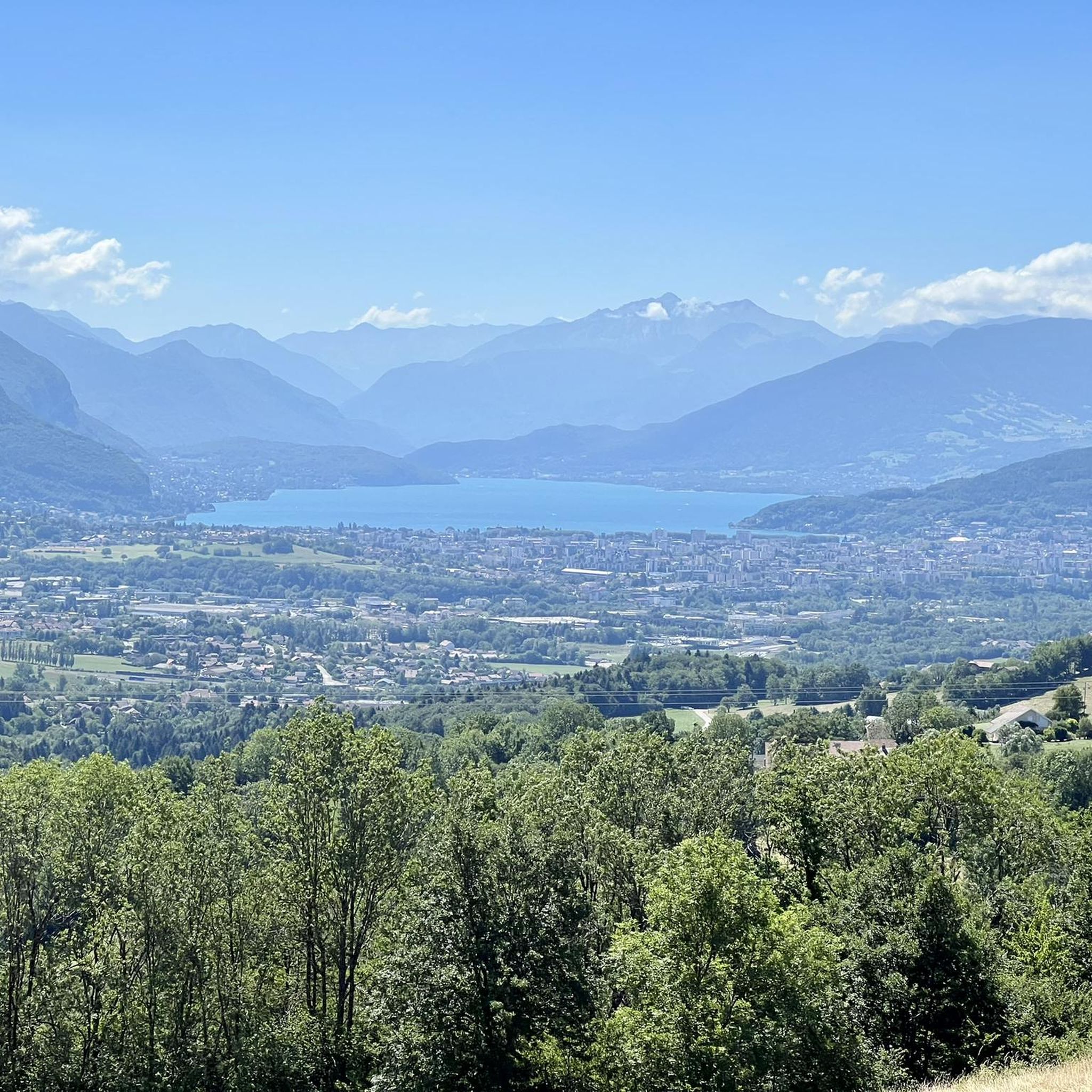
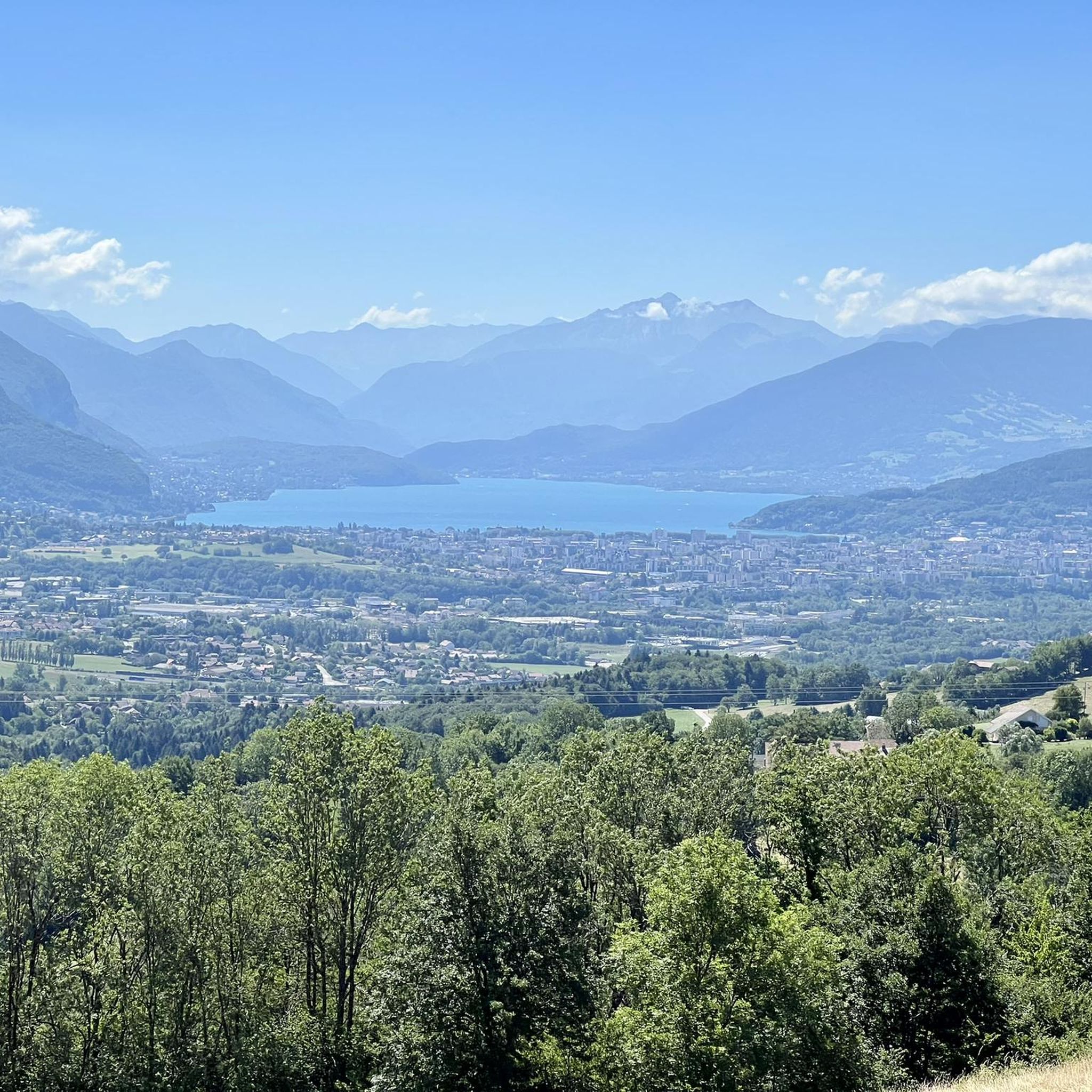
- The most popular mountain peaks is View of Lake Annecy from Mont Veyrier, a viewpoint that rises to 1,291 meters above sea level. This summit provides extensive views of Annecy and its lake.
- Another must-see spot is View of Lake Annecy from Mont Baron, a viewpoint located at 1,299 meters above sea level. Visitors can expect superb views of Lake Annecy, Annecy, and the surrounding mountains, including distant views of Mont Blanc.
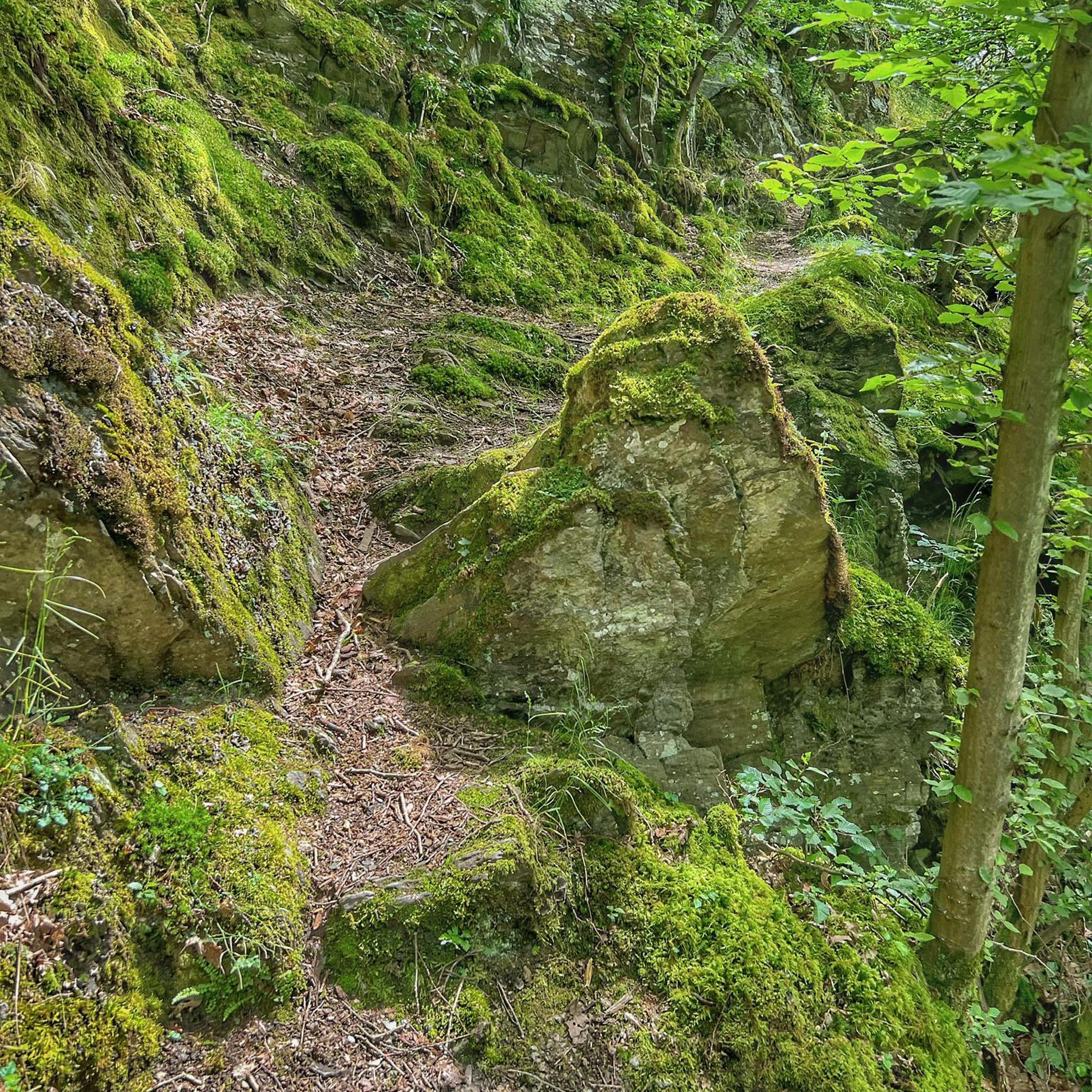
- Visitors also love High-altitude path from Col des Sauts to Mont Baron, a trail offering continuous scenic views. This passage is known for its magnificent vistas over the lake throughout the hike.
- Cuvat is known for its summits, scenic viewpoints, and challenging trails. The region offers a variety of mountain peaks to see and explore, including those with huts and forest sections.
- The mountain peaks around Cuvat are appreciated by the komoot community, with more than 380 upvotes and over 50 photos shared by users.
Last updated: June 24, 2026
View of Lake Annecy from Mont Veyrier
Highlight • Viewpoint
Translated by Google •
Tip by

View of Lake Annecy from Mont Baron
Highlight • Viewpoint
Translated by Google •
Tip by
Sign up now to discover places like this
Get recommendations on the best single tracks, peaks, & plenty of other exciting outdoor places.
Sign up for free
High-altitude path from Col des Sauts to Mont Baron
Highlight (Segment) • Trail
Translated by Google •
Tip by

Tête du Parmelan
Highlight • Summit
Translated by Google •
Tip by

Ascent of Semnoz from Annecy
Highlight (Segment) • Climb
Translated by Google •
Tip by

Sign up for free to discover even more peaks around Cuvat.
Sign up for free
Already have an account?
Start today with a free account
Your next adventure awaits.
Login or Signup


Tips from the Community

Here is the route for the ascent of the Semnoz mountain starting from Annecy
1
0

The site is promoting a hike and there are no details.
0
0

Please note that since 2024, a decree prohibits access to the parking lot and prevents parking along the road. They pass by and issue fines otherwise.
0
0

Overcrowded, closed parking lots
0
0

Views and vistas to rave about.
1
1
Beautiful view over the lake
0
0

The climb to reach Mont Veyrier is a bit steep. The view is beautiful but it is not possible to stop and go back down while Mont Baron is about ten minutes away where you can sit down to observe the view and Lake Annecy. Mont Veyrier is not a place where it is possible to really land without hindering the passage of people because it is only a path.
5
0

Very beautiful passage with a magnificent view
1
0
Frequently Asked Questions
Which mountain peaks around Cuvat offer the best panoramic views of Lake Annecy?
For superb panoramic views of Lake Annecy, consider visiting View of Lake Annecy from Mont Veyrier, which rises to 1,291 meters, or View of Lake Annecy from Mont Baron, slightly higher at 1,299 meters. Both summits provide extensive vistas of the lake, Annecy, and the surrounding mountains, with Mont Baron even offering distant views of Mont Blanc.
Are there challenging mountain trails for experienced hikers near Cuvat?
Yes, several challenging trails are available. The climb to Mont Baron involves steep sections and scrambling. Similarly, the Ascent of Semnoz from Annecy is known for its challenging final section. These routes require good endurance and proper footwear.
What are some intermediate hiking options around Cuvat's peaks?
Intermediate hikers can explore trails leading to Mont Veyrier, which is a bit steep but rewarding. Another great option is the hike to Tête du Parmelan, which offers a superb panorama and includes a mountain hut.
What kind of natural features can I expect to see on the mountain peaks around Cuvat?
The mountain peaks around Cuvat are characterized by significant elevation changes, offering panoramic views of Lake Annecy and the surrounding alpine landscape. You'll encounter summits, forest sections, and high-altitude paths like the High-altitude path from Col des Sauts to Mont Baron, which provides continuous scenic views over the lake.
Are there any mountain huts or facilities on the peaks near Cuvat?
Yes, for instance, the Tête du Parmelan features a refuge of the CAF section of Annecy, which offers catering and dormitory beds from late May to late September. Additionally, the summit of Semnoz, accessible via the Ascent of Semnoz from Annecy, has a restaurant where you can rest and eat.
What do visitors particularly enjoy about the mountain peaks around Cuvat?
Visitors frequently praise the magnificent vistas, especially the views of Lake Annecy and Mont Blanc from peaks like Mont Baron and Mont Veyrier. The continuous scenic views along high-altitude paths are also highly appreciated. Many find the effort required for the climbs to be well worth it for the rewarding panoramas.
Can I find hiking routes of varying difficulties near Cuvat's mountain peaks?
Yes, the region offers a range of hiking routes. For example, you can find moderate hikes like the 'View of Annecy and Lake Annecy – Tête de la Mandallaz loop from Les Burnets' (8.0 km) or more challenging options such as the 'Resistance shelter 1944 – Tête de la Mandallaz loop from Allonzier-la-Caille' (15.1 km). You can explore more options in the Hiking around Cuvat guide.
Are there cycling opportunities near the mountain peaks of Cuvat?
Absolutely. The area around Cuvat provides various cycling routes. For road cycling, you might consider the 'View of the Mountain Peaks – Col des Fleuries loop from Allonzier-la-Caille' (53.1 km, difficult). For touring or mountain biking, routes like the 'Choisy Singletrack Trail loop from Cuvat' (23.2 km, moderate) are available. Discover more in the Cycling around Cuvat and Road Cycling Routes around Cuvat guides.
What is the best season to hike the mountains around Cuvat?
The mountains around Cuvat are generally enjoyable from late spring through early autumn (May to October) when the weather is milder and trails are clear of snow. Summer offers the warmest temperatures, while spring and autumn provide pleasant conditions with fewer crowds and beautiful foliage. Some routes, like Mont Baron, are described as ideal in all seasons, but always check local conditions, especially for higher elevations or winter hiking.
What gear should I bring for hiking the mountain peaks near Cuvat?
Given the significant elevation changes and varying trail conditions, proper footwear is essential. For challenging routes, sturdy hiking boots are recommended. Always carry sufficient water, snacks, sun protection, and layers of clothing to adapt to changing mountain weather. A map or GPS device is also advisable for navigation.
Are there any less-known or 'hidden gem' trails among the peaks near Cuvat?
While the guide highlights popular viewpoints, the region offers many trails that provide a sense of discovery. Exploring the various loops mentioned in the nearby hiking guides, such as the 'Viewpoint – View of Annecy and the Lake loop from Metz-Tessy', can lead to less-trafficked paths and unique perspectives away from the main summits. Always consult detailed route descriptions for specific trail characteristics.
Most popular routes around Cuvat
Most popular attractions around Cuvat

Get inspired with the komoot mobile app


Explore more
See even more amazing summits around Cuvat with these guides:
