The best MTB trails around Ottrott
4.5
(121)
717
riders
34
rides
Mountain biking around Ottrott offers diverse terrain within the Vosges Mountains, characterized by forested environments and varied elevation. The region features prominent natural landmarks like Mont Sainte-Odile, providing challenging ascents and rewarding descents. Trails often traverse sandstone ground, which ensures good grip and quick drying conditions. This area provides a network of routes suitable for different skill levels, from moderate paths to more difficult mountain bike trails.
Best mountain bike trails in Ottrott
- The most popular mountain bike trail is…
Last updated: October 9, 2026
4.7
(23)
102
riders
23.9km
02:42
800m
800m
Hard mountain bike ride. Good fitness required. Advanced riding skills necessary. Some portions of the route may require you to push your bike.
4.9
(11)
103
riders
39.2km
04:08
1,040m
1,040m
Hard mountain bike ride. Very good fitness required. Advanced riding skills necessary. Some portions of the route may require you to push your bike.

4.8
(11)
99
riders
37.4km
04:13
1,150m
1,150m
Hard mountain bike ride. Very good fitness required. Advanced riding skills necessary. Some portions of the route may require you to push your bike.
3.9
(10)
43
riders
25.7km
02:57
810m
810m
Moderate mountain bike ride. Good fitness required. Advanced riding skills necessary.
4.6
(7)
28
riders
24.6km
02:00
300m
300m
Moderate mountain bike ride. Good fitness required. Advanced riding skills necessary.
Get access to more routes and recommendations from other explorers.
Already have an account?
Our route recommendations are based on thousands of hikes, rides, and runs completed by other people on komoot.
Start today with a free account
Your next adventure awaits.


Other adventures around Ottrott

Tips from the Community

Striking rock with a view of the Rhine valley and the Black Forest
0
0
In contrast to the younger, Gallo-Roman chamber towers of the Heidenmauer, the Köberle-Tor is very simply constructed. It uses a natural fault in the sandstone. The passage is narrow and presumably served as a sally port.
0
0
The Odilienberg (763 m) in Alsace is the most important spiritual center of the region. Founded around 690 by Saint Odilia, the monastery attracts hundreds of thousands of pilgrims annually. The centerpiece of the complex is the Basilica of the Assumption of Mary (1687–1692) with the burial chapel, where the relics of the patron saint rest in an 8th-century sandstone sarcophagus. Directly on the panoramic terrace are the Chapel of Tears and the Chapel of Angels (12th century), known for their luminous gold mosaics from 1935. Inside the basilica, there is also a fine wooden inlaid Way of the Cross by Charles Spindler. Below the monastery rocks runs a magnificent hiking trail. It leads past the monumental, colorful ceramic Way of the Cross (14 stations) and the Lourdes Grotto, both integrated directly into the red sandstone by Léon Elchinger in the 1930s. About a 15-minute walk further down, the Odilien spring emerges in the forest, its water traditionally sought for eye ailments. The entire mountain plateau is enclosed by the Heidenmauer, a mysterious, 11-kilometer-long prehistoric defensive wall. Following the hiking trails further south, you reach the Maennelstein (817 m), the highest point of the ridge, which offers a wide panoramic view over the Rhine plain to the Black Forest. The monastery grounds are open all year round and admission is free. Would you like to use this short text for a brochure or are you still looking for information on how to get there for your tour? AI answers may contain errors. For legal advice, you should consult an expert. More information
0
1
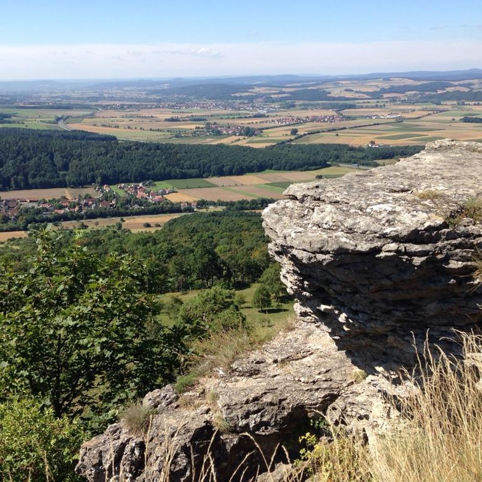
Beautiful viewpoint of the Rhine valley and the Black Forest. The Panoramafelsen is located at 780 m.
0
0
The Maennelstein (Männelstein) is a striking, 817-meter-high Bunter sandstone rock on the southern edge of the Odilienberg (Mont Sainte-Odile) in Alsace. It is considered one of the most beautiful viewpoints in the region and offers a wide panoramic view over the Rhine plain, the Black Forest, and on clear days even as far as the Alps.
0
0
This imposing sandstone block is located below the enclosure of the Pagan Wall (Mur Païen), about fifty meters away. Before the expansion of the forest, this rock offered an excellent vantage point (Lauerposten) to monitor the access to Mont Sainte-Odile on the road from Barr. As proof of the importance of this place, the watchstone was connected to the main enclosure by a cross-wall of the same construction as the Pagan Wall. The sandstone blocks were connected to each other by a system of oak dowels and mortises (Mortaises et Tenons).
0
0
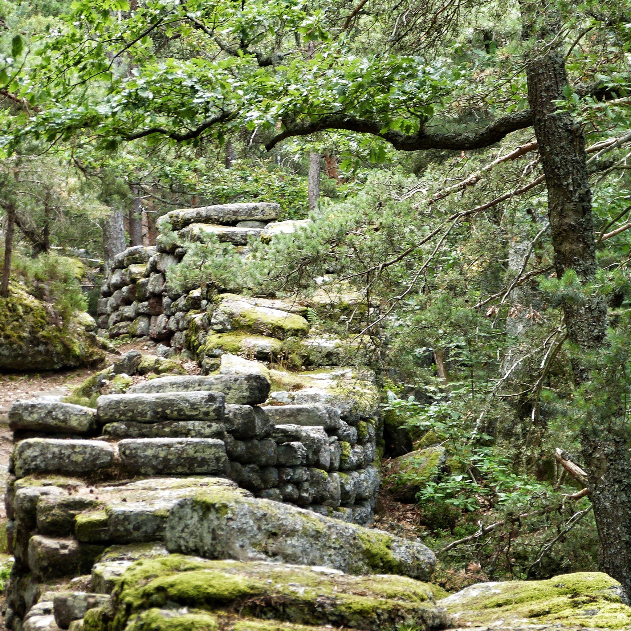
The Heidenmauer (French: Mur Païen) is a monumental, eleven-kilometer-long fortification from the early Middle Ages that encloses the high plateau of Mont Sainte-Odile in Alsace. The imposing structure has fascinated archaeologists and visitors alike for centuries with its sheer dimension and construction. Around 300,000 irregularly hewn sandstone blocks were piled up without mortar to form a dry-stone wall up to two meters wide. To give the huge blocks stability, the builders connected them with swallowtail-shaped wooden clamps made of oak. This extraordinary technique secured the structure against the shifting of stones on the steep forest terrain. For a long time, the structure was surrounded by great mystery. Due to the name Pope Leo IX gave the wall in the 11th century, its origin was suspected to be prehistoric, Celtic, or Roman times. Modern scientific investigations finally brought clarity: with the help of dendrochronology (tree-ring analysis), the wooden connecting wedges could be precisely dated to the late 7th or early 8th century AD. The wall thus originated in the Merovingian era. To this day, research puzzles over the exact purpose of this gigantic structure. The most likely theory is that the wall served as a mighty refuge for the population in times of political unrest. At the same time, the monumental structure demonstrated the power and prestige of the then Dukes of Alsace, to whose family Saint Odile also belonged. Today, the Heidenmauer is a protected cultural monument and a popular destination for hikers. A well-signposted circular path leads in the shade of the trees directly along the historical remains and connects the ruins with mystical places such as the Druid's Grotto and the monastery on the mountain summit.
0
0

Frequently Asked Questions
How many mountain bike trails are available around Ottrott?
There are 28 mountain bike trails around Ottrott, offering a diverse range of options for different skill levels. These include 2 easy, 16 moderate, and 10 difficult routes.
What kind of terrain can I expect on mountain bike trails in Ottrott?
Mountain biking in Ottrott primarily takes place within the Vosges Mountains, featuring forested environments and varied elevation. The trails often traverse sandstone ground, which provides good grip and dries quickly after rain. You'll encounter everything from moderate forest paths to challenging mountain ascents with rocks and roots.
Are there any circular mountain bike routes in Ottrott?
Yes, many of the trails around Ottrott are circular. For example, you can explore the Mont Sainte-Odile Abbey – Château du Birkenfels loop from Ottrott, a challenging 25.2-mile route, or the Rathsamhausen Castle – Rocher des Géants loop from Ottrott, which is a difficult 31.7-mile path offering panoramic views.
What are some scenic viewpoints or landmarks I can see while mountain biking in Ottrott?
The region is rich in scenic views and historical landmarks. You can ride past the prominent Mount Sainte-Odile, which offers magnificent panoramic views of the Plain of Alsace. Other notable sights include the ancient Pagan Wall, and historical castles like Rathsamhausen Castle. The Jadelot Kiosk Viewpoint – Château du Birkenfels loop from Ottrott is a great option for combining cycling with scenic vistas.
Are there any family-friendly mountain bike trails in Ottrott?
While many trails in Ottrott are moderate to difficult, there are options suitable for families or beginners. The region offers some moderate forest paths that are less demanding. For a less strenuous ride, consider the Mountainbike loop from Ottrott, which is a moderate 14.5-mile route.
What is the best season for mountain biking in Ottrott?
The sandstone ground in Ottrott ensures trails dry quickly, making them enjoyable in various conditions. The shaded forests of the Vosges Mountains offer a pleasant riding environment, particularly during warmer months. Spring and autumn generally provide comfortable temperatures and beautiful scenery, though the quick-drying trails mean riding is often possible outside these peak seasons.
What do other mountain bikers enjoy most about the trails in Ottrott?
The mountain bike trails around Ottrott are highly rated by the komoot community, with an average score of 4.6 stars from over 70 reviews. Riders frequently praise the diverse terrain, the challenging ascents and rewarding descents, and the stunning panoramic views, especially those incorporating Mont Sainte-Odile and historical sites like the Pagan Wall.
Are there any waterfalls accessible by mountain bike near Ottrott?
Yes, you can find natural attractions like the Hohwald waterfall in the vicinity of Ottrott. While not directly on every mountain bike route, it's a notable natural monument in the wider area that can be incorporated into longer rides or visited separately.
What is the typical duration for mountain bike trails in Ottrott?
Trail durations vary significantly based on difficulty and distance. Shorter, moderate routes like the Rathsamhausen Castle – Mont Sainte-Odile Abbey loop from Ottrott can be completed in about 1 hour 43 minutes for its 9.6 miles. Longer, more difficult trails can take upwards of 4 to 5 hours, such as the 31.7-mile routes.
Are there any trails that combine historical sites with mountain biking?
Absolutely. Many routes in Ottrott weave through areas rich in history. The Rathsamhausen Castle – Mont Sainte-Odile Abbey loop from Ottrott, for instance, leads through forested areas and past historical landmarks, including the ancient Pagan Wall, offering a blend of natural beauty and historical exploration.
What are the elevation gains like on mountain bike trails in Ottrott?
The trails in Ottrott, situated in the Vosges Mountains, feature significant elevation changes. You can expect challenging ascents and rewarding descents. For example, the Mont Sainte-Odile Abbey – Château du Birkenfels loop from Ottrott involves over 1,100 meters (3,600 feet) of elevation gain, providing a substantial workout.
Most popular routes around Ottrott
Most popular attractions around Ottrott

Get inspired with the komoot mobile app


Explore more
Browse the best MTB trails in other regions.
