The best walks and hikes around Mounes-Prohencoux
4.7
(65)
346
hikers
24
hikes
Hiking around Mounes-Prohencoux offers diverse landscapes within the Regional Natural Park of Grands Causses. The terrain features rolling hills, such as the Summit of Merdelou, and distinctive geological formations like the red earth of Le Rougier de Camarès. The Rance river and its tributaries have carved deep valleys with steep slopes, creating varied scenery. Trails often traverse woodlands and open areas, providing a mix of hiking experiences.
Best hiking trails around Mounes-Prohencoux
- The most popular hiking route is The Summit…
Last updated: July 8, 2026
2.0
(1)
9
hikers
Moderate hike. Good fitness required. Easily-accessible paths. Suitable for all skill levels.
4.7
(3)
19
hikers
6.67km
01:57
170m
170m
Easy hike. Great for any fitness level. Easily-accessible paths. Suitable for all skill levels.

Sign up for free
7
hikers
Easy hike. Great for any fitness level. Easily-accessible paths. Suitable for all skill levels.
5.0
(3)
14
hikers
7.58km
02:15
220m
220m
Moderate hike. Good fitness required. Easily-accessible paths. Suitable for all skill levels.
5.0
(1)
5
hikers
5.49km
01:38
160m
160m
Easy hike. Great for any fitness level. Easily-accessible paths. Suitable for all skill levels.
Get access to more routes and recommendations from other explorers.
Sign up for free
Already have an account?
Our route recommendations are based on thousands of hikes, rides, and runs completed by other people on komoot.
Start today with a free account
Your next adventure awaits.
Login or Signup
Tips from the Community

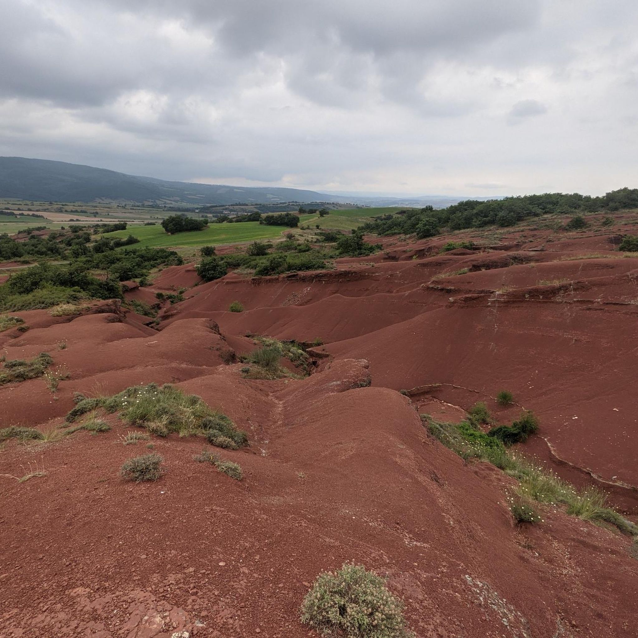
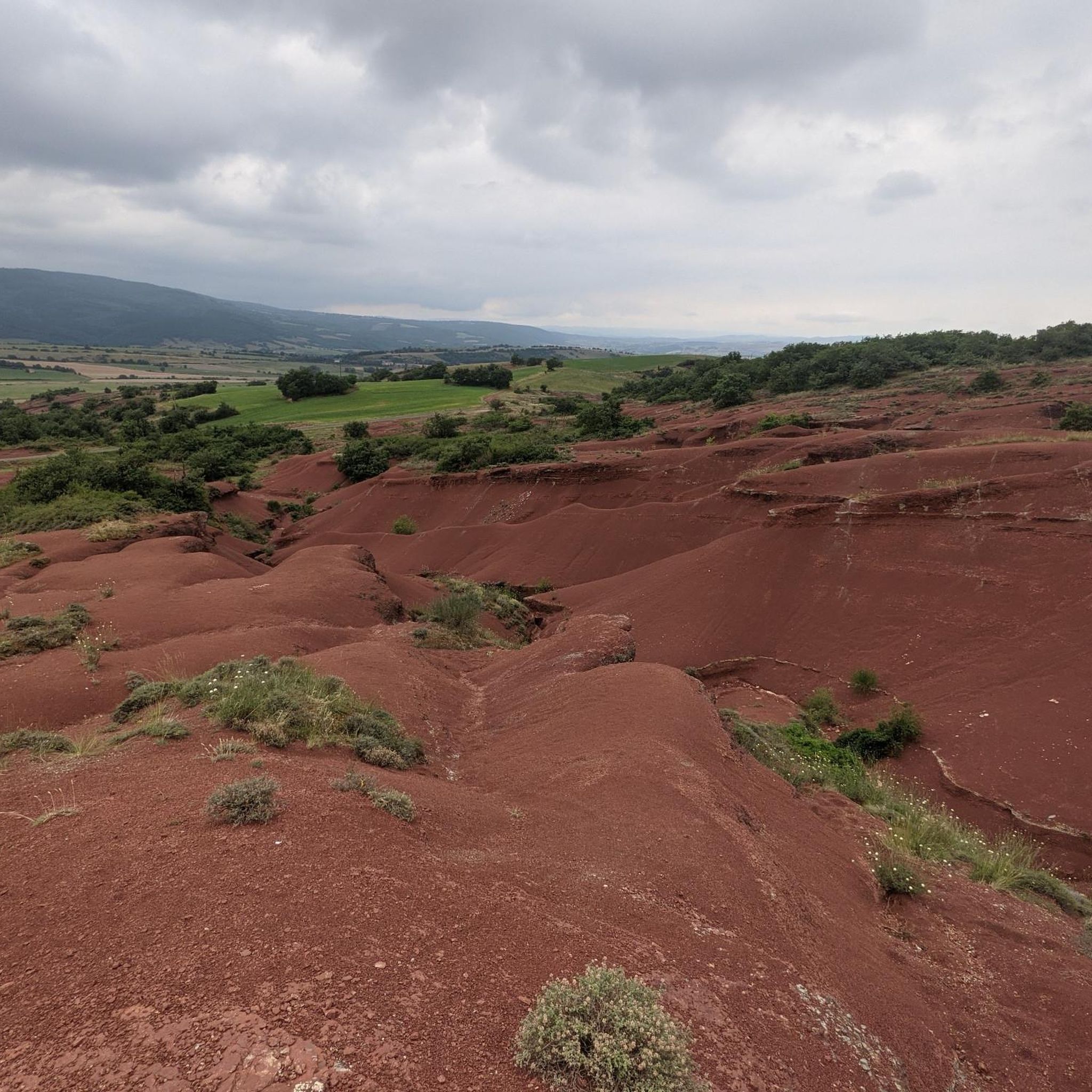
Camarès' blush is simply magnificent! It offers a wide variety of terrain: tracks on the plateau, stony paths on the reliefs present, etc.
0
0

Magnificent moment, we did it on September 12, 2023 at 24° ideal weather it was really good :O
0
0

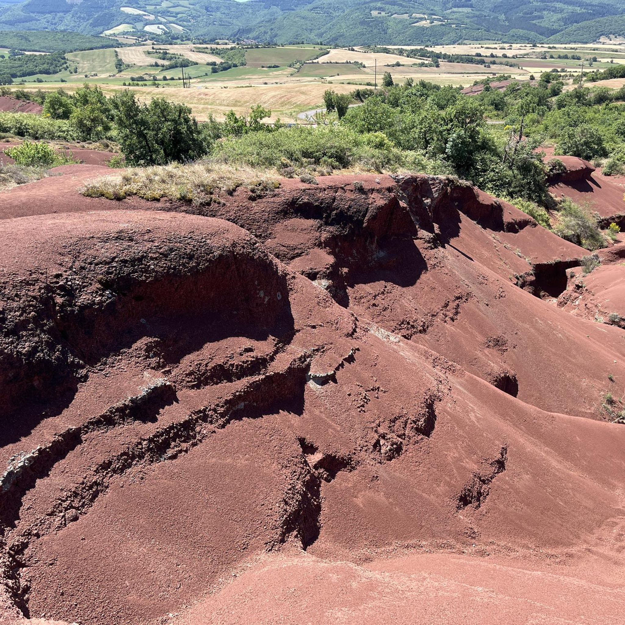
The Rougier de Camarès offers a magnificent landscape of red clay rich in iron.
0
0
The summit of Merdelou, with its 1100 meters of altitude, is one of the highest points in the south of Aveyron. It allows you to enjoy a magnificent view.
1
0
Magnificent landscape of iron-rich red clay.
0
0


Path from Gissac to Andabre in el Rougier de Camarès. Red lunar landscapes resembling Colorado with canyons, gorges... Superb terrain to explore on a mountain bike, with its crumbly soil of red claystone. easily accessible from Montlaur or Camarès.
2
0
Frequently Asked Questions
How many hiking trails are available around Mounes-Prohencoux?
There are over 20 hiking trails around Mounes-Prohencoux, offering a diverse range of experiences. You'll find 9 easy routes, 12 moderate trails, and 1 more challenging option, catering to various fitness levels.
Are there easy or family-friendly hiking options in Mounes-Prohencoux?
Yes, Mounes-Prohencoux offers several easy and family-friendly hiking options. For instance, the Le Rougier de Camarès – Les Montagnettes loop from Rougier de Camares is an easy 4.0-mile (6.4 km) path that explores the unique red earth landscapes, perfect for a relaxed outing.
What are the typical lengths and durations of hikes in Mounes-Prohencoux?
Hikes in Mounes-Prohencoux vary in length and duration. You can find shorter, easy walks like the 1.5-mile (2.5 km) Le Rougier de Camarès – Les Montagnettes loop, which takes about 45 minutes. Moderate trails, such as The Summit of Merdelou by St Méen, are around 5.8 miles (9.3 km) and typically take 2 hours 45 minutes.
Are there circular hiking routes available in Mounes-Prohencoux?
Yes, many of the trails in Mounes-Prohencoux are circular routes, allowing you to start and end at the same point. Examples include The Summit of Merdelou by St Méen – loop and the Hiking loop from Gissac, which is an easy 3.6-mile (5.9 km) option.
What kind of landscapes can I expect to see while hiking in Mounes-Prohencoux?
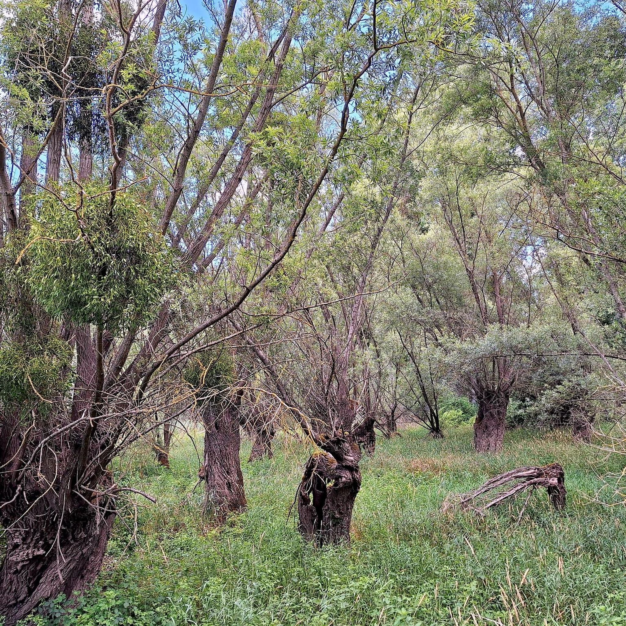
Hiking in Mounes-Prohencoux offers diverse landscapes within the Regional Natural Park of Grands Causses. You'll encounter a mix of rolling hills, such as the Summit of Merdelou, and distinctive geological formations like the red earth of Le Rougier de Camarès. Trails often traverse woodlands and open areas, providing varied scenery.
What do other hikers enjoy most about the trails in Mounes-Prohencoux?
The trails in Mounes-Prohencoux are highly rated by the komoot community, with an average score of 4.7 stars from over 50 reviews. Hikers often praise the varied terrain, from the unique red landscapes of Le Rougier to the views from the hills within the Regional Natural Park of Grands Causses.
Are there any interesting landmarks or attractions to see along the hiking trails?
Yes, the area around Mounes-Prohencoux features several interesting landmarks. You can explore the distinctive red earth of Le Rougier de Camarès, visit the Sylvanès Orthodox Church, or discover the historic Combret Medieval Village. Many trails offer scenic viewpoints like the Magnificent view.
Is Mounes-Prohencoux suitable for beginner hikers?
Absolutely. With 9 easy routes available, Mounes-Prohencoux is well-suited for beginner hikers. These trails typically have less elevation gain and shorter distances, providing a gentle introduction to hiking in the region. The Le Rougier de Camarès – Les Montagnettes loop is a great easy option.
What is the best time of year to hike in Mounes-Prohencoux?
The best time to hike in Mounes-Prohencoux is generally during spring and autumn. These seasons offer pleasant temperatures, vibrant natural colors, and are ideal for enjoying the diverse landscapes without the intense heat of summer or the potential for colder, wetter conditions in winter. However, the region's trails can be enjoyed year-round depending on weather conditions.
Are dogs allowed on the hiking trails in Mounes-Prohencoux?
Generally, dogs are welcome on hiking trails in the Mounes-Prohencoux area, especially within the Regional Natural Park of Grands Causses, provided they are kept on a leash and owners follow local regulations regarding waste disposal. It's always a good idea to check specific trail signage for any restrictions, particularly in protected areas or near livestock.
Are there any trails that offer significant elevation or more challenging terrain?
While most trails are easy to moderate, there is at least one difficult route available for those seeking a greater challenge. The moderate trails, such as The Summit of Merdelou by St Méen, involve notable elevation gains of around 280 meters (920 feet), offering more strenuous climbs and rewarding views from higher points.
Can I find trails that pass through woodlands or open areas?
Yes, the hiking trails in Mounes-Prohencoux frequently traverse both woodlands and open areas. This mix provides varied scenery and experiences, from shaded paths through forests to expansive views across open fields and the distinctive red earth landscapes of Le Rougier de Camarès.
Most popular attractions around Mounes-Prohencoux

Get inspired with the komoot mobile app


Explore more
Browse the best Hikes in other regions.
