The best walks and hikes around Gissac
4.6
(82)
486
hikers
66
hikes
Hiking around Gissac offers diverse natural landscapes and notable geological features. The region is characterized by vast limestone plateaus, deep river gorges, and picturesque valleys, particularly within the Parc naturel régional des Grands Causses. Hikers can explore unique red-hued terrain in areas like the Canyons of Rougier, alongside majestic forests, pastures, and garrigues. The varied topography provides a range of experiences, from river walks to routes with panoramic views over impressive rock formations.
Best hiking trails around Gissac
- The most…
Last updated: August 31, 2026
4.4
(22)
121
hikers
9.45km
02:42
220m
220m
Moderate hike. Good fitness required. Easily-accessible paths. Suitable for all skill levels.
4.8
(4)
23
hikers
6.67km
01:57
170m
170m
Easy hike. Great for any fitness level. Easily-accessible paths. Suitable for all skill levels.

Sign up for free
5.0
(1)
6
hikers
Easy hike. Great for any fitness level. Easily-accessible paths. Suitable for all skill levels.
4.8
(4)
16
hikers
7.58km
02:15
220m
220m
Moderate hike. Good fitness required. Easily-accessible paths. Suitable for all skill levels.
4.6
(5)
15
hikers
7.88km
02:20
230m
230m
Moderate hike. Good fitness required. Easily-accessible paths. Suitable for all skill levels.
Get access to more routes and recommendations from other explorers.
Sign up for free
Already have an account?
Our route recommendations are based on thousands of hikes, rides, and runs completed by other people on komoot.
Start today with a free account
Your next adventure awaits.
Login or Signup
Tips from the Community

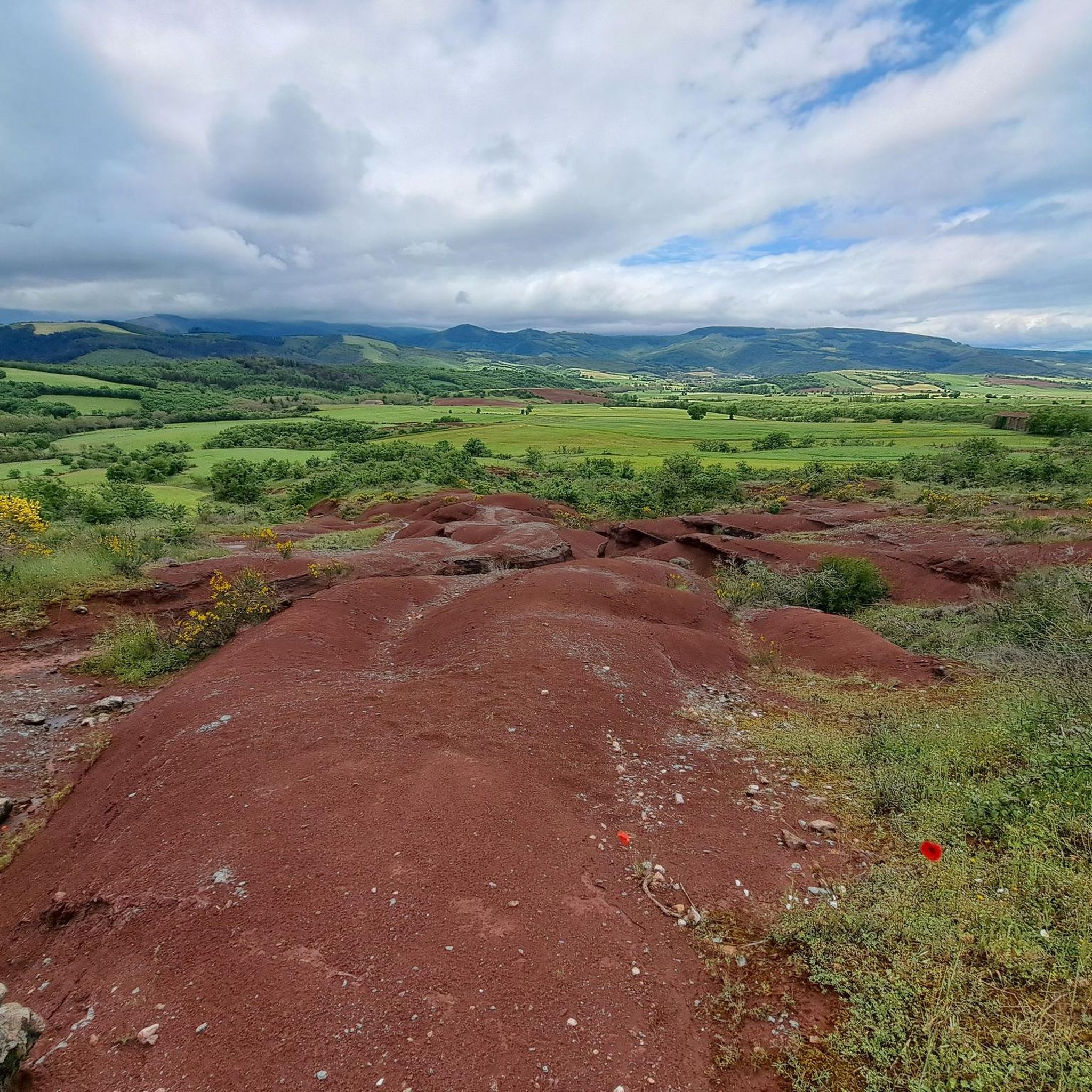
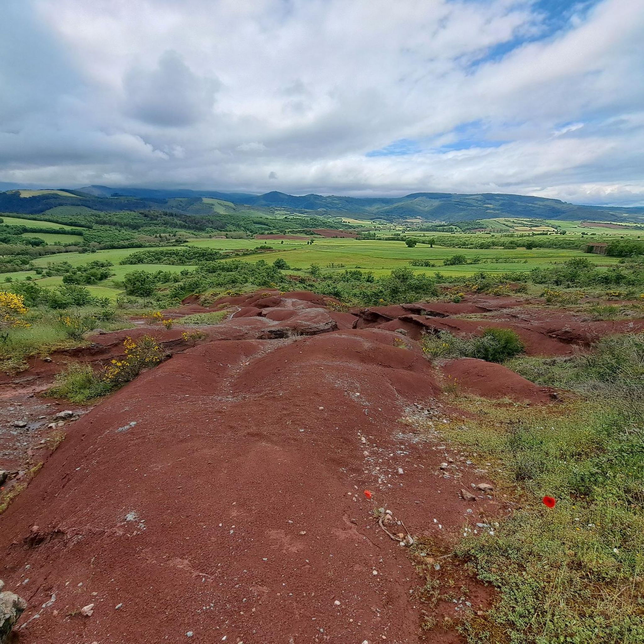
Camarès' blush is simply magnificent! It offers a wide variety of terrain: tracks on the plateau, stony paths on the reliefs present, etc.
0
0

Magnificent moment, we did it on September 12, 2023 at 24° ideal weather it was really good :O
0
0

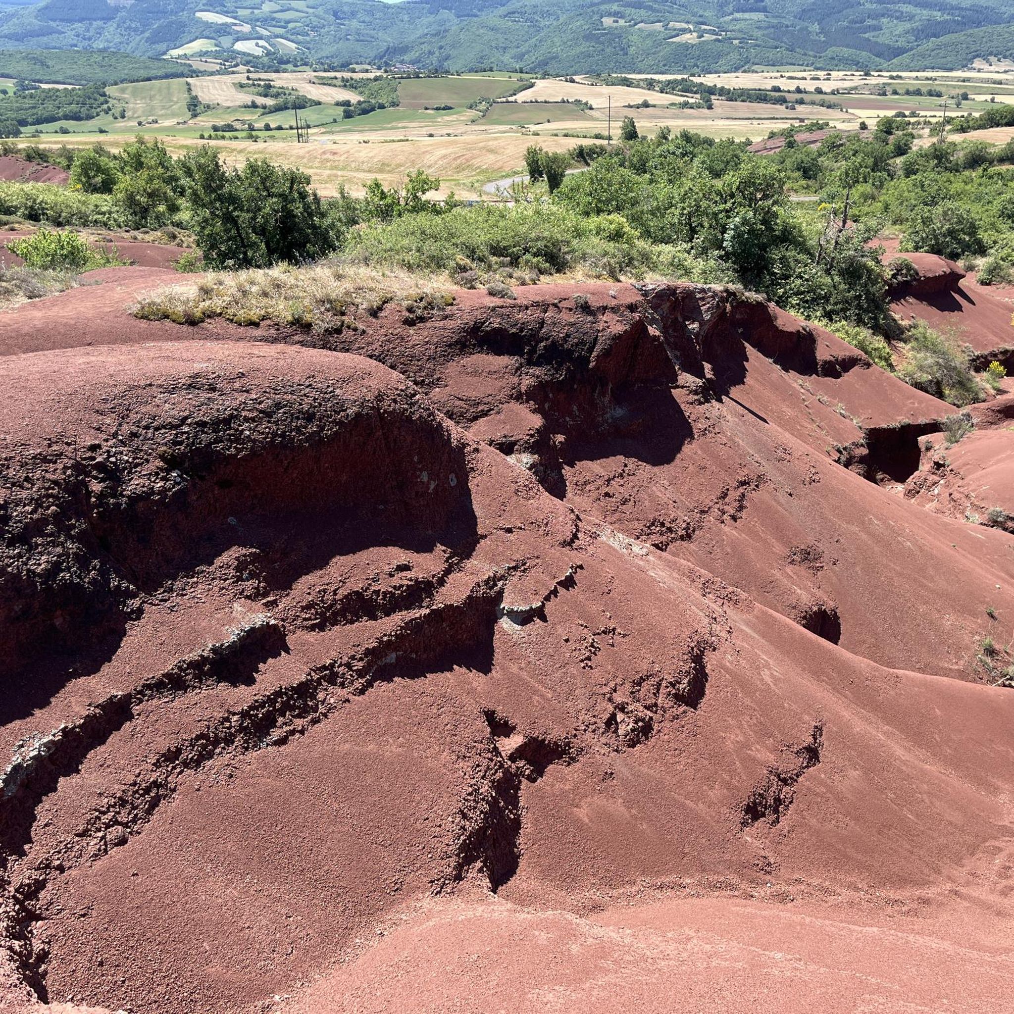
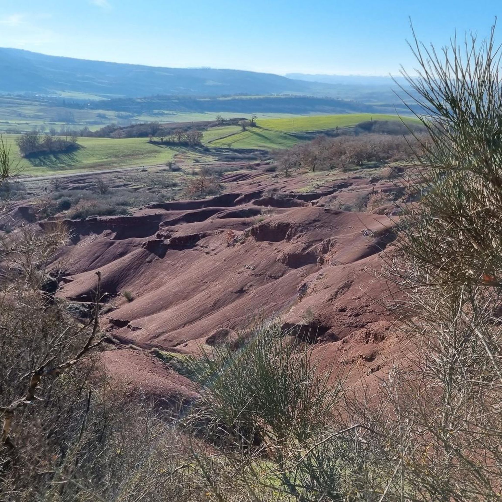
The Rougier de Camarès offers a magnificent landscape of red clay rich in iron.
0
0
Magnificent landscape of iron-rich red clay.
0
0


Path from Gissac to Andabre in el Rougier de Camarès. Red lunar landscapes resembling Colorado with canyons, gorges... Superb terrain to explore on a mountain bike, with its crumbly soil of red claystone. easily accessible from Montlaur or Camarès.
2
0
Frequently Asked Questions
How many hiking trails are available around Gissac?
Gissac offers a wide selection of hiking experiences, with over 50 routes available. These trails cater to various skill levels, including 18 easy, 30 moderate, and 2 more challenging options.
What kind of landscapes can I expect to see while hiking near Gissac?
The region around Gissac is known for its diverse and striking natural landscapes. You can explore the unique red-hued terrain of areas like the Canyons of Rougier, vast limestone plateaus, deep river gorges, and picturesque valleys within the Parc naturel régional des Grands Causses. Trails also lead through majestic forests, pastures, and garrigues, offering panoramic views.
Are there any easy hiking trails suitable for beginners or families?
Yes, Gissac has several easy trails perfect for beginners or families. An example is the shorter version of Le Rougier de Camarès – Les Montagnettes loop from Rougier de Camares, which is 2.5 km long and takes about 45 minutes to complete. This route offers a gentle introduction to the area's beauty.
Can I find circular hiking routes around Gissac?
Many trails around Gissac are designed as circular routes, allowing you to start and end at the same point. A popular moderate option is Around Sylvanes - loop - Regional natural park of Grands Causses, which is 10.5 km long and takes approximately 3 hours and 5 minutes.
What are some notable landmarks or attractions to see along the hiking trails?
While hiking, you might encounter various interesting sites. The region features natural monuments like Le Rougier de Camarès and Rocher de Caylus. You could also discover cultural sites such as the Sylvanès Orthodox Church, nestled in the woods, offering serene moments and beautiful viewpoints.
What is the best time of year to go hiking in Gissac?
Gissac offers pleasant hiking conditions through much of the year. Spring and autumn are particularly popular for their mild temperatures and vibrant natural colors. Summer provides warm weather, ideal for longer days on the trails, while winter can offer unique, crisp landscapes, though some higher or more exposed routes might require more preparation.
Are there any dog-friendly trails in the Gissac area?
Many trails in the Gissac region are suitable for hiking with dogs, allowing you to enjoy the natural beauty together. It's always recommended to keep dogs on a leash, especially in protected areas like the Parc naturel régional des Grands Causses, and to respect local signage regarding pet regulations.
How long do hikes around Gissac typically take?
Hike durations vary significantly depending on the trail's length and difficulty. You can find shorter walks, like the 2.5 km Le Rougier de Camarès – Les Montagnettes loop, which takes about 45 minutes. Moderate trails, such as The Canyons of Rougier (9.5 km), typically take around 2 hours and 41 minutes.
Is public transport available to reach hiking trailheads in Gissac?
While Gissac is well-suited for exploring by car, public transport options to specific trailheads can be limited. It's advisable to check local bus schedules or consider driving to access the starting points of many popular hiking routes, especially those deeper within the natural park areas.
What do other hikers say about the trails in Gissac?
The hiking trails in Gissac are highly regarded by the komoot community, with an average rating of 4.5 stars from over 60 reviews. Hikers often praise the diverse landscapes, from the unique red canyons to the serene forests, and appreciate the variety of routes available for different fitness levels.
Are there any challenging hikes for experienced hikers?
Yes, for experienced hikers seeking a challenge, Gissac offers a few more demanding routes. While the majority are easy to moderate, there are 2 trails classified as difficult, providing greater elevation changes and longer distances to test your endurance amidst the region's rugged beauty.
Where can I park my car when visiting hiking trails in Gissac?
Parking is generally available at or near the trailheads of popular routes around Gissac. Specific parking information can often be found on individual route descriptions. It's recommended to arrive early during peak seasons to secure a spot, especially for well-known areas like the Rougier de Camarès.
Most popular attractions around Gissac

Get inspired with the komoot mobile app


Explore more
Browse the best Hikes in other regions.
