The best walks and hikes around Mimet
4.5
(171)
1,106
hikers
25
hikes
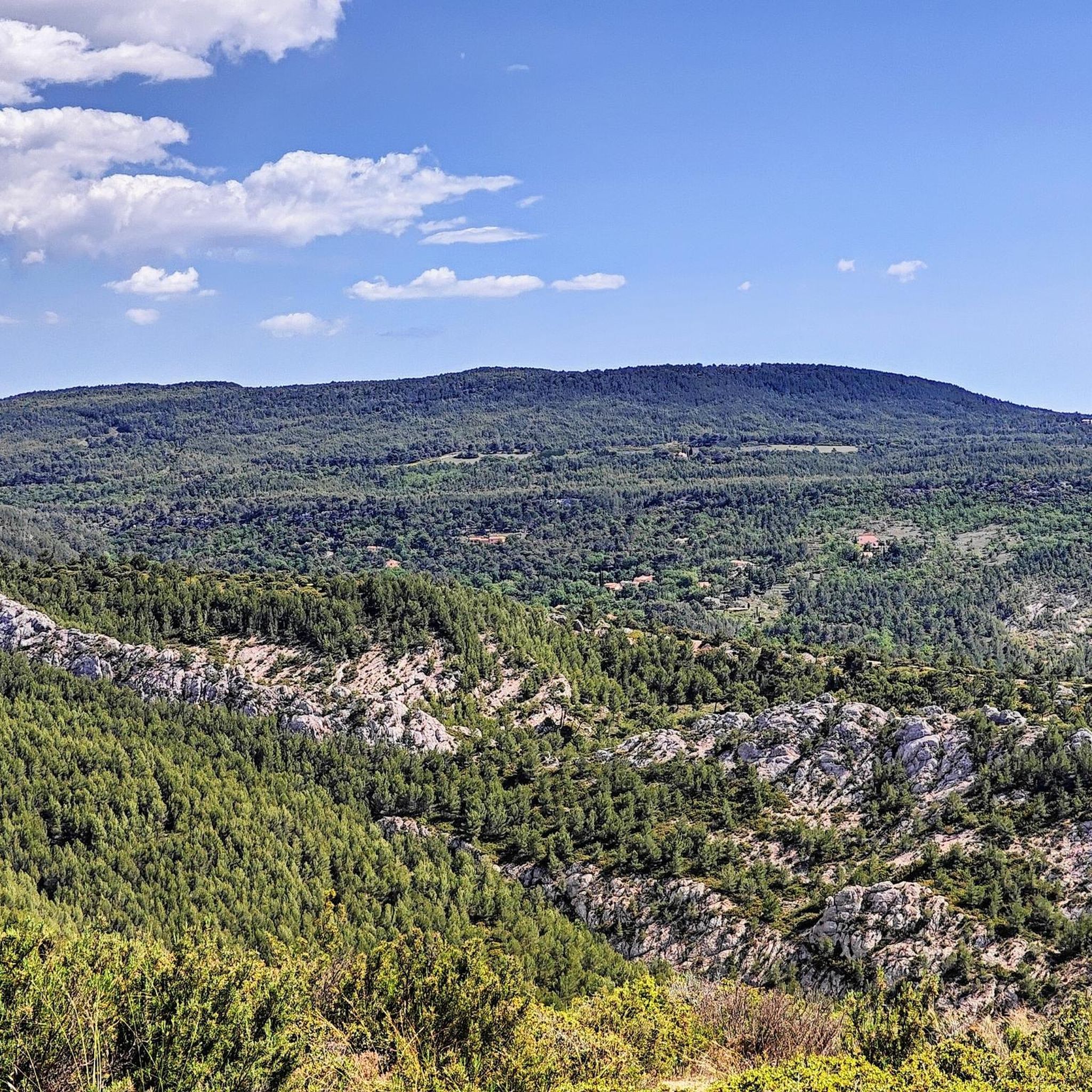
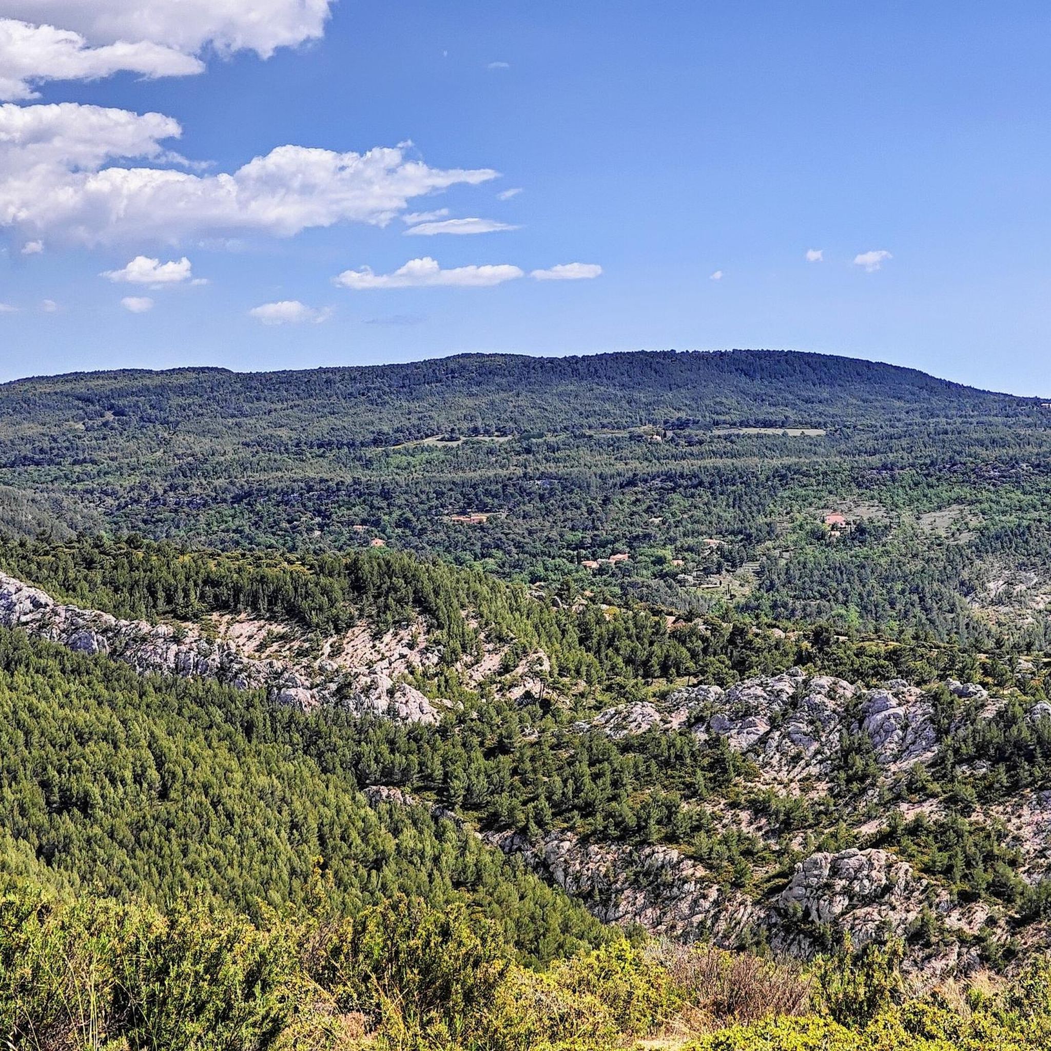
Hiking around Mimet offers access to the rugged terrain of the Massif de l'Étoile, a limestone mountain range characterized by dramatic rock formations and varied vegetation. The region features fragrant scrubland and dense pine forests, including Aleppo and evergreen oaks. Elevations reach up to 778 meters at La Tête du Grand Puech, providing expansive panoramic views. This landscape offers diverse hiking opportunities across its natural features.
Best hiking trails around Mimet
- The most popular hiking route is Tête du Grand…
Last updated: June 25, 2026
4.5
(30)
95
hikers
Moderate hike. Good fitness required. Easily-accessible paths. Suitable for all skill levels.
4.7
(17)
148
hikers
11.2km
03:31
340m
340m
Hard hike. Good fitness required. Sure-footedness, sturdy shoes and alpine experience required.

Sign up for free
4.5
(4)
22
hikers
17.7km
05:42
620m
610m
Hard hike. Very good fitness required. Sure-footedness, sturdy shoes and alpine experience required.
5.0
(5)
26
hikers
13.8km
04:10
440m
430m
Moderate hike. Good fitness required. Easily-accessible paths. Suitable for all skill levels.
4.5
(2)
28
hikers
14.9km
04:32
500m
490m
Hard hike. Good fitness required. Sure-footedness, sturdy shoes and alpine experience required.
Get access to more routes and recommendations from other explorers.
Sign up for free
Already have an account?
Our route recommendations are based on thousands of hikes, rides, and runs completed by other people on komoot.
Start today with a free account
Your next adventure awaits.
Login or Signup

Tips from the Community


Ridge path with panoramic view, quite rocky
0
0
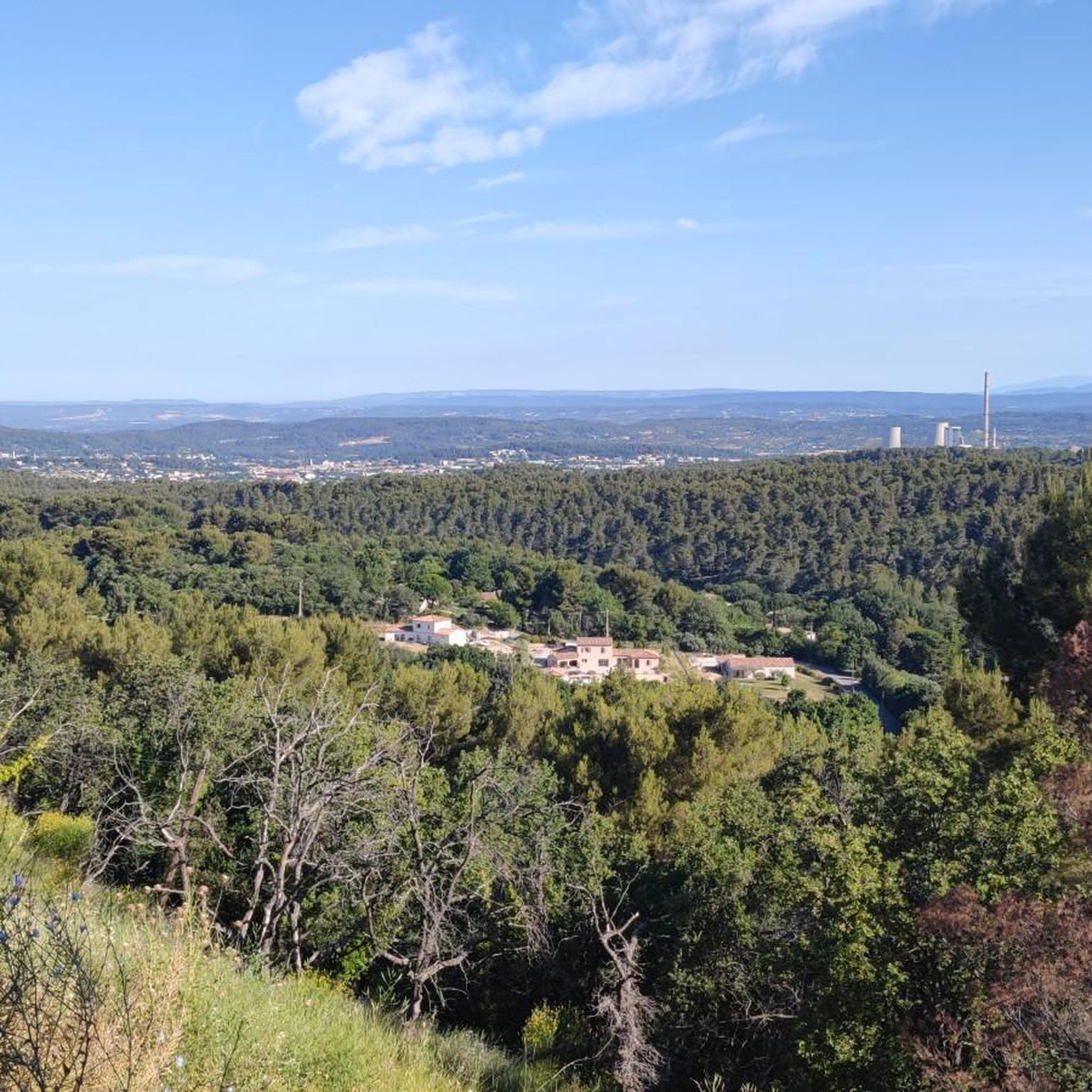
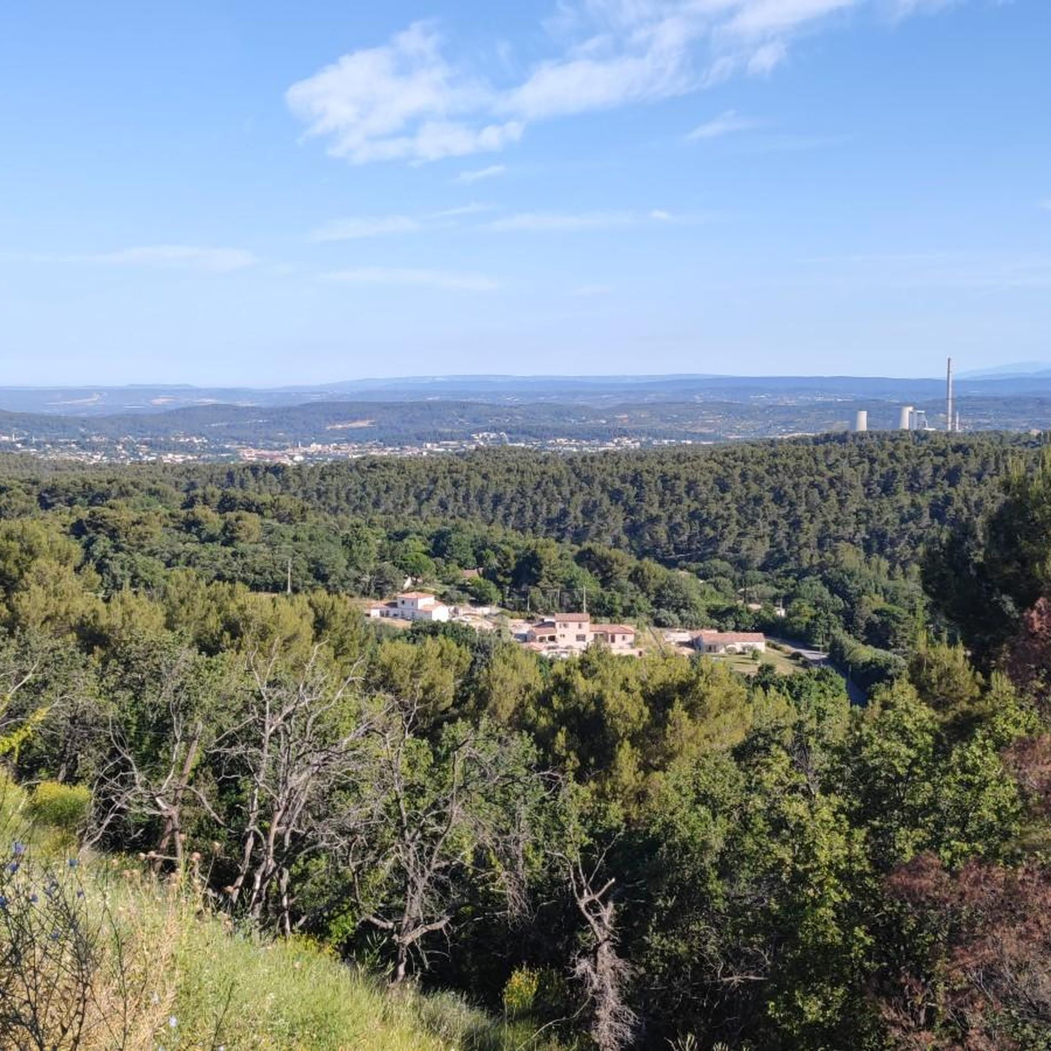
Panoramic view of the entire valley: Marseille, Aix en Provence, Sainte-Victoire, Sainte Baume,...
0
0

The highest point in the region, the head of Grand Puech stands proudly in the middle of the mountains, revealing a breathtaking panoramic view of the surroundings. It is also a witness to history, with traces of human occupation dating back to prehistoric times.
0
0

You can see Marseille when the view is clear. This was not my case, I took advantage of a nice mist.
0
0

Very beautiful village perched on a small hill with lots of hikes to do around
0
0
Frequently Asked Questions
How many hiking trails are available around Mimet?
Mimet offers a diverse selection of over 20 hiking routes. These trails cater to various skill levels, with options ranging from easy walks to more challenging ascents within the Massif de l'Étoile.
What kind of terrain can I expect on Mimet's hiking trails?
The terrain around Mimet is primarily characterized by the rugged limestone formations of the Massif de l'Étoile. You'll encounter varied landscapes, including fragrant scrubland (garrigue) and dense pine forests, with some paths featuring steep sections. Sturdy hiking boots are highly recommended.
Are there any easy or beginner-friendly hikes in Mimet?
Yes, Mimet offers 5 easy hiking routes suitable for beginners or those looking for a less strenuous walk. While the region is known for its challenging terrain, there are accessible options to enjoy the natural beauty.
Can I find circular hiking routes around Mimet?
Many of the hiking trails around Mimet are designed as loops, allowing you to start and finish in the same location. For example, the View of Marseille – View of the village of Mimet loop from Mimet is a popular circular route offering scenic views.
What are the notable landmarks or viewpoints I can see while hiking in Mimet?
Hikers are rewarded with breathtaking panoramic views from higher points like La Tête du Grand Puech. You can often see the city of Marseille, its harbor, the Frioul islands, the Garlaban massif, Sainte-Baume, Sainte-Victoire, and even the distant Luberon mountains and Mont Ventoux on clear days. The prominent Pilon du Roi is another frequent destination for superb vistas.
Are Mimet's hiking trails suitable for families with children?
While many trails in the Massif de l'Étoile feature steep paths, there are easier routes available. Families should look for the 5 easy-rated trails, which offer a gentler introduction to the region's natural beauty. Always check the difficulty and length before setting out with children.
Are dogs allowed on the hiking trails in Mimet?
Generally, dogs are welcome on hiking trails in the Massif de l'Étoile, but it's always advisable to keep them on a leash, especially in areas with wildlife or near livestock. Be mindful of local regulations and ensure your dog is well-behaved and can handle the varied terrain.
What is the best time of year to go hiking in Mimet?
The Massif de l'Étoile is enjoyable for hiking throughout much of the year. Spring and autumn offer pleasant temperatures and vibrant scenery. Summers can be hot, so early morning or late afternoon hikes are recommended, and always carry plenty of water. Winter hikes are possible, especially on the northern flank with its beautiful forests, but be prepared for cooler, more humid conditions.
How can I get to the hiking trails in Mimet using public transport?
Mimet is a commune in the Bouches-du-Rhône department. While specific public transport links directly to all trailheads might be limited, regional bus services often connect Mimet to larger towns like Aix-en-Provence or Marseille, from where you might find local connections. It's best to check local bus schedules for the most up-to-date information.
Is parking available near the trailheads in Mimet?
Yes, parking is generally available near popular trailheads in and around Mimet, especially for routes leading into the Massif de l'Étoile. Specific parking areas are often indicated on local maps or at the start of well-known trails. Always park responsibly and respect local signage.
What do other hikers say about their experience in Mimet?
The hiking experience in Mimet is highly rated by the komoot community, with an average score of 4.6 stars from over 150 reviews. Hikers often praise the stunning panoramic views, the diverse natural features, and the challenging yet rewarding ascents within the Massif de l'Étoile.
Are there any challenging hikes for experienced hikers in Mimet?
Absolutely. Mimet is home to 10 difficult-rated trails, perfect for experienced hikers seeking a challenge. Routes like the Tête du Grand Puech – Pilon du Roi loop from Mimet involve significant elevation gain and cover longer distances, offering a rigorous and rewarding experience.
Are there any specific natural features to look out for on the trails?
Beyond the panoramic views, keep an eye out for the diverse vegetation, including Aleppo pines, evergreen oaks, and downy oaks, especially on the cooler northern flank of the Massif de l'Étoile. The area also features dramatic limestone rock formations and, on some trails, interesting cave formations like those found on the 'Sentier des Grottes'.
Where can I find more information about the Massif de l'Étoile?
For additional details about the Massif de l'Étoile and its hiking opportunities, you can consult resources from local tourism boards. For example, the Marseille Tourism website provides information on hiking in the area: marseilletourisme.fr.
Most popular attractions around Mimet

Get inspired with the komoot mobile app


Explore more
Browse the best Hikes in other regions.
