The best road cycling routes around Cabeza Del Buey
38
riders
7
rides
Road cycling around Cabeza Del Buey offers varied terrain, situated on the northern slopes of the Sierra del Pedregoso, an extension of the Sierra Morena. The region features a mix of steppes, quartzitic highlands, and dehesas, providing diverse backdrops for rides. Significant elevations, such as Tiros (957 meters) and Sierra de la Rinconada (844 meters), contribute to engaging routes with climbs and descents. This topography ensures a range of road cycling experiences across well-paved sections.
Best road cycling routes around…
Last updated: October 16, 2026
96.7km
04:23
1,060m
1,060m
Hard road ride. Very good fitness required. Some segments of this route may be unpaved and difficult to ride.
9
riders
75.0km
03:39
990m
990m
Hard road ride. Very good fitness required. Mostly well-paved surfaces and easy to ride.

9
riders
81.9km
04:03
1,170m
1,170m
Hard road ride. Very good fitness required. Some segments of this route may be unpaved and difficult to ride.
3
riders
70.5km
03:16
770m
770m
Moderate road ride. Good fitness required. Some segments of this route may be unpaved and difficult to ride.
3
riders
116km
05:23
1,240m
1,240m
Hard road ride. Very good fitness required. Mostly well-paved surfaces and easy to ride.
Get access to more routes and recommendations from other explorers.
Already have an account?
Our route recommendations are based on thousands of hikes, rides, and runs completed by other people on komoot.
Start today with a free account
Your next adventure awaits.

Tips from the Community

Located south of Castilblanco, this town is surrounded by ferruginous springs. Here we find an Almohad-era castle, now devoid of walls and decoration, built on an octagonal plan atop a high crag south of the town, on a summit that is difficult to access.
2
0
It is a mountain pass that connects areas of the Sierra de los Villares and Mirabueno. It is part of old livestock routes such as the Cañada Real Segoviana, historically used for transhumance. Landscapes: Sierras de Mirabueno and Los Villares, with forests and landscapes such as Tabla Corta (Boquerón Park) on the Guadalemar River. Ideal for hiking, cycling, and nature photography.
11
0
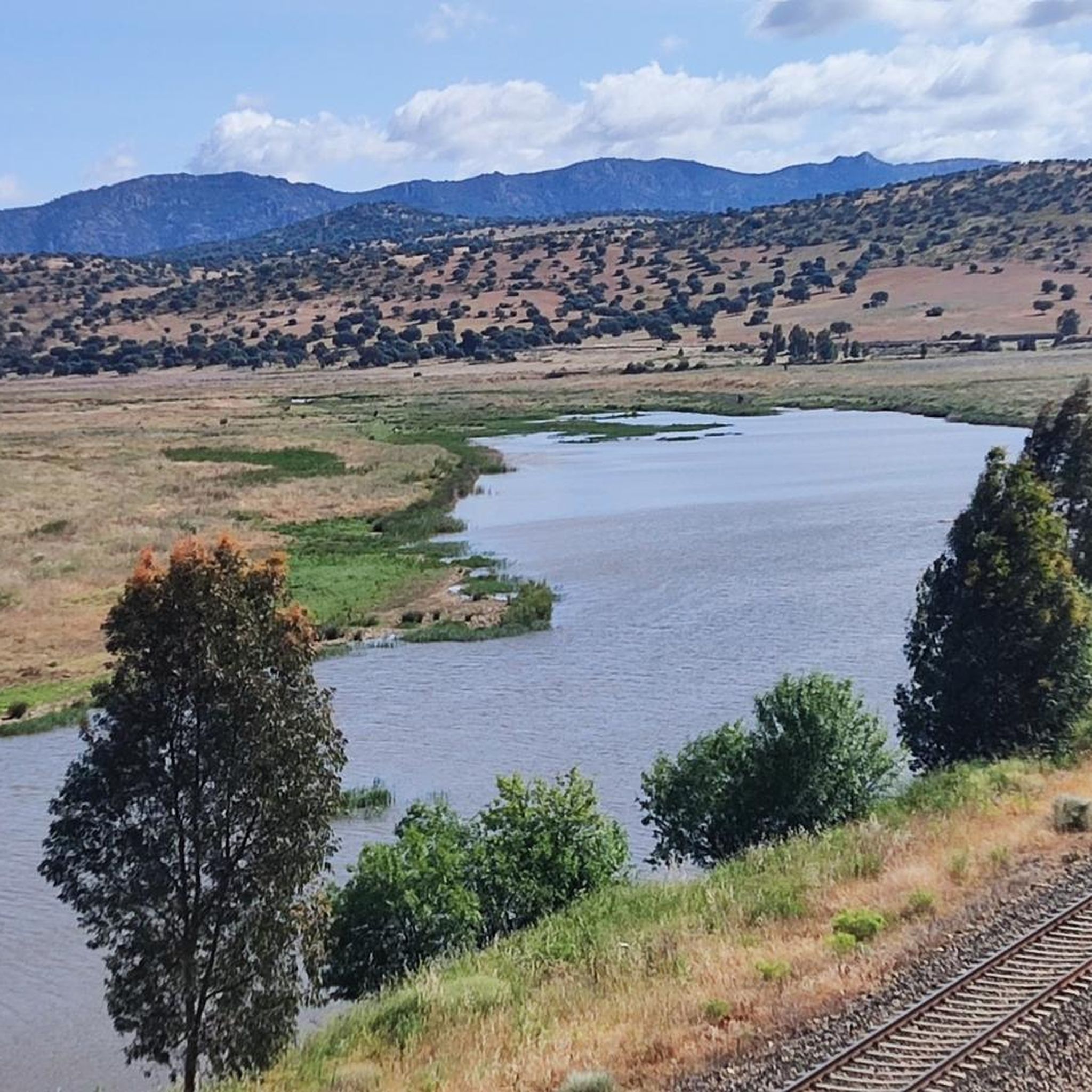
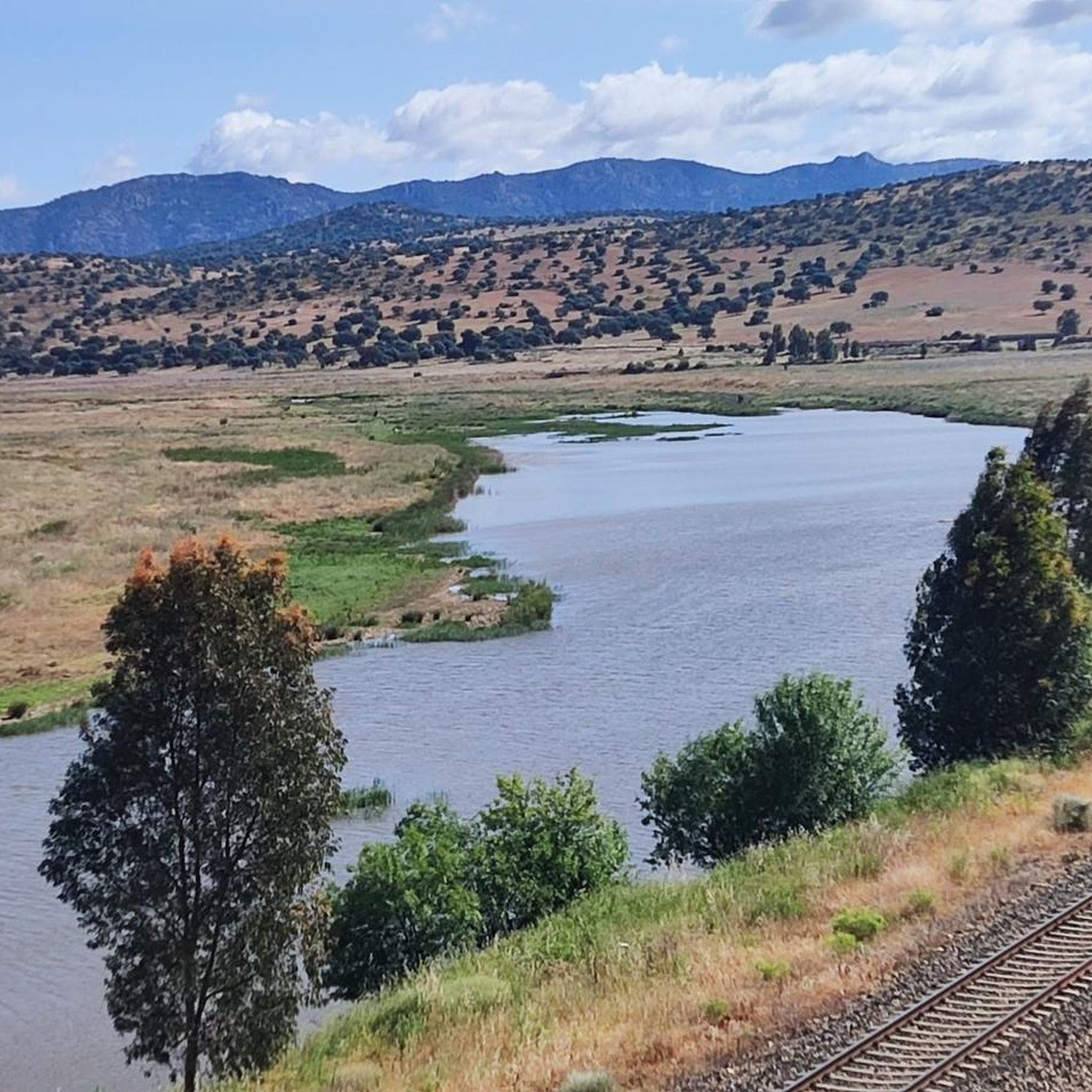
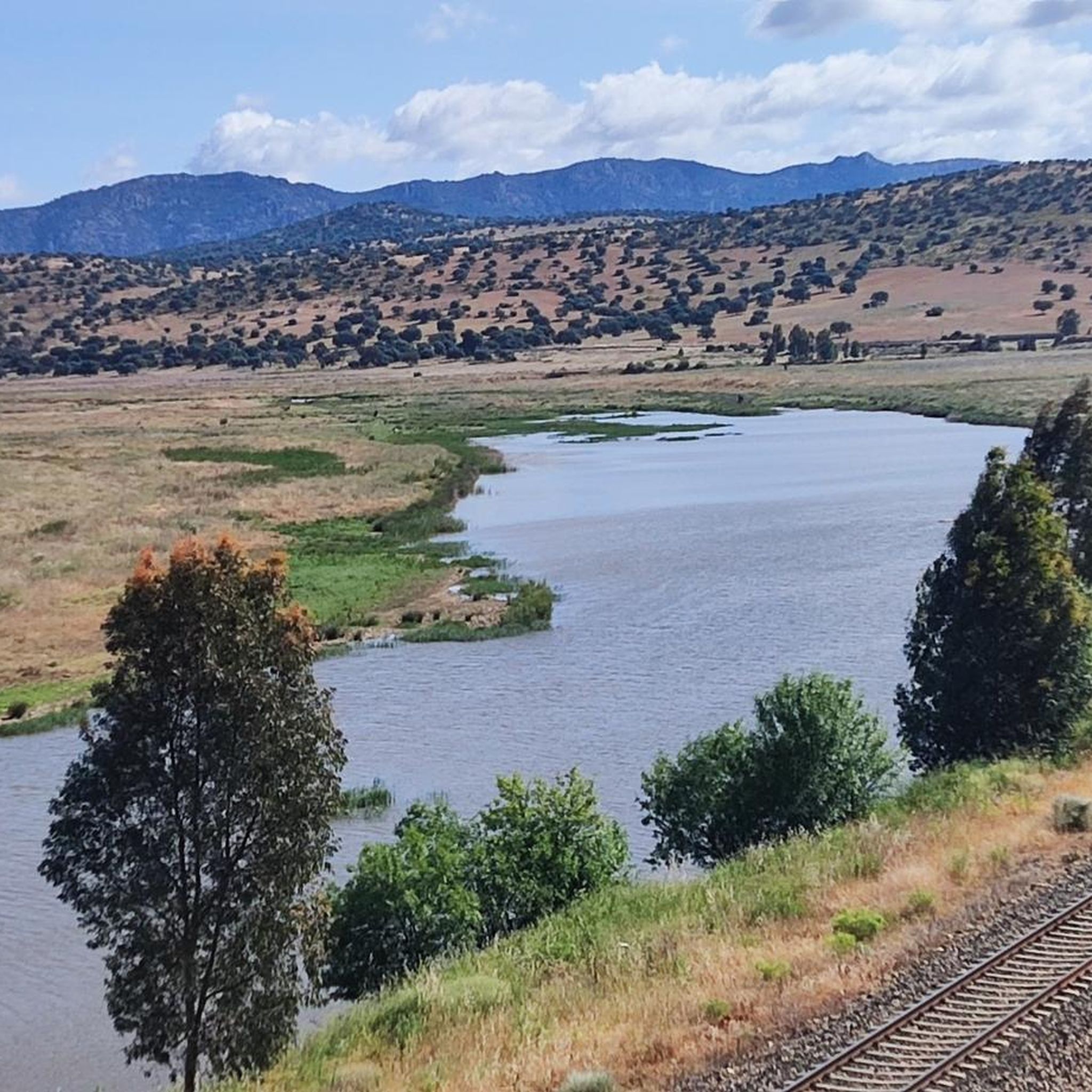
The García de Sola Reservoir, also known as Puerto Peña, is located on the Guadiana River, in the La Siberia Extremeña region (Badajoz). It was built in 1962 as part of the Badajoz Plan and has a capacity of 554 hm³. It is an emblematic site for its natural, scenic, and recreational value.
5
0
Cerro Masatrigo is a hill located in the municipality of Esparragosa de Lares. This hill is known for its almost perfect conical shape, which has earned it the nickname "the magic mountain." It rises 501 meters above sea level and 161 meters above the surrounding terrain. After the construction of the La Serena Dam, Cerro Masatrigo became a peninsula surrounded by the waters of the reservoir.
1
0
Cerro Masatrigo is a hill located in the municipality of Esparragosa de Lares. This hill is known for its almost perfect conical shape, which has earned it the nickname "the magic mountain." It rises 501 meters above sea level and 161 meters above the surrounding terrain. After the construction of the La Serena Dam, Cerro Masatrigo became a peninsula surrounded by the waters of the reservoir.
6
0

This spectacular reservoir was built during the 1960s. The reflection of the sunsets in the water and the surrounding landscape make it a must-see if you're exploring the Guadiana Nature Trail.
0
1
The García de Sola Reservoir is an impressive work of engineering located in the Extremadura region, near Talarrubias, in the province of Badajoz. The reservoir is located in an environment of great beauty, surrounded by imposing rock formations and dense vegetation composed of Mediterranean forests, pine forests and eucalyptus trees. It is a place of great value for birdlife, with species such as the griffon vulture, black vulture, black stork, golden eagle and peregrine falcon.
5
0

Road that runs along the banks of the García de Sola reservoir towards the town of Peloche. The road meanders offering incredible views of the reservoir.
0
1
Frequently Asked Questions
How many road cycling routes are available around Cabeza Del Buey?
There are 5 road cycling routes available around Cabeza Del Buey on komoot, catering to various skill levels. These include 1 easy route, 1 moderate route, and 3 difficult routes, offering diverse experiences across the region's unique landscapes.
What is the typical terrain like for road cycling in Cabeza Del Buey?
The terrain around Cabeza Del Buey is quite varied, situated on the northern slopes of the Sierra del Pedregoso, an extension of the Sierra Morena. You'll encounter a mix of steppes, quartzitic highlands, and dehesas. Significant elevations, such as Tiros (957 meters) and Sierra de la Rinconada (844 meters), contribute to engaging routes with rewarding climbs and descents on well-paved sections.
Are there road cycling routes suitable for beginners in Cabeza Del Buey?
Yes, there is at least one easy road cycling route available. While the guide highlights more challenging options, the varied topography ensures that riders can find paths that match their comfort and experience levels.
What are some challenging road cycling routes for experienced riders?
For experienced riders seeking a challenge, the region offers several difficult routes. One notable option is the Villages of La Serena: Peñalsordo and Capilla — circular from Cabeza Del Buey, which covers 96.7 km with over 1000 meters of elevation gain. Another demanding route is Almaden from Belalcazar — circular via Hinojosa del Duque, spanning 126.2 km with significant climbs.
Are there any circular road cycling routes in the area?
Yes, many of the road cycling routes around Cabeza Del Buey are circular, allowing you to start and end in the same location. For example, the popular Monterrubio de la Serena from Bellacázar — circular via Cabeza del Buey is an 88.5 km loop that passes directly through Cabeza del Buey.
What is the best time of year for road cycling in Cabeza Del Buey?
Given its location in southern Spain, the spring (March to May) and autumn (September to November) months generally offer the most pleasant conditions for road cycling in Cabeza Del Buey. Temperatures are milder, and the landscapes are often at their most vibrant. Summers can be very hot, making early morning or late afternoon rides preferable.
What scenic viewpoints can I expect on road cycling routes in Cabeza Del Buey?
The region offers several scenic viewpoints. You can enjoy panoramic views of the La Serena Reservoir, especially from areas like Cerro Masatrigo or the View of Cerro Masatrigo from Mirador Celeste de Galizuela. The View from Peñón del Pez also provides stunning vistas of the surrounding natural beauty.
Are there any historical or cultural attractions to see along the road cycling routes?
Yes, the area is rich in history. You can encounter historical architecture such as the 16th-century Church of Nuestra Señora de Armentera and the significant Sanctuary of Belén. Ancient structures like the ruins of the Belalcázar Castle and the Castle of Puebla de Alcocer offer spectacular views and a glimpse into the past. The old town's cobbled streets and charming squares in Cabeza Del Buey itself are also worth exploring.
What natural features will I encounter while cycling?
Road cycling routes in Cabeza Del Buey will take you through diverse natural environments. You'll experience the dramatic backdrop of the Sierra del Pedregoso foothills, extensive dehesas (wooded pastures), and quartzitic highlands. The impressive La Serena Reservoir is another prominent natural feature, offering picturesque views along some routes.
Are there long-distance road cycling options available?
Absolutely. For those looking for longer rides, the region offers routes exceeding 100 km. The Almaden from Belalcazar — circular via Hinojosa del Duque route, for instance, is 126.2 km long, providing a substantial challenge for endurance cyclists.
What do other road cyclists enjoy the most about road cycling in Cabeza Del Buey?
Road cyclists using komoot often praise the varied terrain and the engaging nature of the routes. The combination of challenging climbs and scenic descents through diverse landscapes, from steppes to dehesas, is frequently highlighted. The region's unique natural beauty and historical points of interest also contribute to a rewarding cycling experience.
Can I find routes that offer views of the Los Pedroches region?
Yes, some routes provide excellent views of the Los Pedroches region. The Santa Eufemia Loop from Belalcázar is a moderate 73.6 km path specifically noted for its scenic views of Los Pedroches, featuring varied topography and long, straight sections.
Are there routes that pass through multiple villages?
Yes, several routes are designed to connect different villages, allowing you to experience the local culture and architecture. The Villages of La Serena: Peñalsordo and Capilla — circular from Cabeza Del Buey is a prime example, leading you through multiple charming settlements in the La Serena region.
Most popular attractions around Cabeza Del Buey

Get inspired with the komoot mobile app


Explore more
Browse the best Road cycling routes in other regions.
