The best cycling routes around Peralveche
5.0
(2)
20
riders
4
rides
Touring cycling routes around Peralveche offer a diverse landscape in the province of Guadalajara, Spain. The region features varied terrain, including cultivated fields, pine forests, and paths alongside streams and dry riverbeds. Cyclists can experience environmental transitions from agricultural plains to more solitary mountains and ravines. The area is characterized by significant elevation changes, with routes navigating through limestone formations and offering views of prominent geological features.
Best touring cycling routes around Peralveche
- The most popular touring cycling route is…
Last updated: June 28, 2026
3
riders
Hard bike ride. Very good fitness required. Mostly paved surfaces. Suitable for all skill levels.
1
riders
31.5km
02:29
330m
330m
Moderate bike ride. Good fitness required. Mostly paved surfaces. Suitable for all skill levels.

Sign up for free
5.0
(1)
3
riders
35.8km
02:15
430m
430m
Moderate bike ride. Good fitness required. Mostly paved surfaces. Suitable for all skill levels.
5.0
(1)
3
riders
38.7km
02:26
450m
450m
Moderate bike ride. Good fitness required. Mostly paved surfaces. Suitable for all skill levels.
4
riders
71.4km
04:39
980m
980m
Hard bike ride. Very good fitness required. Mostly paved surfaces. Suitable for all skill levels.
Our route recommendations are based on thousands of hikes, rides, and runs completed by other people on komoot.
Start today with a free account
Your next adventure awaits.
Login or Signup
Popular around Peralveche

Tips from the Community

First checkpoint on the route from Madrid to Barcelona. In the main square we find places to get supplies and rest.
0
0

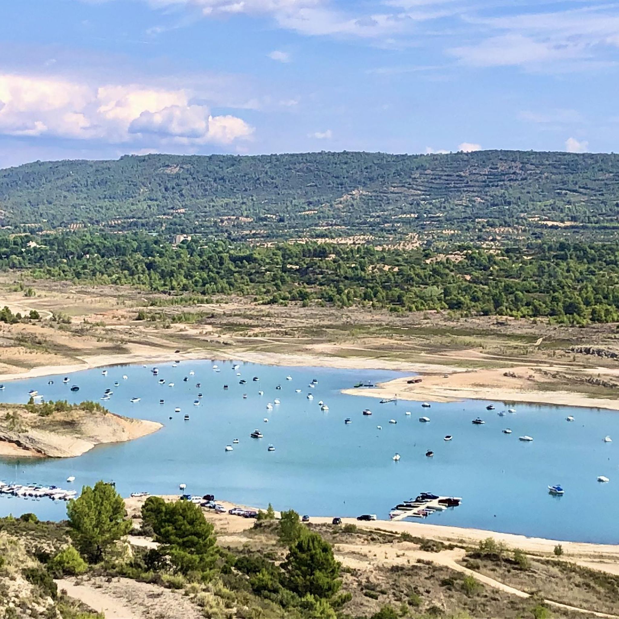
The Entrepeñas viaduct is an impressive construction that allows you to cross this reservoir located in the bed of the Tagus River.
1
0

Walk around the 14th century fortress, built by Don Juan Manuel. The castle has five towers, dominates the landscape and dominates the village below.
2
0
Budia is a cute little town nestled in the plains of the Alcarria and the Tagus valley. The town became famous in the book "Journey to the Alcarria" by Camilo José Cela.
1
0
Magnificent arched viaduct built over the Tagus River and the Entrepeñas Reservoir.
1
0

The Pareja dam, dam or lake, is an infrastructure belonging to the Entrepeñas reservoir, located next to the town of Pareja, taking advantage of the waters of the Ompolveda River.
0
0
Road that meanders through what is called El Picazo, a mountain where the road has to be avoided in a rocky area with a very beautiful landscape!
0
0
Salmerón is a population that is located at the bottom of an area pocketed by hills and where a set of streams that come from the surrounding mountains circulate. The town is built around the church and its famous Callejón del Viento.
1
0
Frequently Asked Questions
What kind of terrain can I expect on touring cycling routes around Peralveche?
The routes around Peralveche offer a diverse landscape, transitioning from the agricultural plains of Alcarria Alta to more solitary mountains and ravines. You'll encounter cultivated fields, serene pine forests, paths alongside streams and dry riverbeds, and notable limestone formations. Some sections may include broken tracks or technical descents, requiring caution.
Are there any challenging touring cycling routes in Peralveche?
Yes, Peralveche features several challenging routes with significant elevation changes. For instance, the Hike from Trillo — circular route along the Tajo River and the Entrepeñas Reservoir is a difficult 71.7 km route with nearly 1,000 meters of ascent. Another demanding option is the Salmerón – Peñafiel Lake loop from Peralveche, covering 71.4 km with similar elevation gains.
What natural landmarks or attractions can I see while cycling in the Peralveche area?
The region boasts several impressive natural features. You can cycle past the Entrepeñas Reservoir, or explore routes that offer views of prominent summits like Tetas de Viana. The unique geological formation of Peña del Arco, a natural arch of calcareous rock, is also a notable sight in the area.
Are there any moderate touring cycling routes suitable for intermediate riders?
Absolutely. Peralveche offers moderate routes that provide a good balance of challenge and accessibility. The Cifuentes from Trillo — circular by the Camino del río Cifuentes is a moderate 31.5 km route with over 300 meters of ascent. Another option is the Alcantud – El Recuenco Start loop from Peralveche, which is 38.9 km long with around 448 meters of climbing.
What do other touring cyclists say about the routes in Peralveche?
The touring cycling routes in Peralveche are highly regarded by the komoot community, holding an average rating of 5.0 stars from several reviews. Cyclists often praise the varied terrain, the scenic pathways through pine forests and along streams, and the challenging yet rewarding climbs that offer panoramic views of the region.
Are there any circular touring cycling routes available from Peralveche?
Yes, many of the touring cycling routes in the Peralveche area are designed as loops. For example, the Salmerón – Peñafiel Lake loop from Peralveche and the Alcantud – El Recuenco Start loop from Peralveche are both circular routes that start and end near Peralveche, allowing for convenient exploration without needing to retrace your path.
What is the best time of year to go touring cycling in Peralveche?
Given the varied terrain and potential for significant elevation, spring and autumn generally offer the most pleasant conditions for touring cycling in Peralveche. Temperatures are milder, and the natural landscapes are vibrant. Summers can be hot, while winters might bring colder temperatures and potentially more challenging conditions on some of the unpaved sections.
Are there any routes that pass through or near other settlements or points of interest?
Yes, some routes will take you through or near charming local settlements. For instance, you might pass through Arbeteta or near the Church of Our Lady of the Assumption, offering opportunities to experience local culture and architecture alongside your ride.
How many touring cycling routes are available in the Peralveche area?
There are several touring cycling routes documented around Peralveche, offering diverse options for cyclists. Currently, komoot lists 4 distinct touring cycling routes in this area, ranging from moderate to difficult in terms of challenge.
What are the typical distances and durations for touring cycling routes in Peralveche?
The touring cycling routes in Peralveche vary significantly in length and duration. You can find routes like the Cifuentes from Trillo — circular by the Camino del río Cifuentes, which is about 31.5 km and takes around 2 hours 30 minutes, up to longer, more challenging rides like the Hike from Trillo — circular route along the Tajo River and the Entrepeñas Reservoir, which is 71.7 km and can take over 4 hours.
Are there any specific geological features to look out for while cycling?
Beyond the general limestone formations, keep an eye out for unique karst features. The area around Peña del Arco is particularly known for its striking arch, limestone walls, and 'tormos' – mushroom-shaped rock formations sculpted by water, providing a distinctive geological backdrop to your ride.
Most popular routes around Peralveche
Most popular attractions around Peralveche

Get inspired with the komoot mobile app


Explore more
Browse the best Cycling routes in other regions.
