The best walks and hikes around Gerena
4.0
(100)
502
hikers
52
hikes
Hiking around Gerena, a municipality in the province of Seville, Spain, offers varied terrain for outdoor exploration. The landscape is characterized by rolling hills, agricultural fields, and areas with Mediterranean vegetation. Several routes feature water elements such as rivers, dams, and reservoirs, providing diverse natural settings. The region's geographical position between La Campiña and Sierra Morena contributes to its varied terrain.
Best hiking trails around Gerena
- The most popular hiking route is Guillena Water Route Trail, a 13.2 miles (21.3 km) trail that takes 5 hours 36 minutes to complete. This difficult route follows water features and offers extensive views of the surrounding area.
- Another top favourite among local hikers is Aznalcóllar Green Corridor Loop, a difficult 13.8 miles (22.3 km) path. This long-distance trail traverses green spaces and open countryside.
- Local hikers also love the Gergal Reservoir Viewpoint – Waterway Path Bridge loop from Padre Benítez, a 11.8 miles (19.1 km) trail leading through areas near a reservoir, often completed in about 5 hours 9 minutes.
- Hiking around Gerena is defined by rolling hills, water features like rivers and reservoirs, and open agricultural landscapes. The network offers options for different ability levels, from easy hikes to challenging long-distance routes.
- The routes in Gerena are highly rated by the komoot community with an average score of 3.9 stars from over 70 reviews. More than 400 hikers have used komoot to explore Gerena's varied terrain.
Last updated: July 4, 2026
3.4
(7)
24
hikers
21.3km
05:37
190m
190m
The Ruta del Agua de Guillena is a hiking adventure that immerses you in the natural beauty of Andalusia, combining riverine and forest landscapes. Spanning 21.3 kilometers, the route follows the courses of the Huelva and Cala rivers, offering serene views of the Gergal reservoir, with panoramic viewpoints like the Mirador de la Solana Recio. This trail allows you to appreciate the rich native flora and fauna, perfect for observing waterfowl, and leads you along unpaved paths and old railway lines.
For this challenging route, which will take approximately 5 hours and 36 minutes with an elevation gain of 186 meters, good planning is essential. The best time to hike it is spring or autumn, when the weather is milder and more pleasant for such an extensive walk. The trail features rest and picnic areas, but it's always advisable to carry enough water and provisions for the entire day.
Beyond its natural value, the Ruta del Agua de Guillena has a deep historical connection to Seville's water supply, evidenced by the Carambolo aqueducts you'll see along the way. You'll also encounter landmarks such as the Palacio de Parladé, which adds a touch of historical charm to the journey. The route offers a complete experience, with options for other outdoor activities like swimming or fishing in certain areas.
1
hikers
22.3km
06:52
100m
100m
Hike the difficult 13.8-mile Río Crispinejo y Cota de los Frailes circular trail from Aznalcóllar, featuring unique semi-aquatic sections.

Sign up for free
5.0
(1)
28
hikers
12.5km
03:22
150m
150m
Moderate hike. Good fitness required. Easily-accessible paths. Suitable for all skill levels.
4.0
(2)
28
hikers
19.1km
05:09
250m
250m
Hard hike. Very good fitness required. Easily-accessible paths. Suitable for all skill levels.
2.0
(22)
13
hikers
7.25km
01:56
80m
80m
Easy hike. Great for any fitness level. Easily-accessible paths. Suitable for all skill levels.
Get access to more routes and recommendations from other explorers.
Sign up for free
Already have an account?
Our route recommendations are based on thousands of hikes, rides, and runs completed by other people on komoot.
Start today with a free account
Your next adventure awaits.
Login or Signup

Tips from the Community

The Guillena Town Hall, also known as the Ayuntamiento de Guillena, is an impressive building with a neoclassical façade dating back to 1782. The building has withstood the years and has undergone several renovations and extensions. Its most notable features are the gigantic pilasters that cross all the floors of the building. Inside the Town Hall is the historical archive, including the Ensenada Land Registry from the 18th century, which is considered the first inventory of its kind in Spain.
6
0
Guillena is a charming Andalusian town near Seville, located at the foot of the Sierra Morena and the historic Vía de la Plata. It breathes history with the remains of a Moorish castle and the impressive Torre de la Reina manor house. You will find typical white houses, enjoy the surrounding nature, taste local specialties such as game dishes and salmorejo, and visit the lively Sunday animal market. Guillena is a great place to experience Andalusian culture and nature, just a stone's throw away from the hustle and bustle of Seville.
6
0
Guillena is a small town located in the province of Seville known for its rich history, diverse landscape and beautiful architecture. The historic centre of the town retains much of its original charm and contains impressive buildings such as the church of Nuestra Señora de la Granada, the monastery of Santa Clara and the palace of the Counts of Torreblanca and the Sierra Norte de Sevilla, a large natural area that offers many possibilities. Guillena is also an important centre for agriculture and livestock, with the production of olive oil, wine and citrus fruits, and a rich gastronomy with traditional dishes such as gazpacho and salmorejo.
9
0

Wooden bridge that crosses the Río Crispinejo, and that represents a natural and green space where in spring times, it is spectacular!
1
0
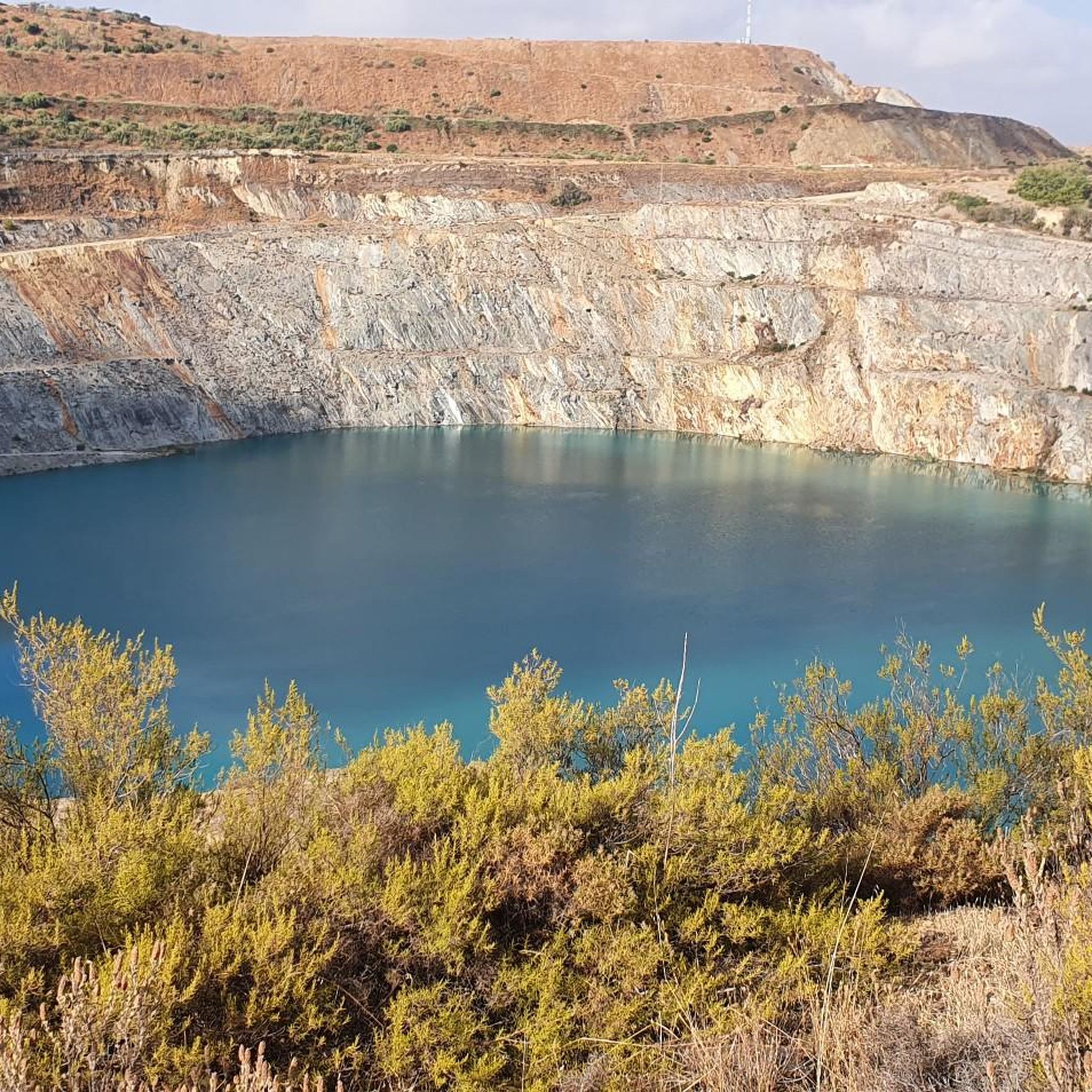
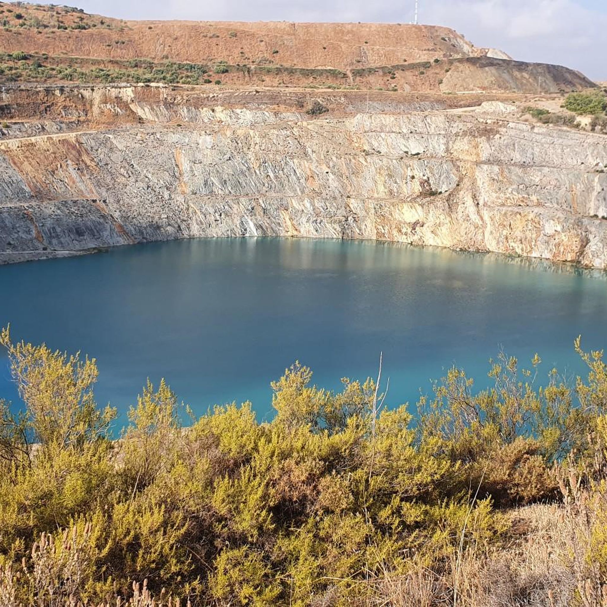
Artificial swamp that is close to the town of Aznalcóllar and that is part of a set of two huge wells.
1
0
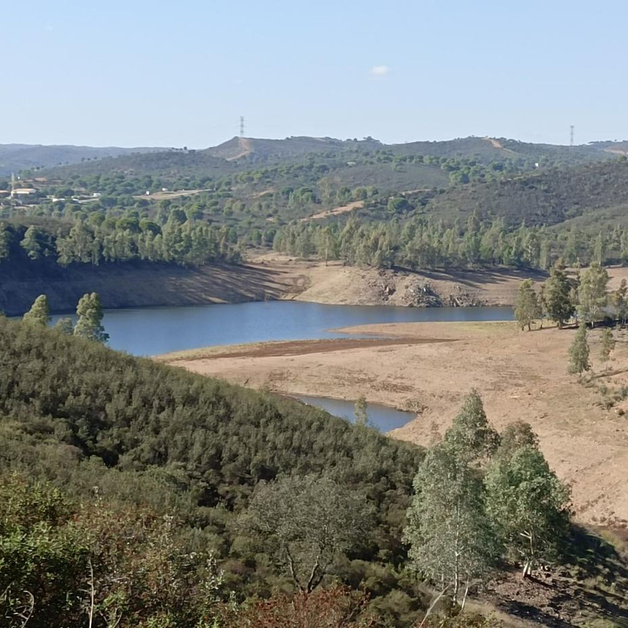
One of the areas of the path where you can see the waters of the Gergal Reservoir. There are plenty of oak forests and low bushes, especially beautiful in spring when everything is very green!
2
0
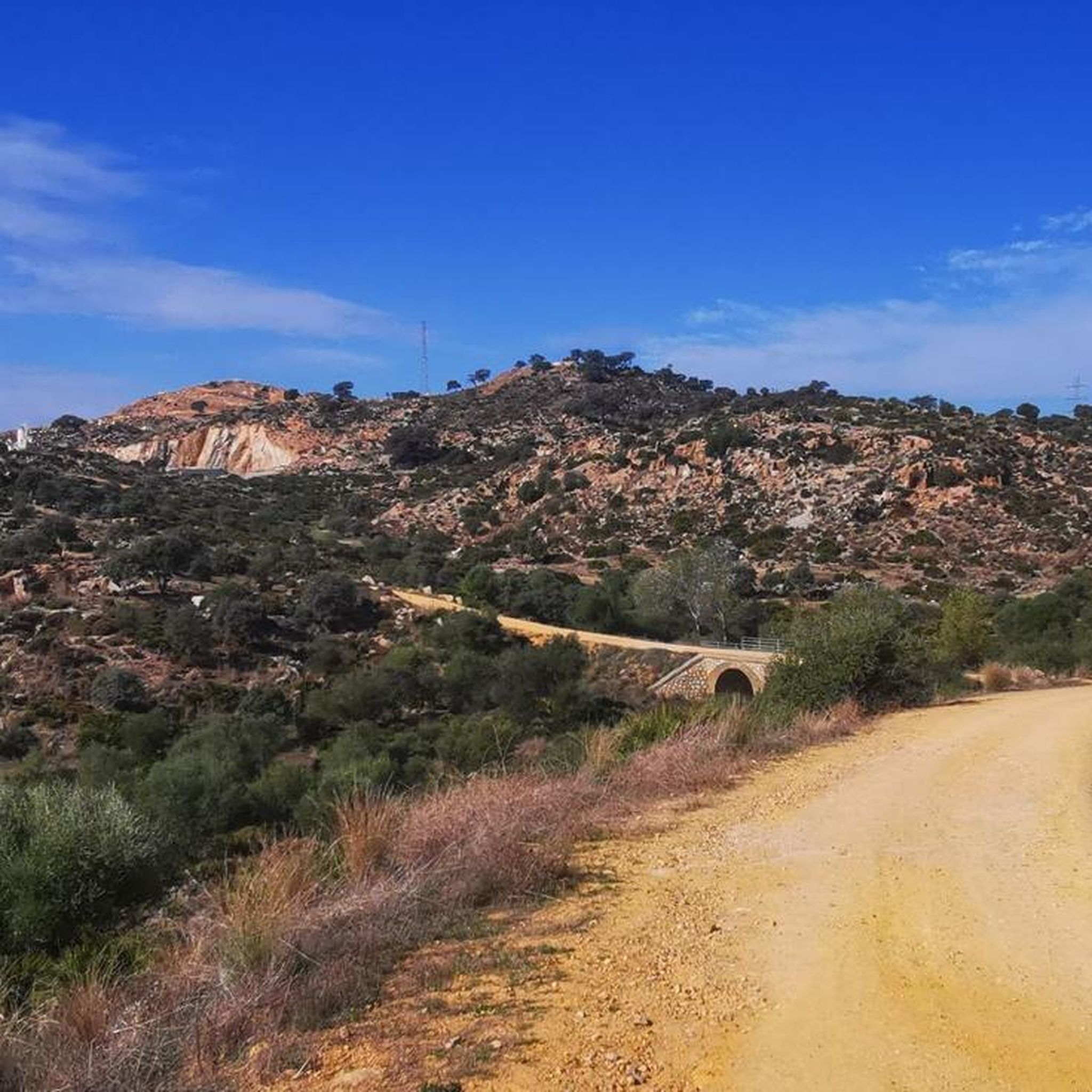
Bridge that is on one of the sections of the Camino del agua and that avoids one of the torrents that appear in the mountains around the dam.
1
0
Space that is located on the banks of the reservoir. A quiet area, with trees and with water from the dam nearby. A good area to spend a pleasant time!
1
0
Frequently Asked Questions
How many hiking trails are available around Gerena?
Gerena offers a diverse network of over 35 hiking trails. These routes traverse rolling hills, agricultural fields, and areas rich in Mediterranean vegetation, providing options for various skill levels.
Are there easy hiking options suitable for beginners or families in Gerena?
Yes, Gerena has 15 easy routes perfect for casual walks or family outings. An example is the View of the River at Sunset – Guillena Town Hall loop from Guillena, which is a pleasant 4.5-mile (7.2 km) trail.
What kind of terrain can I expect on hikes around Gerena?
The terrain around Gerena is characterized by rolling hills, open agricultural landscapes, and Mediterranean vegetation. Many routes also feature water elements such as rivers, dams, and reservoirs, adding to the scenic diversity.
Are there any challenging long-distance hikes in the Gerena area?
For experienced hikers seeking a challenge, Gerena offers 4 difficult long-distance routes. The Aznalcóllar Green Corridor Loop is a notable option, covering 13.8 miles (22.3 km) through green spaces and open countryside.
Can I find circular hiking routes near Gerena?
Yes, many routes around Gerena are circular, allowing you to start and end at the same point. The Overflow at the Dam loop from Aznalcóllar is a popular 7.8-mile (12.6 km) circular trail that explores areas near a dam.
Are there any hikes that feature water elements like rivers or reservoirs?
Absolutely. The region is known for its water features. The Guillena Water Route Trail is a prime example, following water features and offering extensive views. You can also explore areas around the Gergal Reservoir and La Minilla Reservoir.
What are some interesting historical or natural attractions to see while hiking?
Hikers can discover several points of interest. Near some trails, you might find historical sites like the Amphitheatre of Italica or the Italica Archaeological Site. Natural highlights include the Ruta del Agua of the Gergal Reservoir.
What do other hikers say about the trails in Gerena?
The komoot community highly rates the trails in Gerena, with an average score of 3.9 stars from over 70 reviews. Hikers often praise the varied terrain, the presence of water features, and the options for different ability levels.
Is Gerena a good destination for dog-friendly hikes?
While specific dog-friendly routes aren't highlighted, many trails in Gerena's natural and agricultural landscapes are generally suitable for dogs, provided they are kept on a leash and local regulations are followed. Always ensure your dog is well-behaved and you carry waste bags.
What is the best time of year to go hiking in Gerena?
The best time for hiking in Gerena, given its Mediterranean climate, is typically during the spring (March to May) and autumn (September to November). Temperatures are milder and more comfortable for outdoor activities, and the landscape is often lush.
Are there any routes that offer scenic views of the reservoirs?
Yes, several routes provide excellent views of the region's reservoirs. The View of the River at Sunset – The Pines — Gergal Reservoir loop from Guillena is a moderate 7.8-mile (12.6 km) trail that takes you near the Gergal Reservoir, offering picturesque vistas.
Most popular attractions around Gerena

Get inspired with the komoot mobile app


Explore more
Browse the best Hikes in other regions.
