The best walks and hikes around Berrocal
4.1
(46)
160
hikers
18
hikes
Hiking around Berrocal offers routes through a landscape shaped by its mining heritage and distinctive natural features. The region is characterized by mountainous terrain, red-tinged hills, and impressive rock formations. A prominent feature is the Río Tinto, known for its vivid reddish-orange waters due to high iron content. Hikers can explore scenic forests and areas with unique microclimates.
Best hiking trails around Berrocal
- The most popular hiking route is Antiguas Minas de Riotinto - circular route, a 4.8 miles…
Last updated: July 7, 2026
4.4
(12)
37
hikers
9.46km
02:36
150m
150m
Hike the moderate 5.9-mile Senda del Mining Train and Río Tinto mines circular route from Nerva, exploring a unique Martian-like landscape.
4.7
(11)
32
hikers
7.67km
02:06
120m
120m
Moderate hike. Good fitness required. Easily-accessible paths. Suitable for all skill levels.

Sign up for free
4.7
(6)
12
hikers
8.25km
02:21
190m
190m
Hike the moderate Río Tinto Greenway Loop, a 5.1-mile trail through a unique, reddish landscape shaped by ancient mining history.
1.0
(1)
7
hikers
14.5km
04:04
290m
290m
Hike the moderate 9.0-mile Peña del Hierro and Río Tinto Source Trail, exploring a Mars-like landscape with red waters and ancient mines.
5.0
(1)
4
hikers
6.88km
01:54
110m
120m
Hike the easy 4.3-mile (6.9 km) circular trail around the Dolmens of El Pozuelo, gaining 375 feet (114 metres) in under two hours.
Get access to more routes and recommendations from other explorers.
Sign up for free
Already have an account?
Our route recommendations are based on thousands of hikes, rides, and runs completed by other people on komoot.
Start today with a free account
Your next adventure awaits.
Login or Signup
Tips from the Community

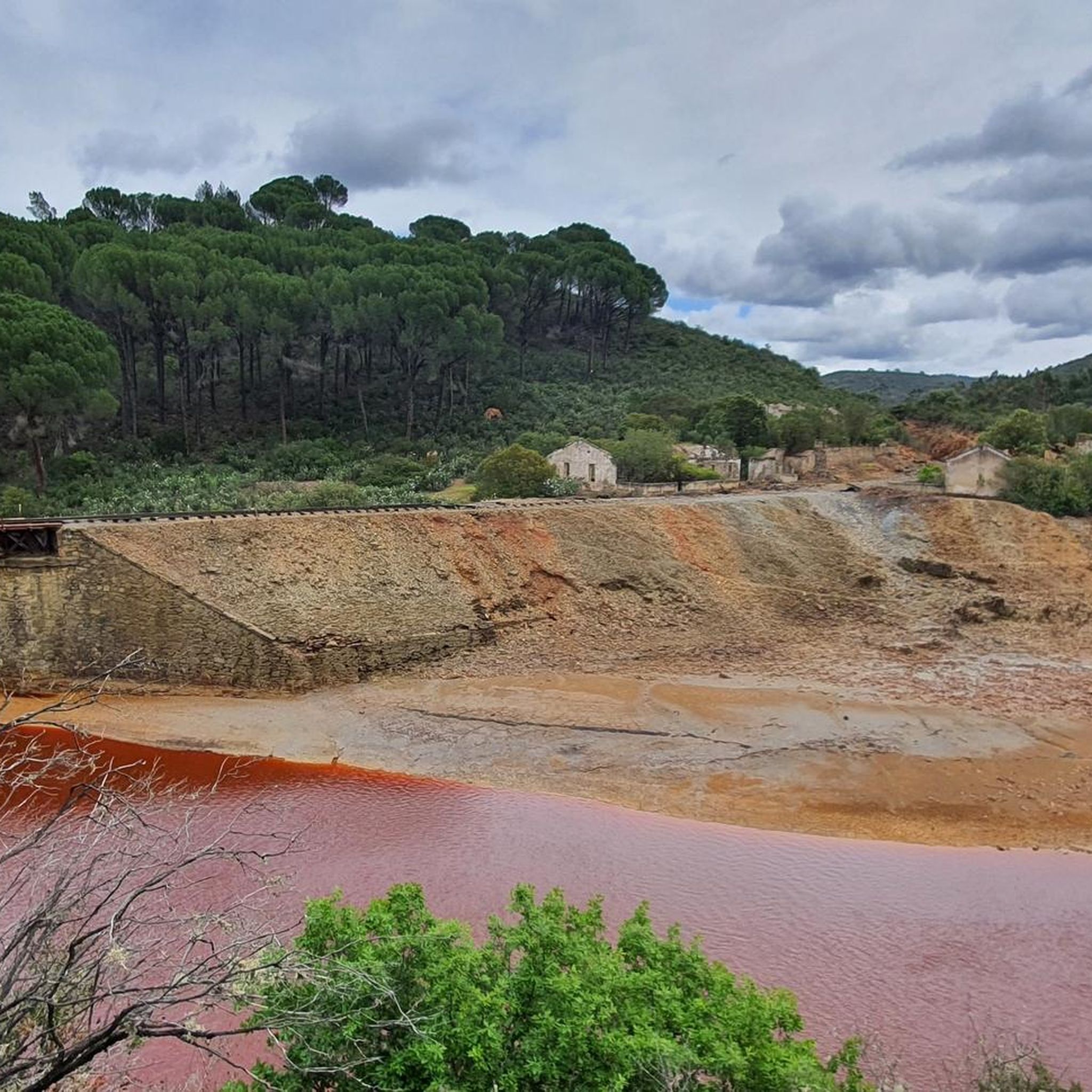
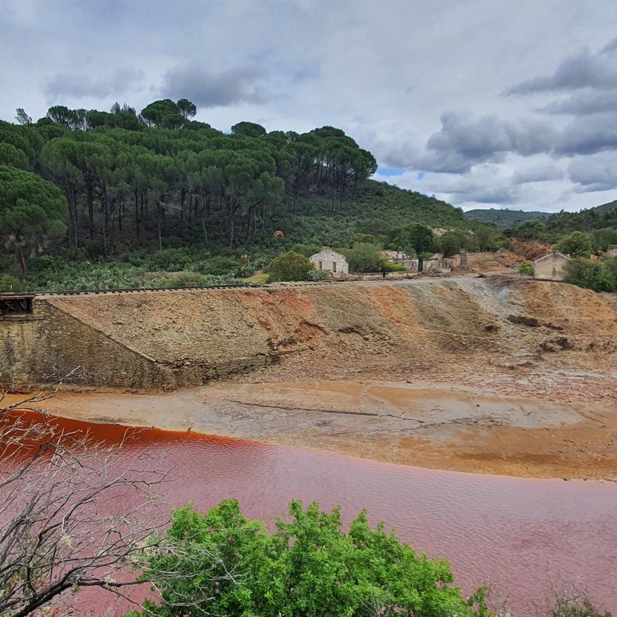
Part of the route runs alongside the river, and due to recent rains, the paths and trails have disappeared. There are sections where it's impossible to know where to walk, and some are even dangerous because of the dense vegetation washed down by the river.
0
0

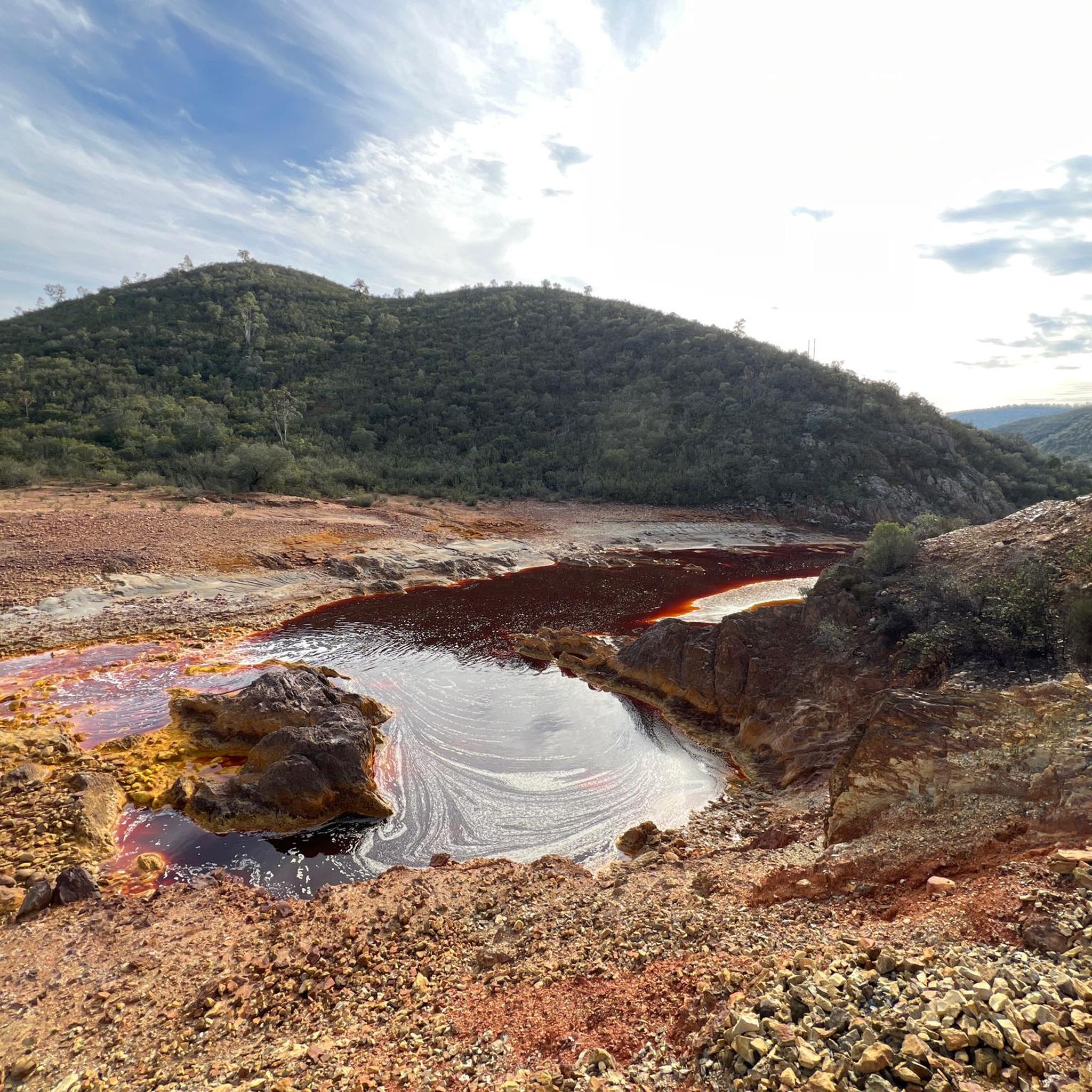
The Peña del Hierro Viewpoint, located in Nerva (Huelva), is part of the Riotinto Mining Park and offers one of the most impressive views of the source of the Tinto River, as well as the mining crater of the old pyrite mine.
1
0
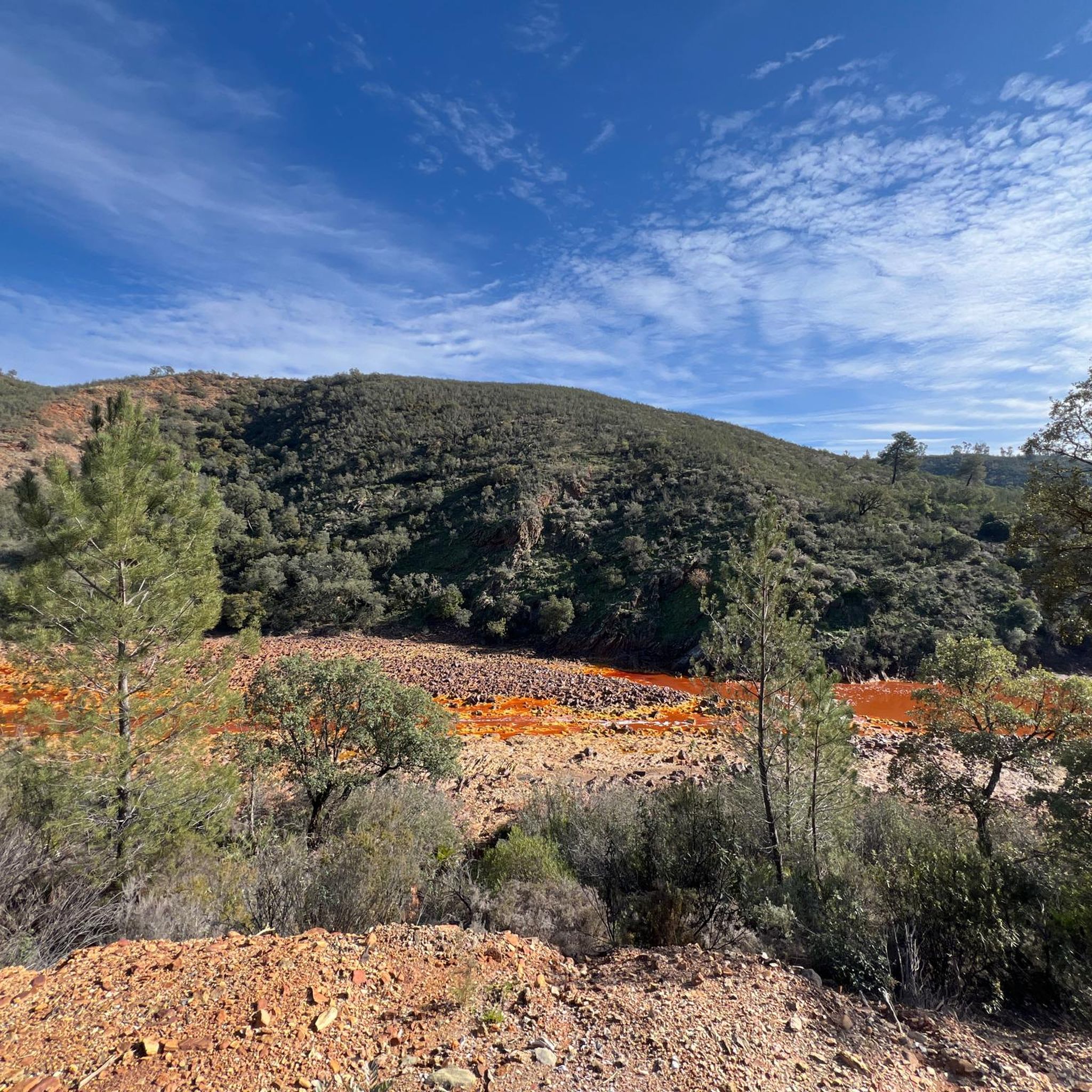
The source of the Tinto River is located in the municipality of Nerva, in the province of Huelva, Andalusia, and is one of the most unique landscapes in Europe due to its reddish color and its scientific and geological value.
1
0

An approximately 3 kilometer long circular route leads around the natural monument Montera de Gossan. Don't miss it because of the beautiful views.
0
0

Of course the views are curious, a little sad but curious.
2
0

Also known as the Padre Caro mountain range, it indicates the source of the Río Tinto which runs through the interior of Huelva for about 100 km until it reaches the Odiel River. Its name is due to the reddish color of its waters, caused by the weathering of minerals with a high content of heavy metal sulfides that were found and exploited in various deposits along the riverbed.
0
0

One of the most populated areas of archaeological sites in Zalamea La Real. This site was excavated in the middle of the 20th century and was dated between 3000 and 2500 BC. c.
2
0
Religious sanctuary of the town of Berrocal. Said congregation was divided into two buildings that represented two sides, the one above and the one below. That is why we still find the Hermitage of the Brotherhood of the Santa Cruz de Abajo and the one above.
1
1
Frequently Asked Questions
How many hiking trails are available in Berrocal?
Berrocal offers a selection of over 15 hiking trails, catering to various fitness levels. These routes explore the region's unique landscapes, including its mining heritage and the distinctive Río Tinto.
What are the difficulty levels of hiking trails in Berrocal?
The trails around Berrocal range from easy to difficult. There are 2 easy routes, 11 moderate routes, and 3 difficult routes, ensuring options for hikers of all experience levels.
Are there any circular hiking routes in Berrocal?
Yes, Berrocal features several circular routes. A notable one is the Antiguas Minas de Riotinto - circular route, which is a moderate 4.8-mile trail exploring the area's mining history. Another challenging option is the Berrocal - El Madroño – circular by the Río Tinto and Arroyo del Gallego, a difficult 14.5-mile trek.
What unique natural features can I expect to see while hiking in Berrocal?
Hikers in Berrocal will encounter the striking Río Tinto, famous for its vivid reddish-orange waters due to high iron content. The region also boasts mountainous terrain, distinctive red-tinged hills, and impressive rock formations like Los Risco Altos, offering a truly unique landscape.
Are there any historical landmarks or attractions along the hiking trails?
Yes, Berrocal's mining heritage is a significant part of its landscape. You can explore sites like the historically significant Corta Atalaya Mine, a massive open-pit mine. The Cachán Bridge, an old railway bridge, also provides access to paths along the red river, blending history with nature.
What do other hikers say about the trails in Berrocal?
The hiking routes in Berrocal are highly rated by the komoot community, with an average score of 4.2 stars from over 30 reviews. Hikers often praise the unique reddish landscape shaped by the Río Tinto and the rich mining history that can be explored along the paths.
Are there any long-distance hiking options in Berrocal?
For those seeking a longer challenge, the El Madroño Miners' Trail is a difficult 11.6-mile route. This trail offers a more extensive exploration of the region's terrain and mining heritage.
Can I hike along the Río Tinto?
Absolutely. The Río Tinto is a central feature of many hikes. For example, the Río Tinto Greenway Loop is a moderate 5.1-mile path that follows the unique reddish landscape influenced by the river. Another option is On the banks of the Riotinto along the old railway, a 5.6-mile trail leading through the distinctive river banks and historical railway.
What kind of scenery can I expect beyond the red river?
Beyond the striking red river and mining landscapes, Berrocal also features scenic forests and areas with unique microclimates, such as La Fuente. These offer diverse flora and fauna, providing a different kind of natural beauty and shade for hikers.
Is Berrocal suitable for nature enthusiasts looking for unique ecosystems?
Yes, Berrocal is an excellent destination for nature enthusiasts. The region's unique geology, particularly the Río Tinto, creates an unusual ecosystem. Additionally, areas like La Fuente are ecologically valuable, boasting a unique microclimate that supports diverse flora and fauna.
Most popular attractions around Berrocal

Get inspired with the komoot mobile app


Explore more
Browse the best Hikes in other regions.
