The best road cycling routes around Berrocal
125
riders
11
rides
Road cycling around Berrocal, located in the Sierra Norte de Málaga, offers a diverse landscape for cyclists. The region features extensive olive groves and varied topography, ranging from relatively flat sections to challenging mountain climbs. This area is recognized as a "Bike Territory" by the Spanish Royal Cycling Federation, providing a network of routes through agricultural land and mountainous terrain. Nearby natural parks like El Torcal present demanding ascents with significant elevation gain.
Best road cycling routes around Berrocal
- The…
Last updated: July 10, 2026
8
riders
58.5km
03:15
1,140m
1,140m
Hard road ride. Very good fitness required. Some segments of this route may be unpaved and difficult to ride.
8
riders
53.5km
03:04
950m
950m
Hard road ride. Very good fitness required. Some segments of this route may be unpaved and difficult to ride.

Sign up for free
49
riders
101km
05:17
1,620m
1,620m
Hard road ride. Very good fitness required. Some segments of this route may be unpaved and difficult to ride.
12
riders
40.8km
02:27
950m
950m
Hard road ride. Very good fitness required. Some segments of this route may be unpaved and difficult to ride.
10
riders
41.9km
02:29
950m
950m
Hard road ride. Very good fitness required. Some segments of this route may be unpaved and difficult to ride.
Get access to more routes and recommendations from other explorers.
Sign up for free
Already have an account?
Our route recommendations are based on thousands of hikes, rides, and runs completed by other people on komoot.
Start today with a free account
Your next adventure awaits.
Login or Signup
Tips from the Community

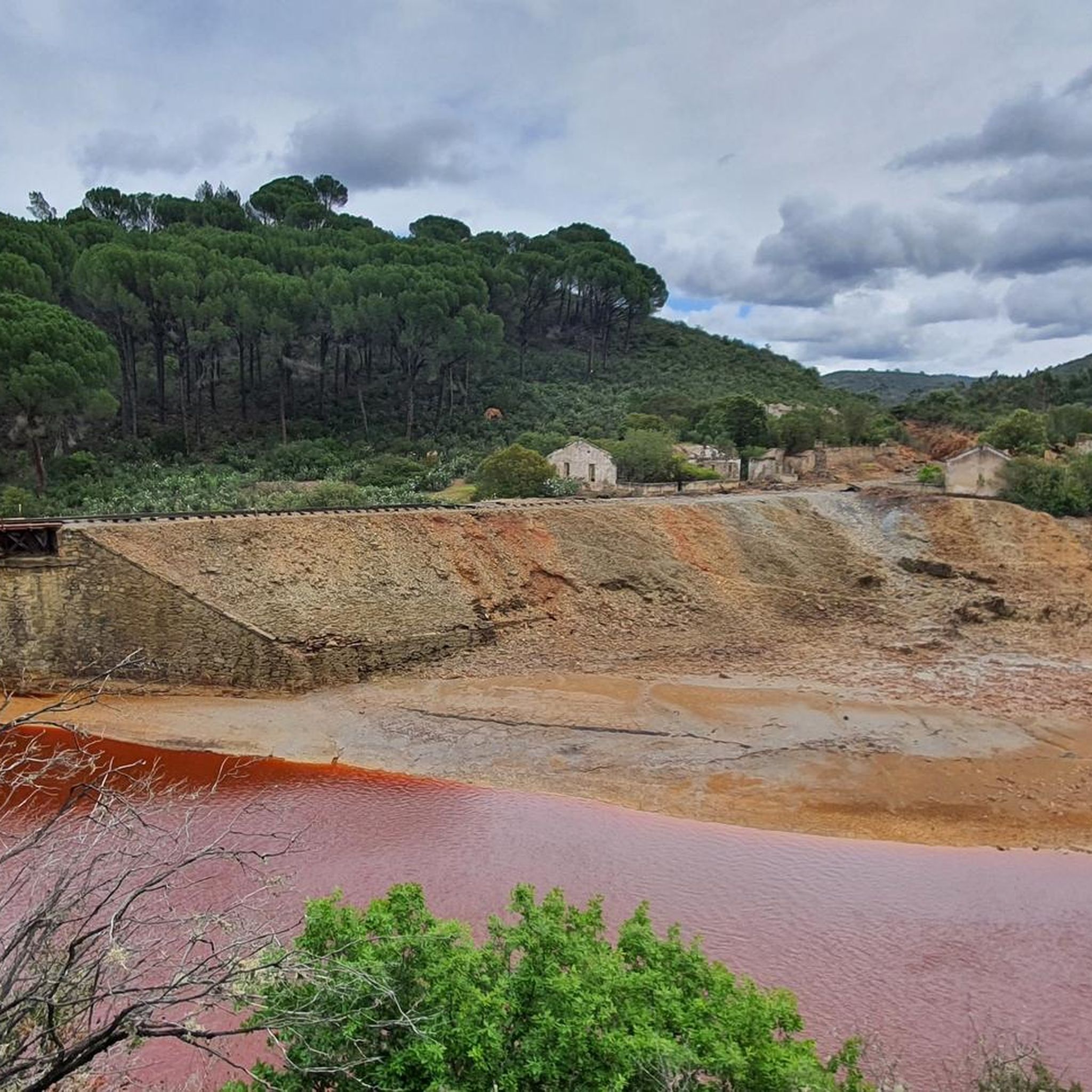
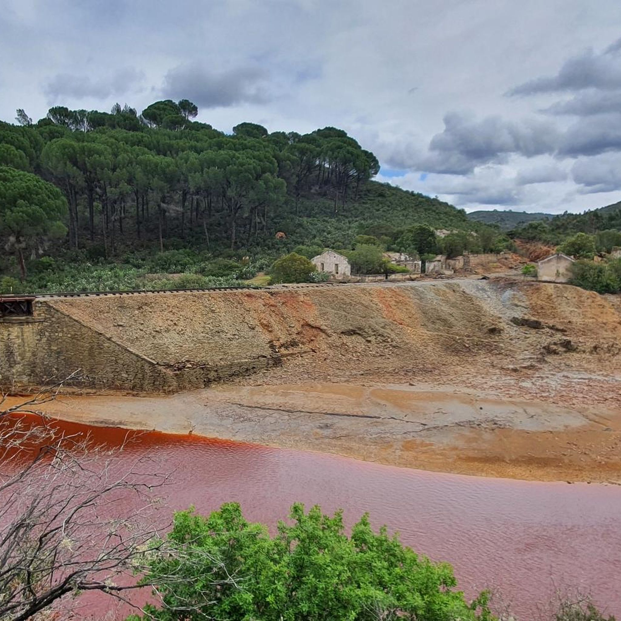
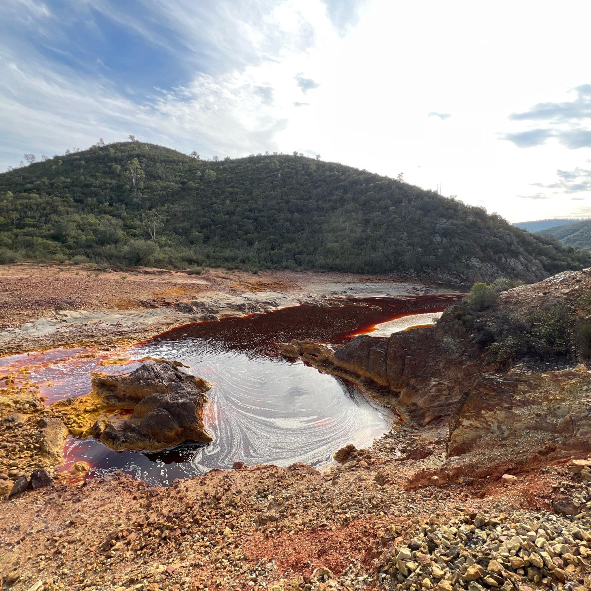
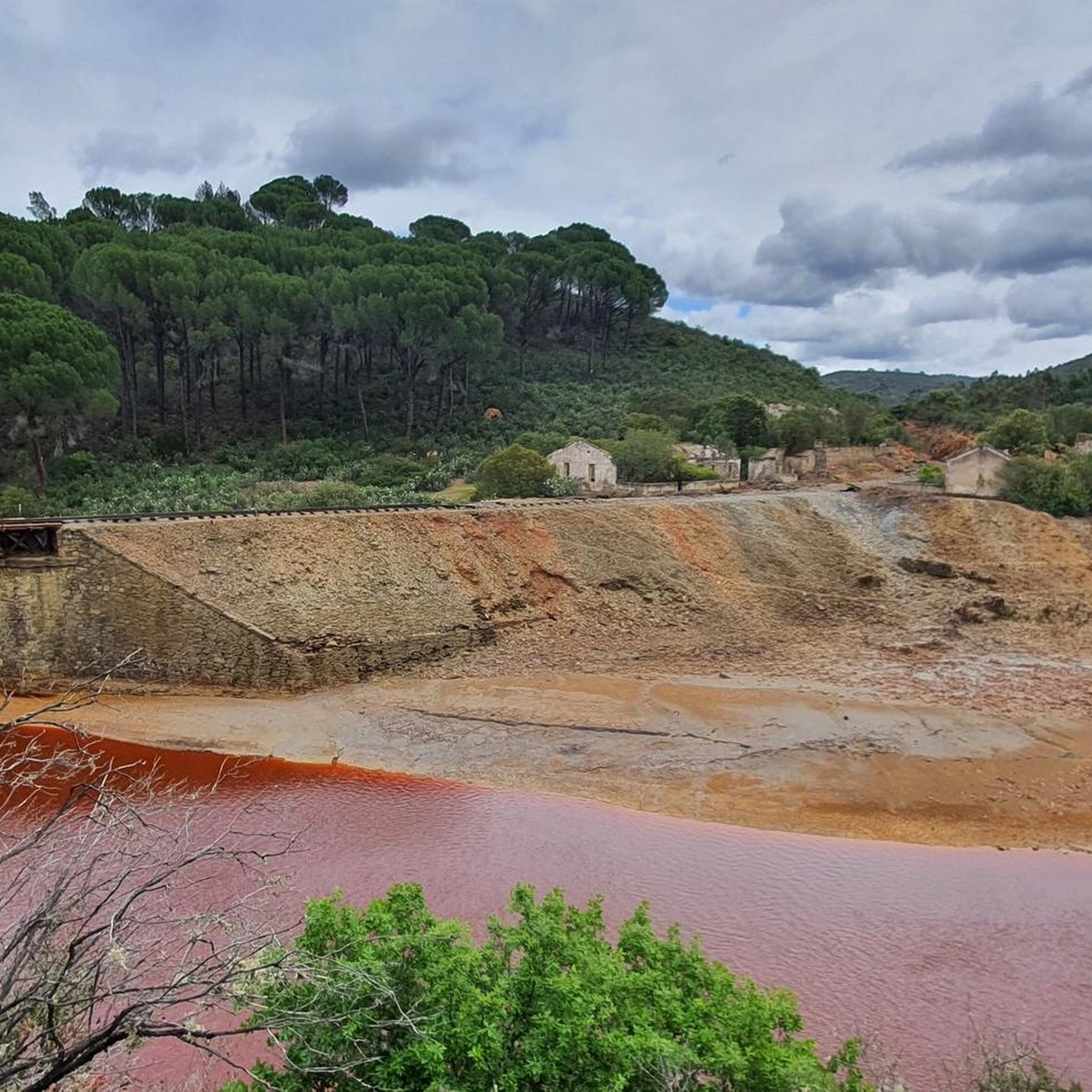
The Tinto River is famous for its intense red-colored waters and extreme acidity, caused by the oxidation of iron and sulfide minerals. It is so peculiar that NASA and other space agencies study it as a terrestrial analogue of Mars, as its extreme conditions host microorganisms capable of surviving in very hostile environments. Furthermore, the area has been mined for over 5000 years by Phoenicians, Romans, and other civilizations.
0
0


Obligatory stopping point if you take the road. There are incredible views even of the Rio Tinto mining railway.
0
0

Religious sanctuary of the town of Berrocal. Said congregation was divided into two buildings that represented two sides, the one above and the one below. That is why we still find the Hermitage of the Brotherhood of the Santa Cruz de Abajo and the one above.
1
1

Old station that is located a few kilometers from the town of Nerva and that was used to transport the materials extracted from the mine.
1
0
Road that passes through where there are the train tracks that brought the materials that came out of the mines to the town of Nerva. These tracks are currently still used by the tourist train that runs there, but the path allows you to see them perfectly as well as the river that is nearby.
3
0
Section of river that is crossed by the road but from where you can see the water passage before entering again towards the mountains near El Madroño.
1
0
A museum dedicated to mining activity in the area and its history. It has an important museographic collection that ranges from archaeological pieces to mining extraction machinery and railway locomotives. The Museum building is the former mining hospital of the Rio Tinto Company Limited.
1
0
Frequently Asked Questions
How many road cycling routes are available around Berrocal?
There are over a dozen road cycling routes around Berrocal, with 11 routes detailed in this guide. The region, part of the Sierra Norte de Málaga, is recognized as a "Bike Territory" and offers an extensive network of over 900 kilometers for cycling.
What is the typical terrain like for road cycling in Berrocal?
The terrain around Berrocal is diverse, ranging from relatively flat sections through extensive olive groves to challenging mountain climbs. You can expect varied topography, including demanding ascents with significant elevation gain, especially near natural parks like El Torcal, where gradients can reach up to 14%.
Are there challenging routes for experienced road cyclists?
Yes, Berrocal is well-suited for experienced road cyclists. Most routes in the area are classified as difficult, featuring substantial elevation gains. For example, the Nerva, El Madroño, route covers 36.3 miles (58.5 km) with over 1,100 meters of climbing. Another challenging option is the Old Zarandas-Naya Station – Riotinto Mines loop from Zarandas-Naya, which is 60.4 miles (97.3 km) long with nearly 1,600 meters of ascent.
Can I find easier road cycling routes in the Berrocal area?
While many routes in Berrocal are challenging, the region does offer varied terrain. For flatter, less demanding rides, consider areas around the Fuente de Piedra Lagoon, known for its circular routes and opportunities for birdwatching. These routes provide a contrasting experience to the mountainous climbs.
Are there any circular road cycling routes around Berrocal?
Yes, there are several circular road cycling routes. A popular option is the Nerva, Minas de Riotinto, Zalamea La Real – circular route, a difficult 33.2-mile (53.5 km) path with nearly 950 meters of climbing. Another is the El Madroño – El Berrocal Viewpoint loop from Berrocal, covering 40.8 km with 948 meters of elevation gain.
What natural features or landmarks can I expect to see while cycling?
Road cycling routes around Berrocal offer stunning natural features. You'll pass through extensive olive groves and "Bosques-Islas" of native flora. The unique karstic landscapes of El Torcal Natural Park are a major highlight, offering breathtaking views of its sculpted rock formations. The Fuente de Piedra Lagoon is another notable natural feature, famous for its flamingos and birdwatching opportunities.
Are there any historical or cultural sites accessible by bike?
Yes, the region boasts several historical and cultural sites. Near Villanueva de Algaidas, you can explore the Los Alcaides Necropolis and ancient cave chapels. Along some routes, you might encounter sites related to the Riotinto Mines, such as the Corta Atalaya Mine, the Touristic Railway for Rio Tinto Mines, or the Riotinto Mines themselves.
What is the best time of year to go road cycling in Berrocal?
The region generally offers good cycling conditions for much of the year. Spring and autumn are often ideal, providing pleasant temperatures for tackling climbs and enjoying the scenery. Summers can be hot, especially in the middle of the day, while winters are typically mild.
Is public transport available to access road cycling routes in Berrocal?
While specific public transport links directly to trailheads might be limited, towns like Villanueva de Algaidas, which serves as a base for exploring the area, are generally accessible. For detailed public transport information, it's advisable to check local bus schedules for connections to the starting points of your chosen routes.
Where can I find parking for road cycling routes in Berrocal?
Parking is typically available in the towns and villages that serve as starting points for routes, such as Villanueva de Algaidas or Nerva. Look for public parking areas within these communities. When planning your route, consider starting from a location with established parking facilities.
Are there any family-friendly road cycling options?
Given that most routes in this guide are rated as difficult, the immediate area around Berrocal might be more suited for experienced cyclists. However, for family-friendly options, consider the flatter, circular routes around the Fuente de Piedra Lagoon, which offer a more relaxed cycling experience suitable for various fitness levels.
What do other cyclists say about road cycling in Berrocal?
Over 130 road cyclists have used komoot to explore Berrocal's varied terrain. They often praise the diverse topography, from the extensive olive groves to the challenging climbs, and the proximity to unique natural landscapes like El Torcal. The region's recognition as a "Bike Territory" also highlights its appeal to the cycling community.
Are there any long-distance road cycling routes in the area?
Yes, the region offers options for longer rides. The Old Zarandas-Naya Station – Riotinto Mines loop from Zarandas-Naya is a significant route, stretching 60.4 miles (97.3 km) and typically taking over 5 hours to complete, making it suitable for those seeking a longer challenge.
Most popular attractions around Berrocal

Get inspired with the komoot mobile app


Explore more
Browse the best Road cycling routes in other regions.
