The best walks and hikes around Lastras De Cuéllar
8
hikers
4
hikes
Hiking around Lastras De Cuéllar offers diverse natural landscapes, characterized by extensive pine forests covering over 60% of the municipality. The region features an undulating relief, with the Cega River flowing through, creating picturesque riverside environments. Notable lacustrine complexes, including the Carrizal and La Tenca lagoons, provide crucial habitats for migratory birds. The area's geological character is influenced by the limestone rock upon which the town is built.
Best hiking trails around Lastras De Cuéllar
- The most popular hiking route…
Last updated: July 15, 2026
16.6km
04:15
70m
70m
Moderate hike. Good fitness required. Easily-accessible paths. Suitable for all skill levels.
21.9km
05:42
130m
140m
Hard hike. Very good fitness required. Easily-accessible paths. Suitable for all skill levels.

Sign up for free
4
hikers
5.73km
01:28
20m
20m
Easy hike. Great for any fitness level. Easily-accessible paths. Suitable for all skill levels.
2
hikers
6.52km
01:41
30m
30m
Easy hike. Great for any fitness level. Easily-accessible paths. Suitable for all skill levels.
2
hikers
8.70km
02:14
30m
30m
Moderate hike. Good fitness required. Easily-accessible paths. Suitable for all skill levels.
Our route recommendations are based on thousands of hikes, rides, and runs completed by other people on komoot.
Start today with a free account
Your next adventure awaits.
Login or Signup



Tips from the Community

The 17th century church of San Andrés is located in the Plaza de España, the central point of the town of Cantalejo, declared a Site of Cultural Interest in 1995. Right next to it there is a water fountain.
2
0
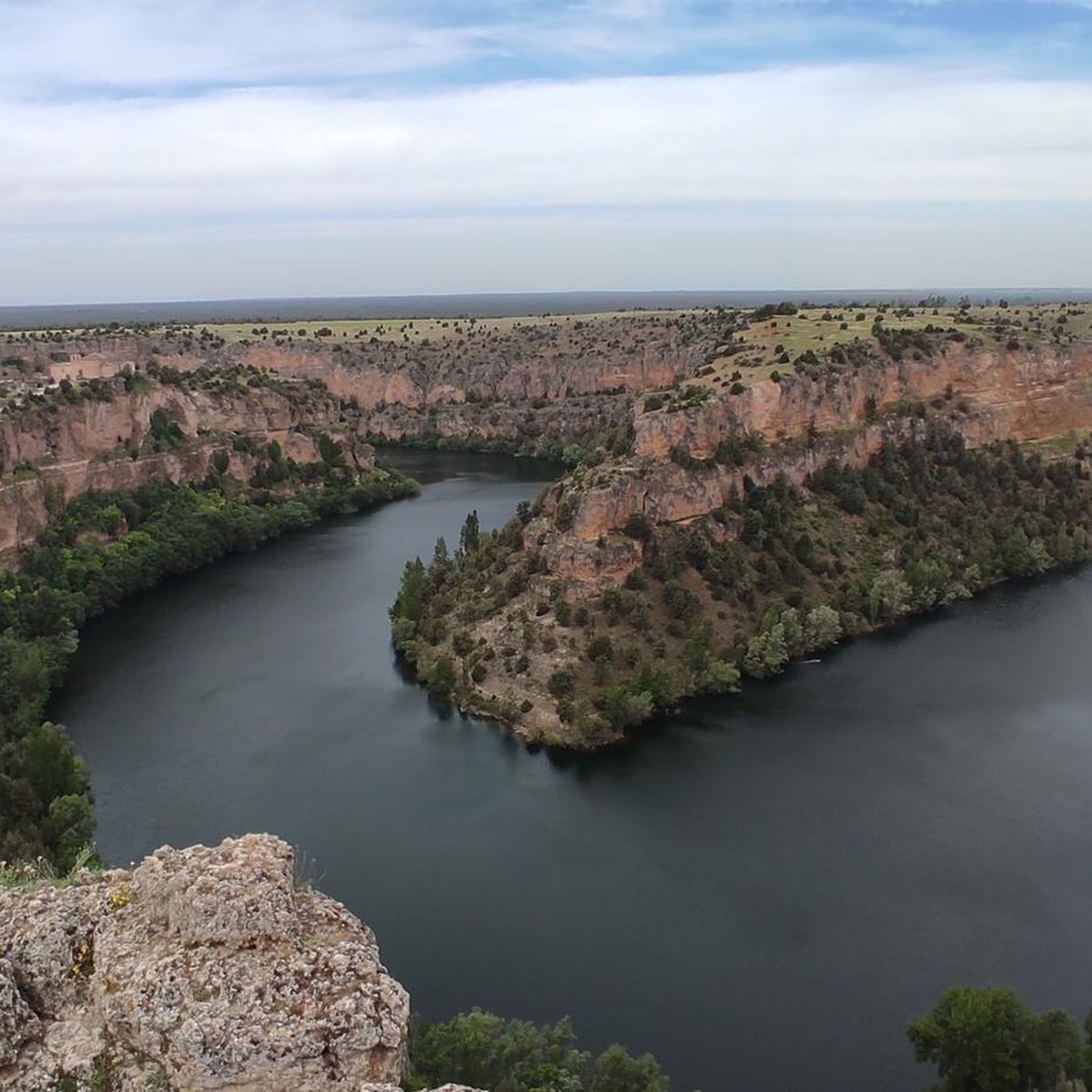
We are at the Convento de la Hoz Viewpoint, which offers us beautiful panoramic views of the meanders of the Duratón River and the Hoz Monastery located in the town of La Hoz de la Vieja. It is accessed via a beautiful forest track of a few kilometers and upon arrival it impresses you with its spectacular views. Highly recommended!
1
1

On the tour of this lake complex, a special bird protection area (SPA), I recommend bringing binoculars to watch birds and wild animals.
1
0

Population that is located in the old middle of the province of Segovia and that is characterized by being in a flat area where the protected natural area of the Hozes del Río Duratón is located to the north.
1
0
Close to the town of Cantalejo there are a set of lagoons that give this area a special landscape. Depending on the time of year, the lagoons are either full or dry, in summer.
1
0
Fuentepelayo is one of those towns that is located in the old middle of the plain between the Sierra de Guadarrama and the Río Duero valley. It is characterized by having two churches at its core, the Iglesia de Santa María and the Iglesia de El Salvador.
0
0
Frequently Asked Questions
What kind of terrain can I expect on hikes around Lastras De Cuéllar?
The terrain around Lastras De Cuéllar is diverse, featuring extensive pine forests, picturesque riverside environments along the Cega River, and significant wetland areas. You'll find an undulating relief, with the town itself built on limestone rock, and Mount Navacedón reaching 908 meters to the north. Routes often contrast cultivated lands with dense forests and riverbanks.
Are there easy hiking routes suitable for beginners in Lastras De Cuéllar?
Yes, Lastras De Cuéllar offers several easy hiking routes perfect for beginners. For instance, the Cantalejo loop from Cantalejo is a 3.5-mile (5.7 km) trail that takes about 1 hour 28 minutes. Another easy option is the Church of San Andrés loop from Cantalejo, which is 2.2 miles (3.6 km) long.
What natural features or landmarks can I see while hiking in the area?
Hikers can explore a rich variety of natural features and landmarks. The region is known for its vast pine forests, the scenic Cega River, and significant wetlands like the Carrizal and La Tenca lagoons, which are crucial habitats for migratory birds. You can also visit the Cantalejo Lagoons or the Lagunas de Cantalejo. Historically, sites like the chimney of the old resin factory and traditional 'Peguera' constructions offer glimpses into the region's industrial past.
Are there any circular hiking routes available?
Yes, many routes in Lastras De Cuéllar are circular, allowing you to start and end in the same location. A popular choice is Lagunas de Cantalejo — circular por Cantalejo, a moderate 10.3-mile (16.6 km) trail. Another option is the Hoces del río Duratón — circular desde Cantalejo por Fuenterrebollo y Sebúlcor, a more challenging 13.6-mile (21.9 km) path.
What is the best time of year to go hiking in Lastras De Cuéllar?
Lastras De Cuéllar offers enjoyable hiking throughout much of the year. The local council often specifies recommended seasons for various routes, suggesting that spring and autumn are ideal for comfortable temperatures and vibrant natural scenery. The pine forests provide shade in warmer months, while the wetlands are particularly interesting during migratory bird seasons.
Are the hiking trails in Lastras De Cuéllar suitable for families with children?
Yes, the area has routes suitable for families. Many of the easy, shorter loops, such as the Cantalejo loop from Cantalejo, are great for families looking for a less strenuous outing. The diverse landscapes, including pine forests and wetlands, offer engaging environments for children to explore nature.
Can I bring my dog on the hiking trails?
Generally, dogs are welcome on many hiking trails in Lastras De Cuéllar, especially in the extensive pine forests and along riverbanks. However, it's always advisable to keep dogs on a leash, particularly in areas designated as Special Protection Areas for Birds (ZEPA) like the Riberas del Río Cega and around the lagoons, to protect local wildlife.
What kind of wildlife can I expect to see while hiking?
Lastras De Cuéllar is rich in biodiversity. You might spot various bird species, especially around the wetlands and the Cega River, which is a Special Protection Area for Birds. Mammals such as squirrels, badgers, deer, wild boars, and even otters can be found. The nearby European Bison Reserve also offers a unique opportunity to observe bison, deer, and raptors.
Are there any cultural or historical sites to visit near the hiking routes?
Beyond the natural beauty, Lastras De Cuéllar offers several cultural and historical attractions. You can visit the Ethnographic Museum, explore the 13th-14th century Church of Santa María Magdalena, or see the hermitages of Humilladero and Nuestra Señora de Salcedón. The site of La Serreta, with its 15th-century palace and 16th-century San Diego hermitage, is also worth exploring.
How long do hikes typically take in Lastras De Cuéllar?
Hiking durations vary significantly depending on the route's length and difficulty. Easy loops, like the Church of San Andrés loop from Cantalejo, can be completed in about 1 hour. Moderate trails, such as Lagunas de Cantalejo — circular por Cantalejo, typically take around 4 hours 15 minutes, while more difficult and longer routes can extend to over 5 hours.
What are the elevation changes like on trails in Lastras De Cuéllar?
The region features an undulating relief, so elevation changes are generally moderate. While Mount Navacedón reaches 908 meters, many trails, especially the easier ones, have relatively gentle ascents and descents. For example, the Cantalejo loop from Cantalejo has only about 22 meters of elevation gain, while more challenging routes like Hoces del río Duratón — circular desde Cantalejo por Fuenterrebollo y Sebúlcor involve around 134 meters of ascent.
Most popular routes around Lastras De Cuéllar
Most popular attractions around Lastras De Cuéllar

Get inspired with the komoot mobile app


Explore more
Browse the best Hikes in other regions.
