The best road cycling routes around Lastras De Cuéllar
4.3
(5)
288
riders
30
rides
Road cycling around Lastras De Cuéllar features diverse landscapes with an undulating relief, providing varied terrain for cyclists. The region is characterized by extensive pine forests covering over 60% of the municipal area, offering scenic backdrops. The Cega River flows through the municipality, creating natural areas with lush vegetation along its banks. Additionally, several lagoons, including Laguna del Carrizal, contribute to the region's varied scenery.
Best road cycling routes around Lastras De Cuéllar
- The most popular road cycling route is…
Last updated: October 28, 2026
10
riders
72.8km
02:54
350m
350m
Moderate road ride. Good fitness required. Mostly well-paved surfaces and easy to ride.
10
riders
55.0km
02:26
540m
550m
Moderate road ride. Good fitness required. Mostly well-paved surfaces and easy to ride.

9
riders
134km
06:23
1,830m
1,830m
Hard road ride. Very good fitness required. Mostly well-paved surfaces and easy to ride.
9
riders
62.0km
02:42
570m
570m
Moderate road ride. Good fitness required. Mostly well-paved surfaces and easy to ride.
13
riders
71.9km
03:25
960m
960m
Hard road ride. Very good fitness required. Mostly well-paved surfaces and easy to ride.
Get access to more routes and recommendations from other explorers.
Already have an account?
Our route recommendations are based on thousands of hikes, rides, and runs completed by other people on komoot.
Start today with a free account
Your next adventure awaits.



Tips from the Community

It's a classic climb in the Vuelta a España and in cyclotourism events like the Perico Delgado ride. The switchbacks section is very demanding: The first 4 km are gentle (2-3%). From the Puente de la Cantina (Cantina Bridge), ramps of 6-7% begin. Between km 6 and 8 are the five tightest bends, almost linked together, in a wooded area. The final kilometer has a steep ramp before reaching the summit.
1
0
They are located on the Segovia side of the Navacerrada Pass, on the CL-601 road (formerly the N-601), which connects La Granja de San Ildefonso with the pass. Approximate altitude: between 1,400 m and 1,700 m. There are seven hairpin bends that traverse the foothills of the Sierra de Guadarrama mountain range. Total length of the pass on this side: 13.6 km, with a 669 m elevation gain and an average gradient of 4.9%. The steepest ramps are in the switchbacks, with gradients of 6-8% and occasional sections reaching 9%. Summit at the Navacerrada Pass (1,856 m).
1
0

The Siete Revueltas are one of the most iconic sections of the road that ascends to the Navacerrada Pass. This section consists of seven hairpin bends, one after the other, marking the final and toughest part of the climb from the Segovia side.
0
0
Fuentidueña has remains of Romanesque walls, several gates and towers. Among them, the Puerta de Alfonso VIII stands out, part of the remains of the castle that today is in ruins. The castle, located in the upper part of a large walled area, had the function of a fortress and served as a last stronghold in case of attack on the population. 😊🏰
4
0

This small town, with only 77 inhabitants, has a beautiful historic center. The Plaza Mayor stands out, with its cobbled streets, and the parish church of Nuestra Señora de la Asunción.
1
0

San Pedro de Gaíllos is a town located at the entrance to the great plains in the north of the province of Segovia. The town, with its church as its flag, governs the core.
1
0

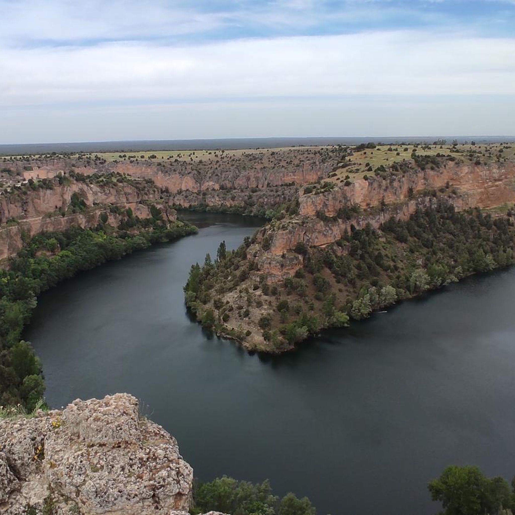
Spectacular view of the Burgomillodo Reservoir Dam. A good place to stop for a coffee or something to eat along the way.
0
0
The small rural town of Carrascal del Río is one of the gateways to the Hoces del Río Duratón Natural Park. The most notable monument of the town in addition to the river landscape is the Church of Our Lady of the Assumption. You can rest in the shade of the trees next to the church.
0
0
Frequently Asked Questions
What kind of terrain can I expect when road cycling around Lastras De Cuéllar?
Lastras De Cuéllar offers a varied road cycling experience with an undulating relief. You'll encounter extensive pine forests, which cover over 60% of the municipal area, providing scenic and often shaded routes. The region also features the Cega River valley and several lagoons, contributing to diverse landscapes. The terrain includes a mix of flat stretches and gentle inclines, typical of the Meseta Central and Tierra de Pinares.
How many road cycling routes are available in Lastras De Cuéllar?
There are over 30 road cycling routes available around Lastras De Cuéllar on komoot. These routes cater to various skill levels, with options ranging from easy to difficult, ensuring there's something for every road cyclist.
Are there routes suitable for experienced road cyclists seeking a challenge?
Yes, experienced road cyclists will find challenging routes with significant elevation gain. For instance, the Navacerrada Pass – Plaza de España, Rascafría loop from Cantalejo is a difficult 158.4 km trail with over 2,400 meters of ascent. Another demanding option is the Navafría Pass – Puerto de Navafría loop from Cantalejo, covering 99.7 km with over 1,400 meters of climbing.
What natural features can I see along the road cycling routes?
Road cycling routes in Lastras De Cuéllar often pass through beautiful natural areas. You can expect to see vast pine forests, the lush banks of the Cega River, and several significant lagoons such as Laguna del Carrizal, Laguna de la Tenca, and the Cantalejo Lagoons. These wetlands are important for biodiversity and offer picturesque views.
Are there any cultural or historical landmarks to visit while cycling?
Yes, the region offers several cultural and historical points of interest. You might encounter the 13th-14th century Church of Santa María Magdalena, or the hermitages of Humilladero and Nuestra Señora de Salcedón. Nearby, you can also visit Turégano Castle or explore the charming settlements of Aguilafuente and Fuentepelayo.
What do other road cyclists think about the routes in Lastras De Cuéllar?
The road cycling routes in Lastras De Cuéllar are highly rated by the komoot community, with an average score of 4.5 stars. Cyclists often appreciate the varied terrain, the scenic pine forests, and the quiet roads that make for an enjoyable experience.
Are there any moderate road cycling routes for a less intense ride?
Absolutely. A popular moderate option is the Church of San Andrés – Burgomillodo Dam loop from Torrecilla del Pinar. This 62.6 km route takes you through varied landscapes, including the Burgomillodo Dam, and is typically completed in about 2 hours 28 minutes. Another moderate route is the Church of San Andrés – La Cuesta loop from Cantalejo, which is 51.4 km long.
What is the best time of year for road cycling in Lastras De Cuéllar?
Given the continental climate, spring and autumn generally offer the most pleasant conditions for road cycling in Lastras De Cuéllar. Temperatures are milder, and the natural scenery is vibrant. Summers can be hot, and winters can be cold, so planning around these seasons is advisable for optimal comfort.
Are there any circular road cycling routes in the area?
Yes, many of the road cycling routes around Lastras De Cuéllar are designed as loops, allowing you to start and finish in the same location. For example, the San Pedro de Gaíllos – Church of San Andrés loop from Cantalejo is a moderate 54.9 km circular route.
What kind of vegetation can I expect to see along the routes?
Beyond the extensive pine forests, the region's natural vegetation includes species like lavender (cantueso), thyme, rockrose (jaras), and broom (retamas). This diverse flora adds to the sensory experience of cycling, especially during blooming seasons.
Is the area suitable for road cyclists looking for quiet roads?
Yes, the broader region, including areas near Lastras De Cuéllar, is known for having quiet roads that are suitable for cycling. This allows for a more peaceful and immersive experience as you explore the landscapes and natural features.
Most popular routes around Lastras De Cuéllar
Most popular attractions around Lastras De Cuéllar

Get inspired with the komoot mobile app


Explore more
Browse the best Road cycling routes in other regions.
