The best MTB trails around Nacionalni park Una
3.9
(12)
59
riders
3
rides
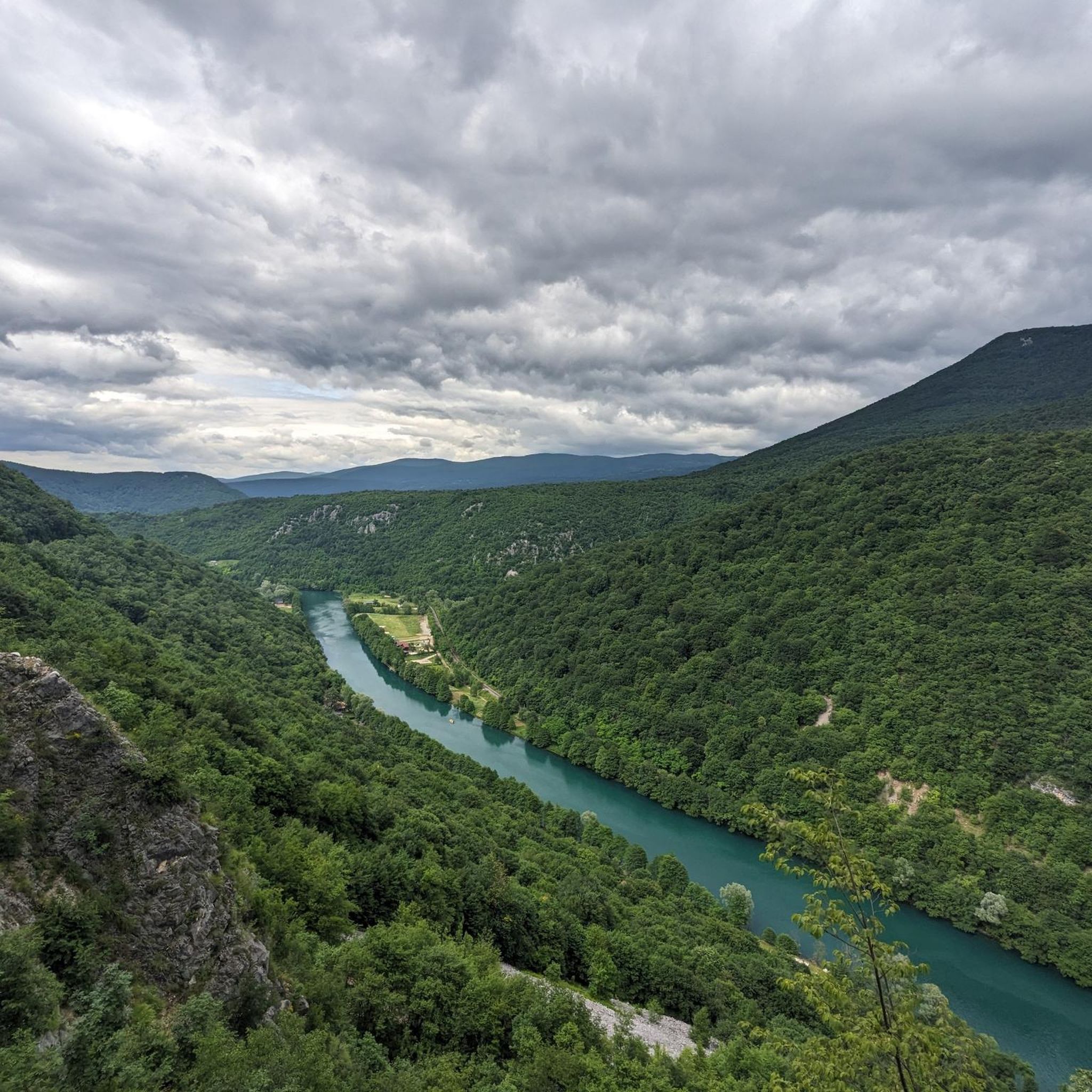
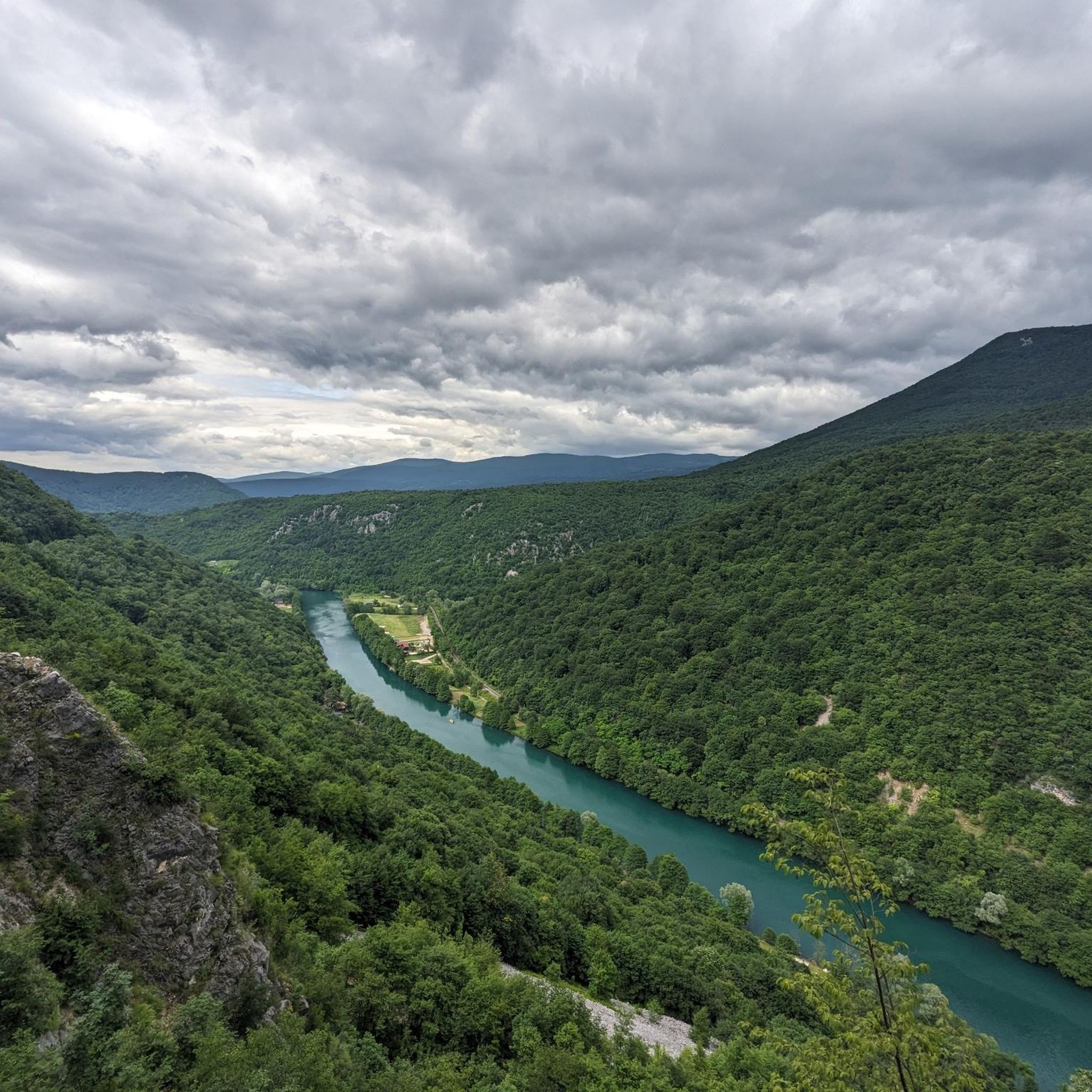
Mountain bike trails Nacionalni park Una traverse diverse landscapes, characterized by the Una River, its numerous waterfalls, and deep canyons. The region features vast, lush forests of beech, fir, and oak, alongside mountainous zones including parts of Plješevica, Grmeč, and Osječenica. These physical features create varied terrain with significant elevation changes, offering a range of mountain biking experiences. The park's well-preserved aquatic systems and karst springs contribute to its unique natural environment for outdoor activities.
Best mountain bike trails around…
Last updated: November 1, 2026
4.7
(11)
42
riders
Moderate mountain bike ride. Good fitness required.
4.0
(2)
15
riders
11.1km
00:57
220m
220m
Easy mountain bike ride.

5
riders
66.6km
05:46
1,260m
1,260m
Hard mountain bike ride. Very good fitness required.
Our route recommendations are based on thousands of hikes, rides, and runs completed by other people on komoot.
Start today with a free account
Your next adventure awaits.
Tips from the Community

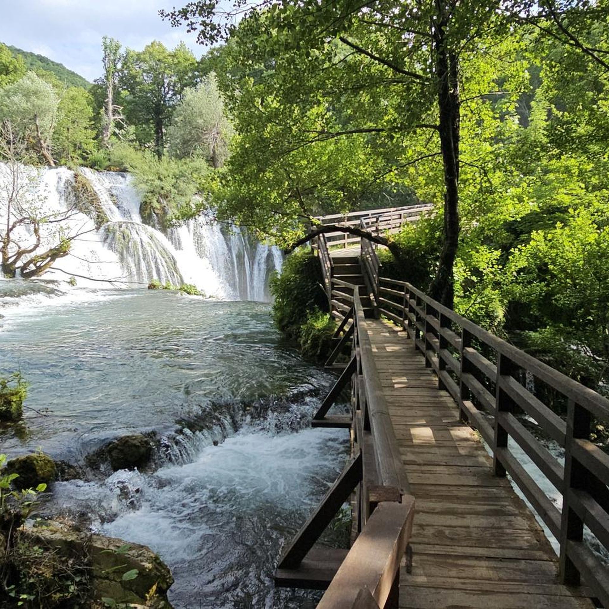
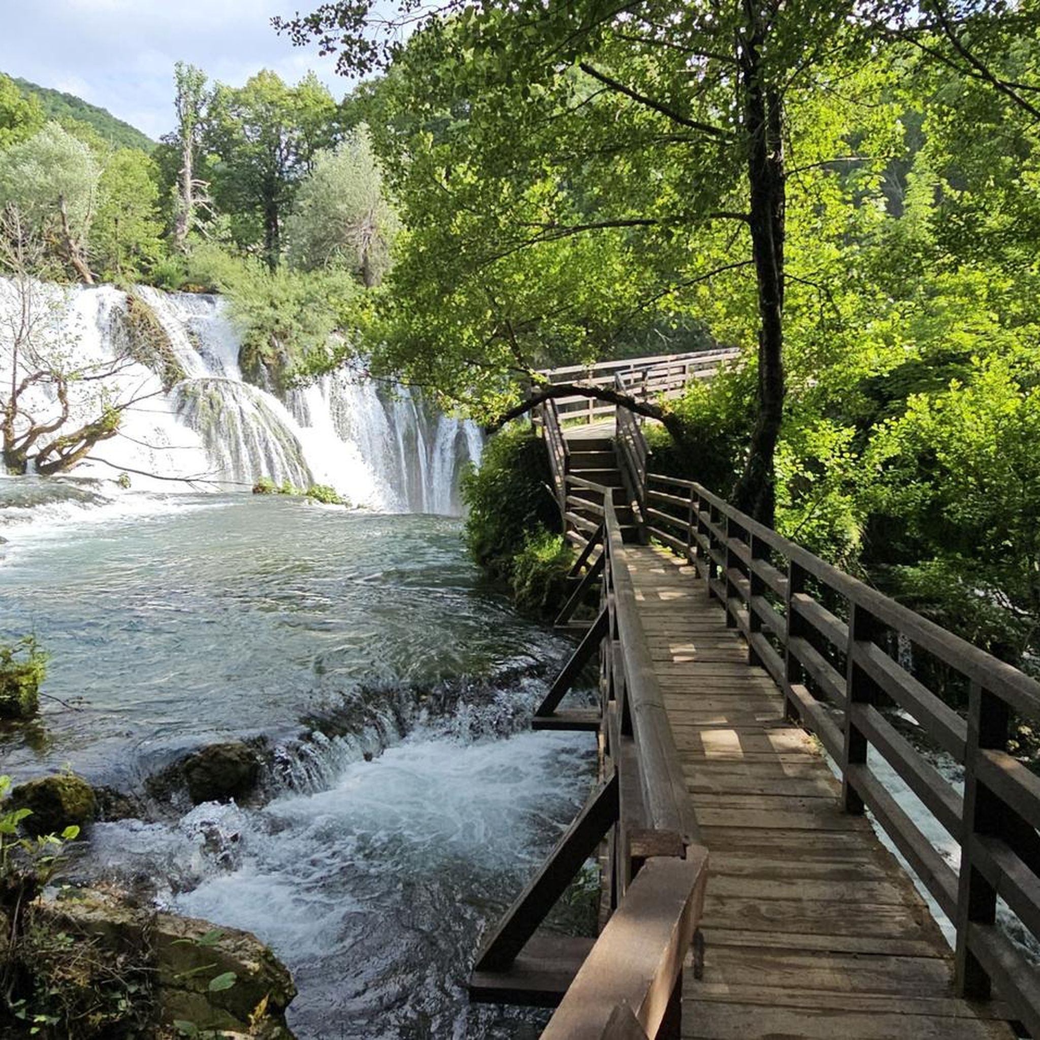
At this location in Martin Brod, as seen in most photos, is the so-called 'Small Waterfall'. It is located on one of the tributaries of the Una River, on the left side of the river course flowing between various village houses and catering establishments. The Unac is a tributary of the Una and flows into the Una about a kilometer downstream.
2
0
U strasnom zagrljaju dvije rijeke, na ušću Unca u Unu, ljubomorno čuva svoje čari neponovljiva i vjekovima nedirnuta prirodna ljepota, naseibuna Martin Brod. U ovom mjestu se nalazi najveći kompleks slapova u Nacionalnom parku “Una”, a nekad je ovdje postojao veliki broj mlinova i bučnica. Naselje je poniklo iz srednjovjekovnog grada koji je podignut krajem XIV ili početkom XV vijeka na ušću Unca u Unu, a postoje mišljenja historičara da ovaj stari grad datira iz XIII vijeka. Po zapisima iz 1396. godine ovaj grad se nazivao Konuba. U izvorima se prvi put spominje 1431. godine kada ga je ugarski kralj Sigismund založio Nikoli Frankopanu. U današnjem Martin Brodu nalazi se pravoslavni manastir Rmnaj koji predstavlja važno duhovno sjedište sjeverne Tromeđe (trograničja Bosne, Like i Dalmacije). Narodna tradicija pripisuje njegovo podizanje Katarini Branković – kćeri srpskog despota Đurđa Brankovića i bizantijske princeze Jerine Kantakuzin a supruzi grofa Urliha II Celjskog. U starijim dokumentima manastir Rmanj se naziva Hrmanj, Ajerman, Chermlja, Szermil, Hermanya, Herman a ime je dobio po Katarininom sinu Hermanu III koji je zbog bolesti mlad umro, te je njemu u spomen Katarina podigla manastir. U narodu se vremenom od imena Herman pretvori u naziv Rmanj i taj naziv je ostao do dana današnjeg. Izvor: https://npuna.com/martin-brod/
4
1
Near entrance number 5 to the National Park is the picnic area "Lučica", equipped with covered tables and benches, which has become an ideal place for locals and visitors to spend their free time pleasantly in nature, enjoying the freshness of the nearby Unac river which flows into the Una not far from this location. The picnic area is located on the right side of the road, just after the entrance to Martin Brod.
3
0
The old town of Ostrovica was built on a hill of the same name, on the left bank of the Una River, above Kulen Vakuf. Before coming under Ottoman rule, it was in the hands of the Frankopans, Juraj Mikulčić, and Ivan Keglević. It came under Ottoman rule in 1523 and only gained significance after the Peace of Karlovac in 1699. From 1523 to 1878, the Turks kept a garrison in Ostrovica. The Turks significantly expanded it, and it then acquired its present form. The town is essentially an elongated rectangle with strong walls up to 10 m high. In 1577, the garrison numbered 60 horsemen and 150 infantrymen, and in 1834, only 20 men. The Imperial forces attacked this town several times (1560, 1698, 1737, 1789, and 1834). In terms of size, Ostrovica was a small town, but as it was located close to both the Venetian and Austrian borders, and also had a favorable defensive position, it was given great importance. Therefore, work was constantly carried out on its expansion and strengthening. The town is surrounded by strong ramparts 10 meters high, with a length of 117 and a width of 83 meters. The main gate was located in front of the ramparts. The fortress consisted of four towers and two bastions. The main entrance is from the south, and the secondary entrance from the north. The commander of the garrison held the title of dizdar, and was officially titled bašaga. From 1699, if not earlier, a captain resided in Ostrovica, who around 1791 moved his seat to Prkosi. Among the dizdars of Ostrovica, the following are mentioned: Nesuhaga (1637), Muhamedaga (1700), and Alijaga (1783). The town also became the seat of the Ostrovica Captaincy, which was founded in the early years of the 18th century and extended on both sides of the upper course of the Una River. It included Orašac, Havala, Kulen Vakuf, and the palankas of Čovka and Donji Lapac. Its captains were members of the well-known Bosnian family Kulenović. Ostrovica, Kulen Vakuf, and Orašac had 989 men in the war of 1714–1718, and after the peace treaty, 561 men. The very next year, 1720, their number increased by 428 men. The military garrison remained in Ostrovica until 1878. https://kulen-vakuf.com/stari-gradovi.html
4
1
The old town of Ostrovica was built on the hill of the same name, on the left bank of the Una River, above Kulen Vakuf. Before coming under Ottoman rule, it was in the hands of the Frankopans, Juraj Mikulčić, and Ivan Keglević. It came under Ottoman rule in 1523 and gained significance only after the Peace of Karlovci in 1699. From 1523 to 1878, the Turks kept a garrison in Ostrovica. The Turks significantly expanded it, and it then acquired its present form. The town is essentially an elongated rectangle with strong walls up to 10 m high. In 1577, the garrison numbered 60 horsemen and 150 infantrymen, and in 1834, only 20 men. Imperial troops attacked this town several times (1560, 1698, 1737, 1789, and 1834). In size, Ostrovica was a small town, but as it was located near both the Venetian and Austrian borders, and also had a favorable defensive position, it was given great importance. For this reason, work was constantly carried out on its expansion and strengthening. The town is surrounded by strong ramparts 10 meters high, with a length of 117 and a width of 83 meters. The main gate was located in front of the ramparts. The fortress consisted of four towers and two bastions. The main entrance is from the south, and the secondary from the north. The garrison commander held the title of dizdar, and was officially titled bašaga. From 1699, if not even earlier, a captain resided in Ostrovica, who around 1791 moved his seat to Prkos. Among the dizdars of Ostrovica, the following are mentioned: Nesuhaga (1637), Muhamedaga (1700), and Alijaga (1783). The town also became the seat of the Ostrovica Captaincy, which was founded in the early years of the 18th century and extended on both sides of the upper course of the Una. It included Orašac, Havala, Kulen Vakuf, and the palankas of Čovka and Donji Lapac. Its captains were members of the well-known Bosnian family Kulenović. Ostrovica, Kulen Vakuf, and Orašac had 989 men in the war of 1714–1718, and after the peace treaty, 561 men. The very next year, 1720, their number increased by 428 men. The military garrison remained in Ostrovica until 1878. Source: https://kulen-vakuf.com/stari-gradovi.html
4
0
Jama ‘Bezdan’ je masovna grobnica na planini Hrgar, jugoistočno od Bihaća. Radi se o prirodnoj vertikalnoj pećini, širokoj dva do tri metra i dubokoj 85 metara. U septembru i oktobru 1997. godine, među slojevima smeća u jami, otkriveni su posmrtni ostaci 83 osobe, od kojih je identifikovano 65. Bron: https://massgravesmap.balkaninsight.com/bezdan-pit/?lang=bs
4
0
Šehidsko obilježje su podigli mještani Ostrovice kao spomen “ubijenim sela Ostrovice od Srbo-četničkog agresdora 1992. godine i u toku rata”. Na mermernoj ploči uklesano je ukupno 15 imena: 10 Ostrovčana ubijenih i bačenih u jamu ‘Bezdan’ na planinin Hrgar u ljeto 1992. godine, 4 mještana ubijena u toku rata i jedne mještanke, civilne žrtva rata.
4
0
Unac is a river in the western part of Bosnia and Herzegovina, a right tributary of the Una River.
4
1
Frequently Asked Questions
How many mountain bike trails are available in Nacionalni park Una?
Nacionalni park Una offers a selection of mountain bike trails catering to various skill levels. Our guide features 3 distinct routes, ranging from easy to difficult, with many more available on komoot.
What are the difficulty levels of mountain bike trails in Nacionalni park Una?
The trails in Nacionalni park Una vary in difficulty. You can find easy routes like the Ruins of Ostrovica Fortress – Ruins of Ostrovica Castle loop, moderate options such as the Ruins of Ostrovica Fortress – Destroyed Bridge over the Una loop, and challenging rides like the Martin Brod Waterfall – Small Waterfall at Martin Brod loop, which features significant elevation gain.
Are there any family-friendly mountain bike trails in Nacionalni park Una?
Yes, there are options suitable for families. The Ruins of Ostrovica Fortress – Ruins of Ostrovica Castle loop is an easy 11.3 km path with 220m elevation, perfect for a less strenuous family outing exploring the castle ruins and surrounding hills.
Can I find circular mountain bike routes in the park?
Yes, many of the mountain bike routes in Nacionalni park Una are designed as loops. Examples include the Ruins of Ostrovica Fortress – Destroyed Bridge over the Una loop and the Martin Brod Waterfall – Small Waterfall at Martin Brod loop, allowing you to start and finish at the same point.
What kind of terrain can I expect on the mountain bike trails?
Mountain biking in Nacionalni park Una offers diverse terrain. You'll encounter a mix of forest paths, gravel roads, and some asphalt sections. The region is characterized by lush forests of beech, fir, and oak, deep canyons, and significant elevation changes, especially on more challenging routes.
What natural attractions can I see while mountain biking in Nacionalni park Una?
The park is renowned for its stunning natural beauty. You can expect to see the emerald-turquoise Una River, impressive waterfalls like Štrbački Buk Waterfall and Milančev Buk Waterfall at Martin Brod, and picturesque river canyons. The trails often lead through dense forests and offer views of the surrounding mountains.
Are there historical sites or landmarks along the trails?
Yes, Nacionalni park Una boasts a rich cultural heritage. You can explore ancient citadels and fortresses such as the dramatic Ostrovica Fortress, which offers panoramic views, and Ostrožac Castle. Some routes, like the Ruins of Ostrovica Fortress – Ruins of Ostrovica Castle loop, specifically highlight these historical points of interest.
What do other mountain bikers say about the trails in Nacionalni park Una?
The mountain bike routes in Nacionalni park Una are highly rated by the komoot community, with an average score of 4.0 stars from over 10 reviews. Riders often praise the stunning natural scenery, the variety of terrain, and the opportunity to experience the pristine beauty of the Una River and its waterfalls.
When is the best time of year for mountain biking in Nacionalni park Una?
The spring, summer, and early autumn months generally offer the best conditions for mountain biking in Nacionalni park Una, with pleasant temperatures and lush landscapes. Winter riding may be possible but can be challenging due to snow and colder conditions, especially at higher elevations.
Are there options for advanced mountain bikers seeking a challenge?
Absolutely. For experienced riders, the Martin Brod Waterfall – Small Waterfall at Martin Brod loop is a challenging 68.6 km trail with a significant 1,270m elevation gain, leading through forested areas and past the impressive Martin Brod Waterfall. The NP Una-Osječenica cycling route, a 62 km round trip with 1137m of cumulative elevation gain, also offers a demanding experience with a high percentage of gravel paths.
Where can I find more information about the Una River's unique features?
The Una River is the centerpiece of the park, known for its exceptional purity and mesmerizing emerald-turquoise waters. It features impressive waterfalls, powerful rapids, and unique travertine barriers. For more detailed information about the river and the park's natural heritage, you can visit the official tourism site: tourismbih.com.
Are there any specific rules or restrictions for mountain biking in Nacionalni park Una?
While cycling is generally encouraged on designated trails and forest roads, it's important to note that it may not be permitted in all specific areas, such as directly around the Martin Brod waterfall, to protect the sensitive ecosystem. Always observe local signage and regulations within the park.
Most popular attractions around Nacionalni park Una

Get inspired with the komoot mobile app


Explore more
Browse the best MTB trails in other regions.
