The best walks and hikes around Barford St. Martin
4.6
(565)
6,240
hikers
20
hikes
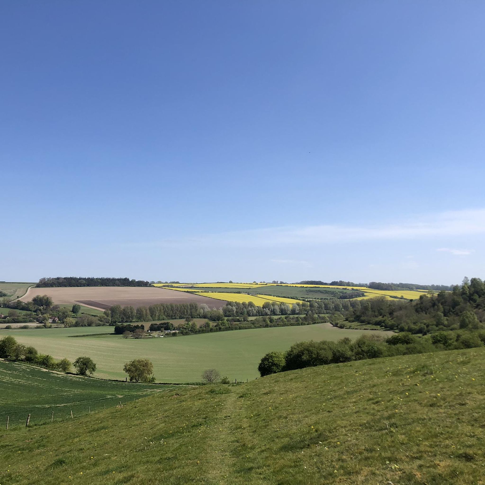
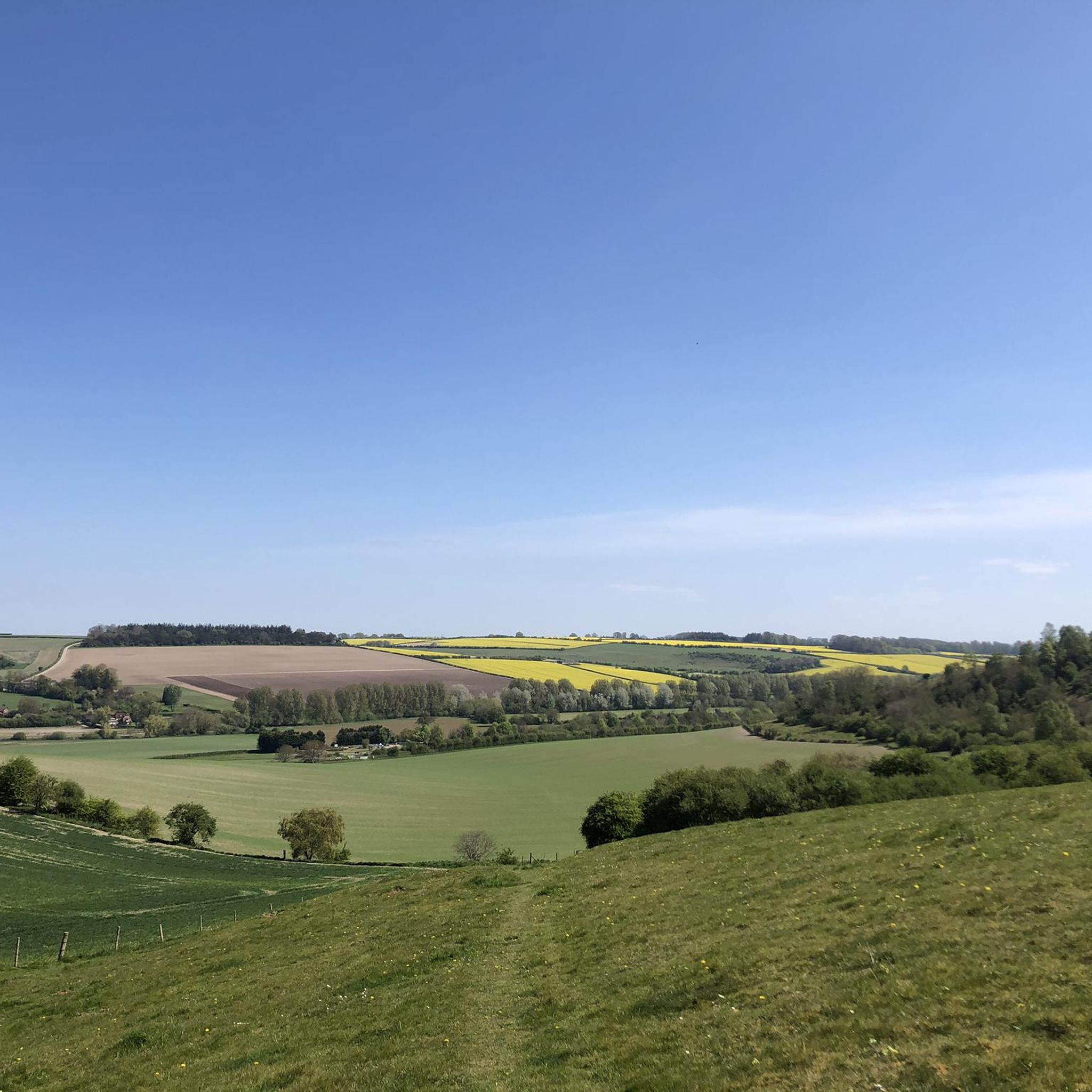
Hikes around Barford St. Martin explore the Cranborne Chase National Landscape. The area is characterized by rolling chalk downlands, the meandering River Nadder, and the ancient Grovely Wood. This landscape provides a mix of woodland paths, riverside walks, and open-field trails.
Best hiking trails around Barford St. Martin
- The most popular hiking route is Heath Hill, Hadden Hill & Grovely Wood loop from Barford St Martin, a 8.4 mile (13.5 km) trail that takes around 3 hours 45 minutes to complete. This is a moderate route that combines hills with sections through Grovely Wood.
- Another top favourite among local hiking enthusiasts is Hadden Hill via Grovely Wood — Cranborne Chase and West Wiltshire Downs, an easy 4.2 mile (6.7 km) path. The trail offers a shorter experience of the area's woodland and hills.
- Local hiking enthusiasts also love the Grovely Wood Forest Trail loop from Great Wishford, a 3.3 mile (5.4 km) trail leading through the forest, often completed in about 1 hour 30 minutes.
- Hiking around Barford St. Martin is defined by ancient woodlands, chalk downlands, and paths along the River Nadder. The network of trails offers options suitable for different ability levels.
- The routes in Barford St. Martin are highly rated by the komoot community with an average score of 4.6 stars from more than 190 reviews. More than 2,800 hikers have used komoot to explore Barford St. Martin's varied terrain.
Last updated: September 27, 2026
4.8
(9)
39
hikers
6.70km
01:51
110m
110m
Embark on an easy hiking adventure along the Monarch's Way and Grovely Wood Loop, a route that winds through varied landscapes. You will cover 4.2 miles (6.7 km) with a gentle elevation gain of 356 feet (109 metres), making it a pleasant journey for most. Expect to spend around 1 hour and 50 minutes exploring the tranquil woodland paths and open downland views. The trail offers a refreshing escape into nature, allowing you to immerse yourself in the peaceful atmosphere of Wiltshire's countryside.
Planning your visit to the Monarch's Way and Grovely Wood Loop is straightforward. The paths are generally well-maintained, consisting of woodland tracks and bridleways, though you might encounter some flinty soil and exposed tree roots in places. Parking is typically available near the trailheads, ensuring easy access for those arriving by car. This route is suitable for a relaxed outing, and its easy difficulty makes it a great choice for a casual hike any time of year.
This loop offers a unique blend of natural beauty and historical intrigue. As you hike, you will follow sections of the historic Monarch's Way, a long-distance footpath tracing King Charles II's escape route. Keep an eye out for ancient Roman roads and Iron Age earthworks that hint at the area's long past. The trail also takes you through Grovely Wood, one of Wiltshire's largest mixed woodlands, providing a sense of discovery as you connect with centuries of history and nature.
5.0
(3)
15
hikers
13.5km
03:48
280m
280m
Embark on a moderate hike through the varied landscapes of the Heath Hill, Hadden Hill & Grovely Wood loop. This 8.4-mile (13.5 km) route takes you across rolling chalk downlands and into ancient woodlands, offering 924 feet (282 metres) of elevation gain over approximately 3 hours and 47 minutes. You will find yourself immersed in the expansive Grovely Wood, one of Wiltshire's largest mixed woodlands, known for its serene atmosphere. Later, enjoy wide-open views from viewpoints like Hadden Hill, providing a pleasant break from the forest paths. The trail combines diverse terrain, from shaded woodland trails to open-field sections.
This moderate hike requires a good level of fitness, so be prepared for a solid outing. While many paths are accessible, some sections demand sure-footedness. Good hiking shoes are highly recommended, especially if you are visiting between autumn and spring, as parts of the trail can become muddy. Plan your visit to allow ample time to complete the full loop comfortably before dusk.
This route is nestled within the beautiful Cranborne Chase and West Wiltshire Downs Area of Outstanding Natural Beauty. A significant portion of your journey winds through Grovely Wood, which is recognized for its nature conservation importance. Keep an eye out for the Purple Emperor butterfly, which calls this woodland home. The trail offers a unique opportunity to experience both ancient forest and open chalk downland in one continuous loop.

5.0
(1)
11
hikers
19.7km
05:19
260m
260m
Embark on the Grovely Wood loop for a challenging hike through ancient woodlands and open downland in the Cranborne Chase & West Wiltshire Downs. This difficult 12.2-mile (19.7 km) route involves 846 feet (258 metres) of elevation gain and typically takes around 5 hours and 18 minutes to complete. You will traverse varied terrain, from tranquil forest paths with oak, ash, and beech trees to expansive chalk downland offering panoramic views of the surrounding countryside, including glimpses of Stonehenge. Expect moderately steep sections as you climb wooded hillsides, and look for chalk grassland bursting with wildflowers on open spaces like Little Langford Down.
Given the trail's difficult rating and varied terrain, good fitness is required for this hike. Sturdy hiking boots are advisable, especially after rain, as paths in Grovely Wood can become muddy. Consider planning your visit for spring, when the woods are particularly beautiful and chalk grasslands are awash with wildflowers.
Grovely Wood is rich in history, with evidence of Iron Age settlements, ancient earthworks, and a Roman road running through it. You will also walk a section of the historic Monarch's Way, tracing King Charles II's escape route. Keep an eye out for the
5.0
(1)
14
hikers
12.2km
03:17
150m
150m
Moderate hike. Good fitness required. Easily-accessible paths. Suitable for all skill levels.
5.0
(1)
6
hikers
13.6km
03:40
170m
170m
Moderate hike. Good fitness required. Easily-accessible paths. Suitable for all skill levels.
Get access to more routes and recommendations from other explorers.
Already have an account?
Our route recommendations are based on thousands of hikes, rides, and runs completed by other people on komoot.
Start today with a free account
Your next adventure awaits.

Tips from the Community

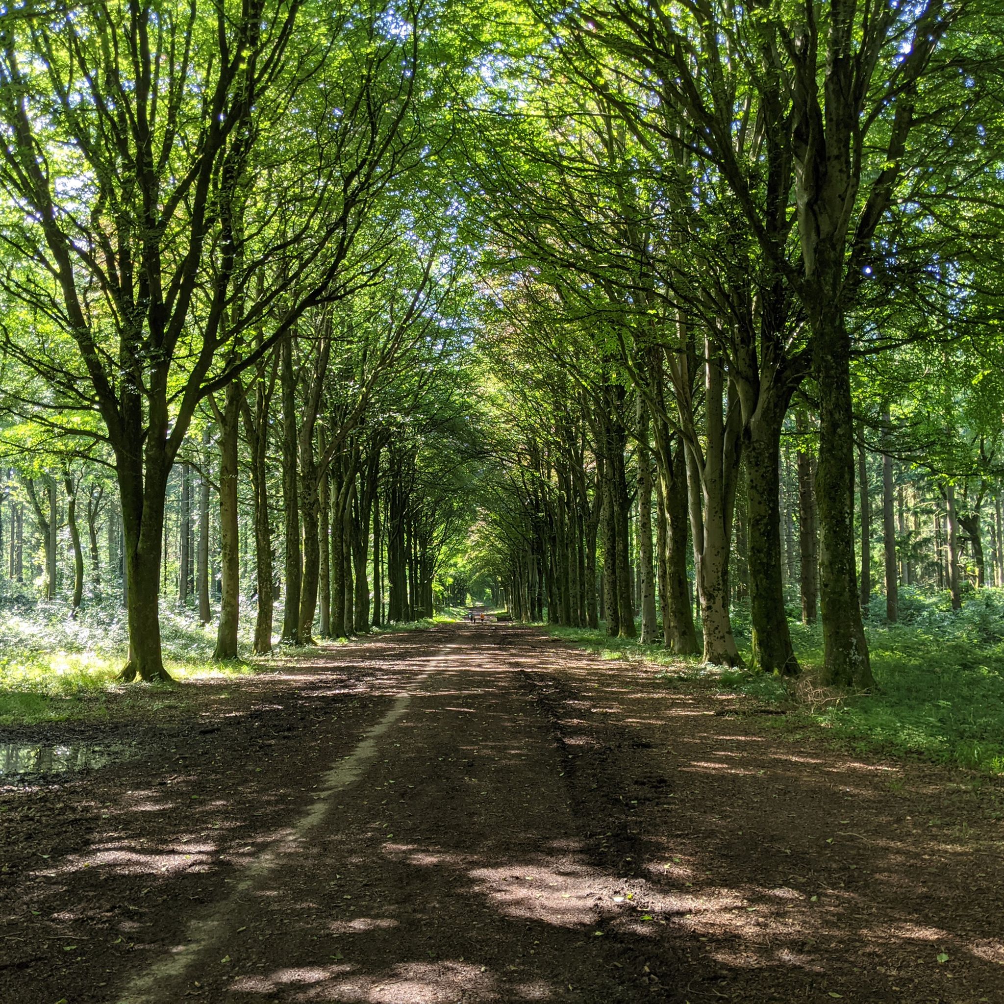
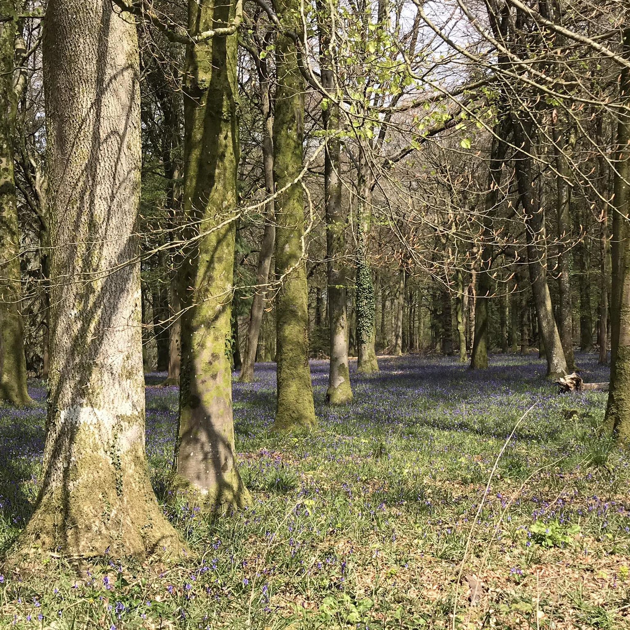
Grovely Wood is one of Wiltshire's largest mixed woodlands and there's loads of trail running potential here. Particularly beautiful in spring, the chalk ridge it woodland adorns is a delight all year round. This section is part of the Monarch's Way, a 625-mile (1,006 km) long-distance trail that represents the escape route taken by King Charles II after his defeat at the battle of Worcester.
0
0
First Broad Drive is an arrow-straight avenue through the heart of Grovely Woods. It's easy to pick up speed along this section; usually straight lines are something of a rarity where trail running is concerned. Unsurprisingly, given its trajectory, it was once part of a Roman road, a section of a trade route that connected the Mendips to the English Channel.
0
0

One of the largest mixed woodlands in southern Wiltshire, situated on a chalk ridge above the River Wylye. It is recognised for its nature conservation importance through designation as a County Wildlife Site. Among the species found here is the Purple Emperor butterfly.
4
0

Good, easy to follow path with great views over the downs.
1
0

Good shoes required from Autumn through to Spring. Stunning footpaths.
1
0


Six miles from Sarum. 1750.
0
0

I only went there as it was marked on the map. It said "Ruins" and I thought maybe something a bit older was to be found! Still interesting to be fair. Looks like a big house has been left to ruin, and in this day and age, seems strange. Don't know any history of it or the place, but gave me a off route location to aim for on the Gravely Woods ride. This is where I got a pungy...must have been a bramble. All the flint and stones in the road and it was a short bit of single track that managed to poke a hole in the tube!
1
0
Frequently Asked Questions
Are the hiking trails around Barford St. Martin suitable for dogs?
Yes, the area is generally very dog-friendly, with many trails passing through open countryside and woodlands like Grovely Wood. However, you will likely encounter livestock in fields, so be prepared to keep your dog on a lead. Also, be mindful of ground-nesting birds, especially on the chalk downlands.
What are the parking options for hikes starting in the area?
Parking can be limited, so arriving early is recommended, particularly on weekends. Some trailheads have small, dedicated car parks, such as the one at Grovely Wood which can accommodate about 8 cars. For other routes, you may find on-street parking in villages or lay-bys on country lanes, but please park considerately.
Are there any easy, family-friendly walks near Barford St. Martin?
Definitely. The area offers several shorter, less strenuous routes perfect for a family outing. A great choice is the Grovely Wood Forest Trail loop from Great Wishford. At just 3.3 miles (5.4 km) with minimal climbing, it's an engaging walk for all ages through the ancient forest.
Can I find a good pub to visit after a walk?
Yes, many walks are routed to start or finish near a traditional village pub, which is a key part of the Wiltshire hiking experience. While we can't recommend specific pubs, you'll find welcoming options in villages like Barford St. Martin, Burcombe, and Great Wishford for a post-hike meal or drink.
What kind of scenery can I expect on a circular walk from Barford St. Martin?
Circular walks from the village typically offer a fantastic mix of classic English countryside. You can expect to journey through the ancient, atmospheric Grovely Wood, cross open chalk downlands with far-reaching views, and follow gentle paths alongside the meandering River Nadder. Many routes combine all three landscapes.
Are there any long-distance hiking trails in the area?
Yes, for those seeking a more challenging day out, there are longer routes available. The Grovely Wood loop — Cranborne Chase & West Wiltshire Downs is a demanding 12.2-mile (19.7 km) trail that provides an extensive exploration of the woodland and surrounding downs.
What do other hikers say about the trails around Barford St. Martin?
The trails are highly regarded by the komoot community. Hikers often praise the variety of scenery, from the tranquility of the ancient woodlands to the stunning, wide-open vistas from the chalk ridges. The mix of well-marked paths and quiet country lanes is also frequently mentioned as a highlight.
Are there any walks with good views of the River Nadder?
Yes, several trails incorporate sections along the River Nadder. These paths offer peaceful walking through classic Wiltshire water meadows. The Hiking loop from Burcombe is a moderate route that includes lovely stretches near the river as it passes through the village.
What is the terrain like? Do I need special hiking gear?
The terrain is varied, consisting of woodland footpaths, farm tracks, grassy fields, and some country lanes. Paths can become very muddy, especially in Grovely Wood and after rain. Sturdy, waterproof hiking boots are highly recommended. Otherwise, standard walking gear is sufficient for most trails.
How many hiking trails are there around Barford St. Martin?
There are over 20 designated hiking routes to explore around Barford St. Martin on komoot. These range from short, easy strolls to more difficult all-day hikes, ensuring there's a trail for every fitness level and interest.
What are some notable places to see while hiking in the region?
The main natural attraction is Grovely Wood, a large and ancient woodland known for its serene atmosphere and diverse paths. Many walkers enjoy finding the 'witches trees' within the wood. The trails also offer access to the expansive chalk downlands of the Cranborne Chase National Landscape, providing excellent, far-reaching views.
Can I get to the trailheads using public transport?
Accessing trailheads directly via public transport can be challenging in this rural area. Bus services connect some of the larger villages, but they may be infrequent. Most visitors find it more convenient to travel by car to a suitable parking spot near their chosen route's starting point.
Most popular routes around Barford St. Martin
Most popular attractions around Barford St. Martin

Get inspired with the komoot mobile app


Explore more
Browse the best Hikes in other regions.
