The best running trails around Bishopstrow
4.3
(27)
2,250
runners
179
runs
Jogging around Bishopstrow offers diverse terrain across the Wiltshire countryside, characterized by rolling chalk downland and prominent hills. The area features varied elevations, expansive views, and tranquil paths along the River Wylye. Extensive woodlands like Southleigh Woods provide additional running opportunities, ranging from easy tracks to more challenging routes.
Best jogging routes around Bishopstrow
- The most popular jogging route is The Range Road loop from Warminster, a 4.4 miles (7.1 km) trail that takes about 44 minutes to complete,…
Last updated: October 18, 2026
5
runners
Moderate run. Good fitness required. Mostly paved surfaces. Suitable for all skill levels.
47
runners
7.09km
00:44
50m
50m
Moderate run. Good fitness required. Mostly paved surfaces. Suitable for all skill levels.

4.0
(1)
14
runners
12.3km
01:25
300m
300m
Hard run. Very good fitness required. Mostly paved surfaces. Suitable for all skill levels.
12
runners
8.16km
00:51
60m
60m
Moderate run. Good fitness required. Mostly paved surfaces. Suitable for all skill levels.
13
runners
Moderate run. Good fitness required. Mostly paved surfaces. Suitable for all skill levels.
Get access to more routes and recommendations from other explorers.
Already have an account?
Our route recommendations are based on thousands of hikes, rides, and runs completed by other people on komoot.
Start today with a free account
Your next adventure awaits.

Tips from the Community

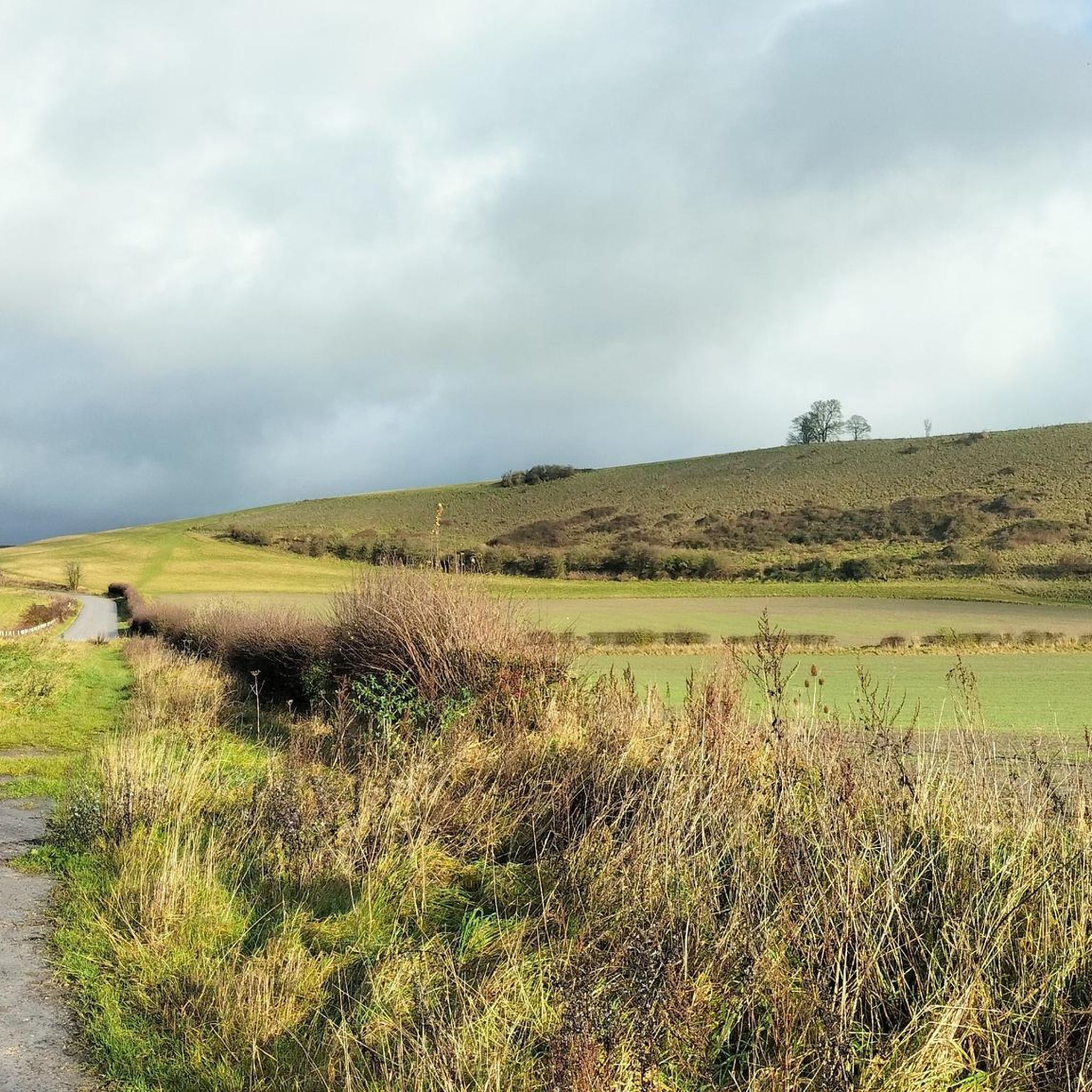
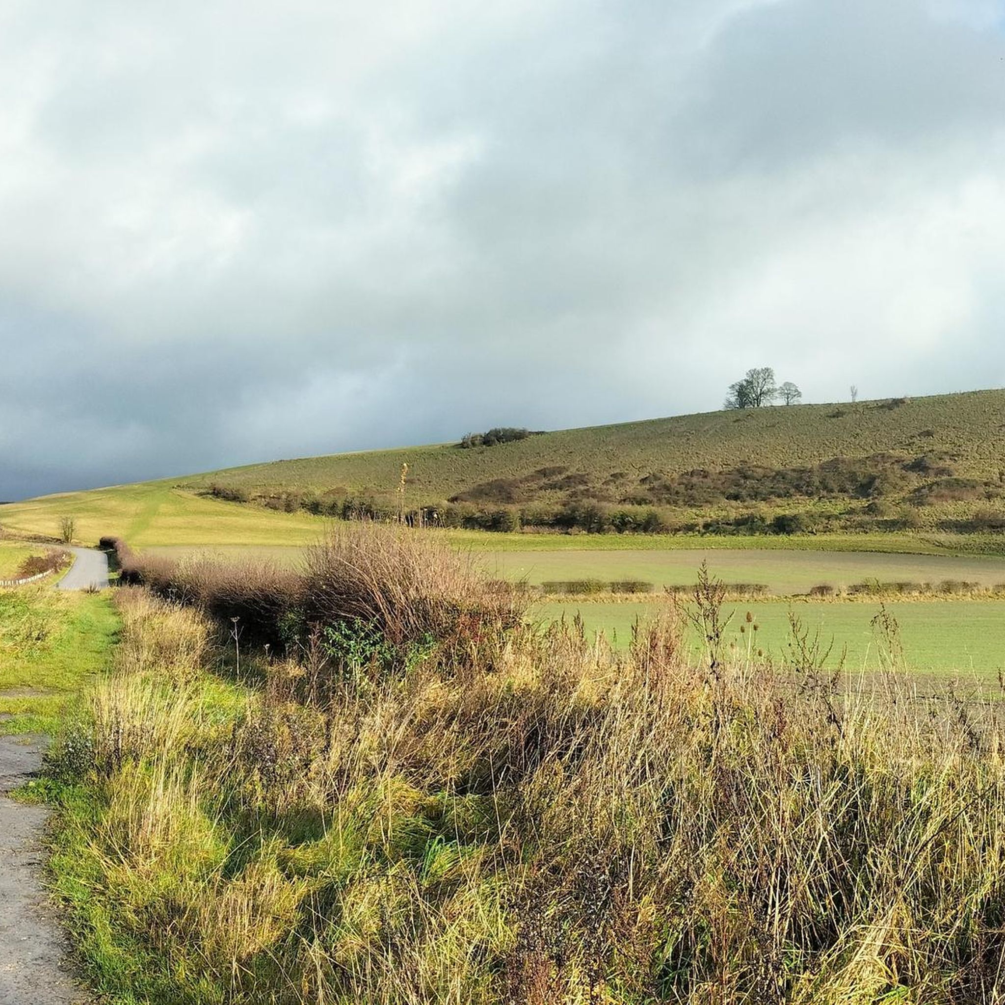
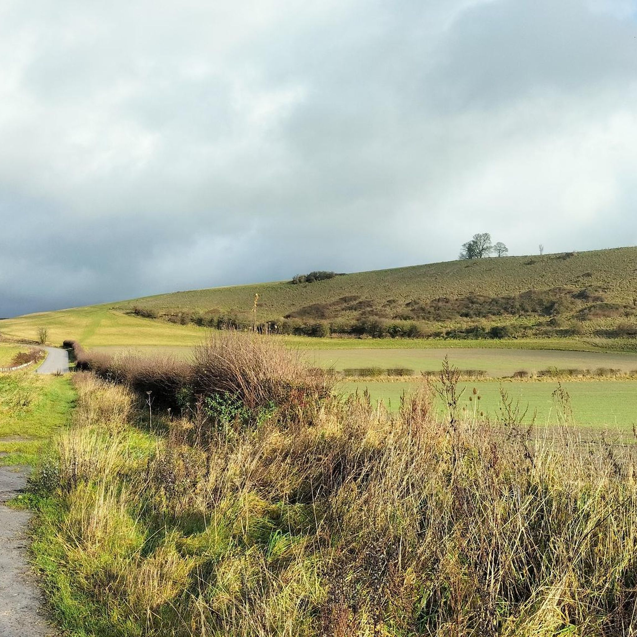
Part of the Imber Range Perimeter Path an open Bridleway, very fast when descending, be careful of the large loose chunks of stone making up the track. Stunning Views.
0
0
During the late 1960s, on weekends and bank holidays, the 11,000 population of Warminster was swelled by hundreds of UFO enthusiasts. Pilgrims were forced to camp in fields as there were not enough hotels. As night fell the hills around the town were thronged with expectant sky-watchers all hoping for a personal sighting of ‘The Warminster Thing’. They were undaunted by the fact that one of the key skywatch locations, Cradle Hill, sat alongside the largest military training zone in the UK. The Barn used to be covered in otherworldly graffiti, only faint markings remain.
0
0

This small footbridge over the Wylye connects Henfords Marsh with Eastleigh Wood Lane. It's likely that there has been a crossing of sorts here for a long time, although it may have been a muddy ford rather than a bridge.
0
0

take a turn off the B3414 to visit the Iron Age hillfort of Scratchbury, 1km or so off the main road and immerse yourself in a scene of unparalleled peace and tranquility
0
0

Battlesbury Hill has a trig point at 208 m. It's ringed by the earthworks of the old Iron Age hill fort which once crowned this hill. Today it's one of the hills at the western end of the Salisbury Plain and the Imber Range.
0
0

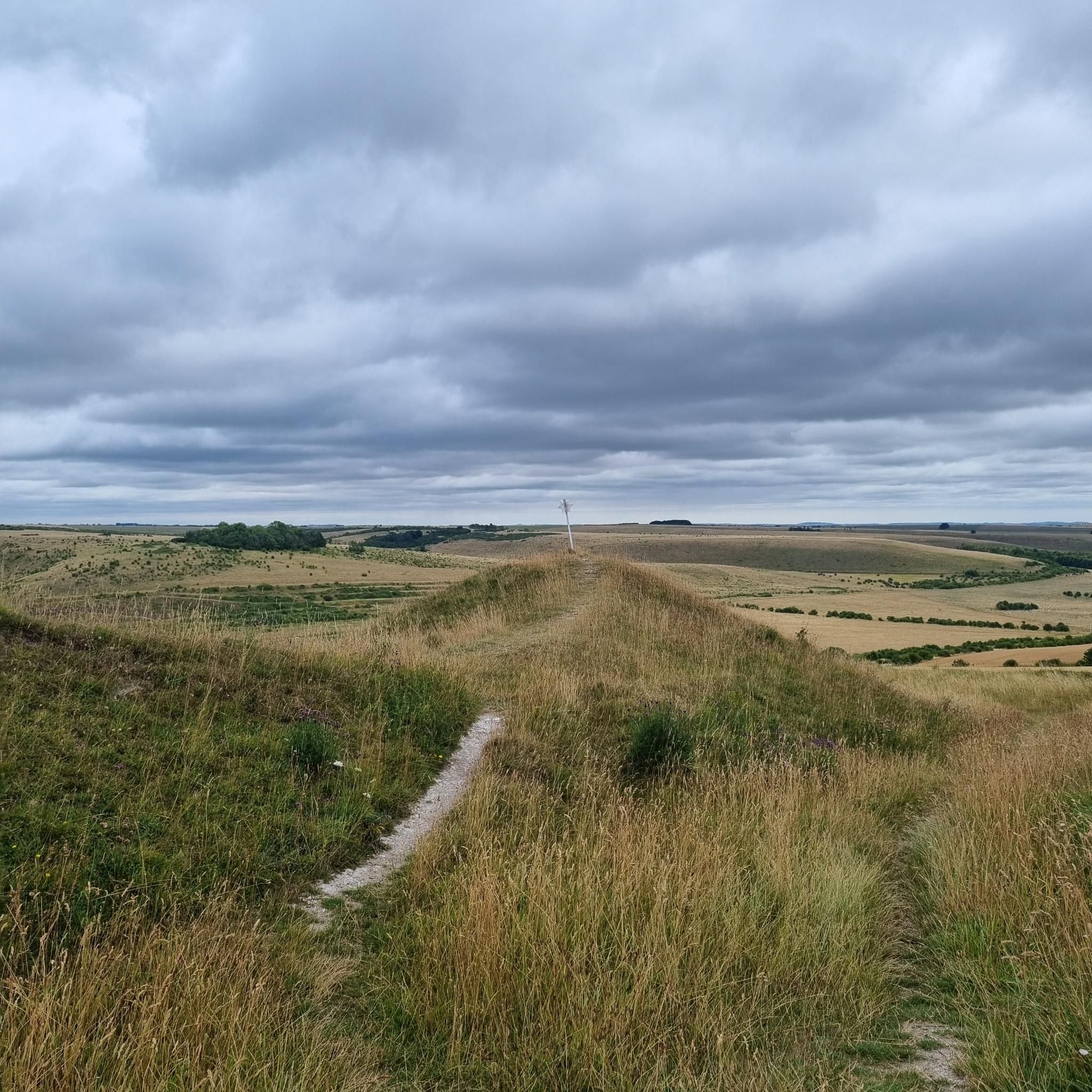
From the tracks on Warminster Down you can enjoy fantastic views to the west and north. The Salisbury Plain chalk plateau drops before you to the valley and, if you look south, you can see the West Wiltshire Downs rising. There are numerous paths streaming out from this point including the Imber Range Perimeter Path, the Wessex Ridgeway and the Land's End Trail.
0
0

A beautiful ruin with audio tour available via a qr code
0
0

Middle Hill, nicknamed locally as ‘piggy in the middle’, is a conical chalk hill that stands between Battlesbury Hill to the northwest and Scratchbury to the southeast. This row of hills is on the southwestern edge of Salisbury Plain overlooks the Wylye valley. Atop the hill you find an ancient and sizable bowl barrow.
1
0
Frequently Asked Questions
How many running routes are available in Bishopstrow, and what are their difficulty levels?
Bishopstrow offers a wide selection of running routes, with over 180 trails to explore. These routes cater to various fitness levels, including 24 easy, 128 moderate, and 35 difficult options, ensuring there's a suitable path for every runner.
What kind of terrain can I expect on running trails around Bishopstrow?
The running trails in Bishopstrow feature diverse terrain, primarily characterized by rolling chalk downland and prominent hills. You'll encounter varied elevations, tranquil paths along the River Wylye, and extensive woodlands like Southleigh Woods, which offer both easy tracks and more challenging routes with significant elevation gain.
Are there scenic viewpoints or historical landmarks along the running routes?
Yes, many running routes in Bishopstrow offer rewarding vistas and pass by historical sites. You can enjoy panoramic views from hills like Battlesbury Hill and Cley Hill. For a blend of history and scenery, consider routes near the iconic Westbury White Horse and Bratton Camp, or explore the grounds around Longleat House.
Can I find circular running routes in Bishopstrow?
Absolutely. Many of the running paths in Bishopstrow are designed as loops, offering convenient circular routes. For instance, you can try the The Range Road loop from Warminster, a moderate 4.4-mile (7.1 km) trail, or the Southleigh Woods loop from Kingdown School, an easier 2.6-mile (4.3 km) option.
Are the running trails in Bishopstrow dog-friendly?
Many of the trails in the Bishopstrow area, especially those through the countryside and woodlands, are generally dog-friendly. It's always a good idea to keep dogs under control, particularly near livestock, and to check for any specific local signage regarding dog access or leash requirements.
Are there family-friendly running options in Bishopstrow?
Yes, Bishopstrow offers several family-friendly running options, particularly the easier routes and those along the River Wylye or within Southleigh Woods. These paths often have gentler gradients and provide a pleasant environment for families to enjoy a run together. The Southleigh Woods loop from Kingdown School is an easy option that could be suitable.
What do other runners enjoy the most about jogging in Bishopstrow?
The running routes in Bishopstrow are highly rated by the komoot community, with an average score of 4.1 stars from over 20 reviews. Runners frequently praise the varied terrain, from challenging hills with rewarding views to tranquil woodland paths, and the overall natural beauty of the Wiltshire countryside.
Are there any long-distance running trails available?
While many routes are moderate in length, Bishopstrow's network allows for longer runs by combining trails or choosing more extensive loops. For example, the Battlesbury Hill loop from Warminster is a moderate 7.6-mile (12.2 km) path that includes significant ascents, offering a good challenge for those seeking a longer distance.
Where can I find parking for the running trails in Bishopstrow?
Parking availability varies by specific trailhead. Many routes start from or pass through areas like Warminster, where public parking is available. For routes venturing into more rural areas or woodlands, look for designated car parks or roadside parking where permitted. Always check local signage.
What is the best time of year for running in Bishopstrow?
Bishopstrow offers enjoyable running conditions throughout much of the year. Spring and autumn provide pleasant temperatures and beautiful scenery with changing foliage. Summer is ideal for early morning or late evening runs to avoid the heat, while winter runs can be invigorating, though some paths might be muddy or slippery, especially on the chalk downland.
Are there any cafes or pubs near the running routes for refreshments?
Yes, Bishopstrow and nearby towns like Warminster offer various options for refreshments. You'll find cafes and pubs where you can refuel after your run. The Bishopstrow Hotel & Spa grounds, for instance, are located along the River Wylye and provide a pleasant environment, though specific access for non-guests may vary.
What are some easy running routes for beginners in Bishopstrow?
For beginners or those looking for an easier run, Bishopstrow has 24 easy routes. A good option is the Southleigh Woods loop from Kingdown School, which is 2.6 miles (4.3 km) long and features relatively flat terrain through pleasant forest tracks.
Most popular attractions around Bishopstrow

Get inspired with the komoot mobile app


Explore more
Browse the best Running Trails & Routes in other regions.
