The best walks and hikes around Lake Beauregard
4.6
(1139)
7,047
hikers
134
hikes
Hiking around Lake Beauregard offers diverse experiences within the Aosta Valley, Italy, characterized by alpine landscapes and the artificial lake formed by the Beauregard dam. The region features mountain streams, views of glaciers, and traditional stone settlements. Trails often provide panoramic vistas of the surrounding peaks and turquoise lakes. This area provides a range of hiking opportunities from accessible lakeside paths to more challenging alpine ascents.
Best hiking trails around Lake Beauregard
- The most popular hiking route is Beauregard Lake Walk loop from Valgrisenche, a 6.6 miles (10.7 km) trail that takes 3 hours 2 minutes to complete. This moderate route follows the artificial lake, offering scenic views of the water and surrounding mountains.
- Another top favourite among local hikers is Beauregard Lake Walk – Bar/Café at the Trailhead loop from Valgrisenche, a moderate 6.8 miles (10.9 km) path. This trail also circles the lake, providing accessible terrain and opportunities for refreshments near the trailhead.
- Local hikers also love the Rifugio degli Angeli - Arp Vieille Loop, a 7.4 miles (11.9 km) trail leading through high alpine terrain, often completed in about 6 hours 19 minutes.
- Hiking around Lake Beauregard is defined by alpine views, glacial landscapes, and serene lake paths, with options for various fitness levels. The network offers routes ranging from moderate lakeside walks to difficult high-altitude ascents.
- The routes in Lake Beauregard are highly rated by the komoot community with an average score of 4.6 stars from over 900 reviews. More than 6000 hikers have used komoot to explore Lake Beauregard's varied terrain.
Last updated: July 9, 2026
4.8
(27)
273
hikers
11.9km
06:19
1,060m
1,060m
Hike the difficult 7.4-mile Rifugio degli Angeli - Arp Vieille Loop, gaining 3480 feet with stunning alpine views and turquoise lakes.
2
hikers
15.3km
07:15
1,170m
1,170m
Alpine loop to turquoise Lago San Grato through traditional stone settlements and wild valleys.

Sign up for free
4.5
(26)
154
hikers
10.7km
03:03
230m
230m
Moderate hike. Good fitness required. Easily-accessible paths. Suitable for all skill levels.
4.5
(23)
121
hikers
10.9km
03:10
270m
270m
Moderate hike. Good fitness required. Easily-accessible paths. Suitable for all skill levels.
4.8
(16)
98
hikers
15.3km
05:27
670m
670m
Hard hike. Very good fitness required. Mostly accessible paths. Sure-footedness required.
Get access to more routes and recommendations from other explorers.
Sign up for free
Already have an account?
Our route recommendations are based on thousands of hikes, rides, and runs completed by other people on komoot.
Start today with a free account
Your next adventure awaits.
Login or Signup

Tips from the Community

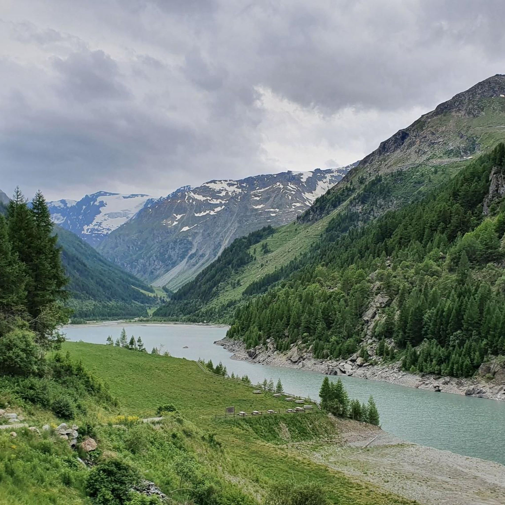
Usellières is the last place reachable by road in the upper part of Valgrisenche. Surrounded by woods, pastures and alpine peaks, it is located in a secluded and quiet environment, at the foot of the Rutor massif and its glaciers. From here the valley closes and continues only with paths.
1
0

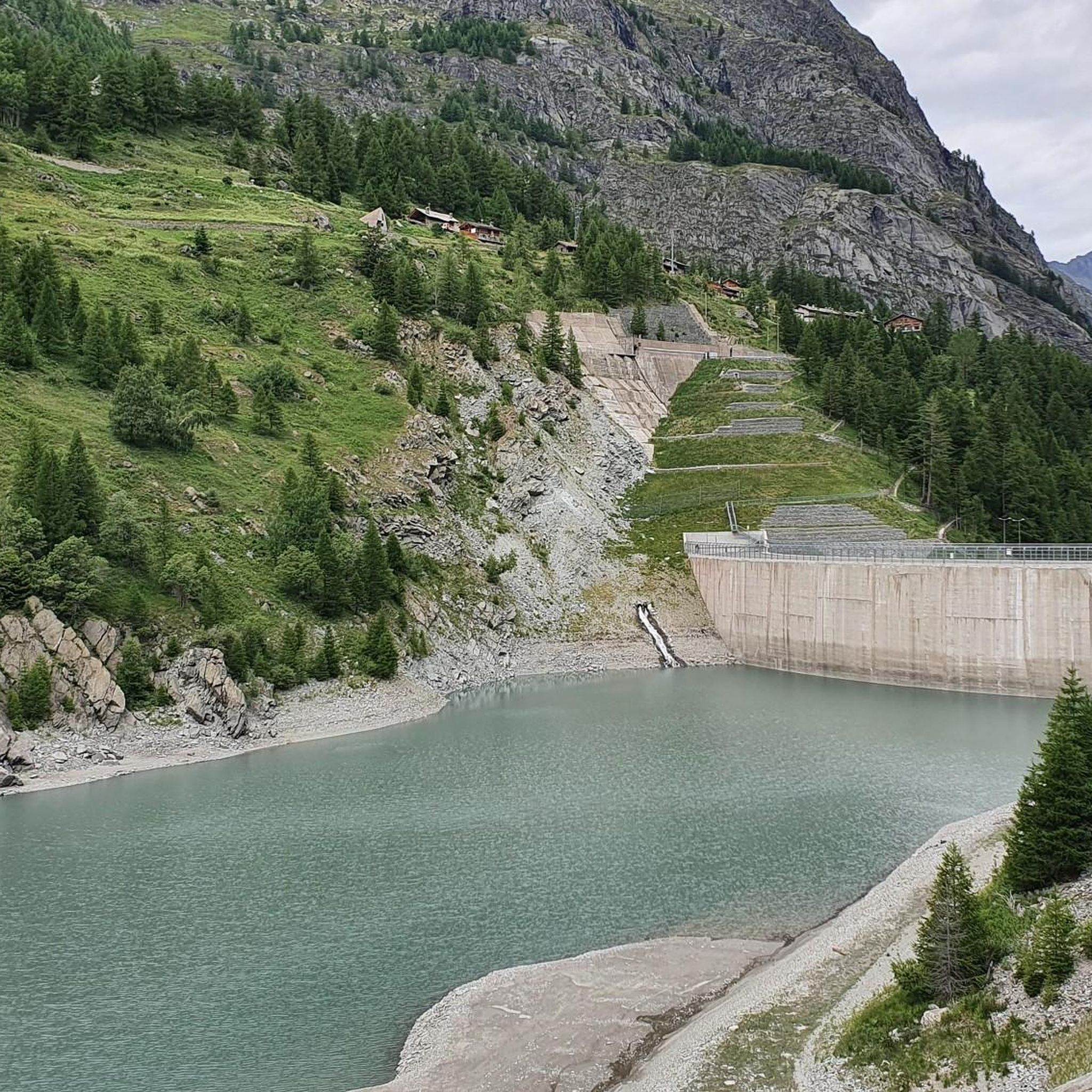
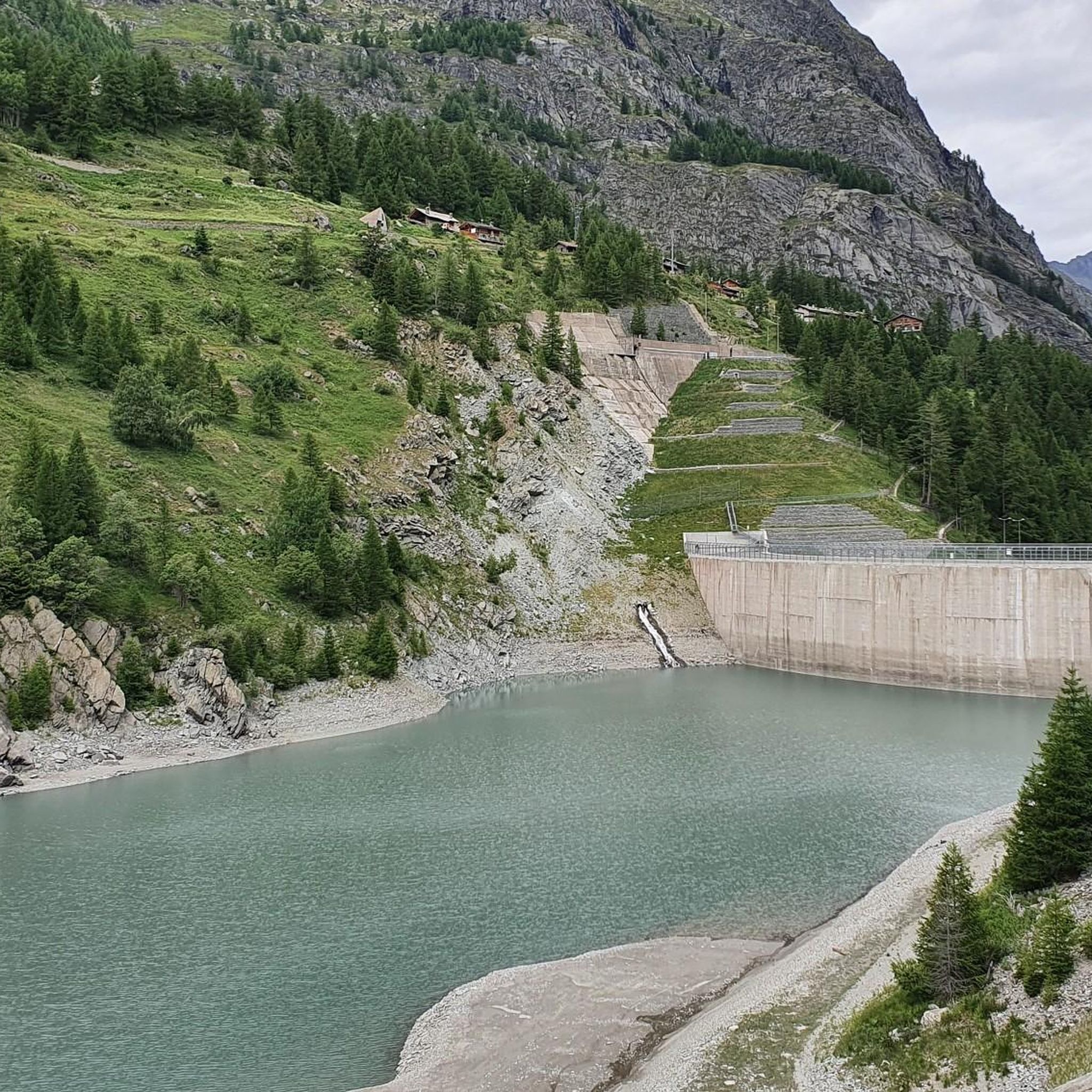
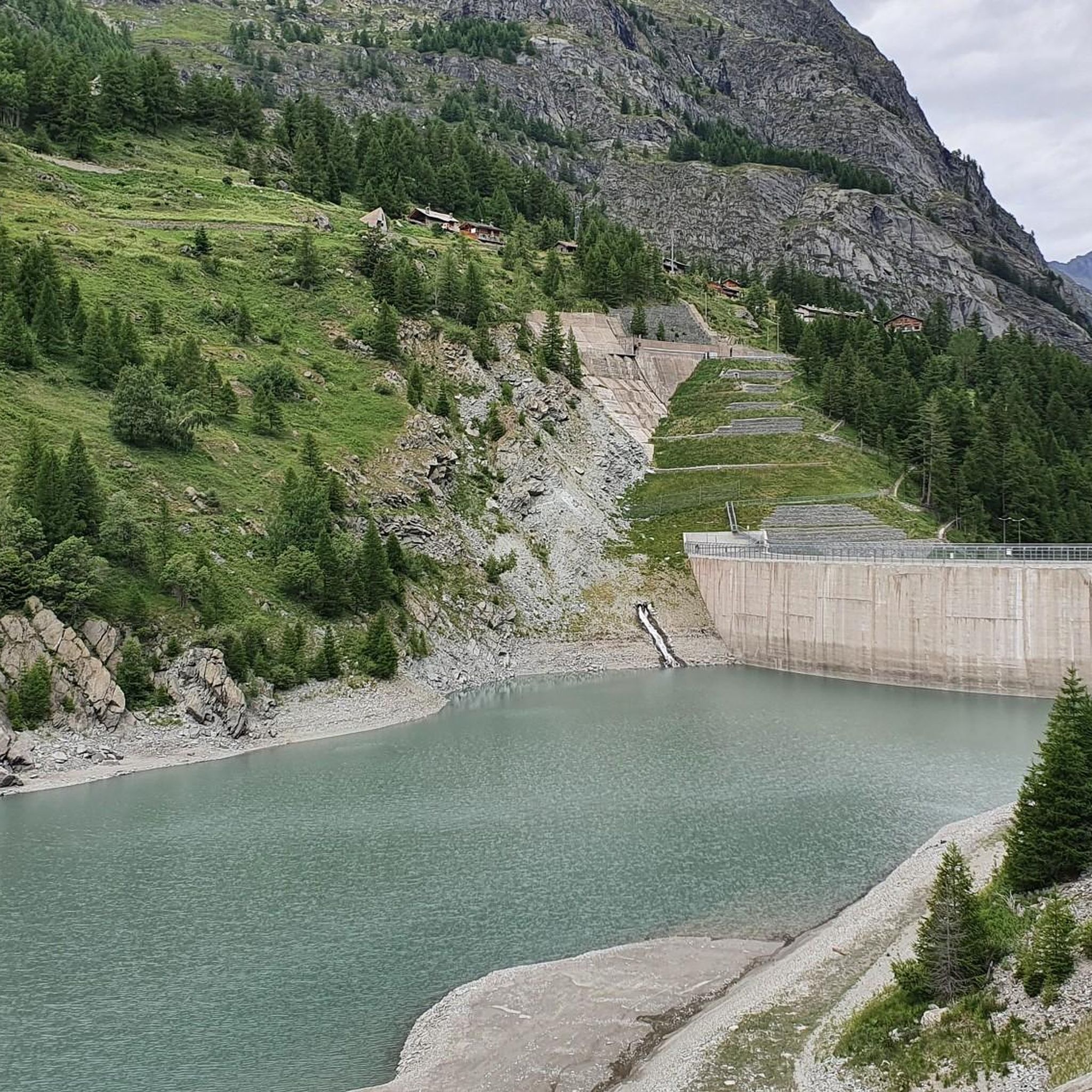
The dirt road runs along Lake Beauregard and the Dora di Valgrisenche River and is perfect for hiking, mountain biking, and gravel biking. The route offers stunning views of the lake and surrounding mountains.
1
0

Small bar that is popular on the way back. It is located just a few hundred meters from the hikers' car park.
59
0
This hiking car park is located directly at the start of the hiking route to the Rifugio Bezzi alpine hut (2,284 m). You cannot park any closer! The large parking spaces (*bordered in blue) are asphalted, as is the access road. GPS coordinates: 45.58577, 7.02971
55
0

Modest altitude difference initially on a dirt road and then on a path that is always well traced and signposted (classified E) which in about two hours and 5.5 km takes us to an altitude of 2450 meters above sea level to admire a splendid mountain lake (still partly frozen at the end of July! ) surrounded by imposing Alpine peaks
0
0

there is a pull down into the valley to see it all
0
0

The refuge degli Angeli al Morion is a refuge located in the municipality of Valgrisenche, in the valley of the same name, in the Graian Alps, at 2,916 m a.s.l. Source: https://it.wikipedia.org/wiki/Rifugio_degli_Angeli_al_Morion
0
0

beautiful glacial lake, easily accessible via the farm and then a wide path
2
0
Frequently Asked Questions
How many hiking trails are available around Lake Beauregard?
There are over 120 hiking routes around Lake Beauregard in the Aosta Valley, Italy. These trails range from easy lakeside paths to challenging high-alpine ascents, offering diverse experiences for all skill levels.
Are there easy or family-friendly hiking options around Lake Beauregard?
Yes, Lake Beauregard offers several easy and family-friendly options, particularly around the artificial lake in Valgrisenche. A simple 5 km route along the lake is suitable for families. For a slightly longer moderate walk, consider the Beauregard Lake Walk loop from Valgrisenche, which is 10.7 km and offers scenic views of the water and surrounding mountains.
What kind of challenging hikes can I find in the Lake Beauregard area?
For experienced hikers seeking a challenge, the Lake Beauregard area in the Aosta Valley provides several difficult routes. One such option is the Rifugio degli Angeli - Arp Vieille Loop, a 11.9 km trail leading through high alpine terrain with significant elevation gain, typically taking over 6 hours to complete. Another challenging route is the Lago San Grato loop from Menthieu, covering over 15 km with substantial elevation changes.
Are there any circular hiking routes around Lake Beauregard?
Yes, many routes around Lake Beauregard are designed as loops. For example, the Beauregard Lake Walk – Bar/Café at the Trailhead loop from Valgrisenche is a moderate 10.9 km path that circles the lake, providing accessible terrain and opportunities for refreshments. Another circular option for more experienced hikers is the Lake San Grato – Grandalpe Stream loop from Lago di Beauregard.
What natural features and landscapes can I expect to see while hiking here?
The Lake Beauregard area in the Aosta Valley is characterized by stunning alpine views, turquoise lakes, and mountain streams. You'll see the artificial lake formed by the Beauregard dam, and if you look closely, you might spot the remains of the abandoned village of Fornet. The trails also offer views of the Ormelune and Suzzey glaciers, as well as the glaciers of La Plattes des Chamois, Tavellaz, and Traversaz.
Are there places to eat or get refreshments near the hiking trails?
Yes, there are small bars and cafes near some trailheads in the Valgrisenche area of Lake Beauregard, offering convenient spots for refreshments before or after your hike. The Beauregard Lake Walk – Bar/Café at the Trailhead loop from Valgrisenche specifically highlights this convenience.
What do other hikers say about the trails around Lake Beauregard?
The hiking routes around Lake Beauregard are highly rated by the komoot community, with an average score of 4.6 stars from over 900 reviews. Hikers often praise the serene lake paths, the stunning alpine views, and the diverse range of trails suitable for various fitness levels.
Is it possible to hike around Lake Beauregard in winter?
While the guide focuses on hiking, the broader region, including the Plateau de Beauregard near Lake Annecy in France, is known for winter activities like snowshoeing. For the Aosta Valley location, conditions can vary significantly in winter, with higher alpine routes becoming challenging due to snow and ice. It's essential to check local conditions and forecasts before attempting winter hikes.
Are there any specific attractions or points of interest along the trails?
Beyond the natural beauty of the lake and glaciers, the area around Lake Beauregard in Valgrisenche is known for traditional stone settlements. The remains of the village of Fornet, submerged when the dam was built, can sometimes be observed. The region itself is part of the Aosta Valley, which boasts extraordinary natural heritage and protected areas.
Is parking available at the trailheads for Lake Beauregard hikes?
Yes, parking is generally available at common starting points for hikes around Lake Beauregard, such as in Mondanges or Usellières in Valgrisenche, which are convenient access points for the lakeside paths.
Can I bring my dog on the hiking trails around Lake Beauregard?
Generally, dogs are welcome on many hiking trails in the Aosta Valley, but it's always advisable to keep them on a leash, especially in protected areas or where wildlife is present. Please check specific trail regulations or local signage for any restrictions before heading out with your dog.
Most popular routes around Lake Beauregard

Get inspired with the komoot mobile app


Explore more
Browse the best Hikes in other regions.
