The best running trails around Lake Beauregard
5.0
(1)
217
runners
15
runs
Jogging around Lake Beauregard offers challenging routes through a mountainous landscape. The region is characterized by high alpine terrain, including significant elevation changes and views of surrounding peaks and valleys. Running trails often follow natural contours, providing a demanding experience for runners.
Best jogging routes around Lake Beauregard
- The most popular jogging route is Lago di Beauregard – Rifugio Mario Bezzi loop from Valgrisenche, a 13.7 miles (22.1 km) trail that takes 2 hours 46 minutes to complete. This…
Last updated: July 5, 2026
7
runners
22.1km
02:47
700m
700m
Hard run. Very good fitness required. Sure-footedness, sturdy shoes and alpine experience required.
35
runners
17.9km
03:45
1,330m
1,320m
Hard run. Very good fitness required. Sure-footedness, sturdy shoes and alpine experience required.

Sign up for free
25
runners
13.3km
01:29
270m
270m
Hard run. Good fitness required. Sure-footedness, sturdy shoes and alpine experience required.
15
runners
13.9km
01:39
390m
390m
Hard run. Very good fitness required. Sure-footedness, sturdy shoes and alpine experience required.
6
runners
17.4km
02:47
810m
810m
Hard run. Very good fitness required. Sure-footedness, sturdy shoes and alpine experience required.
Get access to more routes and recommendations from other explorers.
Sign up for free
Already have an account?
Our route recommendations are based on thousands of hikes, rides, and runs completed by other people on komoot.
Start today with a free account
Your next adventure awaits.
Login or Signup

Tips from the Community

The Dora di Valgrisenche is a stream of over 26 kilometers that originates in the Vaudet basin from the slopes of the Glairetta glacier, feeding the artificial lake of Beauregard along the way. After crossing the entire valley and also being used for hydroelectric power production, the watercourse flows as a tributary into the Dora Baltea.
0
0
Built between 1925 and 1927 as a mountain and military outpost in the municipality of Valgrisenche, the historic Rifugio Mario Bezzi (2,284 meters) is named after one of the most illustrious members of the Turin section of the CAI. Today the structure has 82 beds and offers typical mountain cuisine, serving as an ideal base for traverses towards France and the nearby Benevolo and Chalet de l'Épée refuges.
1
0

Usellières is the last place reachable by road in the upper part of Valgrisenche. Surrounded by woods, pastures and alpine peaks, it is located in a secluded and quiet environment, at the foot of the Rutor massif and its glaciers. From here the valley closes and continues only with paths.
1
0

The Rifugio de L'Epée, opened in 1988 by brothers Ivo and Dario Gerbelle, welcomes hikers from mid-June to late September. The trail to the refuge passes through a majestic forest of ancient larch trees and offers spectacular views of the Bouc Valley, Punta Rabuigne, the Lepère Glacier, and the Becca di Mont Forciaz.
1
0
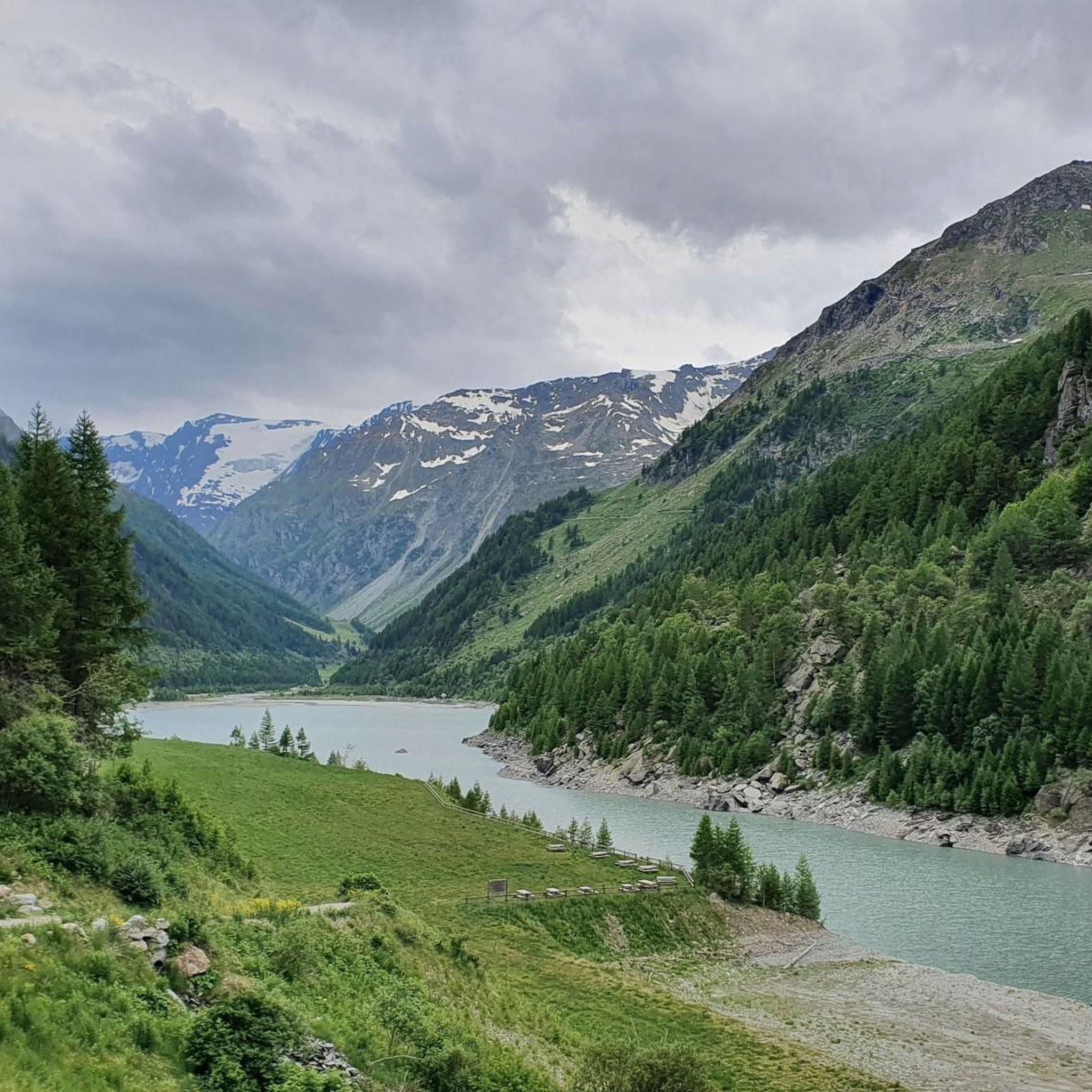
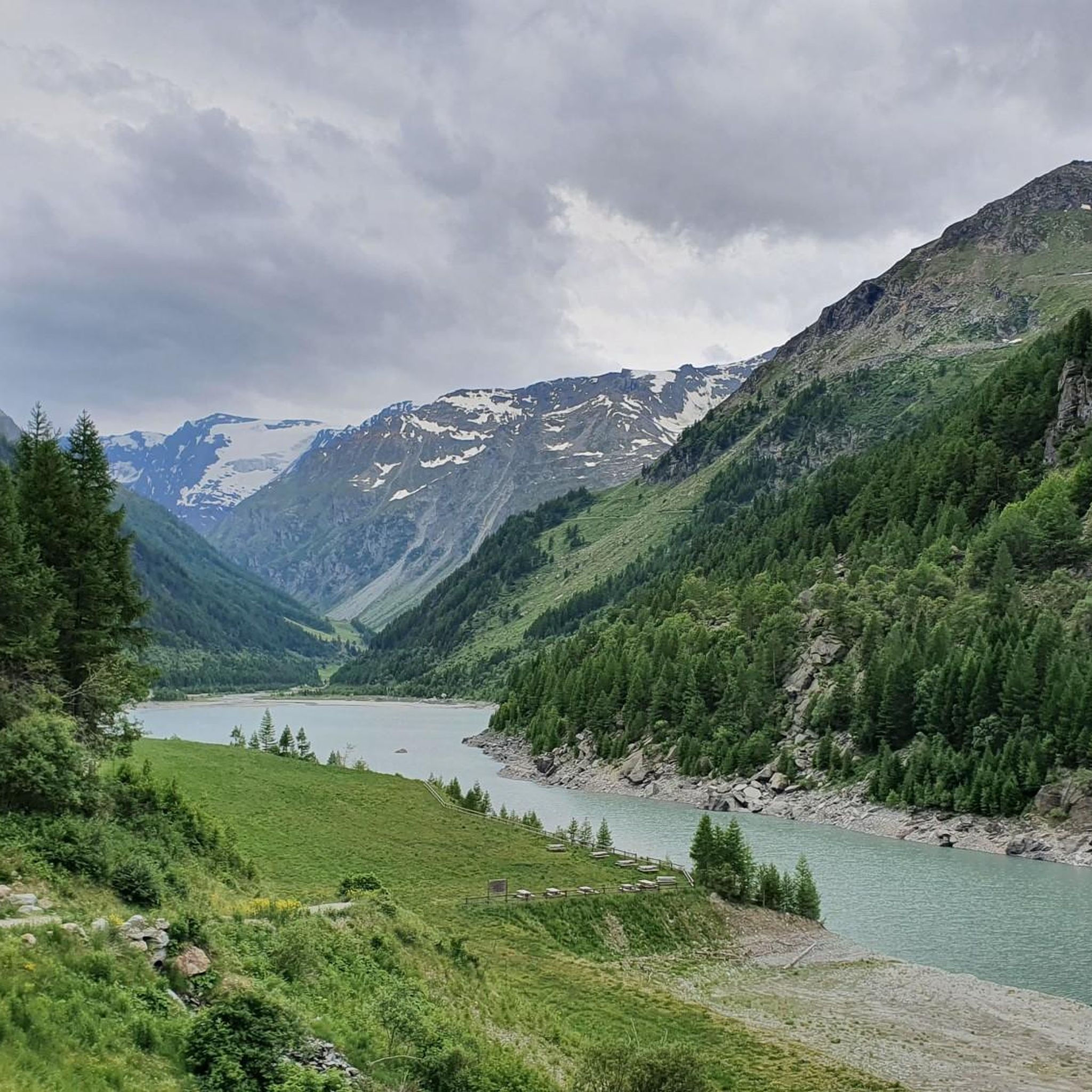
The dirt road runs along Lake Beauregard and the Dora di Valgrisenche River and is perfect for hiking, mountain biking, and gravel biking. The route offers stunning views of the lake and surrounding mountains.
1
0

Gradually, a beautiful view of the valley and the Chalet de l'Épée refuge, which awaits us further on, is revealed.
0
0

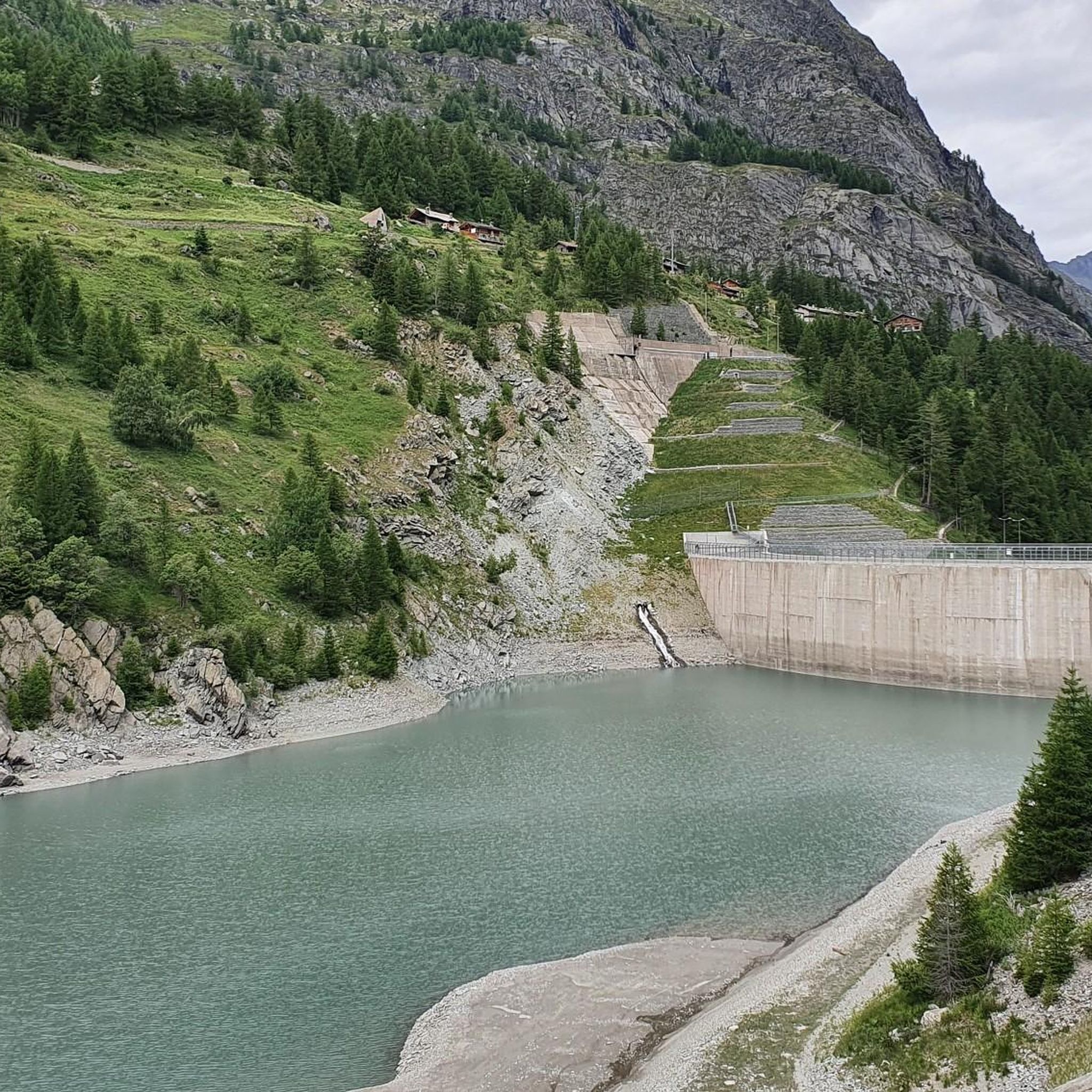
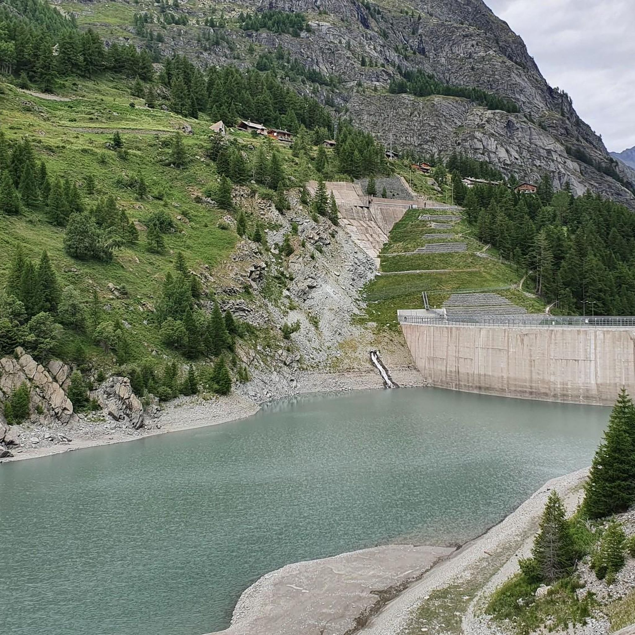
One of Italy's most ambitious energy engineering projects, yet never fully exploited: landslides similar to those of Vajont were detected right from the initial tests, and the capacity was limited from the planned 70 million cubic meters to just 2 million (which is why the village of Fornet, re-emerged from the lake's waters, is still visible). Due to the dam's failure to utilize its full capacity, it was lowered by 52 meters between 2011 and 2015.
0
0
A clearing at the end of the Valgrisenche road, from here you can enjoy an excellent view of the artificial lake and the surrounding mountains.
1
0
Frequently Asked Questions
What is the general difficulty level of running routes in Lake Beauregard?
The running routes around Lake Beauregard are predominantly challenging. All 11 routes listed are classified as difficult, featuring significant elevation changes and high alpine terrain. They are best suited for experienced runners seeking demanding ascents and technical paths.
Are there any easy running trails around Lake Beauregard for beginners?
Given the mountainous landscape and high alpine terrain, all running routes in Lake Beauregard are rated as difficult. There are no easy or moderate trails available in this selection, making it less suitable for beginners.
What kind of distances can I expect on the running routes in Lake Beauregard?
Running routes in Lake Beauregard vary in length, generally ranging from moderate to long distances. For example, the Lago di Beauregard – Valgrisenche loop from Valgrisenche is about 6.9 km (4.3 miles), while the Valgrisenche Village loop from Il Sigaro extends to approximately 18 km (11.2 miles).
Are there circular running routes available around Lake Beauregard?
Yes, many of the running routes around Lake Beauregard are circular, offering varied scenery without retracing your steps. Examples include the Valgrisenche Village loop from Valgrisenche and the Race to the Rifugio degli Angeli — Ring tour.
What kind of views or landmarks can I expect to see while running around Lake Beauregard?
The running routes in Lake Beauregard offer breathtaking panoramic views of the surrounding high alpine peaks and valleys. You'll experience the natural beauty of the mountainous landscape, often encountering the lake itself and various alpine features.
Can I bring my dog on the running trails near Lake Beauregard?
Generally, dogs are welcome on trails in the Lake Beauregard region, but it's always advisable to keep them on a leash, especially in alpine areas where wildlife may be present or near grazing livestock. Always check local regulations for specific routes or protected areas.
Are the running routes around Lake Beauregard suitable for families with children?
Due to the challenging nature of the terrain, with significant elevation gains and difficult classifications, most running routes around Lake Beauregard are not ideal for families with young children. They are better suited for experienced runners.
When is the best time of year to go running around Lake Beauregard?
The best time for running in Lake Beauregard is typically during the warmer months, from late spring to early autumn, when trails are clear of snow and ice. The high alpine environment means conditions can change rapidly, so always check the weather forecast.
Is it possible to go running in Lake Beauregard during winter?
Running in Lake Beauregard during winter can be challenging due to snow, ice, and colder temperatures. Many high alpine trails may be inaccessible or require specialized equipment like snowshoes. It's crucial to check local conditions and avalanche warnings before attempting winter runs.
How can I check the current trail conditions for running in Lake Beauregard?
For current trail conditions, it's best to consult local tourist information centers, mountain refuges, or check online resources from regional authorities. Komoot's community often provides recent updates and photos on specific routes.
Is there parking available near the running trailheads at Lake Beauregard?
Yes, parking is generally available in villages like Valgrisenche, which serve as common starting points for many running routes around Lake Beauregard. Specific parking details can often be found on individual komoot tour pages or local signage.
How many running routes are available in the Lake Beauregard area?
There are 11 running routes available in the Lake Beauregard area, all of which are classified as difficult due to the challenging mountainous terrain and significant elevation changes.
Most popular routes around Lake Beauregard

Get inspired with the komoot mobile app


Explore more
Browse the best Running Trails & Routes in other regions.
