The best running trails around Estany de Travessany
138
runners
8
runs
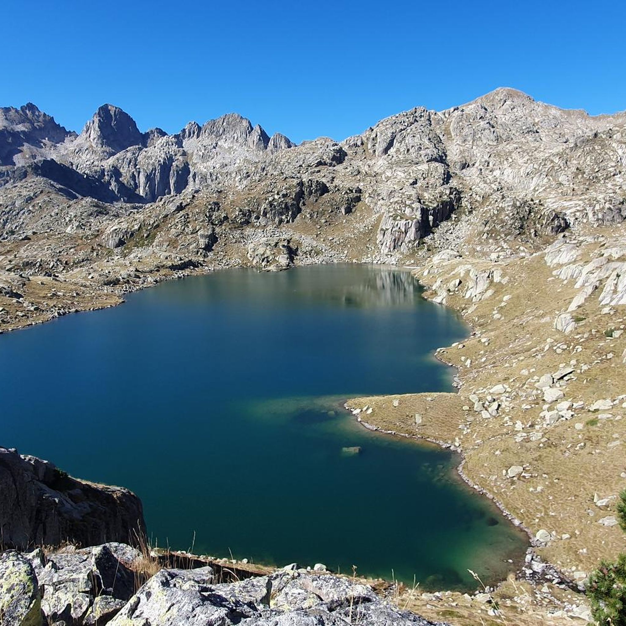
Jogging around Estany de Travessany offers a high-mountain experience within the Aigüestortes i Estany de Sant Maurici National Park. This region is characterized by its glacial origin, with the lake situated at an altitude of 7,372 feet (2,247 meters). Runners will encounter rugged, rocky terrain, significant elevation changes, and panoramic views of surrounding peaks like Pic de Travessany and the Massís del Besiberri. The area features an intricate network of glacial lakes, providing a challenging yet rewarding environment for trail…
Last updated: July 4, 2026
4
runners
Hard run. Good fitness required. Sure-footedness, sturdy shoes and alpine experience required.
11
runners
8.50km
01:25
370m
370m
Hard run. Very good fitness required. Sure-footedness, sturdy shoes and alpine experience required.

Sign up for free
10
runners
16.1km
03:13
1,070m
1,070m
Hard run. Very good fitness required. Sure-footedness, sturdy shoes and alpine experience required.
6
runners
3.40km
00:35
170m
170m
Hard run. Good fitness required. Sure-footedness, sturdy shoes and alpine experience required.
22
runners
13.2km
02:05
460m
460m
This difficult 8.2-mile (13.2 km) jogging route in Aigüestortes i Estany de Sant Maurici National Park features glacial lakes and Pyrenean v
Get access to more routes and recommendations from other explorers.
Sign up for free
Already have an account?
Our route recommendations are based on thousands of hikes, rides, and runs completed by other people on komoot.
Start today with a free account
Your next adventure awaits.
Login or Signup
Popular around Estany de Travessany

Tips from the Community

The Colomèrs refuge is located at an altitude of 2,135 metres in the Upper Aran, next to the Colomèrs Lake, at the northern end of the Carros de Foc route. This route runs through the beautiful Aigues Tortes National Park and the Saint-Maurice Lake. It has 60 places to stay overnight, distributed in five rooms with 12 beds each with bunk beds. The showers are cold water. It also has a meal service.
2
0

The Pòrt de Ratèra is the wide hill that links the Colomers and Saboredo cirques on the northern slope and the Ratera valley that spills into Lake San Mauricio on the south. The ascent from the Saboredo refuge is a fairly affordable and relatively short excursion, ideal if we only have a few hours before returning to the valley.
0
0
Lake Obago is a lake of glacial origin located at 2,236 m in the municipality of Alto Arán, in the Valle de Arán region. Lake Obago is one of the largest lakes in the Cirque de Colomers, a glacial cirque of more than 50 lakes crowned by peaks that exceed 2,500 meters, such as the Tuc de Ratera (2,861 m) or the Gran Tuc de Colomers (2,933 meters).
0
0
This lake is located in Aigüestortes, within the Peripheral Zone of the National Park of Aigüestortes and Estany de Sant Maurici.
0
0
Lake Mayor de Colomers is a lake of glacial origin located at 2128 m in the municipality of Alto Arán, in the Valle de Arán region. Lake Mayor de Colomers is one of the largest lakes in the Cirque de Colomers, a glacial cirque of more than 50 lakes crowned by peaks that exceed 2,500 meters, such as the Tuc de Ratera (2,861 m) or the Gran Tuc de Colomers (2,933 meters). ). The Colomers refuge is located near the lake.
0
0

Beautiful refuge at the foot of the lake that also bears its name and in general, of the valley as a whole. Always stay awake ready in case you need it!
0
0
Mountain lake that is located in this area north of Aigüestortes and that is part of the set of lakes of the Cirque de Colomers.
0
0

Espot serves as a starting point for numerous routes in the Aigüestortes and Estany de Sant Maurici National Park. From here, it is possible to see the Valle de Boí and the Presa de Cavallers, which we can cross by means of a bridge to explore.
1
0
Frequently Asked Questions
What kind of terrain can I expect when running around Estany de Travessany?
The region around Estany de Travessany, located within the Aigüestortes i Estany de Sant Maurici National Park, is characterized by its high-mountain, glacial origin. Runners should expect rugged, rocky terrain with significant elevation changes. The landscape features imposing granite walls, numerous glacial lakes, winding rivers, and pine forests, providing a challenging yet rewarding environment for trail running.
Are there any easy jogging routes available in the Estany de Travessany area?
The jogging routes around Estany de Travessany are generally considered challenging due to the high-altitude setting and rugged terrain. All 8 routes listed in this guide are rated as difficult, attracting experienced trail runners seeking strenuous experiences. There are no easy or moderate routes specifically identified in this guide for the immediate area.
What natural features can I see along the running trails near Estany de Travessany?
The trails offer breathtaking views of picturesque glacial lakes, including Estany de Travessany itself, and numerous smaller lakes. You'll also encounter dramatic mountainous terrain with peaks soaring over 3,000 meters, winding waters, and diverse vegetation ranging from pine forests to alpine pastures. Depending on the season, you might even see snow-capped mountains.
Are there any circular running routes in the region?
Yes, there are several circular running routes available. For instance, the Lake Major of Colomers – Estany Mort loop from Arriu dera Montanheta is a difficult 5.3-mile (8.5 km) path that navigates through part of the region's extensive lacustrine zone. Another option is the challenging Summit of Tuc de Ratera loop from Arriu dera Montanheta, which covers 10.0 miles (16.1 km) through high alpine terrain.
What is the best time of year for trail running around Estany de Travessany?
The best time to visit for jogging is typically from late spring through early autumn. While the area is stunning, snowy conditions can persist into spring, especially at higher elevations, making some routes more challenging or inaccessible. Summer and early autumn offer more stable weather and clearer trails, allowing for the best experience of the high-mountain landscape.
Can I bring my dog on the running trails in Estany de Travessany?
Estany de Travessany is located within the Aigüestortes i Estany de Sant Maurici National Park. National parks often have specific regulations regarding pets to protect wildlife and natural habitats. It is advisable to check the official park regulations regarding dog access on trails before planning your run, as rules can vary and may require dogs to be on a leash or restrict access in certain areas.
Are the running routes suitable for families with children?
Given that all routes in this guide are rated as difficult and feature rugged, high-mountain terrain with significant elevation changes, they are generally more suitable for experienced trail runners. Families with young children or those seeking leisurely walks might find these specific routes too demanding. It's best to look for easier, shorter trails if jogging with family members who are not accustomed to strenuous mountain running.
What are some of the longer running routes available?
For those seeking longer distances, the Summit of Tuc de Ratera loop from Arriu dera Montanheta is a substantial 10.0 miles (16.1 km) route. Another challenging option is the Estany Llong and Estany Redó Trail, which spans approximately 8.2 miles (13.2 km) and features significant elevation gain.
What do other runners say about jogging in Estany de Travessany?
More than 100 runners have used komoot to explore Estany de Travessany's varied terrain. They often highlight the challenging conditions and rugged landscape as a major draw, appreciating the strenuous experiences and the stunning panoramic views of surrounding peaks and glacial lakes that define the high-altitude environment.
Is there public transport or parking available near the running routes?
While the guide focuses on the routes themselves, Estany de Travessany is situated within a national park, which typically has designated access points. Parking facilities are usually available near popular trailheads or park entrances, though they might be limited during peak seasons. Public transport options to such remote high-mountain areas can be scarce, so planning your journey by car is often the most practical approach. Always check specific access details for your chosen trailhead.
What kind of elevation changes can I expect on these running trails?
The routes around Estany de Travessany are known for significant elevation changes, reflecting the region's mountainous character. For example, the Summit of Tuc de Ratera loop involves over 1,000 meters (3,280 feet) of ascent and descent, making it a demanding climb. Even shorter routes like Pantano de Cavallers still feature nearly 300 meters (980 feet) of elevation gain.
Most popular routes around Estany de Travessany

Get inspired with the komoot mobile app


Explore more
Browse the best Running Trails & Routes in other regions.
