The best running trails in Habersham County
5.0
(3)
56
runners
15
runs
Jogging in Habersham County offers a diverse landscape characterized by the foothills of the Blue Ridge Mountains, scenic trails, and clear rivers. The region features significant portions of the Chattahoochee National Forest, providing extensive opportunities for outdoor activities. Runners can experience mountainous terrain with elevation gains, serene lakeside paths, and routes leading to waterfalls.
Best jogging routes in Habersham County
- The most popular jogging route is Currahee Mountain Road, a 5.4 miles (8.7 km) trail that takes about 59 minutes to complete. This route is known for its challenging ascent and panoramic summit views.
- Another top favourite among local runners is Panther Creek Trail, a moderate 6.5 miles (10.5 km) path. This trail leads to the impressive Panther Creek Falls, offering a rewarding destination.
- Local runners also love the Tallulah Falls Rail Trail, a 3.3 miles (5.4 km) trail leading through varied terrain, often completed in about 35 minutes. This route follows a former railway line, providing a generally accessible path.
- Jogging in Habersham County is defined by mountainous terrain, cascading waterfalls, and extensive forest paths. The network offers options for various ability levels, from moderate trails to more challenging ascents.
- The routes in Habersham County are highly rated by the komoot community with an average score of 5.0 stars from over 3 reviews. More than 83 runners have used komoot to explore Habersham County's varied terrain.
Last updated: July 7, 2026
30
runners
8.72km
00:59
240m
240m
Currahee Mountain Road offers a moderate jogging experience, covering 5.4 miles (8.7 km) with a significant elevation gain of 802 feet (245 metres). You can expect to complete this route in about 59 minutes, making it a good option for a consistent uphill challenge. The trail primarily follows a gravel Forestry Road, FSR 62, as it climbs Currahee Mountain. As you jog, you will encounter varied surface conditions, from well-maintained stretches to areas with ruts and exposed rock. The true reward is the Currahee Mountain Summit View, where you can enjoy outstanding panoramic vistas stretching approximately 50 miles in every direction, including the distant Blue Ridge Mountains.
Before you head out, be aware that the trail's conditions can change, especially after heavy rain. Such weather can create slippery and rutted sections due to water accumulation and loose gravel, so plan your visit accordingly. The final mile to the summit is particularly steep, so good fitness is recommended if you plan on running the entire route. Parking is generally available at the trailhead, making access straightforward for your jogging adventure.
The mountain's name, Currahee, holds a special meaning, translating to "stands alone" in Cherokee. This aptly describes its striking, isolated peak within the Chattahoochee-Oconee National Forest. The route provides a unique opportunity to experience both a challenging workout and a historical landmark. Its distinct character sets it apart from other trails in the region, offering a memorable journey to a summit with expansive views.
5.0
(3)
8
runners
5.35km
00:35
70m
70m
Embark on the Tallulah Falls Rail Trail for a moderate jogging experience spanning 3.3 miles (5.3 km), with an elevation gain of 227 feet (69 metres). This route, which you can complete in about 34 minutes, guides you along the serene shores of the Tallulah River, winding through heavily wooded areas that offer ample shade. You will encounter towering rock outcrops and cross a magnificent 230-foot-long suspension bridge, providing unique views over the river as you jog.
This multi-use trail is accessible for various activities, including walking, cycling, and even wheelchairs, making it a welcoming option for many visitors. Dogs are also permitted on the trail, provided they are kept on a leash and you clean up after them. Convenient parking is generally available within Tallulah Gorge State Park, ensuring easy access to the trailhead for your visit.
Located within the scenic Tallulah Gorge State Park, this trail offers more than just a pleasant jog; it immerses you in a rich natural environment. As you move along the path, you can listen for the distinct sounds of the flowing Tallulah River, which adds to the tranquil atmosphere. The iconic suspension bridge is a highlight, offering a memorable vantage point and a unique feature that sets this route apart in the region.

Sign up for free
5
runners
10.5km
01:18
130m
130m
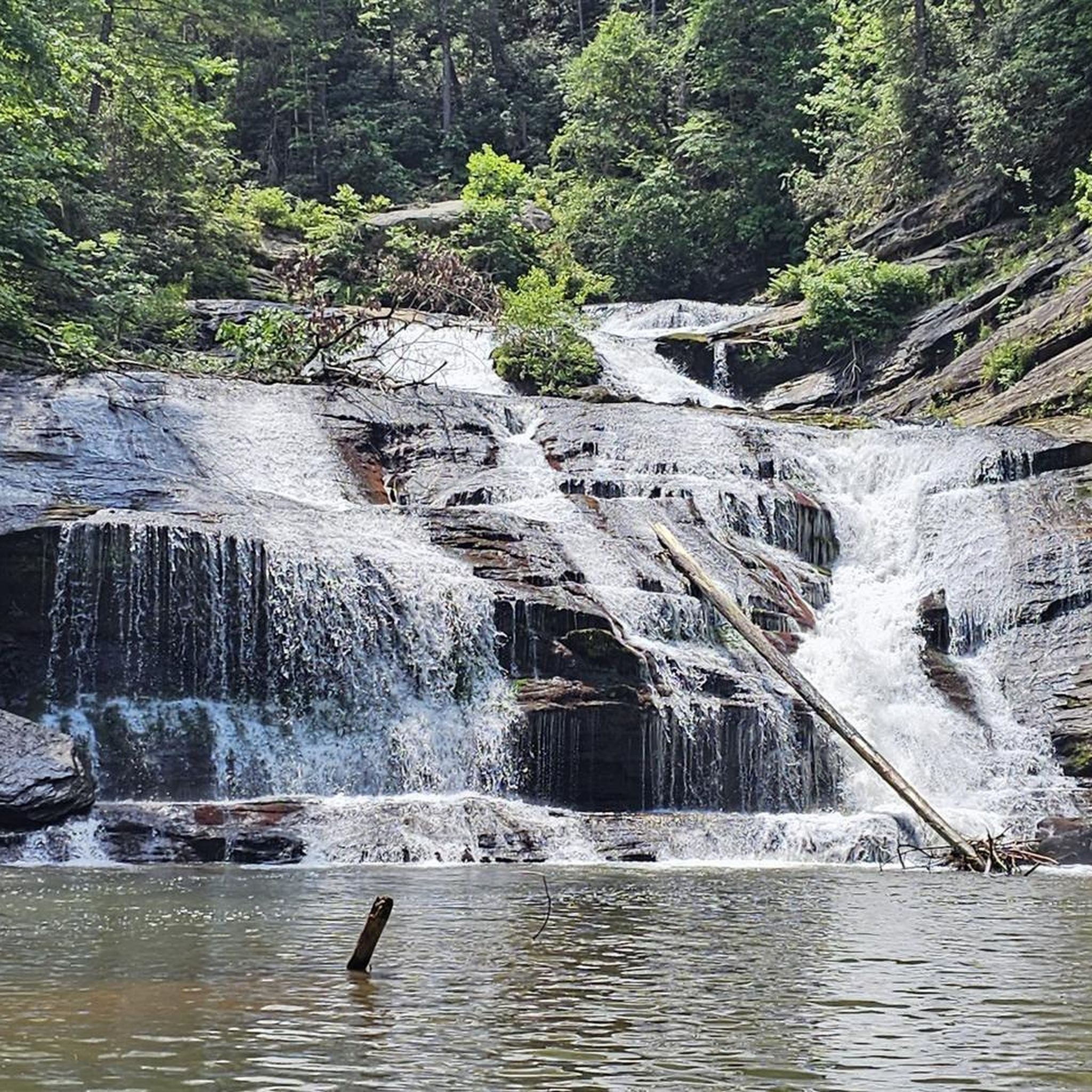
Embark on a moderate jogging route along the Panther Creek Trail, a 6.5 miles (10.5 km) journey that winds through a lush, green forest. You will gain 416 feet (127 metres) in elevation over approximately 1 hour and 17 minutes, with the constant sound of rushing water from Panther Creek accompanying you. The path features rocky and uneven surfaces, sometimes muddy, leading you to the multi-tiered Panther Creek Falls, a striking visual landmark with its deep pool and sandy beach. Expect to be surrounded by towering trees and mossy boulders as you navigate this scenic route.
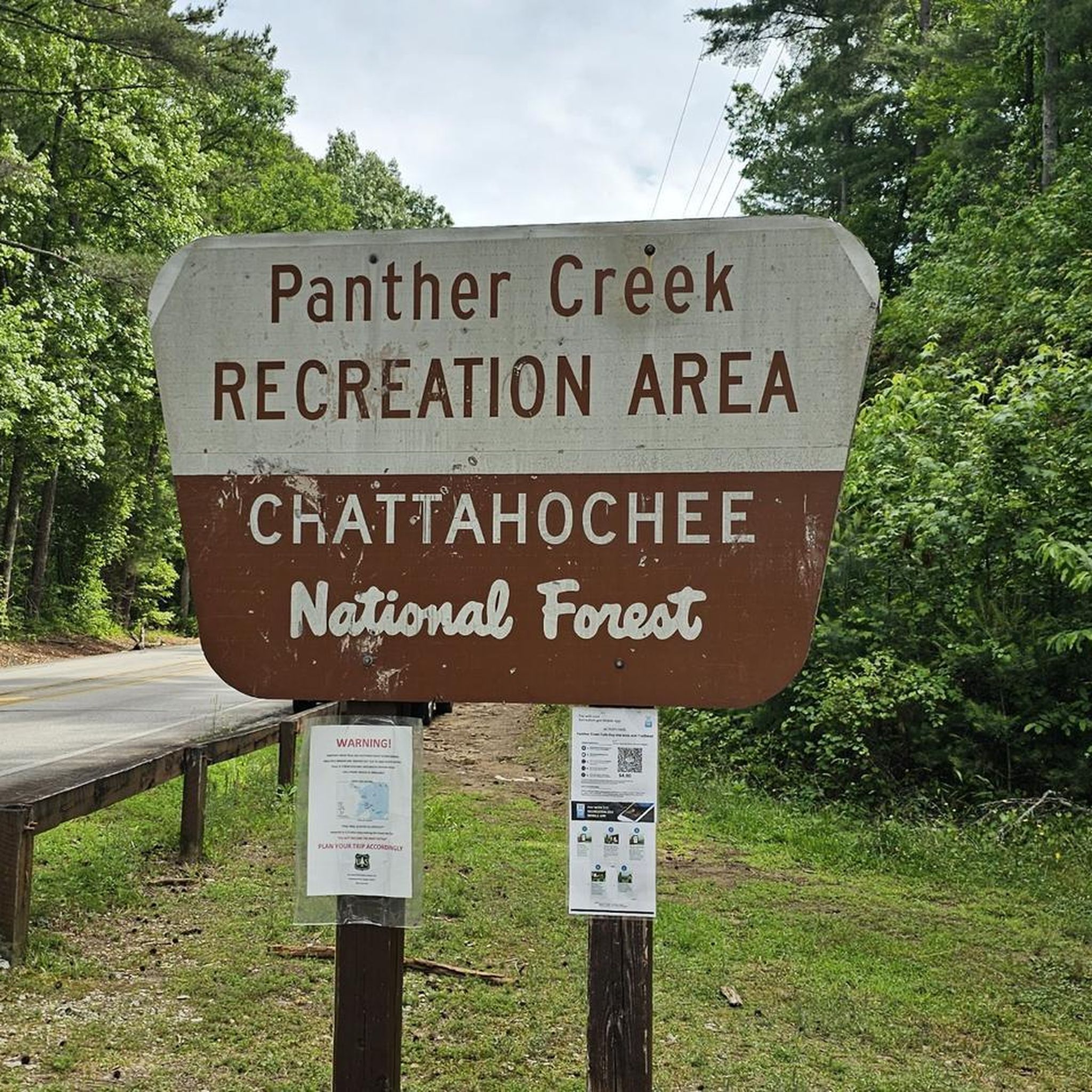
Before you set out, be aware that the trail can have rocky and uneven surfaces, which may become muddy and slippery after rain. It is wise to wear appropriate footwear with good ankle support, as some sections are steep and potentially hazardous. Parking is available at the trailhead, but be prepared for challenging conditions on the route itself. Past hurricane damage has also affected parts of the trail tread.
This trail stands out for its immersive natural experience within the Chattahoochee-Oconee National Forest. As you jog, you will find yourself following the creek, enjoying views of its frothing blue waters and small cascades. The journey culminates at the beautiful Panther Creek Falls, offering a refreshing stop at its deep pool. It is a popular choice for those seeking a rewarding outdoor experience in the region.
2
runners
8.76km
01:04
100m
100m
Lace up your jogging shoes for the Lake Russell Loop, a moderate 5.4-mile (8.8 km) route that offers a diverse workout in the Chattahoochee-Oconee National Forest. You will experience a mix of singletrack, old roadways, and gravel sections, gaining 330 feet (101 metres) in elevation. Expect picturesque views of Lake Russell, especially as you pass along the lakeshore and around coves, where you might spot herons.
This jogging route typically takes about 1 hour and 4 minutes to complete. The Lake Russell Loop is part of the larger Lake Russell Recreation Area, which provides convenient access to parking. Be aware that this is a multi-use trail, so you will share the path with mountain bikers during your visit.
As you follow the route, you will wind through peaceful pine tree groves and hardwoods, crossing several bridges over drainages. A unique feature of the Lake Russell Loop is the section along the lake dam's spillway; be prepared, as this area sometimes requires jogging through ankle-deep water. The recreation area also offers picnic spots, a swimming area, and campgrounds for extended stays.
2
runners
15.9km
02:06
410m
400m
If you are looking for a challenging jogging route, the Stoneplace Trail and High Bluff Trail Loop offers a difficult 9.9 miles (15.9 km) with a significant elevation gain of 1341 feet (409 metres). You can expect to complete this loop in about 2 hours and 6 minutes. The Stoneplace Trail starts on wide dirt and rock paths, following an old roadbed as you descend towards Tugalo Lake, where you will find pleasant views of the water and surrounding mountains.
As you continue onto the High Bluff Trail, the path becomes narrower, winding through a recently burned forest that often features wildflowers. This section eventually opens up to provide more views of the lake and the gorge, including the Oceana Falls Overlook. Before you head out, remember that a permit is required to access these trails. If you plan your visit between September and January, which is hunting season, it is wise to wear brightly colored clothing for your safety.
This route is located within Tallulah Gorge State Park, offering a unique opportunity to experience varied terrain and natural beauty. The combination of an old roadbed and winding forest paths makes for a diverse jogging experience. Keep an eye out for the wildflowers, especially if you visit after the burned areas have had time to recover.
2
runners
3.32km
00:29
120m
120m
Prepare for a challenging experience on the Hurricane Falls loop via North & South Rim Trails. This difficult 2.1 miles (3.3 km) route involves gaining 388 feet (118 metres) in elevation, typically taking around 29 minutes. You will navigate varied terrain, including mulched paths, paved sections, and boardwalks, as you descend into Tallulah Gorge State Park. The trail offers a close-up view of Hurricane Falls, a nearly 100-foot waterfall, and crosses a suspension bridge 80 feet above the Tallulah River. Be aware that despite being listed for jogging, the route's 1,099 stairs and rugged sections make it more suitable for a strenuous stair-climbing workout.
The Hurricane Falls loop is found within Tallulah Gorge State Park. Before you go, note that dogs are not permitted on this specific trail. Given the significant number of stairs and elevation changes, prepare for a strenuous workout. Always check the park's official website for current operating hours and any permit requirements before your visit.
This trail takes you deep into the two-mile-long Tallulah Gorge, offering dramatic views of the canyon. The varied terrain and the unique perspective of the falls and river from the suspension bridge make it a notable route in the region. It provides an intense physical challenge while showcasing the natural beauty of the gorge.
1
runners
4.91km
00:39
150m
150m
Lace up for a refreshing jogging experience on the Angel Falls Trail, a moderate route spanning 3.1 miles (4.9 km). You'll ascend 478 feet (146 metres) over approximately 38 minutes, making it a good workout. The path winds alongside Joe Creek, guiding you through a lush, sun-dappled forest. Expect to see vibrant ferns, rhododendrons, and mountain laurel as you make your way towards the beautiful Panther Falls and the main attraction, Angel Falls. The sound of the creek tumbling over mossy rocks creates a serene backdrop for your run.
Before you head out, know that parking is generally convenient near the trailhead, so you can easily start your jogging adventure. As you progress, be prepared for some varied terrain, including sections with stone stairs. After Panther Falls, you will encounter a steeper stretch where metal cables are installed to assist with safety. Plan your visit accordingly, especially if you prefer a smoother, uninterrupted jogging surface.
This trail is nestled within the Chattahoochee-Oconee National Forest, offering a true immersion in nature. It stands out for its dual waterfall experience, providing a rewarding destination for your efforts. The route showcases the natural beauty of the region, from its rich plant life to the dynamic flow of Joe Creek. It is a popular choice for those seeking a moderate challenge with picturesque views.
9.90km
01:11
260m
260m
Embark on the Rhododendron Trail and Chenocetah Tower Loop for a moderate jogging experience that covers 6.2 miles (9.9 km) with an elevation gain of 856 feet (261 metres). You can expect to complete this route in about 1 hour and 11 minutes. As you jog, you will pass through beautiful rhododendron and hardwood sections, offering a diverse natural setting. Keep an eye out for glimpses of Nancytown Lake and Lake Russell, and enjoy the scenic views from Chenocetah Mountain. The trail also features several waterfalls, adding to its charm.
Planning your visit to this loop is straightforward. The trail is generally well-maintained, making for a pleasant jogging surface, with some sections following old roadways. Parking is typically available since the route is part of the larger Lake Russell Recreation Area. If you plan to visit the Chenocetah Fire Tower, a key landmark on the route, note that it is often open during daylight hours, providing panoramic views from its top room.
This route offers more than just a workout; it provides a unique perspective of the Chattahoochee-Oconee National Forest. From various points, you can enjoy clear sightlines of Lake Russell and even distant Blue Ridge Mountains. The presence of the historic Chenocetah Fire Tower adds a cultural element to your outdoor adventure, connecting you with the region's past.
6.36km
00:48
130m
130m
Embark on Dead Man's Trail for a moderate jogging experience through the lush Chattahoochee-Oconee National Forest. This route spans 4.0 miles (6.4 km) and involves a steady climb of 440 feet (134 metres), typically completed in about 48 minutes. You will find yourself immersed in nature, with the soothing sounds of flowing water often accompanying your run, leading you to a beautiful waterfall where you can pause and enjoy the scenery.
When planning your visit, you can generally expect straightforward access to the trailhead. Parking is usually available within national forests, but it is always wise to check the local forest service websites for any current advisories before you head out. While specific warnings like snow conditions or road closures are not typically an issue for this trail, staying informed ensures a smooth trip.
This trail offers a refreshing escape into the natural beauty of the Chattahoochee-Oconee National Forest. The journey through its verdant landscapes provides a welcome break from daily routines, allowing you to connect with the environment. The highlight of your run will be reaching the scenic Contentment Falls, a perfect spot to appreciate the natural surroundings before continuing your loop.
5.38km
00:40
130m
130m
The Hemlock Falls Trail offers a moderate jogging experience through a pleasant outdoor setting. You will cover 3.3 miles (5.4 km) and gain 420 feet (128 metres) in elevation, which takes about 39 minutes. The route leads you to the beautiful Hemlock Falls, providing a refreshing reward at the end of your effort. Imagine the sound of water as you approach this scenic natural highlight.
When planning your visit to the Hemlock Falls Trail, you should find parking readily available at the trailhead. Before you head out, always make sure to check the local weather forecast and current trail conditions. This ensures you have a safe and enjoyable jogging experience. Being prepared helps you focus on the natural beauty around you.
The Hemlock Falls Trail is situated within the expansive Chattahoochee-Oconee National Forest. This location provides a rich natural backdrop for your jogging adventure. The main draw of the route is, of course, Hemlock Falls itself, a significant natural feature in the area. It stands out as a rewarding destination for those seeking a moderate outdoor activity.
Get access to more routes and recommendations from other explorers.
Sign up for free
Already have an account?
Our route recommendations are based on thousands of hikes, rides, and runs completed by other people on komoot.
Start today with a free account
Your next adventure awaits.
Login or Signup



Tips from the Community

Hemlock Falls is a 15-foot waterfall that cascades down into a big pool of water. The trail to the falls is fairly short and dead-ends at the falls, so this spot can get busy (best to hit the trail early). You can add on some nature trails in Moccasin Creek State Park if you want more miles.
0
0
Hemlock Falls is a 15-foot waterfall that cascades down into a big pool of water. The trail to the falls is fairly short and dead-ends at the falls, so this spot can get busy (best to hit the trail early). You can add on some nature trails in Moccasin Creek State Park if you want more miles.
0
0
The Oceana Falls Overlook is one of the most popular overlooks since it's so close to the trailhead. The viewpoint stares down the gorge with cascades way below.
0
0
Hurricane Falls Overlook is one of the most popular spots within Tallulah Gorge State Park. There is a small spur trail that goes down closer to the water's edge, but the views don't get much better than they are from here. Be prepared for some stair-hiking up and down from the falls. The trails around here also get crowded, so be prepared to enjoy your surroundings with others around.
0
0
The South Rim Trail offers some more perspectives of the waterfalls down below. The trail is mostly tight singletrack with clearly marked overlooks. Note that this trail gets really crowded as the day goes on.
0
0
The Stone Place Trail primarily follows an old roadbed on its way from the main Tullulah Falls Parking lot to Tugalo Lake. This large lake stays widely untouched and is your treat at the end of the Stone Place Trail since you don't get any waterfall views from this path. You can also get to this spot by riding Stone Place Road, which is a pretty smooth dirt road that leads back to the Visitor's Center. Note that you need to be one of the first visitors of the day if you want to go down into the Gorge (which is only open to foot-traffic).
0
0
The Stone Place Trail primarily follows an old roadbed on its way from the main Tullulah Falls Parking lot to Tugalo Lake. This large lake stays widely untouched and is your treat at the end of the Stone Place Trail since you don't get any waterfall views from this path. The Stone Place Trail is one of the few multi-use trails in the park open to bikes, so be aware of other trail users.
0
0
The Stone Place Trail primarily follows an old roadbed on its way from the main Tullulah Falls Parking lot to Tugalo Lake. This large lake stays widely untouched and is your treat at the end of the Stone Place Trail since you don't get any waterfall views from this path. The Stone Place Trail is one of the few multi-use trails in the park open to bikes, so be aware of other trail users.
0
0
Frequently Asked Questions
How many running routes are available in Habersham County?
Habersham County offers a variety of running routes, with over 10 options detailed on komoot. These routes cater to different preferences, from moderate trails to more challenging ascents, ensuring a diverse experience for runners.
Are there jogging routes with waterfalls in Habersham County?
Yes, Habersham County is known for its beautiful waterfalls. You can experience routes like the Panther Creek Trail, which leads to the impressive Panther Creek Falls. Another option is the Hemlock Falls Trail, offering views of Hemlock Falls. For dramatic gorge views including Tempesta Falls and Hurricane Falls, consider routes near Tallulah Gorge State Park, such as the Hurricane Falls loop via North & South Rim Trails.
Can I find running trails with scenic views in the area?
Absolutely. Habersham County, nestled in the Blue Ridge Mountains foothills, offers numerous routes with panoramic vistas. The Currahee Mountain Road is particularly known for its challenging ascent and rewarding summit views. Additionally, the Rhododendron Trail and Chenocetah Tower Loop provides excellent viewpoints, including the Chenocetah Lookout Tower.
Are there any family-friendly running paths in Habersham County?
While many trails in Habersham County feature moderate difficulty, some local parks offer gentler options. Cornelia City Park and Sam Pitts Park both provide walking trails that can be suitable for families looking for a less strenuous run. For specific komoot routes, the Tallulah Falls Rail Trail, following a former railway line, offers a generally accessible path that might be suitable for families.
What about dog-friendly running trails in Habersham County?
Many trails within the Chattahoochee National Forest, which covers a significant portion of Habersham County, are dog-friendly, provided pets are kept on a leash. Routes like the Panther Creek Trail or the Dead Man's Trail are popular choices for runners with their canine companions. Always check specific park or trail regulations before heading out.
Are there circular running routes available?
Yes, Habersham County features several excellent circular running routes. The Lake Russell Loop offers a moderate 5.4-mile circuit with scenic lakeside views. Another option is the Rhododendron Trail and Chenocetah Tower Loop, providing a longer, more varied circular experience.
What kind of terrain can I expect on running trails in Habersham County?
Running in Habersham County offers a diverse range of terrain. You'll find mountainous paths with significant elevation gains, serene lakeside trails, and extensive forest paths. The region's location in the Appalachian foothills means a mix of challenging ascents and descents, as well as some flatter, more accessible sections, often along former railway lines or within community parks.
Are there any longer, more challenging running routes for experienced runners?
For experienced runners seeking a challenge, Habersham County delivers. The Stoneplace Trail and High Bluff Trail Loop is a difficult 9.9-mile route with substantial elevation changes. The Currahee Mountain Road also presents a significant challenge with its consistent uphill climb.
What are some notable landmarks or attractions I might see while running?
Beyond the natural beauty, you can encounter several points of interest. The Panther Creek Falls is a stunning 50-foot waterfall. Along Lake Russell Road, you can enjoy lakeside scenery leading towards the Chenocetah Lookout Tower. For dramatic geological features, routes near Tallulah Gorge State Park offer views of the gorge and its impressive waterfalls like Tempesta Falls and Hurricane Falls, visible from viewpoints such as the View of Tempesta Falls and Hurricane Falls at Tallulah Gorge State Park.
What do other runners enjoy the most about jogging in Habersham County?
The running routes in Habersham County are highly rated by the komoot community, with an average score of 5.0 stars. Runners often praise the diverse terrain, from challenging mountain ascents to serene lakeside paths, and the rewarding natural beauty, especially the cascading waterfalls and panoramic views. The extensive network within the Chattahoochee National Forest is also a significant draw.
Are there any running routes near Lake Russell?
Yes, Lake Russell is a popular spot for outdoor activities, including running. The Lake Russell Loop is a moderate 5.4-mile route that takes you through diverse terrain with scenic lakeside views. Additionally, Lake Russell Road offers a quiet, paved path suitable for running along the lake's banks.
What is the best time of year for running in Habersham County?
Habersham County offers enjoyable running conditions throughout much of the year. Spring and fall generally provide the most pleasant temperatures and vibrant scenery, with blooming wildflowers or colorful foliage. Summer can be warm and humid, but shaded forest trails offer respite. Winter running is also possible, though some higher elevation trails might have cooler temperatures. Always check local weather conditions before heading out.
Most popular routes in Habersham County
Most popular attractions in Habersham County

Get inspired with the komoot mobile app


Didn’t find what you were looking for?
Check out more Running Trails & Routes throughout Habersham County below and find the perfect route in your destination.
Explore more
Browse the best Running Trails & Routes in other regions.
