The best MTB trails in Franklin County
5.0
(1)
251
riders
17
rides
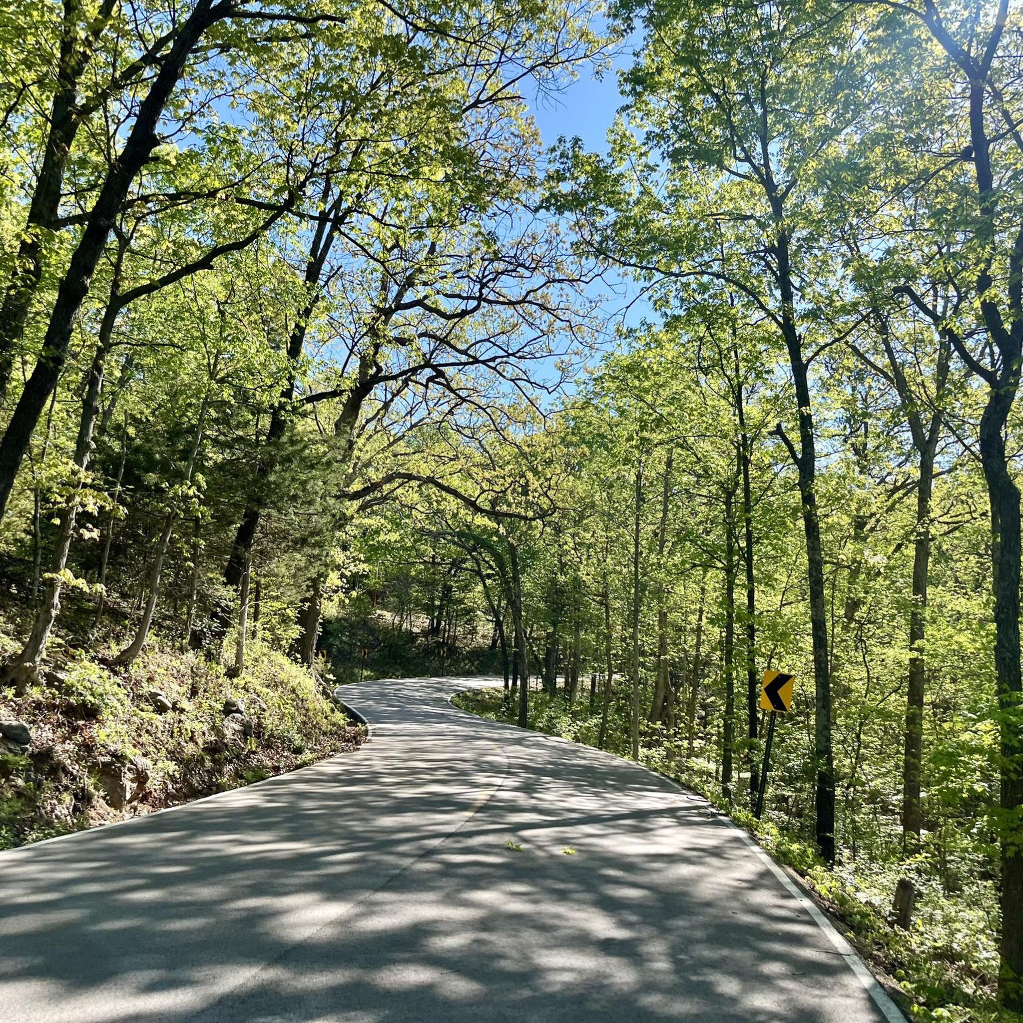
Mountain biking in Franklin County offers a diverse landscape for riders. The region features rolling hills, river valleys, and dense woodlands, providing varied terrain for mountain bike trails. These routes navigate through natural areas, including sections that follow former rail lines and climb to scenic viewpoints. The area provides a mix of elevations and trail types suitable for different skill levels.
Best mountain bike trails in Franklin County
- The most popular mountain bike trail is Lost Valley Trail Loop,…
Last updated: June 25, 2026
45
riders
18.4km
01:39
210m
210m
Easy mountain bike ride. Great for any fitness level. Suitable for all skill levels.
38
riders
20.9km
01:57
320m
320m
Moderate mountain bike ride. Good fitness required. Suitable for all skill levels.

Sign up for free
19
riders
11.8km
01:04
140m
140m
Easy mountain bike ride. Great for any fitness level. Suitable for all skill levels.
2.63km
00:15
50m
60m
Easy mountain bike ride. Great for any fitness level. Suitable for all skill levels.
50
riders
22.9km
02:05
280m
280m
Moderate mountain bike ride. Good fitness required. Suitable for all skill levels.
8
riders
20.0km
01:44
310m
310m
Moderate mountain bike ride. Good fitness required. Suitable for all skill levels.
13
riders
27.2km
01:41
120m
120m
Easy mountain bike ride. Great for any fitness level. Suitable for all skill levels.
7
riders
11.3km
01:04
180m
180m
Easy mountain bike ride. Great for any fitness level. Suitable for all skill levels.
8
riders
12.5km
01:11
200m
200m
Easy mountain bike ride. Great for any fitness level. Suitable for all skill levels.
6
riders
8.90km
00:51
150m
150m
Easy mountain bike ride. Great for any fitness level. Suitable for all skill levels.
Get access to more routes and recommendations from other explorers.
Sign up for free
Already have an account?
Our route recommendations are based on thousands of hikes, rides, and runs completed by other people on komoot.
Start today with a free account
Your next adventure awaits.
Login or Signup




Tips from the Community

These waterproof aid boxes can be found at trail junctions throughout the park. A 29“ tube, tire lever and a few CO2 cartridges. A phone number to PayPal $ to. A great idea! I saw at least 6 of them.
0
0
Picnic table and a bench. Great place to refuel and recoup.
0
0
I liked this section because it wasn’t on the side of the hill as much as some of the other trails. That said, there are plenty of rocks and roots and features. I rode down from the main parking lot and enjoyed the flow. The lowest section looked like it would be very wet in the rain and is very eroded, the trail is now along side a wide ditch from the runoff. Careful if it’s wet.
0
0
A fun section. If you’re riding Clockwise there is a nice technical section twisting downhill through the trees leading up to the crossing. After the water you’ll have wet rubber and the rocks can be slick. Easier in the counter clockwise direction. Water is deeper in spring and summer.
0
0
Back to ride it in December 2025, all those trees were removed so it’s a lot more fun now. Most people seemed to ride the loop counter clockwise with the long gravel climb at the beginning. Clockwise was harder I think.
0
0
Bike repair stand, all the necessary tools and a working air pump. Bathroom and shelter too. No water.
0
0
At mile post 5, just a few feet down from the trail the spring runs right out of the mountain. Really cool
0
0
This is what I was looking for. Narrow singletrack that runs along the terrain. Often off camber with lots of gravel sized rocks mixed in with clay and organic soils. The surface has great grip even when it’s damp. When the organic percentage rises it gives more and slips under climbing loads. The climbs aren’t too steep and there was always enough roots and rocks to keep you interested. Many stream crossings at the draws that were well prepared. Even the switchback were awesome with native stones packed in the clay to give you confidence you won’t wash out a wheel. Awesome. Be aware as of 2 May 2025 between the 5.5 and 7 mile markers there were many trees crossing the trail knocked over from a terrific wind or 🌪️. This is the area closest to the Army site.
0
0
Frequently Asked Questions
How many mountain bike trails are available in Franklin County?
Franklin County offers nearly 20 mountain bike trails, catering to various skill levels. You'll find a good mix of easy, moderate, and difficult routes to explore the region's diverse landscape.
Are there easy mountain bike trails suitable for beginners or families in Franklin County?
Yes, Franklin County has 10 easy mountain bike trails perfect for beginners or family outings. A great option is the Lost Valley Trail Loop, an 11.4-mile route that explores a scenic valley with varied terrain. Another accessible choice is the Matson Hill Loop, which is 7.3 miles long and leads through rolling hills.
What about more challenging mountain bike trails for experienced riders?
For experienced riders seeking a challenge, Franklin County offers 3 difficult mountain bike trails. Consider the Historic Bridge – Beaver Time loop from Defiance, a 14.3-mile route that provides a demanding ride through varied terrain.
Are there any circular mountain bike routes in Franklin County?
Many of the mountain bike trails in Franklin County are designed as loops, offering a convenient way to start and end your ride at the same point. Examples include the Eagle Valley and DeClue Trail Loop and the Spring – Stream crossing loop from Lost Valley Trail Parking.
Where can I find parking for mountain bike trails in Franklin County?
Parking availability varies by trailhead. Many popular routes, such as those near the Lost Valley Trail, typically have designated parking areas. It's advisable to check the specific route details on komoot for information on trailhead access and parking facilities before you go.
What is the best time of year to go mountain biking in Franklin County?
The spring and fall months generally offer the most pleasant conditions for mountain biking in Franklin County, with milder temperatures and vibrant foliage. Summers can be warm and humid, while winters may bring cold temperatures and potential snow or ice, making some trails less accessible.
What kind of terrain can I expect on mountain bike trails in Franklin County?
Franklin County's mountain bike trails feature a diverse landscape, including rolling hills, river valleys, and dense woodlands. You'll encounter varied terrain, from sections following former rail lines to climbs that lead to scenic viewpoints. The region offers a mix of natural surfaces and elevations.
Are there any specific permits required to mountain bike in Franklin County?
Most mountain bike trails in Franklin County do not require special permits for general access. However, it's always a good idea to check for any specific regulations or fees if you plan to ride within state parks or privately managed areas. Komoot route details often provide this information.
What should I bring for a mountain biking trip in Franklin County?
For a mountain biking trip in Franklin County, essential items include a helmet, water, snacks, a basic repair kit (spare tube, pump, multi-tool), and appropriate clothing for the weather. Given the varied terrain and wooded areas, insect repellent and a first-aid kit are also recommended.
Can I expect to see wildlife while mountain biking in Franklin County?
Yes, the dense woodlands and river valleys of Franklin County are home to various wildlife. Riders often report seeing deer, various bird species, and smaller mammals. Remember to maintain a respectful distance and avoid disturbing any animals you encounter.
Are there places to eat or get refreshments near the mountain bike trails?
While some trailheads might have basic facilities, many routes in Franklin County pass through or near small towns and communities where you can find cafes, restaurants, or convenience stores. Planning your route with komoot can help you identify towns or services along your ride.
What do other mountain bikers say about the trails in Franklin County?
The mountain bike trails in Franklin County are highly rated by the komoot community, with an average score of 5.0 stars. Riders often praise the diverse terrain, scenic views, and well-maintained paths that offer enjoyable experiences for all skill levels.
Are there any less-known or 'hidden gem' trails in the area?
While popular routes like the Lost Valley Trail are well-loved, exploring some of the lesser-trafficked trails can reveal hidden gems. For example, the Hogsback Trail offers a shorter, easy ride that provides a different perspective of the local landscape away from the busiest areas.
Most popular routes in Franklin County

Get inspired with the komoot mobile app


Didn’t find what you were looking for?
Check out more MTB trails throughout Franklin County below and find the perfect route in your destination.
Explore more
Browse the best MTB trails in other regions.
