The best cycling routes in Richland County
4.7
(16)
173
riders
28
rides
Touring cycling routes in Richland County traverse diverse landscapes, characterized by riverine environments, urban greenways, and forested areas. The region features a mix of flat, paved paths along rivers and lakes, alongside routes with moderate elevation changes through more developed areas. Cyclists can experience both natural settings and urban scenery, with trails often following waterways.
Best touring cycling routes in Richland County
- The most popular touring cycling route is Palmetto Trail: Capital City Passage, a 9.6 miles (15.5 km) trail that takes 58 minutes to complete. This easy route offers urban sights and river views.
- Another top favourite among local touring cyclists is Three Rivers Greenway, an easy 11.4 miles (18.4 km) path. This trail provides scenic river views through woodlands and parks.
- Local touring cyclists also love the Spring lake to Lake Catherine loop from North Trenholm, a 12.8 miles (20.6 km) trail leading through areas with scenic views around both lakes, often completed in about 1 hour 14 minutes.
- Touring cycling in Richland County is defined by urban greenways, river views, and forested sections. The network offers options for different ability levels, from easy, flat paths to more challenging routes with elevation.
- The routes in Richland County are highly rated by the komoot community with an average score of 4.1 stars from more than 10 reviews. More than 190 touring cyclists have used komoot to explore Richland County's varied terrain.
Last updated: July 7, 2026
5.0
(2)
7
riders
15.5km
00:58
110m
110m
Embark on an easy touring bicycle ride along the Palmetto Trail: Capital City Passage, a route that winds through Columbia, South Carolina. This 9.6-mile (15.5 km) journey, with a gentle 353 feet (107 metres) of elevation gain, offers a unique perspective on the city. You can expect to complete it in about 57 minutes. As you cycle, you will pass by attractive neighborhoods and city parks, experiencing the blend of urban life and green spaces. A notable highlight is riding past the South Carolina State House grounds, offering a glimpse into the state's history. The trail also guides you through the beautiful paved sections of Riverfront Park, providing a flat and car-free cycling experience.
The Capital City Passage is largely paved and clearly marked with Palmetto Trail signs, making navigation straightforward. You will find various points of interest along the way, enhancing your ride. While much of the trail is suitable for cycling, be aware that certain sections through downtown Columbia may have higher traffic volumes. Plan your ride accordingly, especially if you prefer quieter routes. Facilities and a variety of restaurants are conveniently located along the route, particularly as you approach Riverfront Park, making it easy to take a break or grab a meal. This accessibility makes the trail a great option for a casual outing.
This urban passage provides a distinctive way to explore Columbia, offering a blend of city sights and historical landmarks. It showcases the unique contrast of an urban trail, allowing you to experience the city's pulse while enjoying a dedicated cycling path. The route connects various parts of the city, making it an excellent choice for both locals and visitors looking to discover Columbia on two wheels. It's a key part of the larger Palmetto Trail system, offering a convenient and accessible segment within the state capital.
3
riders
18.4km
01:08
100m
100m
Embark on an easy touring cycling adventure along the Three Rivers Greenway, a pleasant 11.4-mile (18.4 km) route that guides you through Columbia, South Carolina. You will experience a gentle elevation gain of 327 feet (100 metres) over approximately 1 hour and 8 minutes. As you pedal, you'll trace the banks of the Broad, Saluda, and Congaree Rivers, enjoying a mix of lush natural settings and urban views, including the Columbia skyline.
Planning your visit is straightforward, as the greenway is well-equipped for cyclists. You'll find amenities like restrooms, water fountains, and picnic areas along the way, making it easy to take breaks. The route is also ADA accessible and dog-friendly, welcoming a variety of users. Access to the greenway is convenient, with hotels, restaurants, and shops located nearby in Columbia's city centers.
This greenway offers more than just a ride; it's an opportunity to connect with the region's natural beauty and history. Keep an eye out for local wildlife, such as deer and great blue herons, often spotted near the water. The route also provides views of the historic Cayce Riverwalk and impressive canal diversion dams, showcasing the area's engineering heritage and scenic river landscapes.

Sign up for free
1
riders
82.3km
04:58
680m
680m
Cycle the difficult 51.2-mile Chapin & Little Mountain Historic District loop, featuring lakeside roads and historic sites.
2
riders
20.6km
01:14
140m
140m
This easy 12.8-mile touring bicycle loop from North Trenholm in Columbia, SC, offers scenic views around Spring Lake and Lake Catherine.
2
riders
48.2km
02:51
250m
250m
Embark on a touring bicycle adventure around the McEntire Joint National Guard Base, starting from Leesburg Road. This moderate route spans 30.0 miles (48.2 km) and involves a total elevation gain of 813 feet (248 metres), typically taking about 2 hours and 50 minutes to complete. You'll enjoy a smooth ride on mostly paved surfaces, offering a consistent cycling experience. As you pedal, keep an eye towards the base; you might catch glimpses or sounds of military aircraft, such as F-16 Fighting Falcons, adding a unique backdrop to your journey. The surrounding Columbia area is known for its wooded landscapes, providing a pleasant natural setting for your ride.
Planning your visit is straightforward, as the starting point for this loop is conveniently located next to a parking lot, ensuring easy access for cyclists. This route does not require any specific permits or fees, and there are no mentioned seasonal closures, allowing for flexible planning. Given its moderate difficulty and length, you should have a good level of fitness to comfortably complete the ride. Consider starting your journey in the morning to make the most of the daylight and avoid peak traffic times.
This touring bicycle route offers a distinctive blend of natural scenery and a unique connection to military aviation. While cycling, you'll be in the vicinity of the McEntire Joint National Guard Base, which is home to F-16 Fighting Falcons, providing an unusual point of interest. Additionally, the Columbia South Carolina Temple, with its well-maintained grounds, stands as a notable architectural landmark nearby, adding another layer of visual interest to the broader region surrounding your ride.
5.0
(1)
2
riders
26.1km
01:38
190m
190m
Embark on the Capital City Passage Loop for a challenging touring bicycle ride through Columbia, South Carolina. This route spans 16.2 miles (26.1 km) and features a significant 625 feet (191 metres) of elevation gain, making it a difficult journey that takes approximately 1 hour and 38 minutes to complete. As you cycle, you will experience an urban landscape, passing by historical sites and city parks, with the impressive South Carolina State House standing out as a key landmark along your way.
When planning your visit, be aware that while much of the Capital City Passage is accessible, certain downtown areas can have heavy traffic, which might be less suitable if you are cycling with children. The route offers limited shade, so prepare for potentially hot conditions if you ride during spring, summer, or fall. Consider starting your ride early in the day to avoid the peak heat and traffic.
Beyond the city streets, the route also includes a scenic river walk along the Columbia Canal and Riverfront Park, providing a refreshing change of scenery. This section allows you to enjoy the natural beauty of the river, and if you visit in spring, you might even see many flowers blooming. This blend of urban exploration and natural riverside paths makes the Capital City Passage Loop a unique touring experience in the region.
85.4km
05:15
720m
720m
This difficult 53.0-mile touring cycling loop around Lake Carolina offers lake views and historical sights in Columbia, SC.
29.6km
01:50
230m
230m
Cycle the Palmetto Trail: Capital City and Fort Jackson Loop, a moderate 18.4-mile route combining urban history and wooded military landsca
26.0km
01:34
210m
210m
Cycle the moderate 16.1-mile Lake Carolina loop from Jacob Mission, enjoying scenic views of the lake and community surroundings.
27.3km
01:38
200m
200m
Cycle the moderate 17.0-mile Lake Carolina loop from Rehoboth, enjoying lake views and a vibrant community in Columbia, South Carolina.
Get access to more routes and recommendations from other explorers.
Sign up for free
Already have an account?
Our route recommendations are based on thousands of hikes, rides, and runs completed by other people on komoot.
Start today with a free account
Your next adventure awaits.
Login or Signup










Tips from the Community

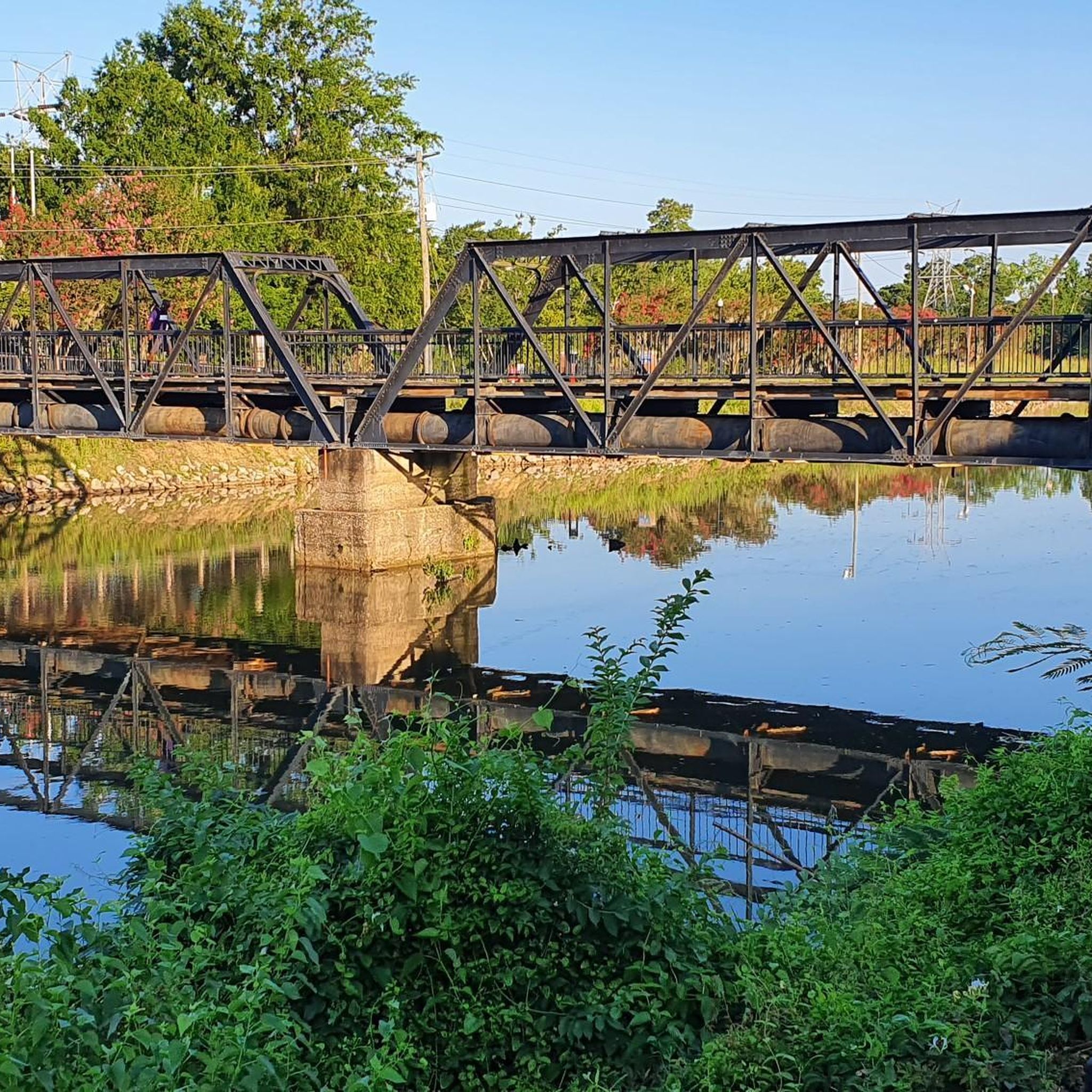
The Cayce Riverwalk is a beautiful section of the Congaree River. It is a great for walking, jogging, bicycling, bird-watching, picnicking and taking in the natural beauty of the riverfront. Be it on foot or bike, make sure to keep a beady eye out for the hand-carved wooden animal sculptures and the lion bench that was hand-wrought by local artists!
0
0
Gervais Street Bridge is a historic bridge listed on the National Register of Historic Places. It is a concrete arch bridge built in 1926. It was added to the National Register of Historic Places in 1980.
0
0
Little Mountain Historic District encompasses 50 contributing buildings and 2 contributing structures that have been added to the National Register of Historic Places. Both buildings and structures date from about 1890 to 1950 and include residences, businesses, and other institutional buildings. This is a very cute railroad town and aptly named after the wooded summited 247 m high hill where it took its name from.
0
0
Chapin fits in neatly into the northern tip of Lexington County. As such it is the main access town to Lake Murray with over 500 miles of coastline. With this type of access there are water activities aplenty and lake side roads to bike around.
0
0
Lake Carolina is the fulcrum of a thriving community area filled with outdoor and recreational activities. There are 30 miles of winding bike and nature trails in the area as well as water activities.
0
0
The beautifully impressive Columbia South Carolina Temple covers 10,700 square feet and stands on a 3.6-acre property. Externally the temple is made of Imperial Danby Vermont marble. The grounds are an immaculate collection of specially selected shrubs and trees. The temple is the 62nd operating temple of the Church of Jesus Christ of Latter-day Saints or LDS Church.
0
0
This is the 10.2-mile (16.4 km) 'Capital City Passage' section of the far longer 500-miles (800km) Palmetto Trail. This is an easy urban section that goes through the city of Columbia from Riverfront Park to Fort Jackson. It passes by the South Carolina State Capitol and the Horseshoe of the University of South Carolina.
0
0

The Three Rivers Greenway is a pathway connecting the three cities of Columbia, West Columbia and Gayce. The name comes from the three rivers that meet here: Broad, Saluda, and Congaree River. The trail provides a mix of river views, woodlands and parks and it is a great destination for hiking, running and cycling.
0
0
Frequently Asked Questions
How many touring cycling routes are available in Richland County?
Richland County offers a diverse selection of over 25 touring cycling routes, catering to various skill levels. These routes range from easy, flat paths to more challenging rides with significant elevation changes.
What types of landscapes can I expect to see while cycling in Richland County?
Touring cyclists in Richland County can experience a mix of urban greenways, scenic river views, and forested areas. Routes often follow waterways, providing a blend of natural settings and urban scenery. For example, the Three Rivers Greenway offers views through woodlands and parks, while the Spring lake to Lake Catherine loop provides scenic views around both lakes.
Are there any family-friendly or easy touring cycling routes in Richland County?
Yes, Richland County has several easy routes perfect for families or beginners. The Palmetto Trail: Capital City Passage is an easy 9.6-mile route offering urban sights and river views. Another great option is the Three Rivers Greenway, an easy 11.4-mile paved path with scenic river views.
What are some notable attractions or landmarks I can explore near the cycling routes?
Richland County offers several interesting attractions. You can explore the unique ecosystem of Congaree National Park Boardwalk, visit Harbison State Forest for diverse wildlife and tree species, or see the historic South Carolina State House. Many routes, like the Palmetto Trail: Capital City Passage, pass through urban areas with access to these points of interest.
Are there any circular touring cycling routes in the area?
Yes, many routes in Richland County are designed as loops, offering a convenient way to start and end your ride at the same point. Examples include the Spring lake to Lake Catherine loop and the Capital City Passage Loop.
What is the best time of year for touring cycling in Richland County?
The spring and fall seasons generally offer the most pleasant weather for touring cycling in Richland County, with mild temperatures and beautiful scenery. Summers can be hot and humid, while winters are typically mild but can have occasional cold snaps. Always check local weather forecasts before heading out.
Are there any routes that offer significant elevation challenges for experienced cyclists?
For those seeking a challenge, Richland County does offer routes with more substantial elevation gains. The Chapin & Little Mountain Historic District loop, for instance, is categorized as difficult with over 680 meters of elevation gain, providing a demanding ride through varied terrain.
What do other touring cyclists enjoy most about cycling in Richland County?
The area is highly rated by the komoot community, with an average score of 4.1 stars from over 10 reviews. Reviewers often praise the diverse terrain, from urban greenways to river views, and the variety of routes suitable for different ability levels. Over 190 touring cyclists have used komoot to explore Richland County's varied terrain.
Are there options for longer touring cycling routes in Richland County?
Yes, for cyclists looking for longer distances, routes like the Lake Carolina via Hard Scrabble & Percival Road loop cover over 85 kilometers, offering an extensive ride through the region. Another option is the Chapin & Little Mountain Historic District loop, which is over 82 kilometers long.
Can I find routes that pass by lakes or offer water views?
Absolutely. Several routes in Richland County feature beautiful lake and river views. The Spring lake to Lake Catherine loop is specifically designed to showcase scenic views around both lakes. Additionally, the Lake Carolina loop from Jacob Mission and Lake Carolina loop from Rehoboth provide opportunities to cycle around Lake Carolina.
What are the general parking and public transport options for accessing bike trails in Richland County?
Access to trails varies by location. Many popular trailheads, especially for routes like the Palmetto Trail: Capital City Passage and Three Rivers Greenway, typically have designated parking areas. For specific details on parking, fees, or public transport availability for individual parks or trail sections like Harbison State Forest or Saluda Shoals Park, it's best to check their official websites directly.
Are dogs allowed on the touring cycling trails in Richland County?
Dog policies vary depending on the specific park or trail. For example, while some greenways may allow leashed dogs, places like Harbison State Forest or Saluda Shoals Park might have specific rules or designated dog areas. It's always recommended to check the regulations of the specific trail or park you plan to visit regarding pets.
Most popular routes in Richland County
Most popular attractions in Richland County

Get inspired with the komoot mobile app


Didn’t find what you were looking for?
Check out more Cycling routes throughout Richland County below and find the perfect route in your destination.
Explore more
Browse the best Cycling routes in other regions.
