The best cycling routes around Pitt Meadows
4.3
(402)
2,166
riders
75
rides
Touring cycling around Pitt Meadows is characterized by its network of multi-use trails, tracing rivers, farmlands, and wetlands within British Columbia's Lower Mainland. The region features extensive flat dyke trails along the Alouette, Pitt, and Fraser Rivers, providing traffic-free routes. These paths offer views of agricultural fields and distant mountains, with minimal elevation changes. The landscape is shaped by diverse ecosystems, including marshlands and river channels.
Best touring cycling routes around Pitt Meadows
- The most popular touring cycling route is Pitt River Bridge – Hyde Creek Salmon Hatchery loop from Pitt Meadows, a 27.9 miles (45.0 km) trail that takes 3 hours 26 minutes to complete. This moderate route follows dyke trails along the Pitt River, offering views of farmlands and distant mountains.
- Another top favourite among local touring cyclists is Pitt River Bridge – Pitt River Dike Trail loop from Maple Meadows, a moderate 27.2 miles (43.8 km) path. This path traverses flat dyke trails, providing expansive views of the Pitt River and surrounding agricultural areas.
- Local touring cyclists also love the Michael Forrest River Walkway loop from Mary Hill, a 12.5 miles (20.0 km) trail leading through riverfront paths, often completed in about 1 hour 33 minutes.
- Touring cycling around Pitt Meadows is defined by dyke trails, rivers, and farmlands. The network offers options for easy, moderate, and difficult routes, catering to various cycling abilities.
- The routes in Pitt Meadows are highly rated by the komoot community with an average score of 4.4 stars from over 300 reviews. More than 2000 touring cyclists have used komoot to explore Pitt Meadows's varied terrain.
Last updated: October 21, 2026
4.2
(98)
313
riders
45.3km
03:24
160m
160m
Moderate bike ride. Good fitness required. Mostly paved surfaces. Suitable for all skill levels.
4.7
(26)
86
riders
46.6km
03:25
90m
90m
Moderate bike ride. Good fitness required. Mostly paved surfaces. Suitable for all skill levels.

5.0
(4)
54
riders
Easy bike ride. Great for any fitness level. Mostly paved surfaces. Suitable for all skill levels.
3.7
(3)
37
riders
21.0km
01:47
80m
80m
Easy bike ride. Great for any fitness level. Mostly paved surfaces. Suitable for all skill levels.
4.0
(2)
17
riders
27.8km
01:57
60m
60m
Easy bike ride. Great for any fitness level. Mostly paved surfaces. Suitable for all skill levels.
Get access to more routes and recommendations from other explorers.
Already have an account?
Our route recommendations are based on thousands of hikes, rides, and runs completed by other people on komoot.
Start today with a free account
Your next adventure awaits.

Tips from the Community

The Alouette River was formerly known as the Lillooet River, but the name was changed since there is a larger, more well known river that had the same name. The name Alouette was chosen for the simple reason that it sounds similar to Lillooet, but French speakers will recognize that it means lark.
0
0

The Hyde Creek Salmon Hatchery is a small powerhouse of local conservation, run entirely by volunteers who raise thousands of coho and chum salmon each year. Its story began in the 1980s with a homemade backyard hatchery, complete with an old bathtub! Drop by on a Saturday morning when volunteers are usually around, and you may get a glimpse behind the scenes before heading back out to watch for salmon in Hyde Creek itself.
1
0

Gates Park offers a mix of paved and natural trail sections along the river, with picnic areas, playgrounds, and sports fields, making it a good starting or ending point for a longer riverside walk or ride into ƛ̓éxətəm.
0
0
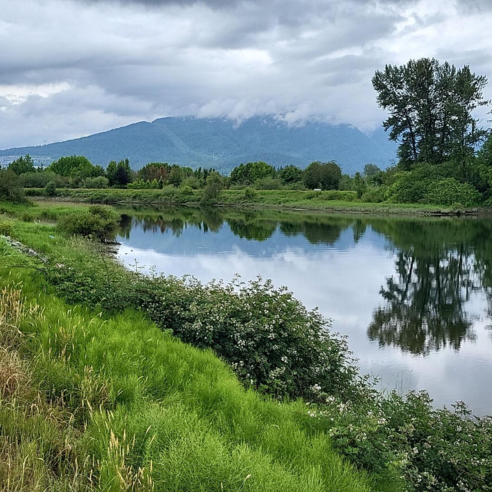
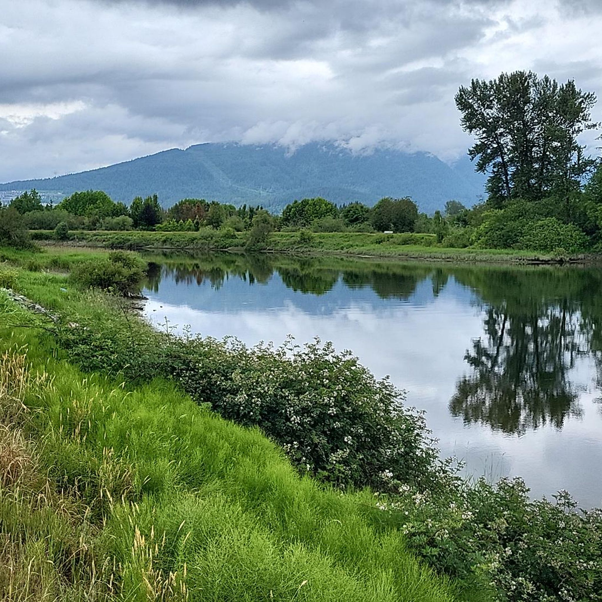
The view opens onto a slow, meandering river cutting through wide-open farmland — a mix of grassy fields, wetland patches, and hedgerows rather than dense forest crowding the banks.
0
0
This brigde was built through community fundraising efforts led by the Colony Farm Park Association, working in partnership with Metro Vancouver, to give walkers and cyclists a direct river crossing within the park's trail network. It serves as a key junction point: crossing it lets visitors extend a walk into a longer loop, linking the western side of the park near the Community Gardens to the eastern Wilson Farm area, rather than backtracking the way they came.
0
0
At this southern spot near Pitt River Road, the Coquitlam River opens up and slows down. The water here is wider and calmer than the fast-moving sections further upstream.
0
0
The park is very practical for visitors because it has clean public washrooms and a large, free parking lot. You can pack a lunch to enjoy at one of the many shaded picnic tables or check out the local food trucks that often park nearby.
0
0

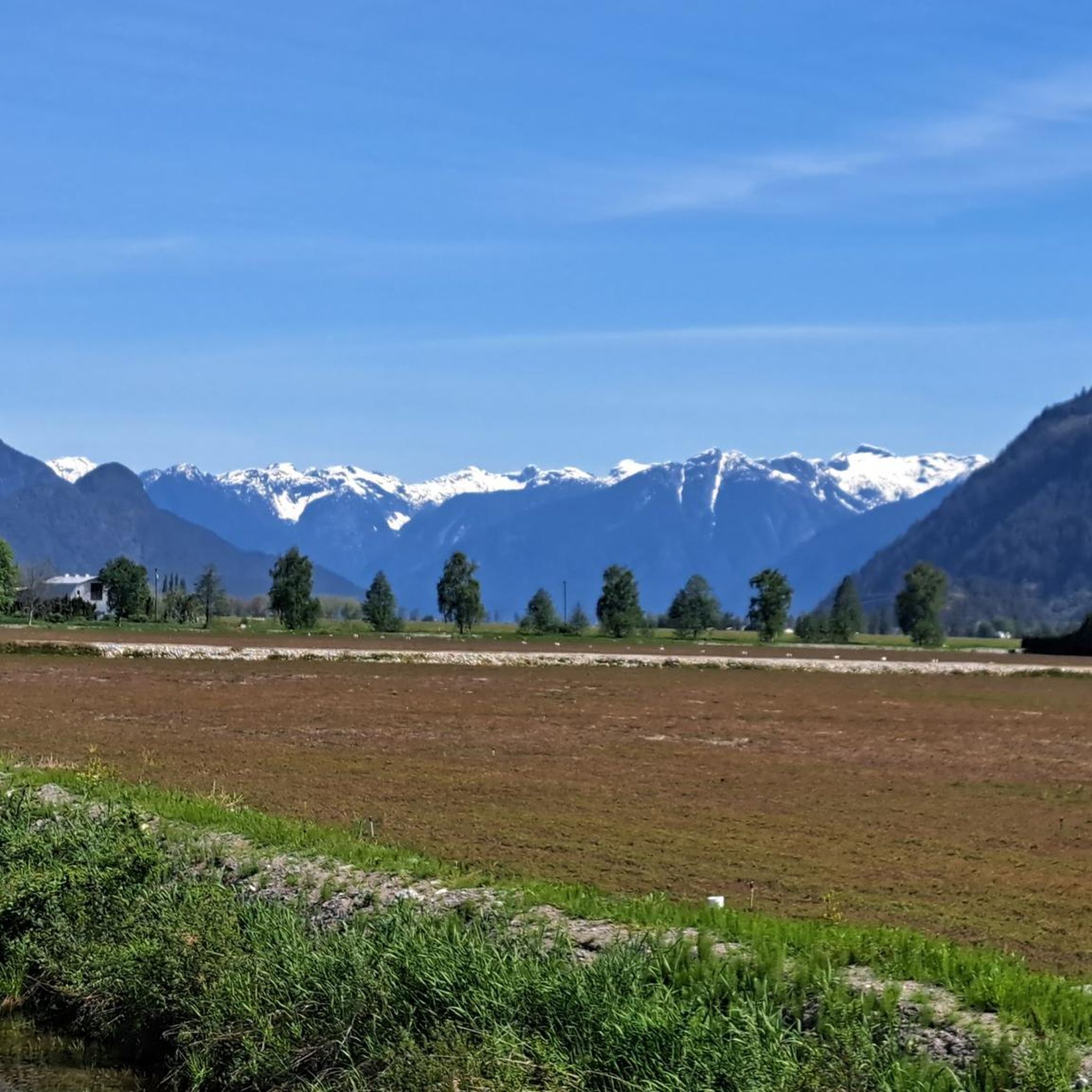
Pitt River Regional Greenway is a multi-use trail that follows the east bank of the Pitt and Fraser rivers through Pitt Meadows. The route runs along dikes and through riparian areas, with wide views of the river, surrounding farmland, and nearby mountains. Its flat, open alignment and proximity to the water give it a calm, spacious feel, with plenty of opportunities to see birds and other wildlife.
0
0
Frequently Asked Questions
How many touring cycling routes are available in Pitt Meadows?
Pitt Meadows offers a wide selection of touring cycling routes, with over 90 routes documented on komoot. These routes cater to various skill levels, including 39 easy, 35 moderate, and 16 difficult options.
What types of terrain can I expect on Pitt Meadows cycling routes?
Touring cycling in Pitt Meadows primarily features extensive flat dyke trails along the Alouette, Pitt, and Fraser Rivers. These are often gravel paths, providing traffic-free expanses. You'll also find routes that incorporate quiet roads, agricultural fields, and marshlands, offering a mix of surfaces and scenic views.
What do other cyclists say about touring cycling in Pitt Meadows?
The touring cycling routes in Pitt Meadows are highly regarded by the komoot community, holding an average rating of 4.4 stars from over 340 reviews. More than 2,000 touring cyclists have explored the area using komoot, often praising the serene natural beauty and well-maintained dyke trails.
When is the best time of year to go touring cycling in Pitt Meadows?
Pitt Meadows offers enjoyable cycling conditions through spring, summer, and fall. The dyke trails and agricultural landscapes are particularly vibrant during these seasons. While winter cycling is possible, conditions may vary with weather, so checking local forecasts is advisable.
Are there any family-friendly touring cycling routes in Pitt Meadows?
Yes, many of the flat dyke trails are ideal for families. Routes like the Pitt River – View of the Pitt River loop from Pitt River Bridge, an easy 12.4-mile (20.0 km) route, offer gentle terrain and scenic views suitable for all ages. The extensive network of traffic-free paths ensures a safe and pleasant experience.
Can I bring my dog on the cycling trails in Pitt Meadows?
Many of the multi-use dyke trails in Pitt Meadows are dog-friendly, provided dogs are kept on a leash. These trails offer ample space for both cyclists and walkers with pets to enjoy the outdoors. Always check local signage for specific regulations on individual trails.
Are there circular touring cycling routes available?
Yes, Pitt Meadows features numerous circular touring cycling routes. A popular option is the Pitt River Bridge – Hyde Creek Salmon Hatchery loop from Pitt Meadows, a moderate 27.9-mile (45.0 km) trail that follows dyke paths along the Pitt River, offering continuous scenic views.
What natural features or landmarks can I see along the cycling routes?
Cycling routes in Pitt Meadows offer views of diverse natural features. You'll encounter the Alouette, Pitt, and Fraser Rivers, marshlands, and extensive agricultural fields. Notable landmarks include the Tynehead Pedestrian Overpass and the Golden Ears Bridge, Fraser River. You might also spot wildlife such as eagles and herons.
Are there routes with good viewpoints in Pitt Meadows?
Absolutely. Many routes along the dykes provide expansive views of the Pitt River, surrounding agricultural areas, and distant mountains, including Golden Ears Provincial Park and sometimes even Mount Baker on clear days. The Coquitlam Lake Viewpoint is also accessible from some routes.
How can I access the cycling routes using public transport?
Pitt Meadows is served by TransLink, which operates bus services connecting to SkyTrain stations. Some routes may have stops near popular trailheads or access points to the dyke trails, making it possible to combine cycling with public transport. Check TransLink schedules and route maps for the most current information.
Where can I park my car when cycling in Pitt Meadows?
Parking is available at various access points to the dyke trails and regional parks throughout Pitt Meadows. Jerry Sulina Park is a common starting point with parking facilities. Always look for designated parking areas to ensure convenience and compliance with local regulations.
Are there any cafes or pubs along the cycling routes?
While many routes traverse natural and agricultural areas, some routes may pass near local amenities. For example, the Pitt River Bridge – Taylight Brewing loop from Pitt Meadows specifically includes a stop at a local brewery, offering a refreshment option during your ride. Exploring the town center of Pitt Meadows will also reveal various cafes and eateries.
What are some easy touring cycling routes for beginners?
Beginners will find many suitable options among the 39 easy routes in Pitt Meadows. The flat dyke trails are particularly welcoming. An excellent choice is the Michael Forrest River Walkway loop from Mary Hill, an easy 12.5-mile (20.0 km) trail that follows riverfront paths with minimal elevation gain.
Are there any routes that showcase the agricultural landscape?
Yes, many routes in Pitt Meadows wind through the region's rich agricultural lands. You can cycle past cranberry and blueberry fields, and even pumpkin patches during harvest seasons. The dyke trails often provide expansive views of these working farms, offering a unique scenic experience.
Most popular attractions around Pitt Meadows

Get inspired with the komoot mobile app


Explore more
Browse the best Cycling routes in other regions.
