Attractions and Places To See around Le nord-est de Manitoulin et les îles - Top 5
Best attractions and places to see around Le nord-est de Manitoulin et les îles include Manitoulin Island, recognized as the world's largest freshwater island, which is characterized by its diverse natural landscapes and cultural significance. The region features notable geographic formations such as the Niagara Escarpment, offering elevated viewpoints, and numerous freshwater lakes, some containing their own islands. Visitors can explore a range of sites, from natural waterfalls and sandy beaches to ancient archaeological locations and Indigenous cultural centers. This…
Last updated: October 10, 2026
Trailhead of Michigiwadinong - Cup and Saucer Trail
Highlight • Trail
Translated by Google •
Tip by

Forest Trail
Highlight • Trail
Showing Translation
Tip by

Sign up now to discover places like this
Get recommendations on the best single tracks, peaks, & plenty of other exciting outdoor places.
Viewpoint 2 at the Cliff Overhangs
Highlight • Viewpoint
Translated by Google •
Tip by
Bridal Veil Falls
Highlight • Waterfall
Tip by

Western Section of the Grand Loop
Highlight (Segment) • Trail
Translated by Google •
Tip by

Sign up for free to discover even more attractions around Le nord-est de Manitoulin et les îles.
Already have an account?
Start today with a free account
Your next adventure awaits.
Popular around Le nord-est de Manitoulin et les îles

Other adventures around Le nord-est de Manitoulin et les îles

Tips from the Community

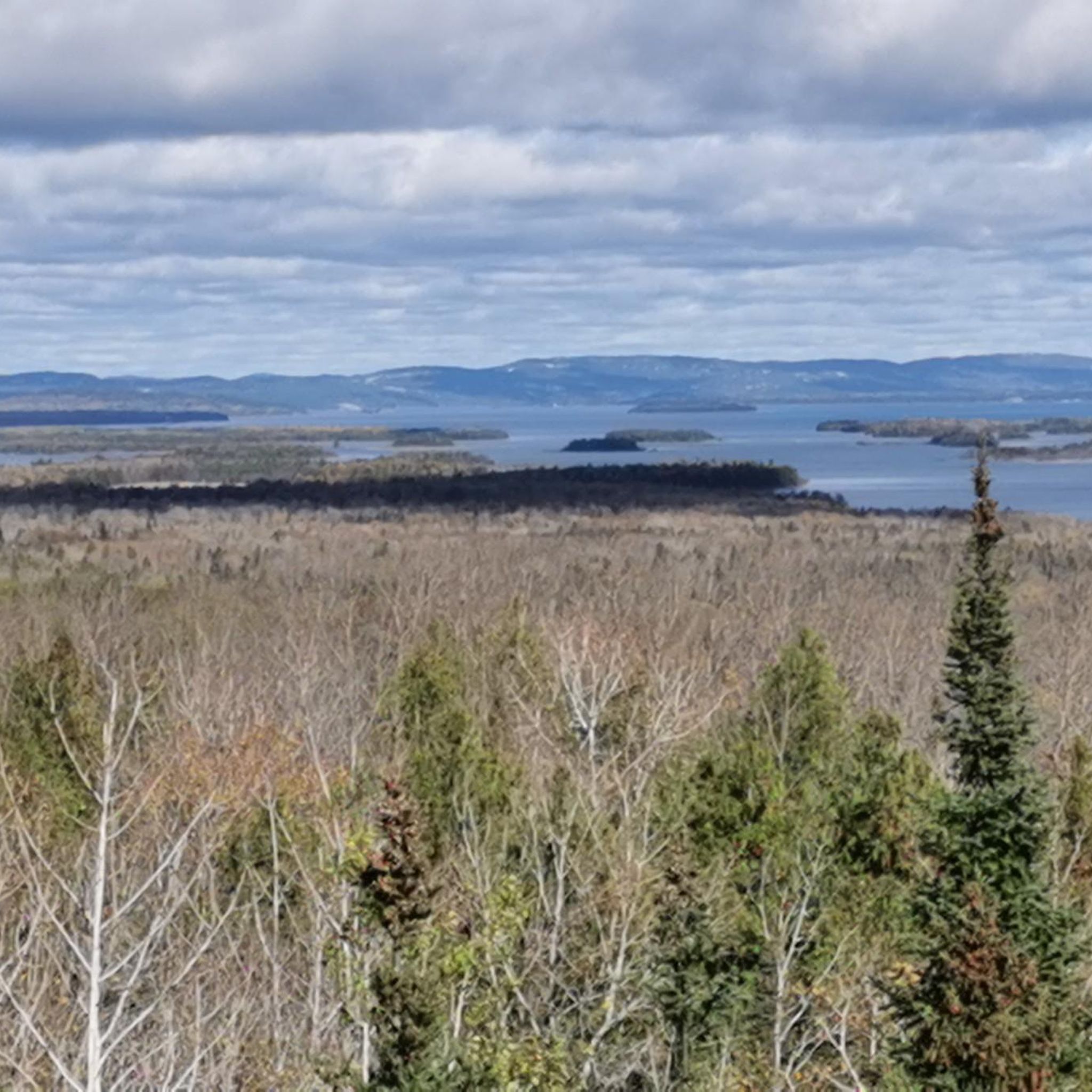
The lookout on the protruding rock to the east allows a view over the forests and Lake Manitou in the distance. The view of the spectacular rock face becomes the highlight of the hike. (Visit on May 21, 2026)
1
0
The trailhead of the Cup and Saucer Trail is located on Highway 540 a few kilometers north of M’Chigeeng. The gravel parking lot can accommodate numerous vehicles. Parking is free of charge; a voluntary contribution is requested. (Visit on May 21, 2026) At the end of May / beginning of June 2017, the trailhead of the Michigiwadinong - Cup and Saucer Trail was relocated; this can be read at: https://escarpment.ca/files/saving-the-cup-and-saucer-trail-2017-pdf.pdf
1
0
The return path on the blue-marked South Loop of the Cup and Saucer Trail runs west of the plateau through a young mixed forest with oaks and birches. There are no viewpoints along the way. (Visit on May 21, 2026) Note: The map shows a loop of the trail southwest of the route; this section is not part of the South Loop and is not recognizable in the forest.
0
0
The forest path is connected with the name of the Newby family, settlers who settled near what was later called Newby’s Bay on Lake Manitou in 1895 and operated a farm. https://dokumen.pub/exploring-manitoulin-9781442674738.html There was or is no railway line on Manitoulin Island. The town of Little Current in the north of the Island was connected in 1913 to the railway line from Sudbury on the mainland by a swing bridge – by the “Manitoulin and North Shore Railway” or later the “Algoma Eastern Railway”. This remained the only railway connection on Manitoulin Island; it was never built further south into the interior of the island. Today the swing bridge is used as a single-lane road on Highway 6. https://trainweb.us/ontariorailways/railaer.htm (Visit on May 21, 2026)
1
0

The ascent to the tour is almost the most interesting part. The views from the rocky edge are quite similar. Three quarters of the tour are then very monotonous and boring through a sparse, bristly forest. Overall, the tour is a disappointment and not worth the drive.
0
0

The stone shelf creates a massive overhang under the river where there is ample space to walk behind the falls. Pretty magical!
1
0


Very nice vantage point, especially during the Indian Summer it is worth taking a break here and marveling at the beautiful colors of the forests :-)
1
0
Frequently Asked Questions
What are the best hiking trails in Le Nord-Est de Manitoulin et les îles?
The region is renowned for its hiking opportunities. The Cup and Saucer Trail Entrance is one of Ontario's most popular trails, leading to spectacular cliffs and offering panoramic views from the Niagara Escarpment. You can find various routes, including a moderate 8.9 km trail and an easier 5.1 km loop, by exploring the hiking guide for Le Nord-Est de Manitoulin et les îles.
Where can I find the most scenic viewpoints in the region?
Le Nord-Est de Manitoulin et les îles offers several breathtaking viewpoints. The View from the East Overlook provides extensive vistas from a unique spearhead-shaped overhang. Another must-see is the View of the North Channel, offering clear views to the northwest. Additionally, the Ten Mile Point along Highway 6 is a popular scenic stop.
Are there any waterfalls or beaches to visit?
Yes, the region boasts beautiful natural water features. Bridal Veil Falls in Kagawong is a picturesque 11-meter waterfall where visitors can walk behind the cascade. For beaches, Providence Bay Beach is known for its clear waters, white sand, and a lovely boardwalk, perfect for swimming and relaxation.
What cultural and historical sites can I explore?
The area is rich in Indigenous culture and history. The Wiikwemkoong Unceded Territory offers authentic Indigenous experiences, including guided tours and cultural festivals like the Annual Wiikwemkoong Cultural Festival. The Sheguiandah National Historic Site is one of Canada's oldest known Indigenous archaeological sites, dating back over 9000 years. The Ojibwe Cultural Foundation in M'Chigeeng preserves and transmits Ojibwe culture through art exhibitions and workshops.
What are some family-friendly activities in Le Nord-Est de Manitoulin et les îles?
Families can enjoy a variety of activities. Swimming and picnicking at Providence Bay Beach are popular choices. Exploring the easy sections of the Cup and Saucer Trail offers an accessible outdoor adventure. Visiting Bridal Veil Falls allows for a unique experience of walking behind a waterfall. Many cultural sites also offer engaging experiences for all ages, such as attending a local Pow-wow.
Can I find unique natural phenomena or landmarks in the area?
Absolutely. Manitoulin Island itself is the world's largest freshwater island. Within it, you'll find Lake Manitou, the largest of the island's 100 freshwater lakes, some of which contain their own islands. A truly unique feature is Treasure Island in Lake Mindemoya, which is the largest island in a lake on an island in a lake.
What is the best time of year to visit Le Nord-Est de Manitoulin et les îles?
The region is beautiful year-round, but the best time depends on your interests. Summer (June to August) is ideal for swimming, hiking, and attending cultural festivals like the Wiikwemkoong Cultural Festival. Autumn offers spectacular fall foliage, especially visible from viewpoints like the View from the East Overlook. Spring brings blooming nature and fewer crowds, while winter offers opportunities for snowshoeing and cross-country skiing.
Are there any opportunities for stargazing or experiencing dark skies?
Yes, the region is excellent for stargazing. The Manitoulin Eco Park is designated as a dark sky preserve, offering a prime location for observing the night sky away from light pollution.
What are some charming towns or villages to visit?
Little Current serves as the main entry point to the island and offers local shops, restaurants, and marinas. Kagawong, home to Bridal Veil Falls, also features the Old Mill Heritage Centre, which is now an art and history center. These villages provide a glimpse into local life and offer amenities for visitors.
What kind of wildlife can I expect to see?
The diverse ecosystems of Manitoulin Island, including forests, wetlands, and lake shores, support a variety of wildlife. Visitors might spot deer, various bird species, and smaller mammals. Provincial parks like Misery Bay Provincial Park offer trails through different habitats, increasing the chances of wildlife encounters.
Are there any specific trails for more adventurous hikers?
For those seeking a challenge, the Cup and Saucer Trail includes sections with varying difficulty, including more adventurous routes along the Niagara Escarpment. The Cliff Trail with Forest and Lake View offers breathtaking views along cliffs up to 70 meters steep, with fewer hikers on its southern part for a more secluded experience.
What is the significance of the Little Current Swing Bridge?
The Little Current Swing Bridge is an iconic landmark and the primary vehicular entry point to Manitoulin Island. It's a historic structure that swings open to allow marine traffic to pass through the North Channel, offering an interesting sight and a unique welcome to the island.
Most popular routes around Le nord-est de Manitoulin et les îles
Most popular attractions around Le nord-est de Manitoulin et les îles

Get inspired with the komoot mobile app


Explore more
Still not found the Highlight you’re looking for? See guides of the top attractions in other regions:
