The best running trails around Scugog
45
runners
6
runs
Jogging around Scugog offers diverse landscapes and extensive trail networks. The region is characterized by Lake Scugog, a large inland body of water, and the varied terrain of the Oak Ridges Moraine. Deciduous forests and significant wetlands, including the Lake Scugog Marsh, contribute to the natural environment. These features provide a range of settings for running, from waterfront paths to shaded forest trails.
Best jogging routes around Scugog
- The most popular jogging route is Running loop from Haydon, a…
Last updated: August 22, 2026
9
runners
7.21km
00:54
110m
100m
Moderate run. Good fitness required. Mostly paved surfaces. Suitable for all skill levels.
7
runners
7.28km
00:55
110m
110m
Moderate run. Good fitness required. Mostly paved surfaces. Suitable for all skill levels.

Sign up for free
8
runners
8.20km
00:58
100m
100m
Moderate run. Good fitness required. Mostly paved surfaces. Suitable for all skill levels.
9
runners
13.6km
01:40
110m
110m
Moderate run. Good fitness required. Mostly paved surfaces. Suitable for all skill levels.
3
runners
11.3km
01:16
100m
100m
Moderate run. Good fitness required. Mostly paved surfaces. Suitable for all skill levels.
Our route recommendations are based on thousands of hikes, rides, and runs completed by other people on komoot.
Start today with a free account
Your next adventure awaits.
Login or Signup

Tips from the Community

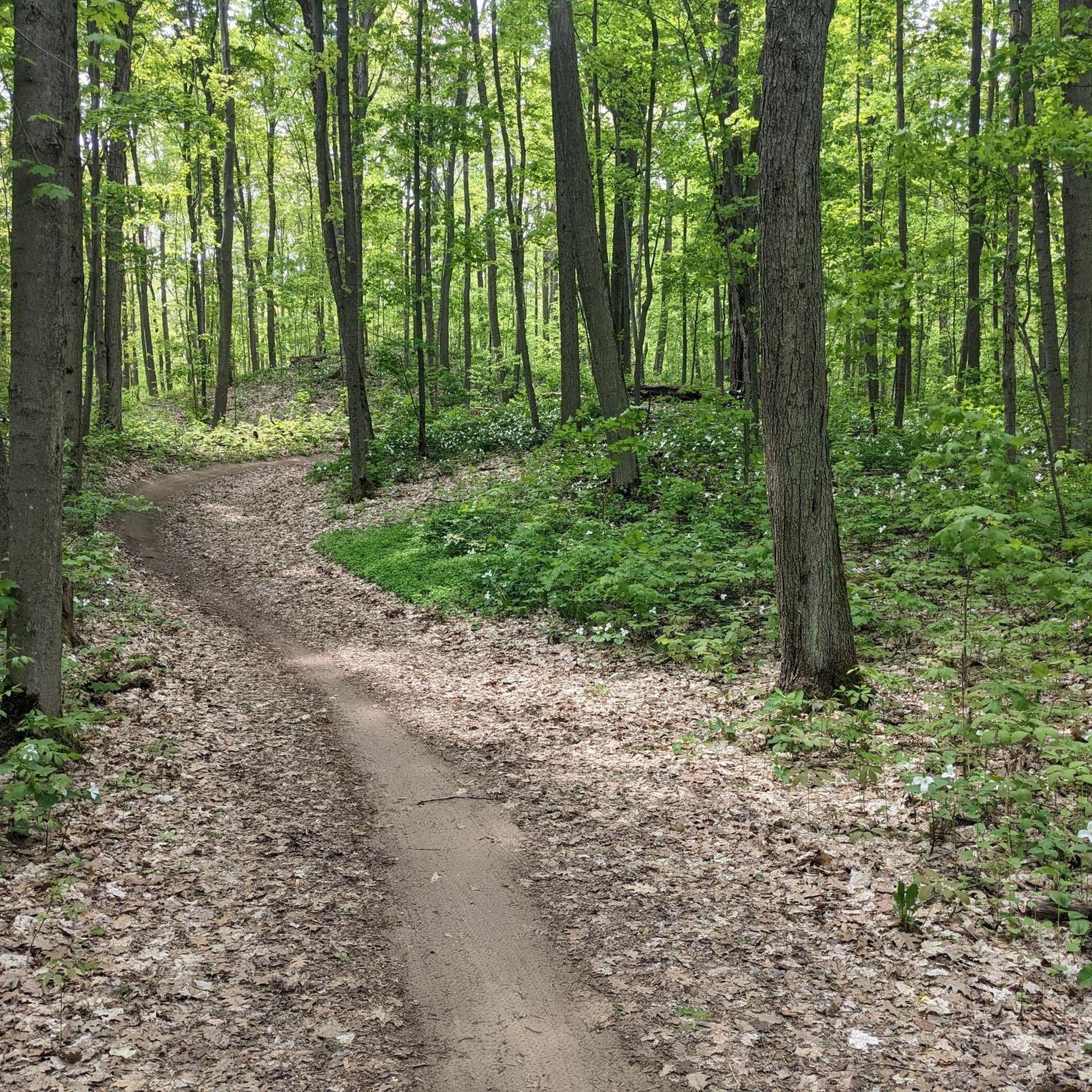
Durham Region Forest - Timber's Tract is a 596-hectare satellite forest open to mountain biking, E-biking, gravel biking, winter fat biking, hiking, trail running, snowshoeing and Nordic skiing. The area is less busy than the Durham Forest Main Tract. After years of logging, the area was restored with “plantation forest” zones, where today you can see pine, spruce trees and other hardwoods lined up in neat rows.
0
0
Timber's Track is an old road turned into a wide trail, for hikers and bikers to explore Durham Region Forest. The forests here are thick, and trails are well-marked. Enjoy the shady woods in summer or in winter after the leaves dropped their leaves while snowshoeing.
0
0

Devil’s Den Trail is one of the main routes in Heber Down Conservation Area. The trail passes through shaded ravine terrain, crosses bridges and boardwalks, and leads to the area known as Devil’s Den, a narrow valley once tied to local folklore. The story goes that this area was once used as a layover spot for horse thieves in the late 19th century, and later crossed by a railway bridge whose concrete remnants still remain today. With steeper grades and a more enclosed feel than some of the park’s other paths, this trail is ideal for a more rugged and immersive walk through the valley.
0
0
This paved lot is the main access point for the trails in Heber Down Conservation Area, with plenty of parking and washrooms just off Cochrane Street. From here, you can quickly reach the wooded paths, bridges, and the steeper terrain leading into Devil’s Den, making this a popular starting point for longer loops through the conservation area. There is a parking fee of around $6 per vehicle, or it is waived with a CLOCA membership pass.
0
0
Frequently Asked Questions
What kind of terrain can I expect on running routes in Scugog?
Scugog offers a diverse range of terrains for runners. You'll find routes along the picturesque Lake Scugog waterfront, through varied landscapes of the Oak Ridges Moraine, and within extensive deciduous forests and wetlands. Surfaces can range from paved sections, like parts of the Heber Down – Heber Down Conservation Area loop, to gravel, woodchips, and more natural, rugged trails in areas like the Nonquon Wildlife Area.
Are there easy running routes suitable for beginners in Scugog?
Yes, Scugog has options for all fitness levels, including easy running routes perfect for beginners. The Port Perry Waterfront Trail System, for instance, offers a leisurely 5 km path with minimal elevation gain, featuring a mix of gravel, woodchips, and paved sections. While most komoot routes are moderate, there is at least one easy route available, ensuring a gentle introduction to running in the area.
Where can I find longer distance running trails in Scugog?
For those seeking longer runs, Scugog and the surrounding Durham Region offer several excellent options. The Durham Regional Forest loop from Main Clearing is a moderate 13.6 km trail, and the Countryside Preserve loop from Uxbridge extends to 11.5 km. These routes provide ample distance through varied forest and countryside settings.
Are there any circular running routes in Scugog?
Yes, many of the running routes in Scugog are designed as loops, offering convenient circular paths. Examples include the popular Running loop from Haydon, the Durham Regional Forest loop from Durham Regional Forest, and the Heber Down – Heber Down Conservation Area loop. These circular routes allow you to start and finish at the same point, often with dedicated parking.
What scenic viewpoints or natural attractions can I see while running in Scugog?
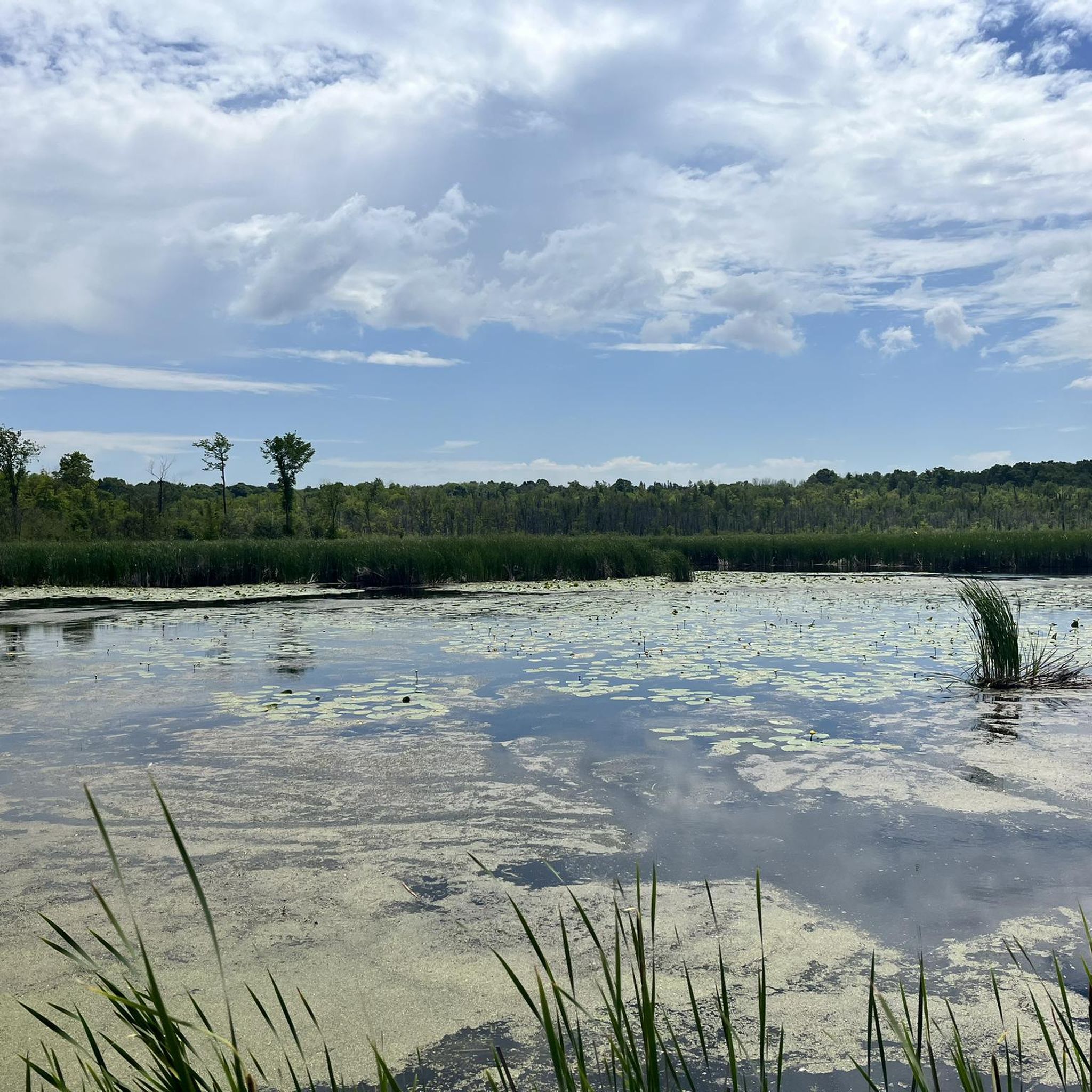
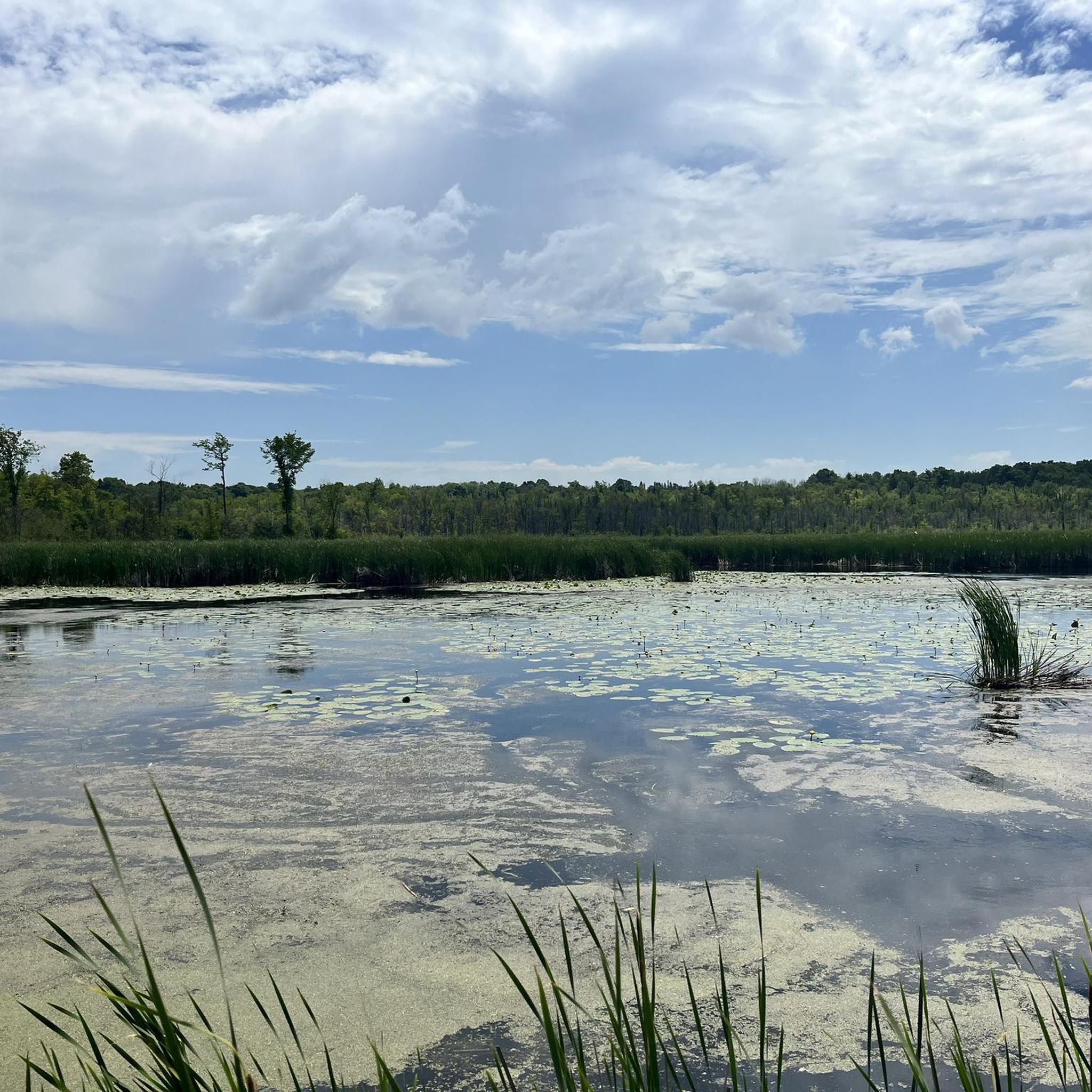
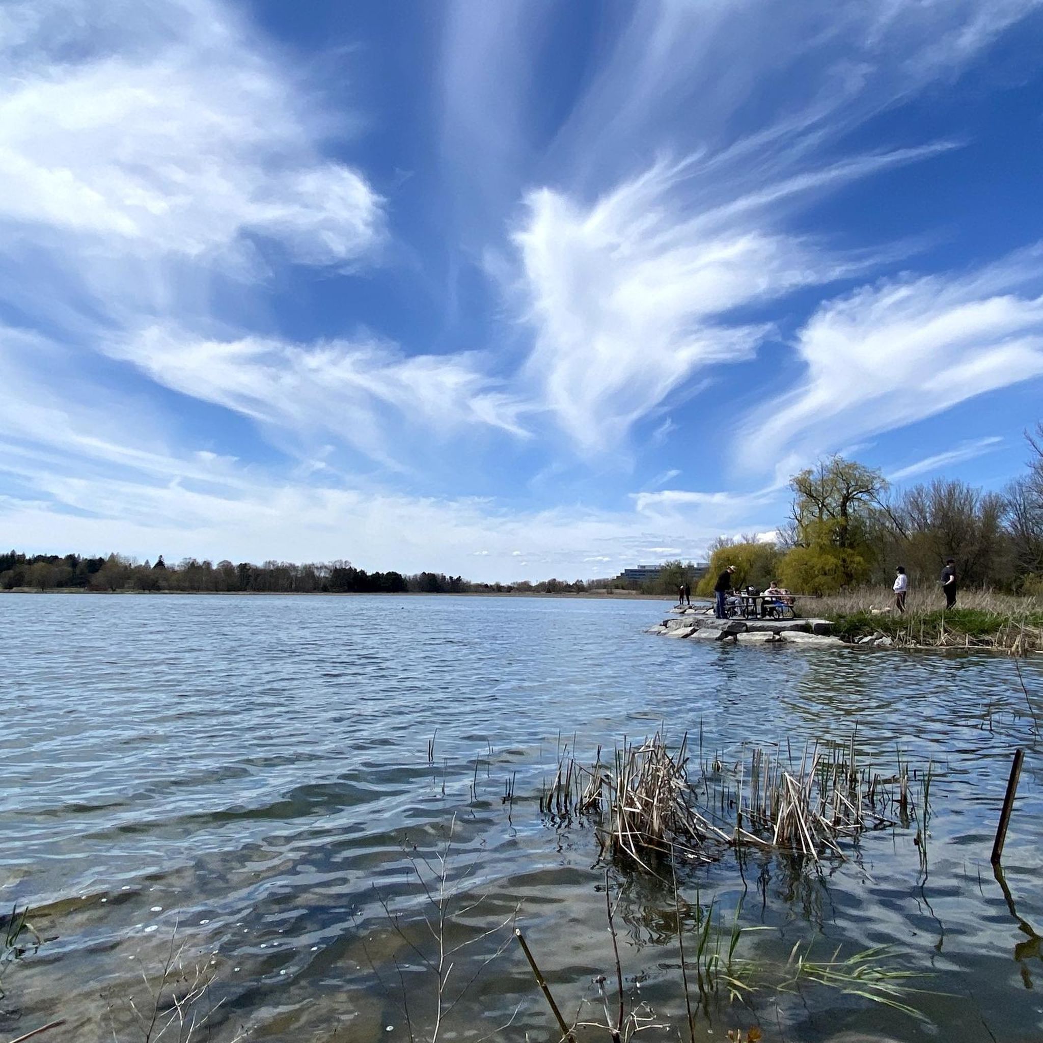
Scugog's running routes are rich with natural beauty. You can enjoy picturesque waterfront views along Lake Scugog, especially on trails within the Port Perry Waterfront Trail System. The region also features significant wetlands like the Lake Scugog Marsh, and diverse deciduous forests. Highlights like the Durham Regional Forest Trails and the Wetlands Boardwalk on Uxbridge Rail Trail offer beautiful natural scenery.
Are there family-friendly running trails in Scugog?
Absolutely. Many trails in Scugog are suitable for families, especially those with gentler gradients and well-maintained surfaces. The Port Perry Waterfront Trail System is an excellent choice, offering a flat, scenic path with a mix of surfaces. The Dr. Bruce Park Loop, part of the South Port Perry Trail System, also combines paved and limestone paths and features playgrounds, making it ideal for families.
What do other runners say about jogging in Scugog?
Runners using komoot frequently praise Scugog for its varied and accessible trail networks. With over 40 visitors exploring the region's routes, the area is appreciated for its diverse landscapes, from tranquil lakefront paths to engaging forest trails. The mix of terrains and options for different fitness levels makes it a popular choice among the running community.
Are there any historical or cultural landmarks near the running routes?
While the focus is largely on natural landscapes, Scugog does have points of interest. For example, the Spencer School and Silver Maple is a notable historical site in the area. Many routes also pass through or near charming small hamlets, offering glimpses into the local community and heritage.
Where can I find parking for running trails in Scugog?
Many of Scugog's popular running areas offer convenient parking. For instance, access points for the Port Perry Waterfront Trail System are available from Queen Street, Casimir Street, and Mary Street. Conservation areas like Heber Down and Durham Regional Forest also typically provide designated parking facilities for trail users, making it easy to start your run.
Are there any trails that are particularly good for a challenging run?
For a more challenging experience, consider the trails within the Durham Regional Forest. While many komoot routes here are moderate, the broader Durham Regional Forest system includes loops up to 10 miles with 1000 ft of elevation gain, requiring good fitness. The Durham Regional Forest loop from Main Clearing, at 13.6 km, offers a good moderate challenge.
Can I find information about other outdoor activities in Scugog?
Beyond jogging, Scugog is a comprehensive destination for outdoor recreation. You can find opportunities for boating, fishing, and cycling, especially around Lake Scugog and its extensive trail networks. For more general information about exploring the area, you can visit scugogtourism.ca.
What makes the Durham Regional Forest a good place for running?
The Durham Regional Forest is an excellent location for running due to its varied lengths and elevation gains, catering to different fitness levels. It features extensive forest trails, providing a shaded and natural setting. Routes like the Durham Regional Forest loop from Durham Regional Forest offer a moderate challenge through beautiful woodland scenery.
Most popular attractions around Scugog

Get inspired with the komoot mobile app


Explore more
Browse the best Running Trails & Routes in other regions.
