The best cycling routes in Ochoco National Forest
5.0
(3)
104
riders
15
rides
Touring cycling in Ochoco National Forest offers diverse landscapes, transitioning from dense ponderosa pine forests to expansive high desert terrain. The region features rimrock, canyons, and unique geological formations, providing varied backdrops for cycling. Elevations range across the forest, with routes often incorporating both climbs and descents. This environment supports a network of roads and trails suitable for touring cyclists seeking varied terrain.
Best touring cycling routes in Ochoco National Forest
- The most popular touring cycling route is Brewer Reservoir…
Last updated: October 1, 2026
10
riders
53.0km
04:36
680m
680m
Hard bike ride. Very good fitness required. Mostly paved surfaces. Suitable for all skill levels.
7
riders
7.07km
00:42
110m
110m
Easy bike ride. Great for any fitness level. Mostly paved surfaces. Suitable for all skill levels.

10
riders
174km
11:12
2,170m
2,170m
Hard bike ride. Very good fitness required. Mostly paved surfaces. Suitable for all skill levels.
5
riders
43.9km
04:51
1,500m
1,500m
Hard bike ride. Very good fitness required. Mostly paved surfaces. Suitable for all skill levels.
4
riders
Moderate bike ride. Good fitness required. Mostly paved surfaces. Suitable for all skill levels.
Get access to more routes and recommendations from other explorers.
Already have an account?
Our route recommendations are based on thousands of hikes, rides, and runs completed by other people on komoot.
Start today with a free account
Your next adventure awaits.



Tips from the Community

This is a fantastic hostel, with a super kind management. Cyclists should definitely plan to stop here. Also a cafe next door that serves breakfast.
1
0

You can park off of Route 207 near the BLM gate and head up the trail from here. The trail takes you through cow pastures at the start, so be sure to close gates behind you and keep an eye out for cattle!
0
0

In the heart of Oregon's rugged landscape stands the Crooked River High Bridge, a steel arch masterpiece by Conde McCullough, born in 1926. Its grandeur, with a 295-foot deck above the canyon floor, a 330-foot main span, and a total length of 464 feet, once carried travelers on US 97. However, the demands of modern traffic led to its graceful retirement in 2000, making way for the Rex T. Barber Veterans Memorial Bridge. Today, it remains a cherished walkway, a living testament to history.
0
0
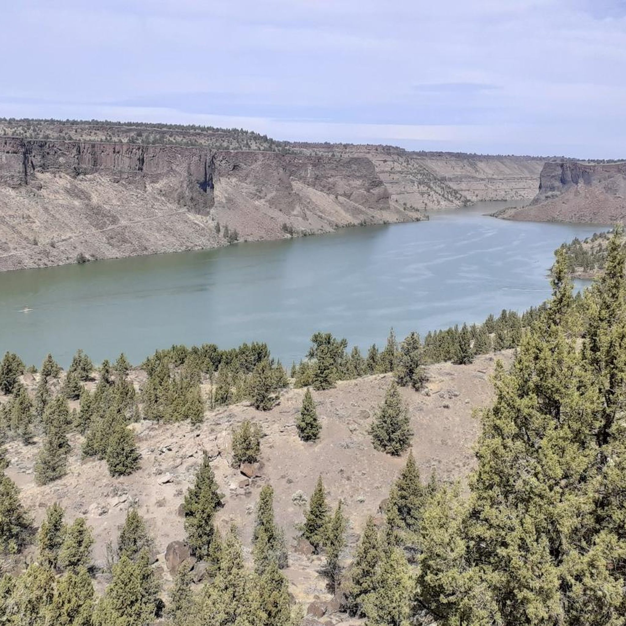
In Central Oregon lies the awe-inspiring Crooked River Gorge, a profound 500-foot chasm, enveloped by soaring 400-foot cliffs and teeming with diverse wildlife. Climbers are drawn to the upper reaches, where age-old columnar basalt cliffs, sculpted by the Crooked River over 1.2 million years, beckon with their timeless allure.
0
0

Round Mountain stands at 6,755 feet above sea level and is accessible via either the northern trailhead at Walton Lake or the southern trailhead near Lookout Mountain. A fire lookout station once stood on the summit, but was burned down in a fire in 1972. The summit now hosts a communication tower. Great views from the peak give a 360 degree views of the surrounding mountains.
0
0
The Round Mountain Trail runs for 9.5 miles from Walton Lake at the northern trailhead to Lookout Mountain in the south. The path traverses a ridge line and offers great views of the surrounding mountains and alpine forests.
0
0
Lookout Mountain is a 6925 foot tall summit in Ochoco National Forest. The peak can be reach via either the Mother Lode Mine Trail or the Line Butte Trail. There are great views of the surrounding mountains from the upper vista.
0
0

Cyclists are welcome without this accommodation, which is located in a former church. Several types of accommodation are possible: dormitory, single rooms, camping. Access to sanitary facilities, kitchen, living room with games, DVDs, books, etc. Incomparable atmosphere and hospitality. A stop not to be missed!
1
0
Frequently Asked Questions
How many touring cycling routes are available in Ochoco National Forest?
Ochoco National Forest offers a variety of touring cycling routes. Our guide features 15 routes, ranging from easy to difficult, allowing cyclists to explore the diverse landscapes of the region.
When is the best time of year for touring cycling in Ochoco National Forest?
The period from late spring through mid-summer is particularly favorable for touring cycling in Ochoco National Forest. During this time, you can enjoy abundant wildflowers along the routes and generally pleasant weather conditions.
What natural landmarks can I see while touring cycling in Ochoco National Forest?
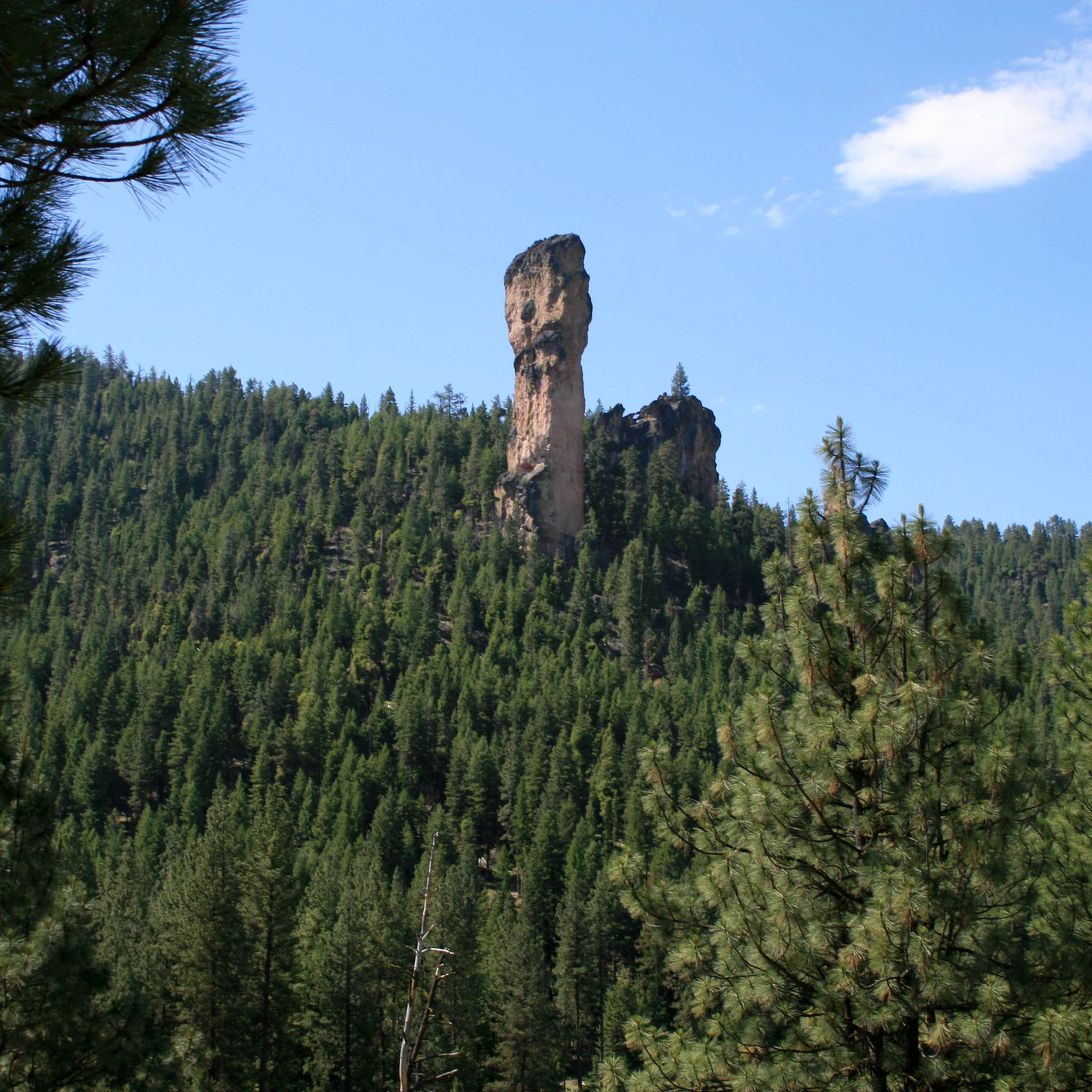
The region is rich in geological wonders. You might encounter the striking volcanic formation of Stein's Pillar, or the immense Crooked River Gorge, which offers captivating desert landscapes. The forest also features prominent peaks like Lookout Mountain and expansive areas like Big Summit Prairie, known for its seasonal wildflower displays.
Are there any waterfalls along the touring cycling routes in Ochoco National Forest?
Yes, you can find waterfalls in the area. For example, Steelhead Falls is a notable natural feature located within the region, offering a scenic stop for cyclists.
What kind of wildlife might I encounter on the touring cycling trails?
While touring cycling in Ochoco National Forest, it's not uncommon to encounter various wildlife. Cyclists often spot mustangs, deer, and antelope, especially when traversing green prairies and open areas. The region is also popular for birdwatching.
Are there any easy touring cycling routes suitable for beginners?
Yes, Ochoco National Forest offers routes suitable for beginners. For instance, the Bike loop from Juniper Hill Park is an easy 4.4-mile trail that leads through local parkland, perfect for a relaxed ride.
Can I find challenging touring cycling routes in Ochoco National Forest?
Absolutely. The forest has several difficult routes for experienced touring cyclists. One such challenging option is the Mitchell Mountain – Sutton Mountain Trailhead loop from Buck Point, which covers a significant distance and elevation gain.
Are there circular touring cycling routes in the Ochoco National Forest?
Many touring cycling routes in Ochoco National Forest are designed as loops, allowing you to start and end at the same point. An example is the North Point – Duncan Butte loop from Lookout Mountain Lower Trailhead, which offers a challenging circular journey.
What do other touring cyclists enjoy about the routes in Ochoco National Forest?
The touring cycling routes in Ochoco National Forest are highly rated by the komoot community, with an average score of 5.0 stars. Cyclists often praise the diverse landscapes, from dense ponderosa pine forests to expansive high desert terrain, and the network of roads with minimal traffic, which is ideal for touring.
Are there places to stop for refreshments or supplies along the routes?
While specific cafes are not abundant directly on all trails, some routes pass near small towns or general stores. For example, the Kloochman and Meatloaf routes, mentioned in regional research, include a stop at the Post General Store, which can be a good place for supplies.
What kind of terrain can I expect on touring cycling routes in Ochoco National Forest?
The terrain in Ochoco National Forest is highly varied. You'll experience a dramatic transition from dense ponderosa pine forests to expansive high desert landscapes. Routes often combine gravel and paved roads, with significant elevation changes, including continuous climbs to mountaintops and fast descents.
Is public transport available to access touring cycling routes in Ochoco National Forest?
Public transport options directly into the more remote areas of Ochoco National Forest for accessing specific touring cycling routes are limited. Most cyclists typically drive to trailheads or starting points, as the region is characterized by a network of roads with minimal traffic, making it ideal for self-supported touring.
Most popular routes in Ochoco National Forest
Most popular attractions in Ochoco National Forest

Get inspired with the komoot mobile app


