The best MTB trails around Sausalito
4.8
(198)
1,675
riders
67
rides
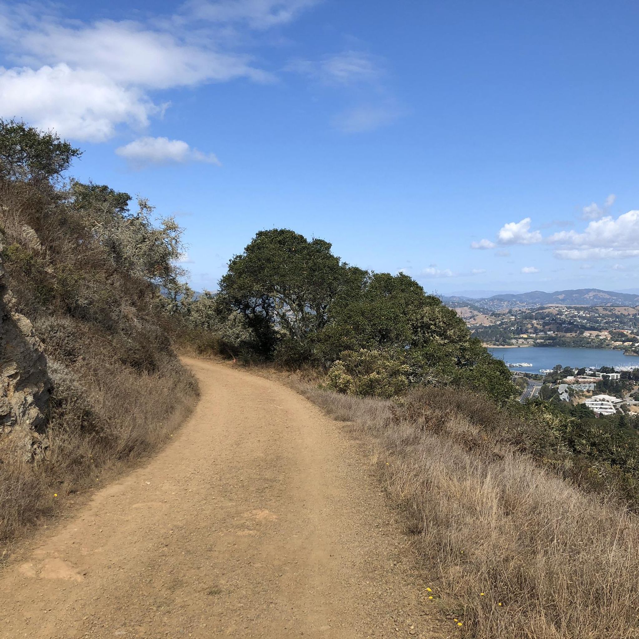
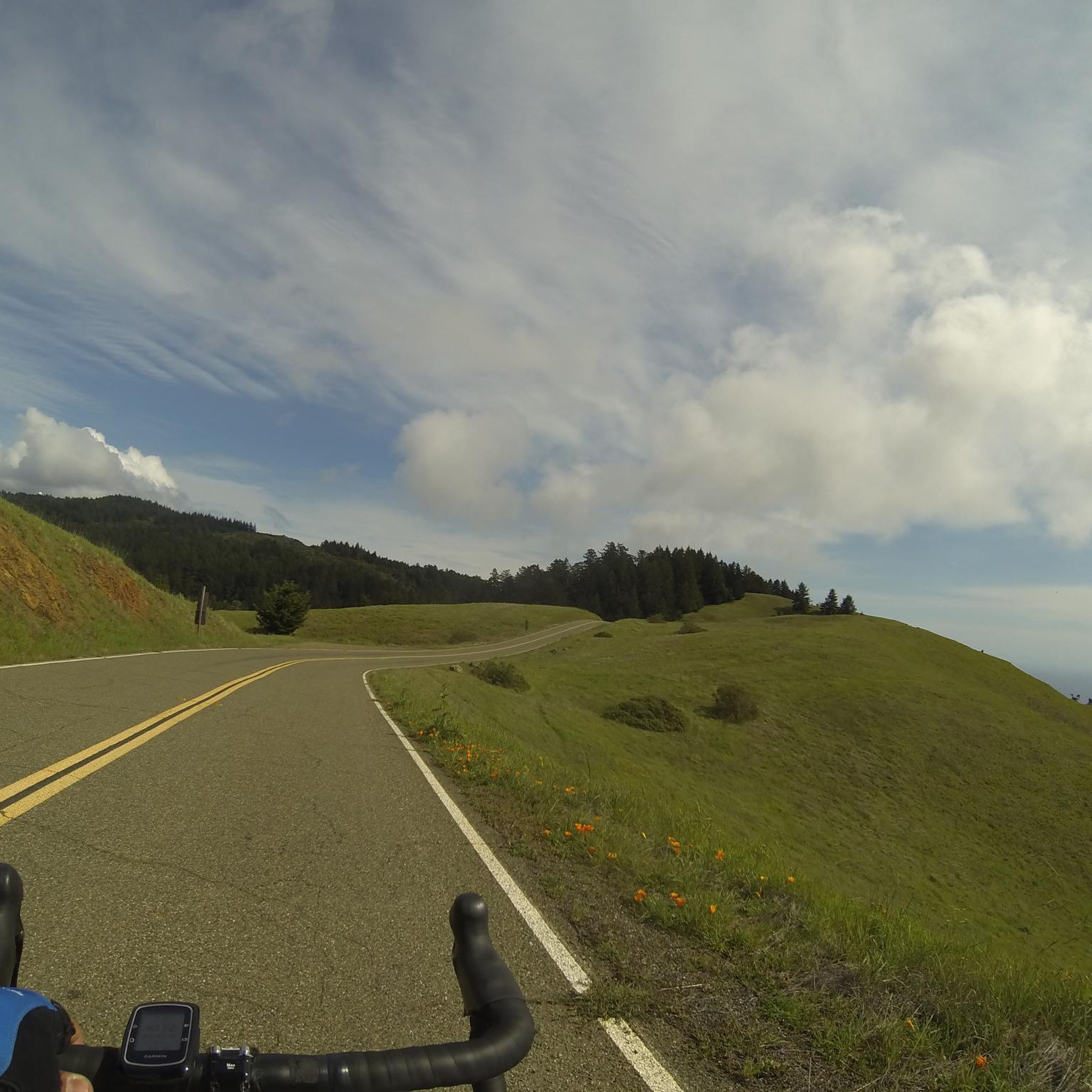
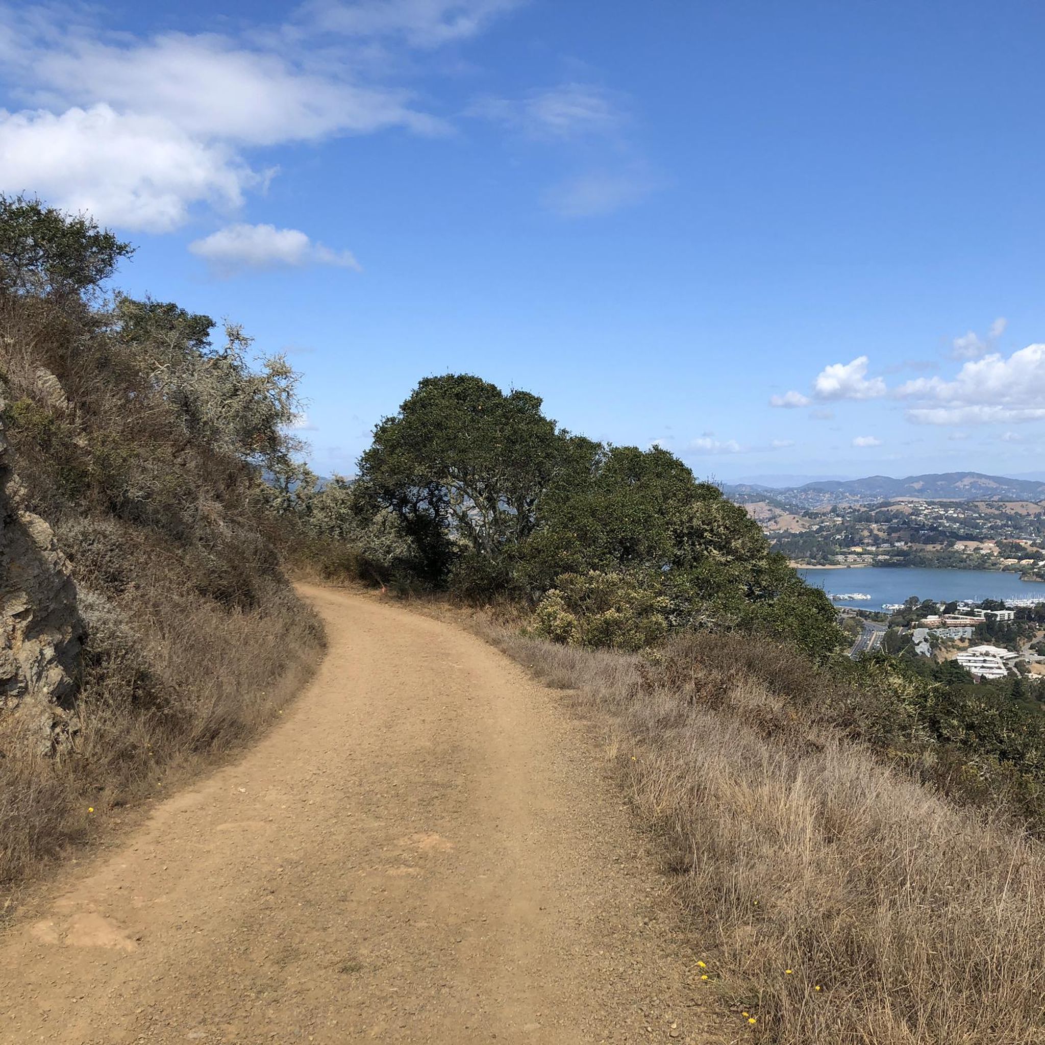
Mountain biking around Sausalito offers access to diverse terrain and scenic landscapes along the San Francisco Bay. The region is characterized by coastal bluffs, rolling hills, and extensive trail systems within areas like the Marin Headlands and Mount Tamalpais. Riders can find a mix of singletrack, doubletrack, and dirt roads, providing varied experiences. This area provides nearly 40 miles of continuous publicly accessible open space for mountain biking.
Best mountain bike trails around Sausalito
- The most popular mountain bike trail is Miwok, Coastal, and Dias Ridge Loop, a 10.9 miles (17.6 km) trail that takes 1 hour 59 minutes to complete. This route features diverse terrain and panoramic views of the Pacific Ocean.
- Another top favourite among local mountain bikers is Tennessee Valley/Muir Beach loop, a difficult 20.1 miles (32.4 km) path. This trail offers challenging climbs and coastal scenery leading to Muir Beach.
- Local mountain bikers also love the Marincello, Bobcat, Miwok and Old Springs Loop, a 7.2 miles (11.5 km) trail leading through the Marin Headlands, often completed in about 1 hour 19 minutes.
- Mountain biking around Sausalito is defined by coastal paths, rolling hills, and a network of singletrack and doubletrack trails. The network offers options for different ability levels, from easy rides to more advanced routes.
- The routes in Sausalito are highly rated by the komoot community with an average score of 4.8 stars from over 180 reviews. More than 2000 mountain bikers have used komoot to explore Sausalito's varied terrain.
Last updated: August 19, 2026
4.8
(10)
101
riders
37.8km
03:13
740m
740m
Moderate mountain bike ride. Good fitness required. Suitable for all skill levels.
22
riders
Moderate mountain bike ride. Good fitness required. Suitable for all skill levels.

Sign up for free
21
riders
23.0km
02:08
550m
550m
Moderate mountain bike ride. Good fitness required. Suitable for all skill levels.
19
riders
Moderate mountain bike ride. Good fitness required. Suitable for all skill levels.
5.0
(5)
11
riders
32.2km
02:27
630m
630m
Moderate mountain bike ride. Good fitness required. Suitable for all skill levels.
Get access to more routes and recommendations from other explorers.
Sign up for free
Already have an account?
Our route recommendations are based on thousands of hikes, rides, and runs completed by other people on komoot.
Start today with a free account
Your next adventure awaits.
Login or Signup

Tips from the Community

Batterij Townsley is a place where nature and history meet. As you climb along the rugged cliffs of the Marin Headlands, the old coastal defense slowly emerges from the landscape. Once at the top, a panorama opens up that will leave you speechless: the Pacific Ocean, the Golden Gate Bridge, and the endless horizon. The abandoned bunkers and tunnels give the place a mysterious atmosphere, as if time has stood still here. A perfect stop to enjoy, wander, and completely immerse yourself in the view.
1
0

Corte Madera Larkspur Path crosses bike trails along canals, car free
0
0
Redwood-San Andreas Wetlands overlooks at the crossing of three bike trails
0
0
the typical boat houses north of San Francisco
1
0

Good vantage point.
0
0
Part of the coastal defenses along Coastal Trail, latest remnants here date from the WW II and early cold war era.
0
0
Top of the climb up Coastal Trail on or along Conzelman Rd. From here the road dropping down is a one-way road to the west. Trails loop around the military facilities on Hawk Hill, with tunnels and large cannon placements remaining from the WW II era.
0
0
Active horse barn maintained in the protected national recreation area and reminder of the military and also ranching history of the headlands.
0
0
Frequently Asked Questions
How many mountain bike trails are there around Sausalito?
Sausalito and its surrounding areas offer a wide selection of mountain biking opportunities, with over 60 routes available. These trails cater to various skill levels, from easy rides to more challenging paths.
What types of mountain bike trails can I expect in Sausalito?
The region features a diverse mix of trail types, including singletrack, doubletrack, dirt/gravel roads, and even some paved paths. You'll find routes that wind through coastal bluffs, rolling hills, and extensive trail systems within areas like the Marin Headlands and Mount Tamalpais.
Are there any easy mountain bike trails suitable for beginners or families?
Yes, Sausalito offers several easy routes perfect for beginners or family outings. One notable option is the Crissy Field – Fort Point loop from Little Alcatraz, which is rated as easy and provides scenic views with minimal elevation gain. Overall, there are 16 easy routes in the area.
Can I find challenging mountain bike trails in Sausalito?
Absolutely. For experienced riders seeking a challenge, Sausalito has several difficult trails. The Tennessee Valley/Muir Beach loop is a difficult 20.1-mile path known for its challenging climbs and stunning coastal scenery leading to Muir Beach. There are 7 difficult routes in total.
Are there mountain bike trails that offer panoramic views or lead to natural landmarks?
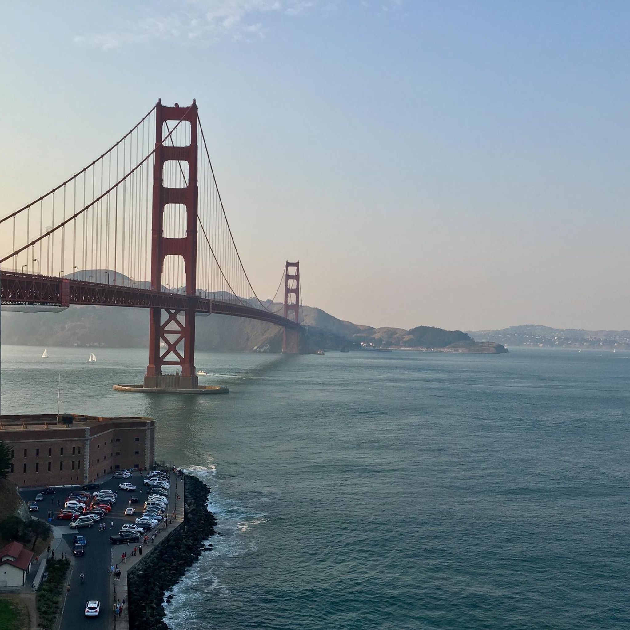
Many trails in Sausalito provide breathtaking views of the San Francisco Bay, the Golden Gate Bridge, and the Pacific Ocean. For instance, the Miwok, Coastal, and Dias Ridge Loop offers diverse terrain and panoramic ocean vistas. You can also find viewpoints like Sunrise Site and explore areas around Mount Tamalpais Summits for expansive scenery.
Are there any circular mountain bike routes in the Sausalito area?
Yes, many mountain bike routes around Sausalito are designed as loops, allowing you to start and end at the same point. Popular loop options include the Marincello, Bobcat, Miwok and Old Springs Loop, which takes you through the Marin Headlands, and the Dias Ridge Trail – Muir Beach loop.
What is the best time of year for mountain biking in Sausalito?
Sausalito's mild climate makes it suitable for mountain biking year-round. However, spring and fall often offer the most pleasant conditions with moderate temperatures and clear skies, providing excellent visibility for the scenic views. Winter can be a good option too, though some trails might be muddy after rain.
What do other mountain bikers say about the trails in Sausalito?
The mountain biking trails around Sausalito are highly regarded by the komoot community, with an average rating of 4.8 stars from over 180 reviews. Riders frequently praise the stunning coastal paths, the variety of terrain, and the well-maintained network of singletrack and doubletrack trails that cater to all ability levels.
Are there any facilities or places to rest along the trails?
Yes, you can find facilities and rest stops in the wider Sausalito area. For example, the Warming Hut and Fishing Pier offers a place to pause, and the Pantoll Ranger Station & Campground provides additional facilities. Some routes may also pass by charming towns where you can find cafes and other amenities.
Is parking available near the mountain bike trails in Sausalito?
Parking is generally available at various trailheads and access points throughout the Marin Headlands and Mount Tamalpais State Park, which are popular starting points for many Sausalito mountain bike routes. Specific parking availability can vary by location, so it's advisable to check local signage.
Can I reach the mountain bike trails using public transport?
While many trails are best accessed by car, some areas around Sausalito and the Marin Headlands are accessible via public transport, particularly bus routes that serve the region. Planning your route with public transport options in mind can help you reach certain trailheads, though direct access to all trails might require a short ride or walk.
Most popular routes around Sausalito
Most popular attractions around Sausalito

Get inspired with the komoot mobile app


Explore more
Browse the best MTB trails in other regions.
