The best walks and hikes around National City
4.7
(66)
2,352
hikers
162
hikes
Hikes around National City provide access to a variety of landscapes, from coastal wetlands and river valleys to chaparral-covered hills. The region's trail systems navigate through areas like Sweetwater Summit Regional Park and Otay Valley Regional Park. Many routes follow waterways such as the Sweetwater River or pass through restored marshlands, offering opportunities for birdwatching.
Best hiking trails around National City
- The most popular hiking route is Sweetwater Park Trail loop — Rohr Park, a 3.2 mile (5.1 km) trail that takes 1 hour 17 minutes to complete. This is a mostly flat walk through the park, suitable for all skill levels.
- Another top favourite among local hiking enthusiasts is Otay Valley Regional Park Trail — Chula Vista, a moderate 8.0 mile (12.9 km) path. The trail follows the Otay River and passes several ponds within the park.
- Local hiking enthusiasts also love the Coronado Beach via Ocean Boulevard — Coronado, a 3.6 mile (5.8 km) trail leading through a coastal area, often completed in about 1 hour 27 minutes.
- Hiking around National City is defined by urban park paths, coastal walks, and trails through river valleys. The network of routes offers options for different ability levels, from easy beginner-friendly hiking trails to more moderate outings.
- The routes in National City are highly rated by the komoot community with an average score of 4.6 stars from over 60 reviews. More than 1,800 hikers have used komoot to explore National City's varied terrain.
Last updated: July 15, 2026
24
hikers
5.41km
01:22
10m
10m
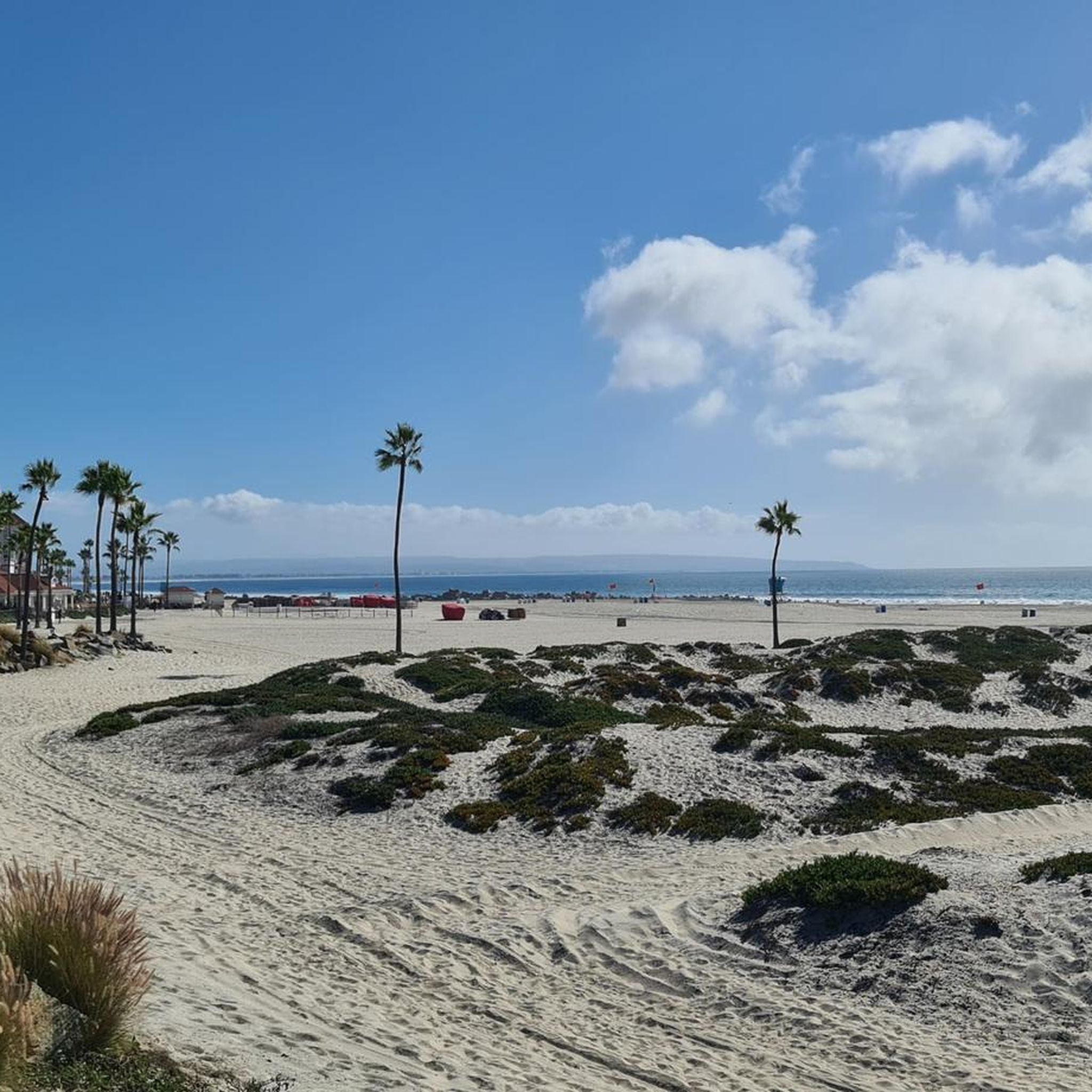
Coronado Beach offers an easy hiking experience along a wide, sandy expanse, perfect for a relaxed coastal stroll. You can enjoy expansive views of the Pacific Ocean as you walk, with the iconic Hotel del Coronado providing a striking backdrop. This route covers 3.4 miles (5.4 km) with a minimal elevation gain of 46 feet (14 metres), making it accessible for nearly everyone. Expect to complete this pleasant walk in about 1 hour and 22 minutes, enjoying the gentle sea breeze and the sound of the waves.
Planning your visit to Coronado Beach is straightforward, as the flat and wide terrain makes it accessible for most hikers. Parking is generally available in the areas surrounding the beach, particularly near the Hotel del Coronado. If you are bringing your dog, head to the dedicated Dog Beach located at the north end of the beach, where your furry friends can enjoy off-leash freedom. Consider starting your hike in the morning or late afternoon to avoid the busiest times and enjoy cooler temperatures.
This trail stands out for its unique blend of natural beauty and historical significance. The expansive sandy beach is not only a popular spot for relaxation but also offers a glimpse into the region's coastal ecosystem. The presence of the historic Hotel del Coronado adds a distinctive architectural element to your walk, contrasting with the natural ocean views. It is a prime example of a classic Southern California beach experience, offering both scenic beauty and convenient amenities.
3.0
(1)
12
hikers
9.03km
02:17
20m
10m
The Tijuana Estuary offers a truly special hiking experience, immersing you in one of Southern California's last natural coastal wetlands. You'll wander through varied habitats like salt marsh and sand dunes, enjoying expansive views of the wetlands and the Pacific Ocean, especially near the river mouth where the Tijuana River meets the sea. The terrain is mostly flat, with a mix of dirt, gravel, and sandy paths, making it a gentle 5.6-mile (9.0 km) journey perfect for wildlife spotting, particularly for the over 370 bird species that call this area home.
Planning your visit is straightforward, with a visitor center available to help you get oriented. If you plan to explore the sandy sections, especially on the Coast Trail, it's a good idea to check tide schedules for easier walking on harder-packed sand. The trail is generally accessible and takes about 2 hours and 16 minutes to complete, with a minimal 57 feet (17 metres) of elevation gain, making it a moderate and rewarding outing for most hikers.
This isn't just any coastal walk; the Tijuana Estuary is a designated "Wetland of International Importance," serving as a critical breeding, feeding, and nesting ground along the Pacific Flyway. Its unique geographical position at the southwestern tip of the United States, bordering Mexico, adds to its distinct character. It stands out as one of the few remaining natural estuaries in a region where over 90% of coastal wetlands have been lost to development.

Sign up for free
10
hikers
8.19km
02:04
10m
10m
Experience the refreshing ocean air and scenic views on the Seacoast Trail, a delightful coastal path in Imperial Beach. This route offers a pleasant journey along the Pacific, where you can enjoy the sounds of the waves and the vibrant atmosphere of the beachfront. Keep an eye out for the iconic Imperial Beach Pier, a popular landmark that punctuates the walk and provides a great spot to take in the surroundings.
Planning your visit is straightforward; the trail is easily accessible within Imperial Beach, California. While there are no permits or fees, parking can be competitive, especially on sunny days, so arriving early is a good strategy. This trail is a moderate 5.1 miles (8.2 km) with a minimal 31 feet (9 metres) of elevation gain, making it a comfortable 2-hour and 3-minute hike for nearly everyone.
This trail is a fantastic option for those seeking a relaxed outing rather than a challenging climb. Its location within San Diego County's Imperial Beach means you're never far from local amenities and the lively community. It's a great way to enjoy the California coastline without committing to a long or strenuous adventure.
18.0km
04:33
20m
30m
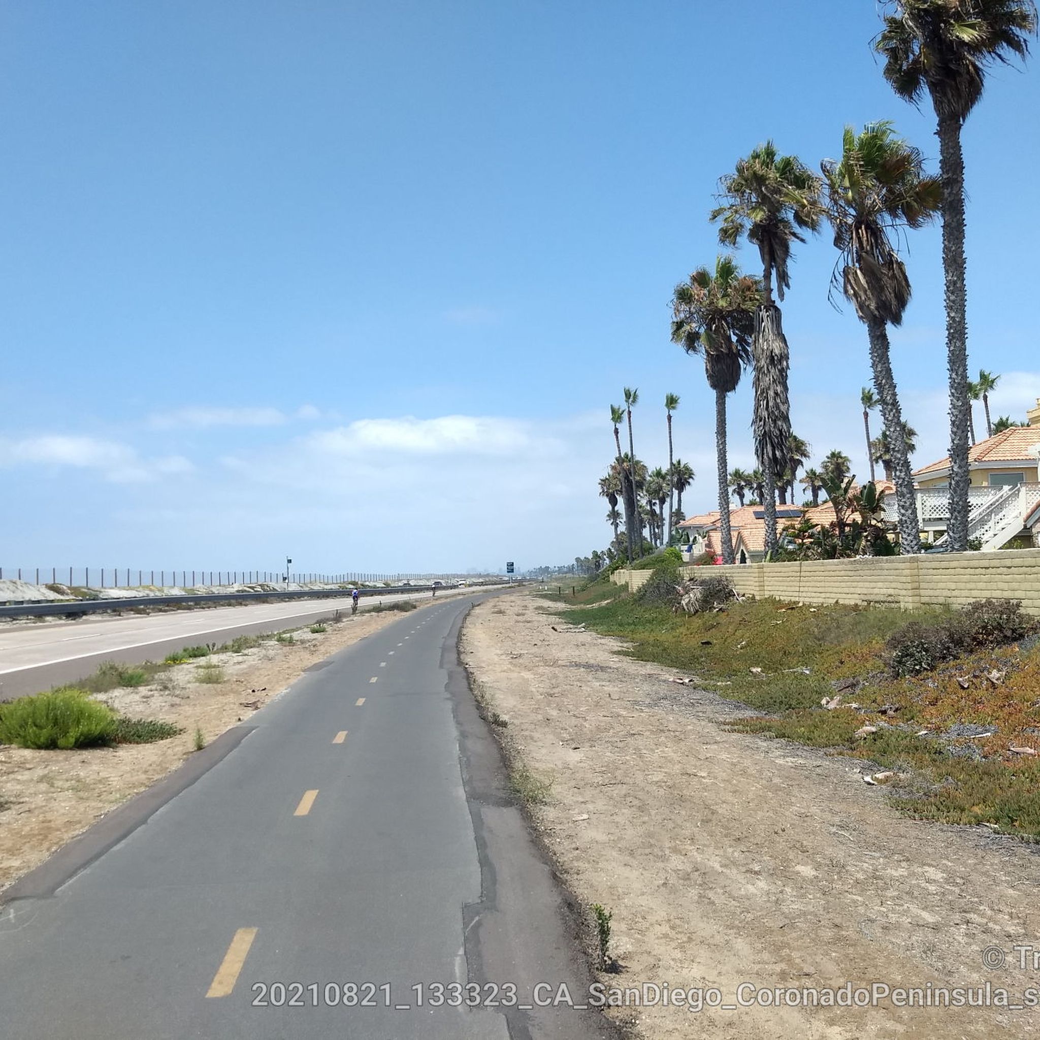
The Bayshore Bikeway: Silver Strand Trail offers a unique hiking experience along a narrow sand spit, providing continuous views of both San Diego Bay and the Pacific Ocean. This 11.2-mile (18.0 km) moderate route, with a mere 75 feet (23 metres) of elevation gain, is mostly flat and paved, making it accessible for a leisurely 4-hour and 32-minute stroll or a brisk jog. You'll traverse diverse coastal landscapes, from palm-lined sections to mudflats and salt marshes, with the Coronado Bridge often in sight.
Planning your visit to this popular route is straightforward; the trail is well-maintained and suitable for all ages and fitness levels. Be sure to bring plenty of water and sun protection, as the path offers very little shade along its entire length. Parking is available at various points, including near Silver Strand State Beach, which also provides access to amenities.
This segment of the larger Bayshore Bikeway is notable for its historical significance, following a former rail corridor, and its ecological importance, passing through the San Diego Bay National Wildlife Refuge. Here, you can observe a variety of shorebirds and other wildlife, making it a great spot for nature enthusiasts. The Silver Strand State Beach hiking trails also connect to the ambitious California Coastal Trail, offering a glimpse into a broader network of scenic pathways.
4.70km
01:15
40m
60m
The Church Canyon Trail offers a delightful, easy hike right within the San Diego area, perfect for a quick nature fix. As you follow the narrow paths, about 1.5 persons wide, you'll discover interesting geologic features and, if you time it right, chalk dudleya blooming. It's a gentle 2.9-mile (4.7 km) loop with only 123 feet (38 metres) of elevation gain, taking about 1 hour and 14 minutes, making it an ideal choice for a casual walk.
Planning your visit is straightforward, as the trail is nestled within a neighborhood, offering easy access. Remember to bring your own water, as there are no facilities on the route. Parking is usually available nearby, and the trail is enjoyable throughout the year, though spring can be particularly scenic with potential blooms.
This trail stands out for providing a genuine nature experience within an urban environment, making it a convenient escape from city life. It's a great option for those seeking a peaceful stroll without having to travel far, offering a glimpse of local flora and unique geological formations.
Get access to more routes and recommendations from other explorers.
Sign up for free
Already have an account?
Our route recommendations are based on thousands of hikes, rides, and runs completed by other people on komoot.
Start today with a free account
Your next adventure awaits.
Login or Signup



Tips from the Community

Coronado Central Beach is a great place to stroll. It's not ideal for cycling because it's so busy.
0
0


Small visitor center explaining the purposes and benefits of the estuary for both wildlife habitat and cleaning the water.
0
0
Tijuana Slough National Wildlife Refuge placard
0
0
entrance to Tijuana Estuary national reseve
0
0

This is a great place to learn about water safety and operating small watercraft. The bike path goes right past the center, but the path is elevated and fenced off. The easiest way to get to the aquatic center is via the pedestrian tunnel on the other side of the highway. There are tables outside that make for a nice picnic spot.
0
0

The San Diego Bay National Wildlife Refuge is a wildlife refuge that was created to protect San Diego's historic coastal salt marsh and mudflat habitat. The refuge is home to a wide variety of wildlife. There are several bike paths that run along the coast, which give you great views of the water and a chance to spot wildlife.
0
0

This area spans 1,072 acres and comprises wetlands where the Tijuana River meets the ocean, bordering Imperial Beach. Throughout, there are impressive views of the wetlands and coastline, offering excellent birdwatching opportunities.
0
0
Frequently Asked Questions
Are there many dog-friendly hiking trails near National City?
Yes, many parks and trails in the area welcome dogs on a leash. The Sweetwater River Trail is a popular choice for dog walkers, offering a chance to see wildlife in the San Diego National Wildlife Refuge. Always check the specific park's regulations before you go, as some sensitive habitat areas may have restrictions.
What are some good options for easy, beginner-friendly hikes?
The National City area has numerous options for beginners. Paradise Creek Educational Park offers two miles of easy, accessible nature trails through coastal oak woodland and restored marshlands. For a simple urban park walk, the Downtown San Diego loop provides a flat, paved route to explore the city on foot.
Can I find any hikes with ocean views?
Definitely. For a classic coastal experience, the walk along Coronado Beach offers stunning views of the Pacific Ocean. The trail is mostly flat and follows the iconic shoreline, making it a relaxing way to enjoy the sea breeze.
Are there any family-friendly trails or parks suitable for children?
Rohr Park is an excellent choice for a family outing. It features green spaces, a playground, and easy walking paths. Another great option is Otay Valley Regional Park, which has over 8 miles of mostly flat, multi-use trails perfect for an easy-going family hike and birdwatching around its seven ponds.
What do other hikers think of the trails around National City?
The trails are highly regarded by the komoot community, with an average rating of 4.6 stars. Hikers often praise the region's surprising diversity, from the peaceful wetlands and river valleys to the scenic vistas from the surrounding hills.
How many hiking trails are available in the National City area?
There are over 120 designated hiking routes to explore around National City. The majority of these are rated as easy, with a good number of moderate trails and a couple of difficult ones for those seeking a challenge.
Where can I find a more challenging hike?
For a significant challenge, the Silver Strand Trail is a long-distance route that will test your endurance. For a challenging climb, locals often head to the Cowles Mountain Trailhead, which is well-known for its steep, uphill path leading to panoramic summit views.
Are there any trails with waterfalls?
While the National City area is rich in coastal marshes and river valleys, prominent waterfalls are not a common feature of the local trails. The hikes here are better known for their scenic reservoir views, abundant birdlife, and diverse plant ecosystems.
What are some popular places for hiking near National City?
Several spots are local favorites for hiking.
Mission Trails Regional Park is a vast park with over 60 miles of trails for all skill levels. Cowles Mountain is famous for its rewarding uphill climb and panoramic views. For a different experience, the Sweetwater River Trail offers a flatter route through the San Diego National Wildlife Refuge, known for its wildlife sightings.
What is the terrain like on the trails in Otay Valley Regional Park?
The trails in Otay Valley Regional Park are generally flat and well-maintained, making them suitable for easy hikes and family outings. The paths are multi-use and wind along the Otay River valley, passing by several ponds that are excellent for birdwatching.
Are the trails accessible by public transport?
Many of the more urban trails and parks, such as those within National City itself or in downtown San Diego, are accessible via the San Diego Metropolitan Transit System. However, reaching trailheads for more remote parks like Sweetwater Summit or Mission Trails Regional Park is often easier by car. It's best to check transit routes in advance for your specific destination.
Is there good parking at the main trailheads?
Most major parks, like Rohr Park and Sweetwater Summit Regional Park, offer dedicated parking lots. Popular trailheads such as Cowles Mountain can get very crowded, especially on weekends, so arriving early is recommended to secure a spot. Street parking may be available for some urban or coastal routes.
Most popular attractions around National City

Get inspired with the komoot mobile app


Explore more
Browse the best Hikes in other regions.
