The best cycling routes around Castaic
4.9
(40)
397
riders
26
rides
Touring cycling routes around Castaic are set within northern Los Angeles County, characterized by its diverse landscape. The region features the expansive Castaic Lake, rolling hills covered in chaparral and oak woodlands, and scenic views of the Sierra Pelona Mountains. The area offers a network of trails and roads, including paths along the Santa Clara River, suitable for various cycling experiences.
Best touring cycling routes around Castaic
- The most popular touring cycling route is Santa Clara River – Iron Horse Bridge loop from Six Flags Magic Mountain, a 16.5 miles (26.5 km) trail that takes 1 hour 33 minutes to complete, offering views along the Santa Clara River.
- Another top favourite among local touring cyclists is Santa Clara River – Starbucks loop from Valencia High School, an easy 9.4 miles (15.2 km) path that follows the river and passes through local areas.
- Local touring cyclists also love the Santa Clara River – Iron Horse Bridge loop from Valencia High School, an 9.0 miles (14.5 km) trail leading through the Santa Clara River area, often completed in about 50 minutes.
- Touring cycling around Castaic is defined by routes along the Santa Clara River, views of Castaic Lake, and paths through rolling hills and oak woodlands. The network offers options for different ability levels, from easy loops to more moderate rides.
- The routes in Castaic are highly rated by the komoot community with an average score of 4.9 stars from more than 10 reviews. More than 200 touring cyclists have used komoot to explore Castaic's varied terrain.
Last updated: October 27, 2026
5.0
(3)
49
riders
Easy bike ride. Mostly paved surfaces.
37
riders
22.7km
02:00
330m
330m
Moderate bike ride. Good fitness required. Mostly paved surfaces.

5.0
(1)
31
riders
15.4km
00:55
90m
90m
Easy bike ride. Mostly paved surfaces.
5.0
(4)
47
riders
Easy bike ride. Mostly paved surfaces.
4.5
(2)
16
riders
14.9km
00:51
60m
60m
Easy bike ride. Mostly paved surfaces.
Get access to more routes and recommendations from other explorers.
Already have an account?
Our route recommendations are based on thousands of hikes, rides, and runs completed by other people on komoot.
Start today with a free account
Your next adventure awaits.


Tips from the Community

At about 84 miles long, the Santa Clara River is the largest natural river system in southern California remaining in a relatively undeveloped state. Along its length there is the 8 mile long Santa Clara River Trail, which is a paved bicycle and walking path in the city of Santa Clarita.
0
0

Here, under the powerlines, South Fork River Trail and an extension of Newhall Avenue cross.
0
0

I usually turn around here.
0
0

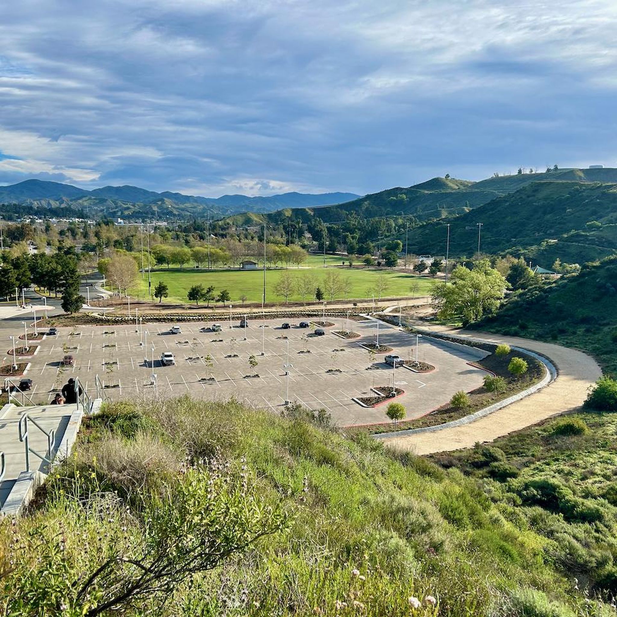
From this spot just off of the San Francisquito Creek Trail in Santa Clarita, CA, you get fantastic open views down the valley across the grasslands and of the powerlines. This is a nice place to stop and sip some water or snap a photo before continuing on your ride.
0
0

At about 84 miles long, the Santa Clara River is the largest natural river system in southern California remaining in a relatively undeveloped state. Along its length there is the 8 mile long Santa Clara River Trail, which is a paved bicycle and walking path in the city of Santa Clarita.
0
0

The San Francisquito Creek Trail travels through various parks and across different bridges on the banks of the Santa Clara River and San Francisquito Creek. The path is completely paved and goes on both sides of the creek, giving you the chance to run or cycle a loop depending on what trailhead you start at.
0
0

Great riverside trail that runs through Santa Clarita along the Santa Clara River. The path is traffic free, so it's a great place for a family walk.
0
0
Frequently Asked Questions
What kind of terrain can I expect on touring cycling routes around Castaic?
The touring cycling routes in Castaic traverse a diverse landscape, featuring rolling hills covered in chaparral and oak woodlands, with scenic views of the Sierra Pelona Mountains. Many routes follow the Santa Clara River, offering relatively flat sections, while others may include more varied terrain with gentle climbs.
Are there easy touring cycling routes suitable for beginners in Castaic?
Yes, Castaic offers numerous easy touring cycling routes. Out of 26 available routes, 21 are rated as easy. A good option is the Santa Clara River – Starbucks loop from Valencia High School, an easy 9.4-mile path that follows the river.
What are some notable natural features or landmarks to see while cycling in Castaic?
Cyclists can enjoy views of the expansive Castaic Lake and the surrounding Sierra Pelona Mountains. Many routes also pass by the Santa Clara River and the historic Iron Horse Bridge, offering picturesque spots along the way.
Are there any moderate or challenging touring cycling routes in Castaic?
While Castaic is known for its many easy routes, there are also options for those seeking a more moderate challenge. For instance, the Central Park Trail – Santa Clara River loop from Valencia High School is a moderate 16.7-mile route with over 980 feet of elevation gain. There is also one route rated as difficult for experienced cyclists.
What do other cyclists say about touring cycling in Castaic?
The komoot community highly rates touring cycling in Castaic, with an average score of 4.9 stars from more than 10 reviews. Cyclists often praise the scenic views, the well-maintained paths along the Santa Clara River, and the variety of routes suitable for different skill levels.
Are there any circular touring cycling routes around Castaic Lake?
While there isn't a single dedicated touring cycling route that fully circles Castaic Lake within our guide, many routes offer scenic views of the lake and its surroundings. The Santa Clara River – Iron Horse Bridge loop from Six Flags Magic Mountain is a popular circular route that provides a good touring experience in the area.
What is the best season for touring cycling in Castaic?
Castaic offers a warm Mediterranean setting, making it suitable for cycling year-round. Springtime is particularly vibrant with wildflower displays. The Castaic Lake State Recreation Area is open from sunrise to sunset daily, except on December 25th, allowing for flexible planning.
Are there any multi-use trails in Castaic that are suitable for touring cyclists?
Yes, the Castaic Lake State Recreation Area features an extensive network of multi-use trails. While some are geared towards mountain biking, many paths, especially those along the Santa Clara River and San Francisquito Creek Trail, are well-suited for touring cyclists and are shared with hikers and equestrians.
Where can I find parking for touring cycling routes in Castaic?
Many touring cycling routes in Castaic start from accessible locations with parking. For example, routes like the San Francisquito Creek Trail – Iron Horse Bridge loop from Copper Hill often have parking available near their starting points in residential or park areas. Specific parking details can usually be found on individual route pages.
Are there any family-friendly touring cycling routes in Castaic?
Castaic has many easy routes that are suitable for families. The relatively flat sections along the Santa Clara River provide a safe and enjoyable environment for cyclists of all ages. The Santa Clara River – Iron Horse Bridge loop from Valencia High School is an easy 9-mile trail that is often completed in under an hour, making it a good option for a family outing.
Can I bring my dog on touring cycling trails in Castaic?
While specific trail regulations vary, many multi-use trails in the Castaic area, particularly within the Castaic Lake State Recreation Area, generally allow dogs on leash. It's always recommended to check the specific rules for each trail or park you plan to visit. For general park information, you can visit the California State Parks website.
Most popular attractions around Castaic

Get inspired with the komoot mobile app


Explore more
Browse the best Cycling routes in other regions.
