The best road cycling routes around Castle Pines
4.3
(50)
2,335
riders
91
rides
Road cycling routes around Castle Pines, Colorado, traverse diverse landscapes characterized by rolling hills, extensive paved trail systems, and views of the Front Range. The region offers convenient access to dedicated bike lanes and multi-use paths, providing varied terrain for cyclists. These routes often feature scenic views of natural attractions like reservoirs and open spaces.
Best road cycling routes around Castle Pines
- The most popular road cycling route is Rueter-Hess Reservoir loop from Castle Rock, a 29.9 miles (48.3 km) trail that takes 2 hours 29 minutes to complete. This moderate route offers scenic views around the reservoir.
- Another top favourite among local road cyclists is Wildcat Point via Monarch Boulevard & Buffalo Trail, an easy 13.8 miles (22.3 km) path. This route features dedicated bike lanes and scenic views from Wildcat Point Overlook.
- Local road cyclists also love the Cherry Creek Trail – The Cherry Creek Trail loop from Rock Canyon High School, a 47.4 miles (76.3 km) trail leading through the Cherry Creek Valley, often completed in about 4 hours 16 minutes.
- Road cycling around Castle Pines is defined by rolling hills, extensive paved trail systems, and views of the Front Range. The network offers options for different ability levels, from easy loops to more challenging rides.
- The routes in Castle Pines are highly rated by the komoot community with an average score of 4.6 stars from over 40 reviews. More than 2000 road cyclists have used komoot to explore Castle Pines's varied terrain.
Last updated: September 30, 2026
4.3
(3)
15
riders
48.3km
02:29
480m
480m
Cycle the moderate 30.0-mile Rueter-Hess Reservoir loop from Castle Rock, featuring scenic views and a challenging climb.
2
riders
22.3km
01:20
270m
270m
The Wildcat Point via Monarch Boulevard & Buffalo Trail offers a delightful road cycling experience through Daniels Park, combining smooth asphalt with some compacted gravel sections. You'll pedal through natural beauty, enjoying the changing scenery as you make your way to the Wildcat Point Overlook, which provides expansive views, including a clear sightline to Denver. This route is an easy 13.8-mile (22.3 km) journey with 895 feet (273 metres) of elevation gain, making it accessible for most cyclists.
Planning your ride on this trail is straightforward. The route is well-suited for road cycling and doesn't require any special permits or fees. While much of the path is paved, be prepared for about 1.7 miles (2.76 km) of compacted gravel, which adds a unique element to the ride. It's a great option for a morning or afternoon outing, typically taking around 1 hour and 20 minutes to complete.
This trail stands out for its combination of dedicated bike lanes and scenic overlooks, offering a diverse experience for road cyclists. Its relatively easy difficulty and well-maintained sections, coupled with the panoramic views from Wildcat Point, make it a popular choice in Daniels Park. The presence of mixed terrain, including the compacted gravel, provides a slightly varied challenge for those looking beyond purely paved paths.

18
riders
112km
05:29
1,130m
1,130m
Hard road ride. Very good fitness required. Mostly well-paved surfaces and easy to ride.
5.0
(1)
27
riders
75.3km
04:14
450m
450m
Moderate road ride. Good fitness required. Mostly well-paved surfaces and easy to ride.
27
riders
31.7km
01:54
390m
390m
Moderate road ride. Good fitness required. Some segments of this route may be unpaved and difficult to ride.
Get access to more routes and recommendations from other explorers.
Already have an account?
Our route recommendations are based on thousands of hikes, rides, and runs completed by other people on komoot.
Start today with a free account
Your next adventure awaits.

Tips from the Community

Railbender Park is a fantastic skate and tennis park. It's an ideal spot to take a break from your bike ride and watch the skateboarders in action. The park also features picnic benches and ample parking. If you're planning a longer ride on the Cherry Creek Trail, Railbender Park offers direct access to the trail, making it a great place to start or end your journey.
0
0

The Cherry Creek Trail is paved and smooth the entire way. The entire path totals nearly 40 miles and is really popular for biking. It's utilized as a commuter trail so plan on seeing many others out on the trail.
0
0
The Cherry Creek Regional Trail is a part of the Colorado Front Range Trail and runs along Cherry Creek, connecting Cherry Creek State Park in the north to Castlewood Canyon State Park in the south. It links parks and offers scenic views of cottonwoods, willows, and grasslands.
0
0
McCabe Meadows, located in Parker, Colorado, is a park and arboretum that borders Salisbury Equestrian Park. It boasts several nature paths, with the paved Cherry Creek Trail running through the center of the property.
0
0
The Cherry Creek Trail is paved and smooth the entire way. The entire path totals nearly 40 miles and is really popular for walking, running, and biking. It's utilized as a commuter trail, too, so plan on seeing many others out on the trail.
0
0
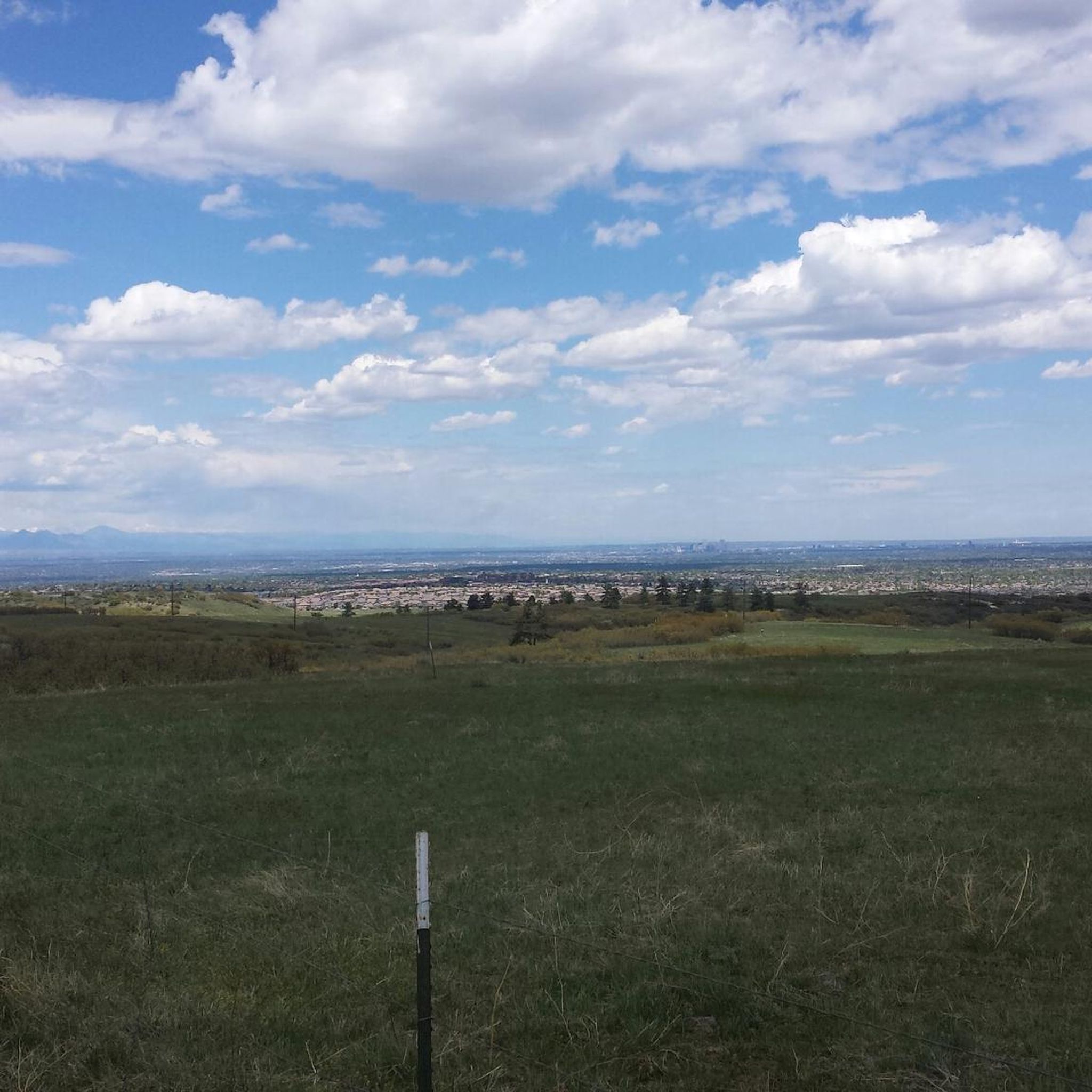
At 6,610 feet, Wildcat Point serves as a great overlook of the city and surrounding foothills. You can easily access this overlook from Daniels Park.
0
0
This short section of the Cherry Creek Trail starts to break away from the busier roads and passes through the Bayou Gulch Open Space. There's always a chance to see some wildlife off the side of the path when biking through here.
0
0
At 6,610 feet, Wildcat Point serves as a great overlook of the city and surrounding foothills. You can easily access this overlook from Daniels Park.
0
0
Frequently Asked Questions
How many road cycling routes are available around Castle Pines?
There are nearly 90 road cycling routes around Castle Pines, offering a wide variety of options for different skill levels. You'll find approximately 18 easy routes, over 60 moderate routes, and about 10 more challenging rides.
Are there any easy road cycling routes suitable for beginners or families in Castle Pines?
Yes, Castle Pines offers several easy road cycling routes. A great option is the Wildcat Point via Monarch Boulevard & Buffalo Trail, an easy 13.8-mile path featuring dedicated bike lanes and scenic views from Wildcat Point Overlook. The Village at Castle Pines also has 11 miles of paved multi-use trails perfect for a relaxed ride.
What are the most scenic road cycling routes in the Castle Pines area?
Many routes in Castle Pines offer stunning scenery. The Rueter-Hess Reservoir loop from Castle Rock provides beautiful views around the reservoir. Additionally, routes through Daniels Park offer dramatic views of the Front Range, including Pikes Peak and Longs Peak, and you might even spot a historic bison herd.
Are there any long-distance road cycling trails that connect to other areas?
Absolutely. The C-470 Bike Trail System, easily accessible from Castle Pines, is a concrete path that runs from Parker to Golden. It connects to other extensive trail systems like the Cherry Creek Trail, the Highline Canal Trail, and the South Platte River Trail, offering vast riding opportunities. The Cherry Creek Trail loop from Rock Canyon High School is a popular 47.4-mile route through the Cherry Creek Valley.
What kind of landscapes can I expect to see while road cycling around Castle Pines?
Road cycling around Castle Pines will take you through diverse landscapes, including rolling hills, extensive paved trail systems, and open spaces. You'll enjoy views of the Front Range, natural attractions like reservoirs, and areas with cottonwoods, willows, and grasslands, especially along the Cherry Creek Trail.
Are there any loop road cycling routes in Castle Pines?
Yes, loop routes are a popular feature in the area. The Rueter-Hess Reservoir loop from Castle Rock is a well-known moderate 29.9-mile option. Another significant loop is the Cherry Creek Trail loop from Rock Canyon High School, which is 47.4 miles long.
What are some notable landmarks or attractions I can see along road cycling routes?
Many routes offer access to interesting landmarks and natural features. You can explore Hidden Mesa Open Space with its expansive views and sandstone cliffs, or ride past the Cherry Creek Trail which runs along Cherry Creek. Daniels Park is known for its dramatic Front Range views and a historic bison herd. The Cherry Creek Park – View of Cherry Creek Reservoir loop from Rosie Rueter Trailhead offers views of the reservoir.
What do other road cyclists say about the routes in Castle Pines?
The road cycling routes in Castle Pines are highly regarded by the komoot community, with an average rating of 4.6 stars from over 40 reviews. More than 2,000 road cyclists have explored the varied terrain, often praising the well-maintained paved trail systems and the stunning views of the Front Range.
What is the best time of year for road cycling in Castle Pines?
The region is generally excellent for road cycling during spring, summer, and fall. The annual Elephant Rock Ride, now the Subaru Elephant Rock Cycling Festival, kicks off the Colorado cycling season, indicating that spring is a great time to start. Always check local weather conditions, as winter can bring snow and colder temperatures.
Are there any challenging road cycling routes for experienced riders?
Yes, for experienced riders seeking a challenge, there are approximately 10 difficult routes available. One such route is the Rueter-Hess Reservoir – The Cherry Creek Trail loop from RidgeGate Parkway, which spans over 70 miles and includes significant elevation changes.
Where can I find parking for road cycling routes in Castle Pines?
Many trailheads and parks in and around Castle Pines offer convenient parking. For instance, the C-470 Bike Trail System and the Cherry Creek Trail have various access points with parking facilities. Local parks like Elk Ridge Park, Retreat Park, and Coyote Ridge Park also provide parking for accessing multi-use trails.
Most popular attractions around Castle Pines

Get inspired with the komoot mobile app


Explore more
Browse the best Road cycling routes in other regions.
