The best walks and hikes around Austell
4.7
(128)
284
hikers
12
hikes
Hiking trails around Austell, Georgia, are primarily characterized by the diverse landscapes surrounding Sweetwater Creek. The region features a mix of woodlands, forests with varied flora, and open fields. Sweetwater Creek State Park, a central hiking destination, introduces rugged hills, rocky bluffs, and significant rock outcrops along the creek's course. This varied terrain provides a range of hiking experiences, from riverside paths to ridge walks.
Best hiking trails around Austell
- The most popular hiking route is Sweetwater Creek Red and…
Last updated: October 30, 2026
25
hikers
16.8km
04:40
290m
290m
Embark on the Sweetwater Creek Yellow, Red, and White Loop for a diverse hiking experience through Sweetwater Creek State Park. This route immerses you in varied terrain, from the rocky…
25
hikers
4.77km
01:22
110m
120m
The Sweetwater Creek Yellow Trail offers a dynamic hiking experience through Georgia's beautiful hardwood forests, tracing the banks of the wide Sweetwater Creek. You'll encounter varied terrain, from compacted soil…

2
hikers
5.08km
01:22
60m
70m
The Sweetwater Creek White and Green Loop offers a delightful blend of natural beauty and historical intrigue just outside Atlanta. This easy 3.2-mile (5.1 km) hike guides you through diverse…
5.0
(2)
88
hikers
7.09km
01:54
90m
90m
The Sweetwater Creek Red and White Trail Loop offers a captivating blend of history and natural beauty, making it one of Sweetwater Creek State Park's most popular trails. You'll wander…
3.3
(3)
19
hikers
8.85km
02:29
170m
170m
If you're looking for a varied and scenic hike near Atlanta, the Sweetwater Creek Yellow, Orange, and Blue Trail Loop is a solid choice. This moderate 5.5-mile (8.9 km) route…
Get access to more routes and recommendations from other explorers.
Already have an account?
Our route recommendations are based on thousands of hikes, rides, and runs completed by other people on komoot.


Tips from the Community

A five-story 19th-century textile mill, built in the 1840s, was once the heart of the village of New Manchester and produced cotton yarn for the Confederacy during the American Civil War. • What can you see from the trail? The imposing red brick walls of the ruins tower above the banks of Sweetwater Creek. You can see them from about a half-mile along the Red Trail. The building is partially overgrown, giving it a mysterious and photogenic character. • Historical Significance In July 1864, the mill was destroyed by General Sherman's troops during his march on Atlanta. The ruins have been preserved ever since as a reminder of this turbulent period in American history. • Film History The ruins served as a backdrop for films such as The Hunger Games: Mockingjay – Part 1 and Avengers: Infinity War, making it a popular spot for film buffs and photographers.
2
0
During my hike along the Yellow Trail in Sweetwater Creek State Park, I soon came across an impressive bridge that connects the access roads with the eastern hiking trails. This large steel and wooden bridge spans the fast-flowing Sweetwater Creek and provides a literal and figurative transition from civilization to the tranquility of the forest. From the center of the bridge, you have a magnificent view of the creek's whitewater shoals and the historic ruins of the New Manchester Mill on the other side. The contrast between the rust-colored steel of the bridge, the clear blue water, and the green of the surrounding forests is particularly photogenic. The bridge is not only a visual highlight but also a key junction in the trail network. It connects the Red Trail with the Yellow Trail, allowing for a varied loop through both sections of the park.
2
0

Jack’s Lake Waterfall is a scenic destination for trail runners who enjoy a challenge. The trail is about 4.5 miles long and follows the Jack’s River, crossing it several times over wooden bridges. The waterfall is a spectacular sight, especially after a heavy rain, and offers a refreshing spray for runners who need to cool off. The trail is moderately difficult, with some steep and rocky sections, but also some flat and smooth areas. Runners should be prepared for changing weather conditions, as the trail is located in a remote and forested area.
0
0
The New Manchester Mill Ruins are located in the Sweetwater Creek State Park, which offers a variety of trails for different skill levels. You can follow the Red Trail, which is rated easy to difficult, to reach the ruins of the cotton mill that was burned by Union troops during the Civil War. Along the way, you can enjoy the views of the white-water rapids and the lush greenery of the park. The trail is about one mile long and has some rocky and steep sections, so be prepared for a challenging run. The New Manchester Mill Ruins are a great place to explore the history and nature of Georgia while getting some exercise.
0
0
Jack’s Lake is located near the Sweetwater Creek State Park, which is home to the ruins of the New Manchester Manufacturing Company, a historic cotton mill that was burned down by the Union Army during the Civil War. It is a great place to experience the natural and cultural beauty of Georgia while getting a good workout.
0
0
Jack’s Hill is part of the historic Santa Fe Trail, which was used by traders and settlers in the 19th century. You can see the trail ruts at the Ivan L. Boyd Prairie Preserve and the Black Jack Park, where the Battle of Black Jack took place in 1856. The trails here offer a variety of terrain, from river bottomlands and marshes to upland forests and open meadows. You can also enjoy the views of the George H. Sparks Reservoir and the Sweetwater Creek rapids. Jack’s Hill is a great place to experience the natural and cultural heritage of Douglas County while getting a good workout.
0
0

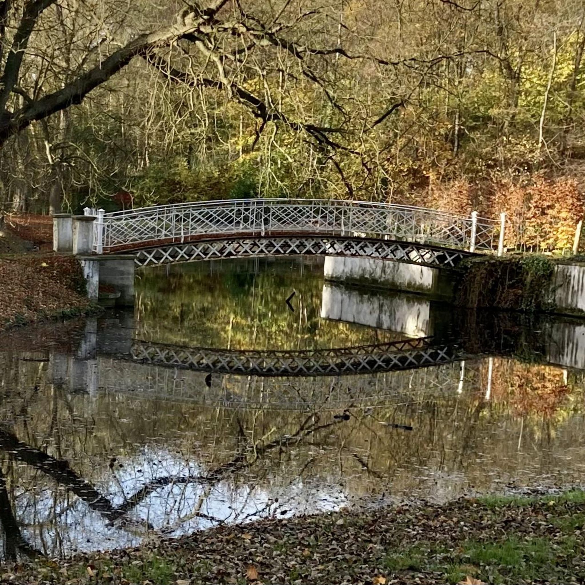
A bridge made of wood and metal crosses over Sweetwater Creek. The bridge was built in 2012 after flooding destroyed the previous bridge.
0
0
The ruins of New Manchester Manufacturing Company, originally known as the Sweetwater Mill. The building was once a cotton mill, built in 1849, that was burned during the American Civil War. Various films, such as The Hunger Games, have used this area as a scenic backdrop.
1
0
Frequently Asked Questions
How many hiking trails are available around Austell?
Austell offers a diverse network of over 12 hiking trails, catering to various skill levels. These routes primarily explore the natural beauty surrounding Sweetwater Creek and other local green spaces.
What makes hiking around Austell unique?
Hiking in Austell is unique due to its blend of rugged natural features and historical significance. The trails often follow the picturesque Sweetwater Creek, featuring rocky bluffs, rapids, and diverse woodlands. You can also explore historical sites like the New Manchester Manufacturing Company ruins, adding a cultural dimension to your outdoor adventure.
What do other hikers say about the trails in Austell?
The hiking trails around Austell are highly rated by the komoot community, with an average score of 4.9 stars from over 120 reviews. Hikers frequently praise the varied terrain, the scenic beauty of Sweetwater Creek, and the well-maintained paths that offer both challenging and relaxing experiences.
When is the best time of year to go hiking in Austell?
The fall season is particularly beautiful for hiking in Austell, as the hardwood forests display vibrant autumn colors. Spring also offers pleasant temperatures and the chance to see wildflowers. Summers can be warm and humid, while winters are generally mild, making hiking enjoyable year-round, though some trails might be muddy after rain.
Are there easy hiking trails suitable for beginners in Austell?
Yes, Austell offers several easy hiking trails perfect for beginners. An excellent option is the White Trail loop — Sweetwater Creek State Park, which is 4.4 miles long and traverses remote areas, winding through stream coves and along ridges overlooking Sweetwater Creek with minimal elevation gain.
Can I find moderate hiking routes in Austell?
Absolutely. For those seeking a moderate challenge, the Blue Trail to Orange Trail loop — Sweet Water Creek State Park is a popular choice. This 5.5-mile route offers views of the Atlanta skyline from a high-elevation ridge and passes through beautiful hardwood forests, providing a good workout with varied terrain.
Are there any loop trails in Austell?
Yes, many trails in Austell are designed as loops, offering a convenient way to explore without retracing your steps. Examples include the White Trail loop and the Blue Trail to Orange Trail loop, both within Sweetwater Creek State Park.
Are the hiking trails around Austell dog-friendly?
Many trails in the Austell area, especially within Sweetwater Creek State Park, are dog-friendly, provided your dog is on a leash. The Silver Comet Trail, while not exclusively in Austell, is also a popular paved route where dogs are welcome. Always check specific park regulations before heading out.
Are there family-friendly hiking options in Austell?
Sweetwater Creek State Park offers several family-friendly trails. The easier routes, like the New Manchester Mill Ruins – Bridge over Sweetwater Creek loop, are suitable for families with children, combining natural beauty with historical points of interest. Local parks like Legion Park also provide accessible walking trails.
Are there any trails with historical significance in Austell?
Yes, the New Manchester Mill Ruins are a significant historical landmark accessible via several trails in Sweetwater Creek State Park. The Red (History) Trail specifically leads to these impressive five-story ruins of a textile mill destroyed during the Civil War, situated alongside the white-water rapids of Sweetwater Creek.
Where can I find scenic viewpoints or natural features on the trails?
Sweetwater Creek State Park is rich in scenic views. The Yellow (East Side) Trail offers views of the mill ruins and a prehistoric cave, while the Orange Trail provides views of the Atlanta skyline from a high-elevation ridge. The rugged landscape along Sweetwater Creek itself, with its rocky bluffs and rapids, offers numerous picturesque spots.
What are the parking options for Sweetwater Creek State Park?
Sweetwater Creek State Park has designated parking areas for visitors. A daily parking fee or an annual Georgia State Parks Pass is typically required. It's advisable to arrive early on weekends or holidays as parking lots can fill up quickly.
Is public transport available to reach hiking areas like Sweetwater Creek State Park?
While public transport options directly to the entrance of Sweetwater Creek State Park may be limited, you can check local transit services for routes that get you close to Austell. However, for most hiking areas, driving and parking remain the most convenient options.
Are there places to eat or stay near the hiking trails in Austell?
Austell and its surrounding areas offer various dining and accommodation options. You can find local cafes and restaurants in downtown Austell, as well as hotels and other lodging choices within a short drive of Sweetwater Creek State Park and other trailheads.
Most popular routes around Austell
Most popular attractions around Austell

Get inspired with the komoot mobile app


Explore more
Browse the best Hikes in other regions.
