The best walks and hikes around Bellingham
4.8
(5)
78
hikers
30
hikes
Hiking around Bellingham offers a diverse range of experiences, from coastal paths to forested trails. The region features varied terrain, including low-lying areas with wetlands and river systems, alongside routes that gain moderate elevation. This geographical mix provides opportunities for different types of outdoor activities, catering to various skill levels.
Best hiking trails around Bellingham
- The most popular hiking route is Wenakeening Woods and Idylbrook Loop, a 3.8 miles (6.1 km) trail that takes 1 hour 34 minutes to complete. This easy route features a gentle elevation gain of 82 feet (25 meters).
- Another top favourite among local hikers is Franklin Town Forest Red Loop, an easy 1.8 miles (2.8 km) path. This route leads through forested areas with a total ascent of 133 feet (41 meters).
- Local hikers also love the Franklin State Forest Loop, a 1.2 miles (1.9 km) trail leading through a state forest, often completed in about 32 minutes.
- Hiking around Bellingham is defined by river paths, forested loops, and varied terrain. The network offers options for different ability levels.
- The routes in Bellingham are highly rated by the komoot community with an average score of 4.7 stars from over 4 reviews. More than 70 hikers have used komoot to explore Bellingham's varied terrain.
Last updated: June 29, 2026
4
hikers
6.12km
01:34
20m
30m
Easy hike. Great for any fitness level. Easily-accessible paths. Suitable for all skill levels.
3
hikers
1.90km
00:32
40m
40m
Easy hike. Great for any fitness level. Easily-accessible paths. Suitable for all skill levels.

Sign up for free
5.0
(1)
2
hikers
2.84km
00:46
40m
40m
Easy hike. Great for any fitness level. Easily-accessible paths. Suitable for all skill levels.
2
hikers
1.57km
00:24
0m
10m
Easy hike. Great for any fitness level. Easily-accessible paths. Suitable for all skill levels.
2.91km
00:46
30m
30m
Easy hike. Great for any fitness level. Easily-accessible paths. Suitable for all skill levels.
Get access to more routes and recommendations from other explorers.
Sign up for free
Already have an account?
Our route recommendations are based on thousands of hikes, rides, and runs completed by other people on komoot.
Start today with a free account
Your next adventure awaits.
Login or Signup



Tips from the Community

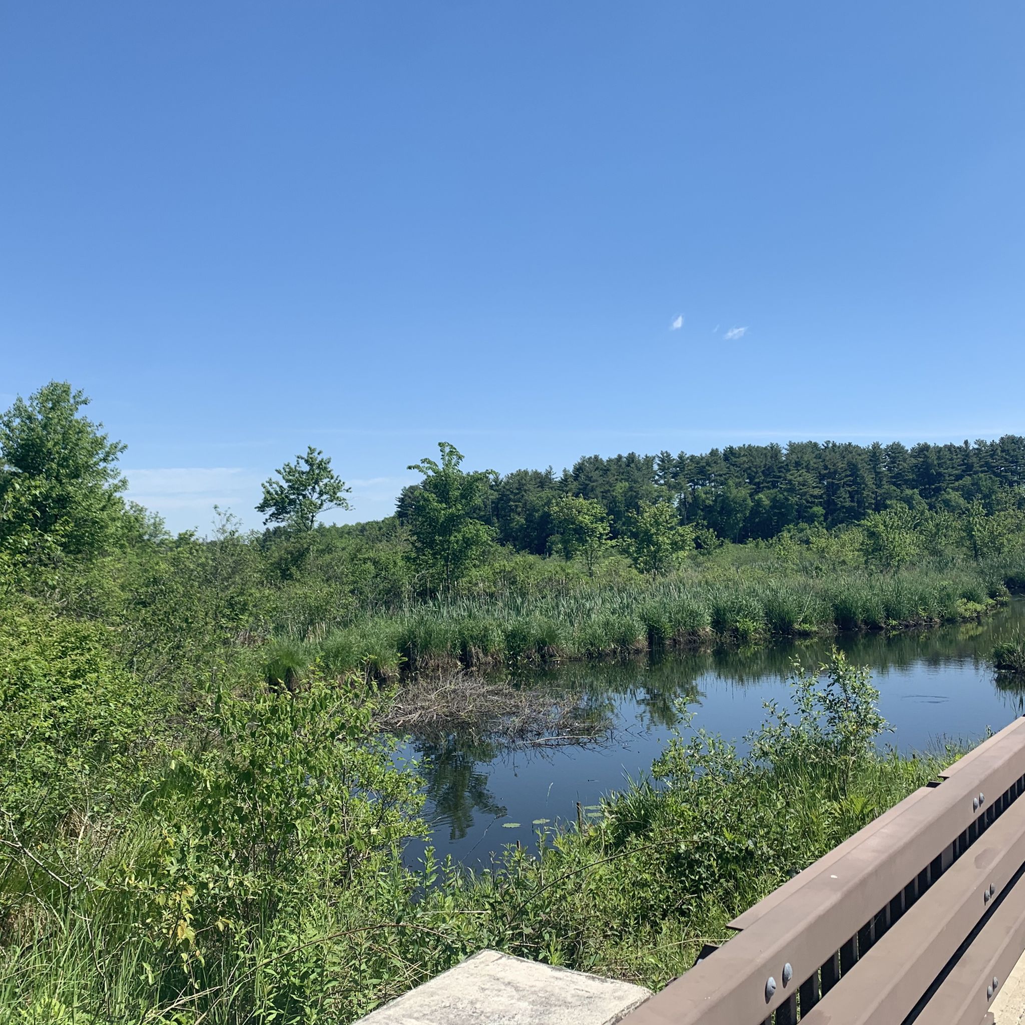
At this spot, you are between the two Franklin Reservoirs and get great views down both of them on either side of the path over the water. This is a nice place to pause and snap a few photos before continuing on your hike around the ponds and the DelCarte Conservation Area.
0
0

Franklin State Forest is a beautiful expanse of undeveloped land that offers ample opportunities for outdoor activities. Covering an area of 843 acres, this forest is a paradise for nature enthusiasts. You can explore miles of winding trails and fire roads by hiking, running, or mountain biking while enjoying the breathtaking views of nature.
0
0
Frequently Asked Questions
How many hiking trails are available around Bellingham?
Bellingham offers a variety of hiking experiences with over 10 routes documented on komoot. These trails range from easy, leisurely strolls to more challenging paths, catering to different skill levels and preferences.
What are some easy hiking trails suitable for families in Bellingham?
For families looking for an easy outing, the Burnt Swamp Trail loop at Birchwold Farm is a great option, taking just over an hour to complete with minimal elevation gain. Another excellent choice is the Franklin Reservoirs Figure-8 at DelCarte Conservation Area, a shorter trail through a scenic conservation area. The Hertz Trail along Lake Whatcom and the Lake Padden loop are also popular, mostly flat options.
Are there any trails with waterfalls near Bellingham?
Yes, Bellingham is home to beautiful waterfalls. Whatcom Falls Park features the eponymous stunning waterfalls and over five miles of scenic trails. You can also find the Blackstone River Bike Path Waterfall, which is a notable highlight. Additionally, Chuckanut Falls in the Chuckanut Mountains offers a shorter hiking option to a picturesque cascade, and the Nooksack River area is known for Nooksack Falls.
What are the best trails for scenic views in Bellingham?
For breathtaking panoramic views, consider Oyster Dome in the Chuckanut Mountains, which offers expansive vistas of the San Juan Islands, Olympic Mountains, and the Coast Mountains of British Columbia. Higher up, Artist Point and the Chain Lakes Loop near Mount Baker are renowned for spectacular alpine scenery and views of Mount Baker and Mount Shuksan. Sehome Hill Arboretum also provides sweeping views of the city and Bellingham Bay from its observation tower.
Are there any dog-friendly hiking trails in Bellingham?
Many trails in Bellingham are dog-friendly, but leash rules often apply. Whatcom Falls Park and Lake Padden Park are popular choices for walking dogs. Always check specific trail regulations before heading out, especially in sensitive natural areas, to ensure a pleasant experience for everyone.
What is the best time of year to go hiking in Bellingham?
Bellingham offers year-round hiking opportunities. Spring and summer are ideal for wildflowers and accessing higher elevation trails like those near Mount Baker. Fall brings vibrant foliage, while many lower elevation trails, such as those in the Chuckanut Mountains or along the coast, remain accessible and enjoyable even in winter. Higher elevations transition to snowshoeing in winter.
Are there any loop hikes available in Bellingham?
Yes, Bellingham has several excellent loop hikes. The Burnt Swamp Trail loop is an easy option. Another popular loop is around Lake Padden, offering a 2.5-mile urban park experience. The Stimpson Nature Reserve provides a 3-mile loop through old-growth forest, and the Chain Lakes Loop near Mount Baker is a renowned alpine loop for more experienced hikers.
What kind of natural features can I expect to see on Bellingham's trails?
Bellingham's trails showcase a diverse range of natural features. You'll encounter lush old-growth forests, picturesque mountain lakes like Fragrance Lake and Lost Lake, and stunning waterfalls. Coastal trails offer views of the Salish Sea, San Juan Islands, and unique rocky shorelines at places like Clayton Beach. Higher up, alpine meadows, glaciers, and panoramic mountain vistas dominate the landscape near Mount Baker.
Are there any interesting landmarks or attractions near the hiking trails?
Absolutely. Along the trails, you can explore various points of interest. The Upper Charles Trail and Adams Street Conservation Land offer natural beauty. For serene water features, visit Hopedale Pond and Parklands or Louisa Lake. The historic Fairhaven district, connected by the South Bay Trail, is also a charming area to explore after a hike.
Do I need a Discover Pass or any permits for hiking near Bellingham?
Many state parks and recreation lands in Washington, including some popular hiking areas near Bellingham, require a Discover Pass for vehicle access. It's always best to check the specific requirements for your chosen trailhead before you go. Some national forest areas or specific trails might also have their own permit systems, especially for overnight trips or high-demand areas.
Are there public transportation options to reach trailheads in Bellingham?
Bellingham has some public transportation options that can get you close to certain trailheads, particularly those within city limits or easily accessible areas like Whatcom Falls Park or Lake Padden. However, for trails further afield, especially in the Chuckanut Mountains or near Mount Baker, personal vehicle access is often necessary. Planning your route with local transit schedules is recommended.
Where can I find accommodation near Bellingham's hiking areas?
Accommodation options are available throughout Bellingham, with choices ranging from hotels to guesthouses. If you're focusing on specific areas, you can find places to stay near Chuckanut Drive for easy access to the Chuckanut Mountains, or closer to Lake Whatcom for trails in that vicinity. The city center also provides convenient access to various hiking spots and amenities.
Most popular attractions around Bellingham

Get inspired with the komoot mobile app


Explore more
Browse the best Hikes in other regions.
