The best running trails around Bellingham
4.8
(5)
303
runners
45
runs
Jogging around Bellingham offers a diverse range of landscapes, from waterfront paths along the Salish Sea to forested trails and lakeside loops. The region is characterized by its position between the bay and the North Cascade Mountains, providing varied terrain for runners. An extensive network of trails caters to different preferences, including urban routes with bay views and more challenging paths through old-growth forests.
Best jogging routes around Bellingham
- The most popular jogging route is Choate Park and High School Trail, a 2.5 miles (4.0 km) trail that takes 27 minutes to complete. This easy route offers a straightforward path suitable for a quick run.
- Another top favourite among local runners is Franklin State Forest Figure Eight loop, a moderate 4.2 miles (6.7 km) path. This route winds through forested areas, providing a natural setting for a longer run.
- Local runners also love the Upper Charles Trail loop from K-Mart/Double Tree Hotel, a 7.6 miles (12.3 km) trail leading through urban and green spaces, often completed in about 1 hour 16 minutes.
- Jogging around Bellingham is defined by waterfront paths, forested trails, and lakeside loops, offering a variety of scenic routes. The network provides options for different ability levels, from easy urban runs to more challenging moderate trails.
- The routes in Bellingham are highly rated by the komoot community with an average score of 4.5 stars from 4 reviews. More than 224 runners have used komoot to explore Bellingham's varied terrain.
Last updated: June 29, 2026
1
runners
4.05km
00:27
20m
20m
Jog the easy 2.5-mile Choate Park and High School Trail, featuring varied terrain, scenic views of Choate Pond, and woodland paths.
6.73km
00:50
60m
60m
Jog the moderate 4.2-mile Franklin State Forest Figure Eight loop, gaining 198 feet through classic New England forest terrain.

Sign up for free
20
runners
12.9km
01:21
70m
70m
Moderate run. Good fitness required. Mostly paved surfaces. Suitable for all skill levels.
20
runners
12.3km
01:17
50m
50m
Moderate run. Good fitness required. Mostly paved surfaces. Suitable for all skill levels.
5.0
(2)
18
runners
6.01km
00:38
40m
40m
Moderate run. Good fitness required. Mostly paved surfaces. Suitable for all skill levels.
Get access to more routes and recommendations from other explorers.
Sign up for free
Already have an account?
Our route recommendations are based on thousands of hikes, rides, and runs completed by other people on komoot.
Start today with a free account
Your next adventure awaits.
Login or Signup



Tips from the Community

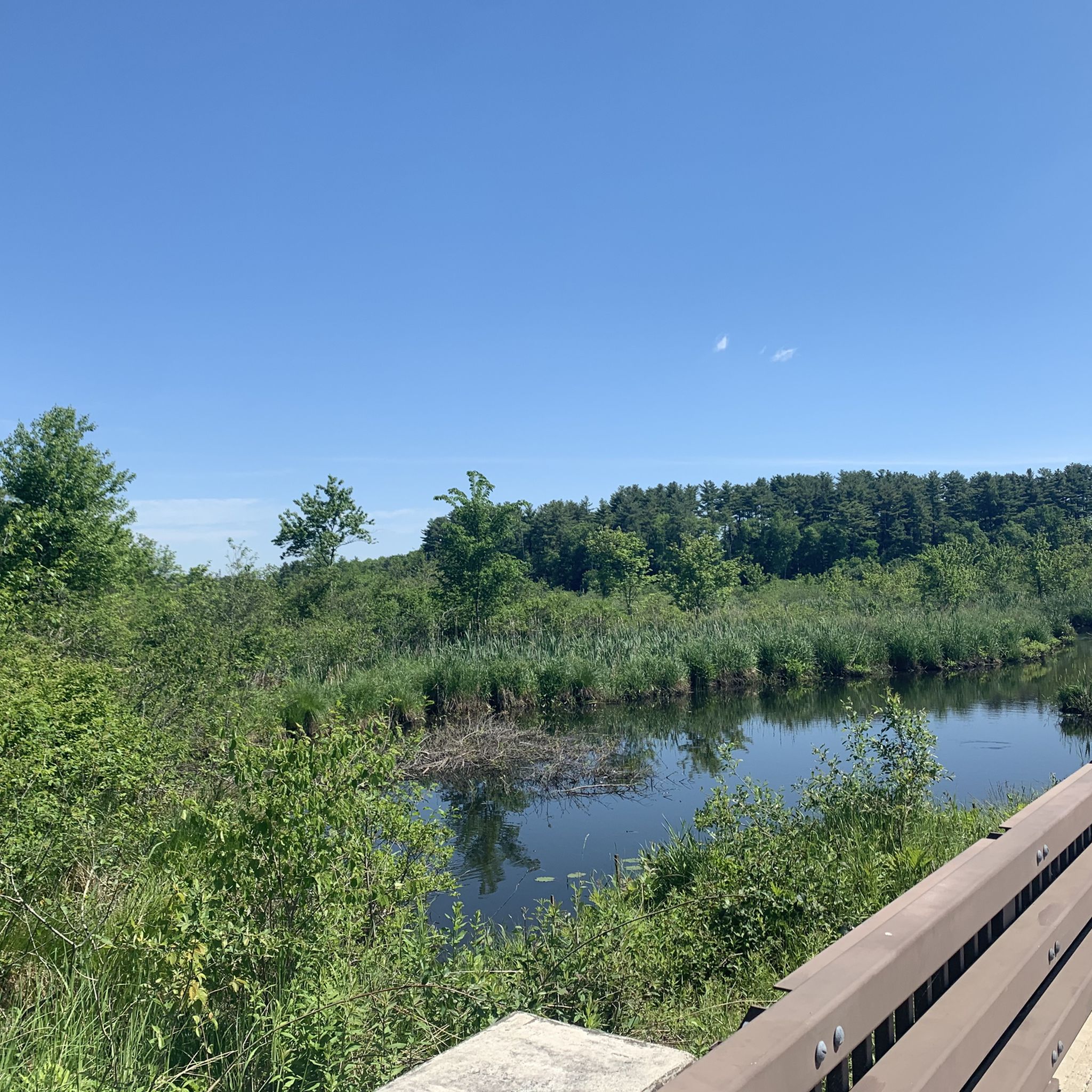
Choate Park West is a beautiful preserve adjacent to Choate Park, a fantastic urban park providing diverse amenities. It boasts a serene pond, a stunning dam, swimming beaches, picnic tables, playgrounds, ball fields, tennis and basketball courts, and much more. It's the perfect location for a family outing, a picnic with friends, or enjoying a refreshing walk or run in a beautiful outdoor setting.
0
0
Franklin State Forest is a beautiful expanse of undeveloped land that offers ample opportunities for outdoor activities. Covering an area of 843 acres, this forest is a paradise for nature enthusiasts. You can explore miles of winding trails and fire roads by hiking, running, or mountain biking while enjoying the breathtaking views of nature.
0
0

The Upper Charles Rail Trail is a 13.5-mile rail trail that consists of a packed dirt and cinder path the entire time. This section of the trail passes through the Wenakeening Woods and offers access to their singletrack hiking trail network.
0
0

Get out into the woods and enjoy your run in this beautiful landscape.
1
0

Former railroad track the Upper Charles Trail is currently over 13 miles long. It eventually plans to connect the communities of Milford, Ashland, Sherborne, Holliston, Framingham and Hopkinton. It will then do more than 24 miles in total when fully completed.
0
0

The rail trail here is nice. It goes by a waterfall and through downtown Milford. The trail eventually extends to Holliston which was not paved and not as nice.
0
1
Frequently Asked Questions
What types of running routes can I find in Bellingham?
Bellingham offers a diverse range of running experiences, from scenic waterfront paths along Bellingham Bay to challenging trails through old-growth forests and serene lakeside loops. You can find urban routes with bay views, forested trails, and paths leading to mountain access points.
Are there easy running trails suitable for beginners in Bellingham?
Yes, Bellingham has several easy running options. For instance, the Choate Park and High School Trail is an easy 2.5-mile route. Additionally, the paved sections of the South Bay Trail offer a relatively flat and accessible run along the waterfront, perfect for those starting out.
Where can I find running routes with scenic water views in Bellingham?
For stunning water views, consider the **South Bay Trail**, which offers picturesque sections across Taylor Dock and views of Lummi Island and the Chuckanut Mountains. Combining this with the path to **Zuanich Point** extends your waterfront experience with expansive views of Squalicum Harbor. **Boulevard Park** also features a lovely boardwalk over the water.
Are there any loop or circular running routes in Bellingham?
Many trails in Bellingham offer loop options. A popular choice is the 2.6-mile loop around **Lake Padden**, which features rolling terrain. The **Stimpson Nature Preserve** also has a 3-mile main loop and a 1.8-mile loop around Lake Geneva through old-growth forest. You can also find loops like the Franklin State Forest Figure Eight loop for a moderate forest run.
Can I find running trails that pass by waterfalls in Bellingham?
Absolutely! **Whatcom Falls Park** is an excellent destination for this. It features over five miles of scenic trails that wind through lush forested areas, past the iconic Whatcom Falls, and along Whatcom Creek, providing a beautiful backdrop for your run.
What are some longer, more challenging running routes in the Bellingham area?
For longer and more challenging runs, explore the extensive trail system in the **Chuckanut Mountains**, with routes like the **Oyster Dome Trail** offering challenging terrain and panoramic vistas. The **Interurban Trail** can also be extended south to Larrabee State Park, providing a 7-mile (one way) run with varied terrain.
Are there dog-friendly running trails in Bellingham?
Many of Bellingham's outdoor spaces and trails are dog-friendly, though leash laws and specific regulations may apply. Areas like **Lake Padden** and **Whatcom Falls Park** are popular choices for runners with dogs, offering ample space and varied terrain. Always check local signage for specific rules.
What do other runners say about the jogging routes in Bellingham?
The running routes in Bellingham are highly regarded by the komoot community, holding an average score of 4.5 stars from 4 reviews. Runners often praise the diverse landscapes, from serene lakeside paths to challenging forest trails, and the stunning scenic views available throughout the region.
Are there any urban green spaces for running within Bellingham city limits?
Yes, even within the city, you'll find great options. **Cornwall Park** offers a 1.1-mile loop with rolling trails through its woods, providing a quiet, forested run. Western Washington University and the adjacent **Sehome Arboretum** also feature hilly, approximately 3-mile runs with attractive pedestrian paths.
Where can I find running routes that are suitable for families?
Family-friendly running options include the paved sections of the **South Bay Trail** for an easy, flat experience with bay views. **Whatcom Falls Park** also offers well-maintained paths through forested areas that are suitable for both casual joggers and families looking for a pleasant outing.
Are there running routes that connect to other attractions or points of interest?
Many routes offer connections to points of interest. The **Interurban Trail** is accessible from Historic Fairhaven Village and can lead towards Larrabee State Park. The **Railroad Trail** connects Memorial Park to Lake Whatcom and eventually merges with trails in Whatcom Falls Park, allowing you to explore multiple areas on a single run.
What is the best time of year to go running in Bellingham?
Bellingham offers great running opportunities year-round. Spring and fall provide mild temperatures and vibrant scenery, while summer is ideal for enjoying the waterfront and forested trails. Even in winter, many trails remain accessible, offering a unique, serene experience, though some higher elevation trails might require checking conditions.
Most popular routes around Bellingham
Most popular attractions around Bellingham

Get inspired with the komoot mobile app


Explore more
Browse the best Running Trails & Routes in other regions.
