The best running trails around Delaware Water Gap
74
runners
6
runs
Jogging around Delaware Water Gap offers a diverse landscape for runners, characterized by the winding Delaware River, dense forested hills, and varied elevations. The region features a mix of challenging mountain trails and more gentle paths along water bodies. Runners can expect to encounter significant climbs and descents, providing a robust workout amidst natural scenery. These routes traverse a landscape shaped by ancient geological forces, offering a unique trail running experience.
Best jogging routes around Delaware Water Gap
- The most…
Last updated: September 27, 2026
32
runners
5.43km
00:54
360m
360m
Hard run. Very good fitness required. Mostly paved surfaces. Suitable for all skill levels.
12
runners
7.74km
01:03
280m
280m
Moderate run. Good fitness required. Mostly paved surfaces. Suitable for all skill levels.

4
runners
14.7km
01:56
360m
360m
Hard run. Very good fitness required. Mostly paved surfaces. Suitable for all skill levels.
12
runners
13.4km
01:27
80m
80m
Moderate run. Good fitness required. Mostly paved surfaces. Suitable for all skill levels.
9
runners
12.8km
01:24
70m
70m
Moderate run. Good fitness required. Mostly paved surfaces. Suitable for all skill levels.
Our route recommendations are based on thousands of hikes, rides, and runs completed by other people on komoot.
Start today with a free account
Your next adventure awaits.


Other adventures around Delaware Water Gap

Tips from the Community

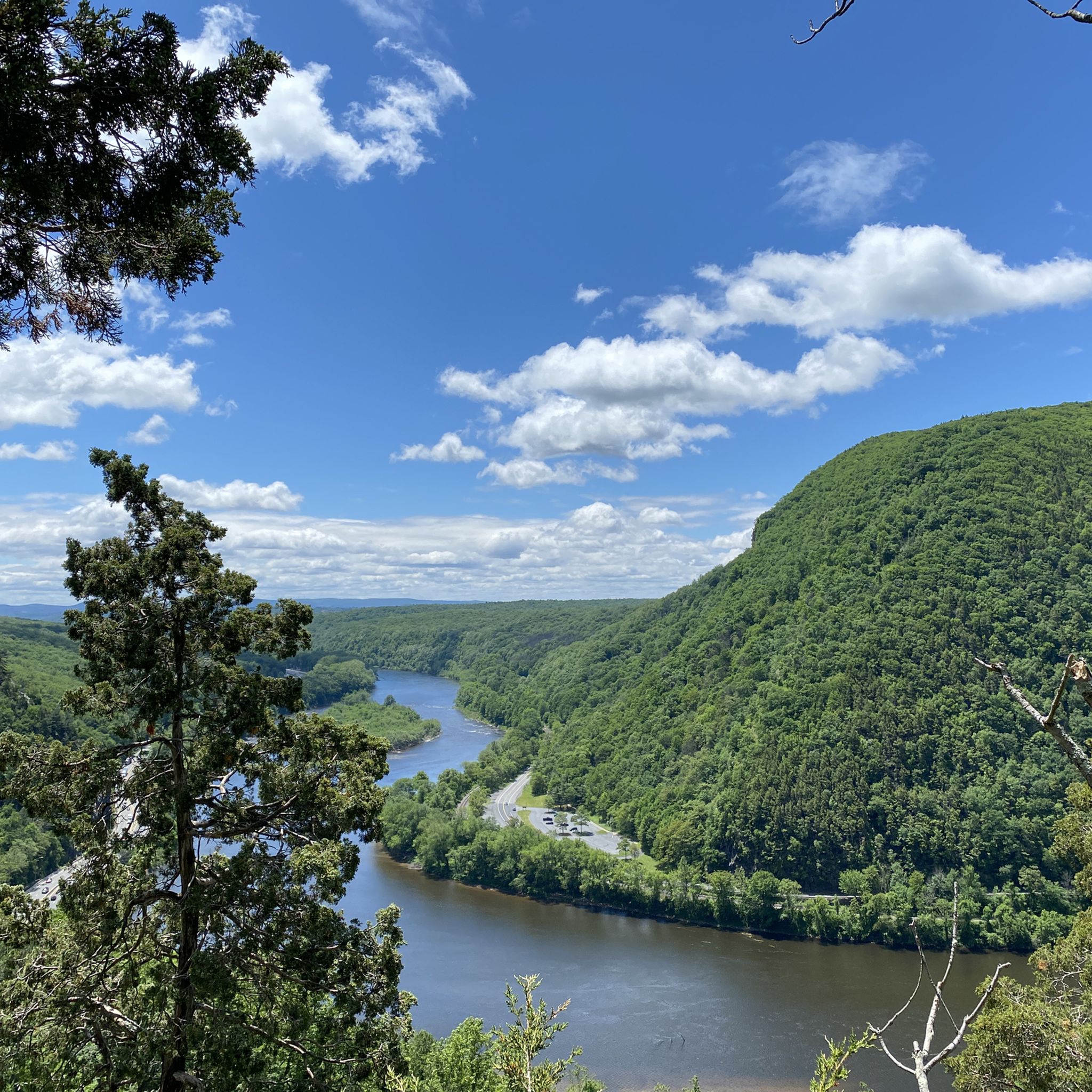
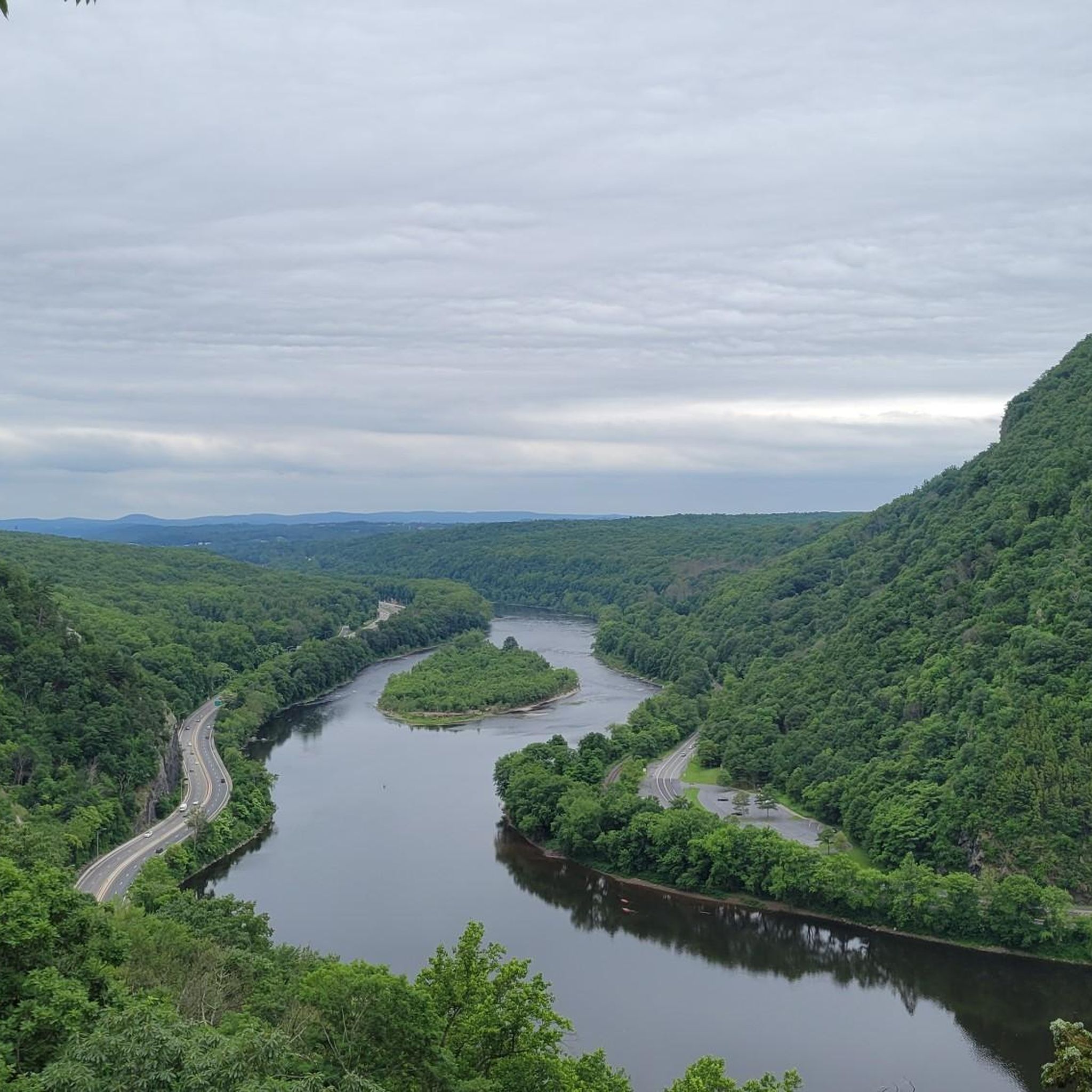
Mount Minsi offers great views of Mount Tammany and the Delaware River.
0
0
Mount Tammany is part of the Kittatinny Mountains. From the lookout, you have a great view of Mount Minsi and the Delaware River.
0
0

This natural pond is relatively clean and therefore is a good refilling spot for backpackers (at the northern outlet). Swimming and boating are not allowed. Only a few species of fish (e.g. Pumpkinseed Sunfish and yellow perch) can tolerate the naturally slightly acidic waters. At the north end is a an outlet from the pond. This small brook first flows under rocks, then emerges into a steam. Despite being mildly acidic, the water from this brook is safe to drink. Just filter it first!
0
0
Frequently Asked Questions
How many running routes are available in Delaware Water Gap?
This guide features nearly 10 dedicated running routes around the Delaware Water Gap. These trails offer a diverse range of experiences, from moderate paths to challenging mountain runs.
Are there any easy running trails in Delaware Water Gap for beginners?
The running routes highlighted in this guide for the Delaware Water Gap are generally moderate to difficult, focusing on providing a robust workout amidst natural scenery. There are no easy routes listed in this selection.
What are some moderate running routes in the Delaware Water Gap area?
For a moderate running experience, consider the Mount Minsi Loop, which is 4.8 miles (7.7 km) and offers scenic overlooks of the Delaware River. Another good option is the Coal Pocket loop from East Stroudsburg, a 13.4 km (8.3 miles) route with less elevation gain.
Are there challenging trails for experienced runners in Delaware Water Gap?
Absolutely. Experienced runners will find several challenging options. The Mount Tammany Red Dot and Blue Blaze Trail Loop is a difficult 3.4-mile (5.4 km) trail with significant elevation gain and panoramic views. Another demanding route is the Sunfish Pond and Dunnfield Creek Trail Loop, spanning 9.1 miles (14.7 km) through forested areas.
Can I find circular running routes in Delaware Water Gap?
Yes, many of the popular running trails in the Delaware Water Gap are circular routes, perfect for varied scenery without retracing your steps. Examples include the Mount Tammany Red Dot and Blue Blaze Trail Loop, the Mount Minsi Loop, and the Sunfish Pond and Dunnfield Creek Trail Loop.
What kind of scenery can I expect on these running trails?
The Delaware Water Gap offers diverse scenery for runners, characterized by the winding Delaware River, dense forested hills, and varied elevations. You can expect panoramic views from mountain summits, serene paths alongside water bodies like Sunfish Pond, and trails that traverse ancient geological formations. Many routes also feature sections of the famous Appalachian Trail.
Are there any running routes that pass by water features or waterfalls?
Yes, several routes incorporate beautiful water features. The Sunfish Pond and Dunnfield Creek Trail Loop takes you past Sunfish Pond and along Dunnfield Creek Trail, where you can enjoy the sounds of flowing water. The region is also home to Eureka Creek, which adds to the natural beauty of some areas.
What is the best time of year for trail running in Delaware Water Gap?
Spring and fall are generally considered the best times for trail running in the Delaware Water Gap. The weather is milder, and the natural scenery is vibrant with spring blooms or autumn foliage. Summer can be hot and humid, while winter running is possible but requires appropriate gear for potentially icy or snowy conditions on higher elevations.
Are dogs allowed on the running trails in Delaware Water Gap?
Many trails within the Delaware Water Gap National Recreation Area are dog-friendly, but regulations can vary by specific trail or park section. It's always best to check the current rules for the particular route you plan to run, and ensure your dog is on a leash and you clean up after them.
Where can I find parking for these running trails?
Most popular trailheads in the Delaware Water Gap region, especially for routes like the Mount Tammany or Mount Minsi trails, have designated parking areas. Details regarding parking availability and access points are typically provided on the individual route pages on komoot.
What do other runners enjoy most about jogging in Delaware Water Gap?
Runners frequently praise the diverse terrain and stunning natural beauty of the Delaware Water Gap. The komoot community often highlights the challenging climbs, rewarding panoramic views from spots like the Delaware Water Gap viewpoint, and the peaceful experience of running through dense forests and along the river.
Can I combine running with exploring nearby attractions?
Absolutely! The Delaware Water Gap is rich in natural attractions. After a run, you can explore highlights such as Sunfish Pond, the scenic Dunnfield Creek Trail, or take in the expansive views from the Delaware Water Gap viewpoint. Many routes pass directly by these points of interest.
Most popular attractions around Delaware Water Gap

Get inspired with the komoot mobile app


Explore more
Browse the best Running Trails & Routes in other regions.
