Magic Mountain Wilderness
Magic Mountain Wilderness
The best cycling routes in Magic Mountain Wilderness
4.3
(7)
107
riders
10
rides
Touring cycling routes in Magic Mountain Wilderness traverse a landscape characterized by chaparral-covered hillsides, mixed pines, and rugged canyons within the Angeles National Forest and San Gabriel Mountains National Monument. The area features diverse terrain, from paved river paths along the Santa Clara River to challenging climbs through mountainous regions. While designated wilderness areas have cycling restrictions, the surrounding national forest offers extensive routes.
Best touring cycling routes in Magic Mountain Wilderness
- The most popular touring cycling route is Santa…
Last updated: June 29, 2026
18
riders
42.5km
02:44
460m
460m
Hard bike ride. Very good fitness required. Mostly paved surfaces. Suitable for all skill levels.
17
riders
Hard bike ride. Very good fitness required. Mostly paved surfaces. Suitable for all skill levels.

Sign up for free
5
riders
53.5km
03:45
1,010m
1,010m
Hard bike ride. Very good fitness required. Mostly paved surfaces. Suitable for all skill levels.
3.0
(1)
4
riders
60.1km
04:08
1,040m
1,040m
Hard bike ride. Very good fitness required. Mostly paved surfaces. Suitable for all skill levels.
6
riders
67.3km
04:09
570m
570m
Hard bike ride. Very good fitness required. Mostly paved surfaces. Suitable for all skill levels.
Get access to more routes and recommendations from other explorers.
Sign up for free
Already have an account?
Our route recommendations are based on thousands of hikes, rides, and runs completed by other people on komoot.
Start today with a free account
Your next adventure awaits.
Login or Signup

Tips from the Community

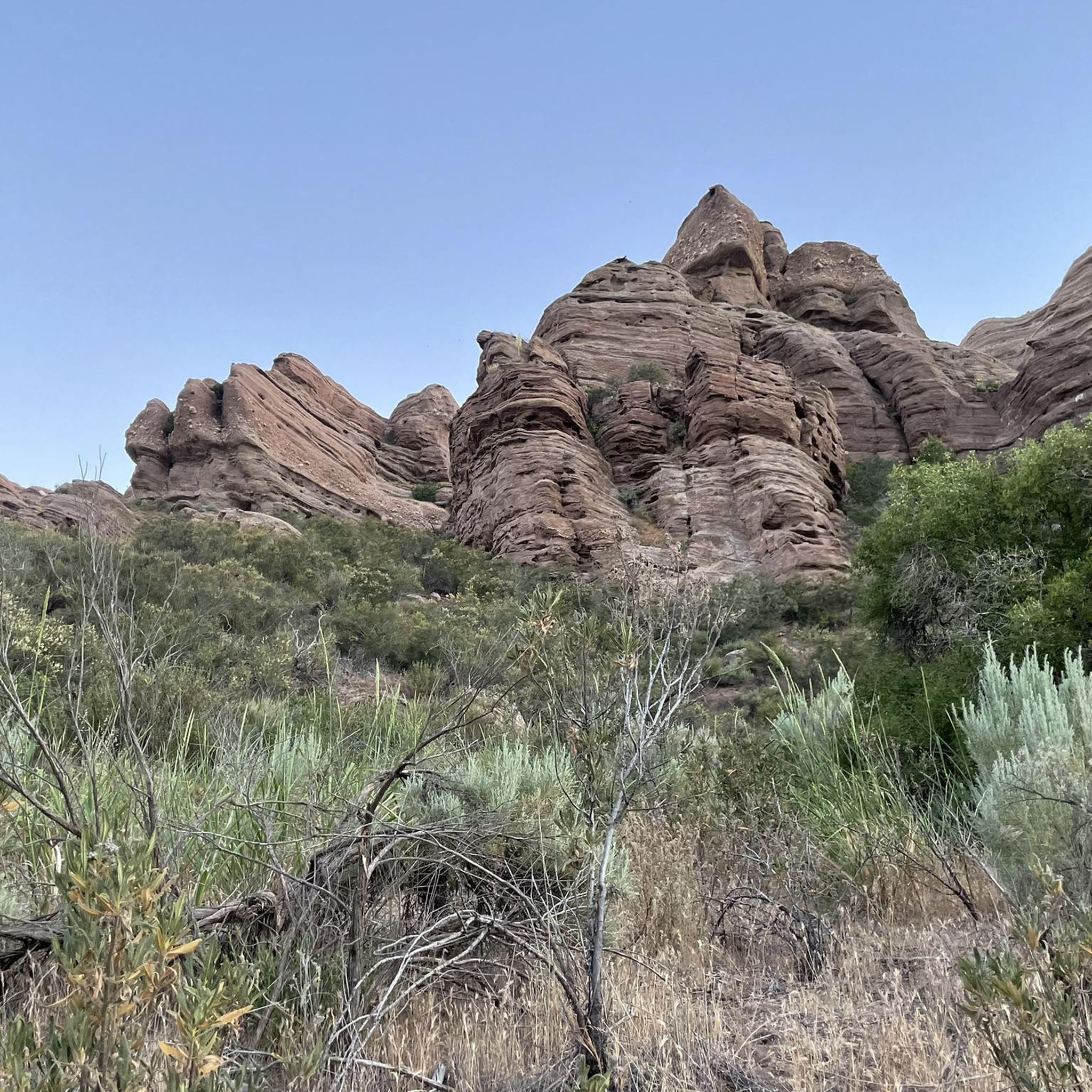
The Mountains Recreation and Conservation Authority (MRCA) Open Space includes a network of dirt roads through Elsmere and Whitney Canyons. There roads are also great sunny biking trails, from which you get great views of the mountains of Angeles National Forest.
0
0

At about 84 miles long, the Santa Clara River is the largest natural river system in southern California remaining in a relatively undeveloped state. Along its length there is the 8 mile long Santa Clara River Trail, which is a paved bicycle and walking path in the city of Santa Clarita.
0
0

Whitney Canyon Park spans 442 acres, offering hiking, biking, and horseback riding trails through oak woodlands and along creeks and small waterfalls. The trails provide awesome views year-round, while the cooler months are especially enjoyable. Lots of parking is available for the public.
0
0
Here, under the powerlines, South Fork River Trail and an extension of Newhall Avenue cross.
0
0
Placerita Canyon Road is a doubletrack dirt trail accessible for hiking or biking. A gate blocks vehicle access, and the road offers a scenic route trough the Placerita Canyon Natural Area.
1
0

I usually turn around here.
0
0

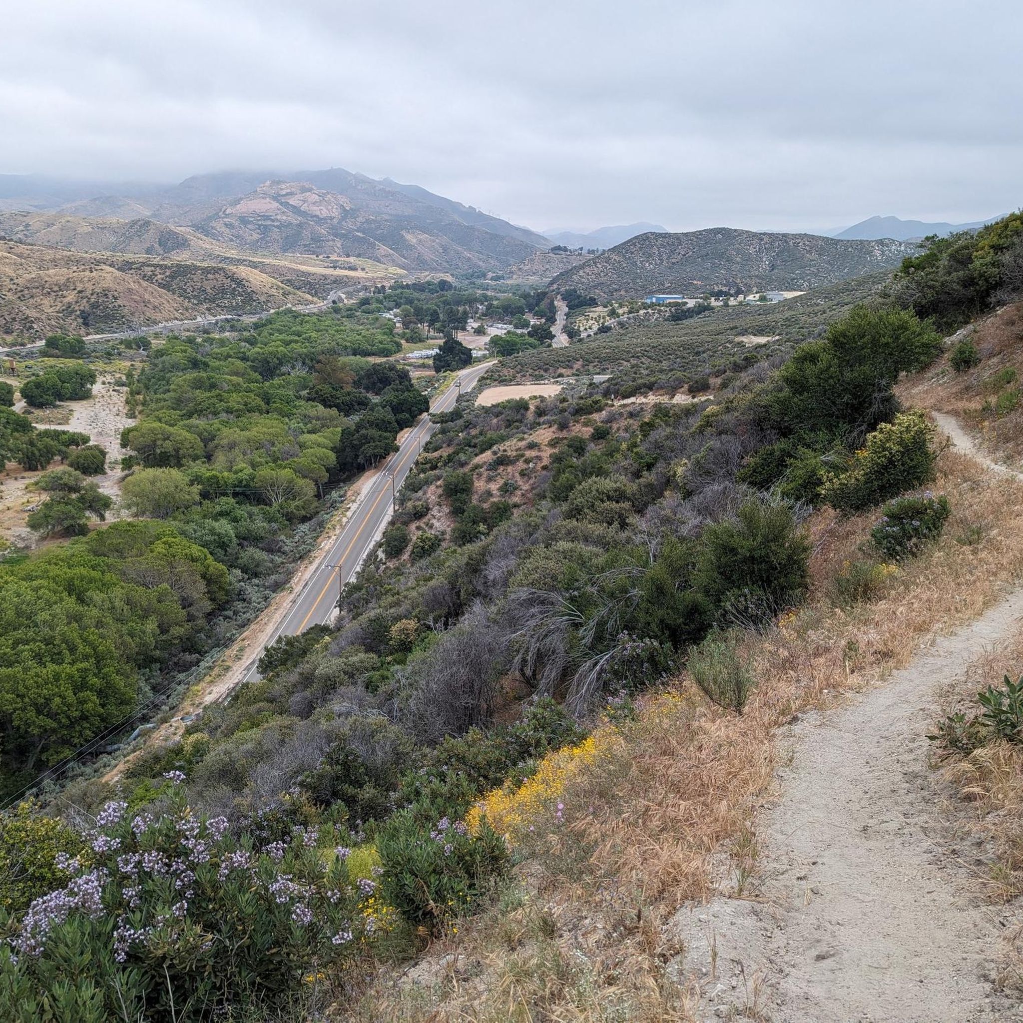
From this spot just off of the San Francisquito Creek Trail in Santa Clarita, CA, you get fantastic open views down the valley across the grasslands and of the powerlines. This is a nice place to stop and sip some water or snap a photo before continuing on your ride.
0
0

The Santa Clara Trail is a really popular path for running, biking, and hiking. It's seen some recent trail maintenance, so a lot of the areas that were facing some erosion problems have been tended to. The trail is basically all uphill one direction and all downhill the other, so it's a great trail if you're ready to get in a workout.
0
0
Frequently Asked Questions
How many touring cycling routes are available in the Magic Mountain Wilderness area?
There are 10 touring cycling routes available in the broader Magic Mountain Wilderness area, encompassing parts of the Angeles National Forest and San Gabriel Mountains National Monument. These routes offer a variety of experiences, from easy river paths to challenging mountain climbs.
Are there any easy touring cycling routes suitable for beginners or families?
Yes, there are easy touring cycling routes available. The Santa Clara River – Santa Clara River loop from Vista Canyon is an easy 17.9-mile (28.8 km) route that follows the scenic Santa Clara River. The West Fork National Scenic Bikeway, though not listed in the top routes, is also known for being a relatively flat, paved route popular with families along the West Fork San Gabriel River.
What kind of terrain can I expect on touring cycling routes in this region?
The terrain varies significantly. You can expect chaparral-covered hillsides at lower elevations, transitioning to mixed pines and hardwoods at higher altitudes. Routes can range from paved river paths, like those along the Santa Clara River, to challenging road cycling routes with significant elevation gains and dramatic views through rugged canyons and mountainous regions. Some segments may be unpaved.
Are there any challenging touring cycling routes for experienced riders?
Absolutely. The region offers several difficult routes for experienced touring cyclists. The Placerita Canyon Trail – MCRA Open Space loop from Placerita Canyon State Park is a challenging 12.9-mile (20.8 km) path with significant elevation gain. Another demanding option is the Little Tujunga Canyon Loop, a 33.3-mile (53.5 km) trail through canyon landscapes, and the Bear Divide – Dillon Divide loop from Via Princessa which features over 1000m of elevation gain.
What are the best times of year for touring cycling in the Magic Mountain Wilderness area?
The best times for touring cycling generally depend on the specific route and elevation. Lower elevation routes can be enjoyed for much of the year, though summer can be very hot. Higher elevation routes in the Angeles National Forest are often best in spring and fall when temperatures are milder and before winter snows might impact accessibility. Always check local weather conditions before heading out.
Are there any circular touring cycling routes in the area?
Yes, many of the touring cycling routes in the Magic Mountain Wilderness area are designed as loops. For example, the popular Santa Clara River – Santa Clara River loop from Vista Canyon and the challenging Little Tujunga Canyon Loop are both circular routes, allowing you to start and end at the same point.
What natural features or landmarks can I expect to see along the touring cycling routes?
The region is rich in natural beauty. You'll encounter diverse vegetation including chaparral, mixed pines, and hardwoods. Rugged, vertical-walled canyons with perennial streams are common. The Santa Clara River itself is a significant natural feature, and some routes offer views of Magic Mountain Peak. The area is also known for its wildlife, including the possibility of spotting California condors.
What do other touring cyclists say about the routes in Magic Mountain Wilderness?
The touring cycling routes in the Magic Mountain Wilderness area are highly rated by the komoot community, with an average score of 4.3 stars from over 4 reviews. Cyclists often praise the diverse terrain, from scenic river paths to challenging mountain climbs, and the stunning vistas found throughout the Angeles National Forest and San Gabriel Mountains National Monument.
Are there any restrictions on where I can cycle in the Magic Mountain Wilderness?
Yes, it's important to note that bicycles are generally not permitted within the designated Magic Mountain Wilderness Area itself. However, the surrounding Angeles National Forest and San Gabriel Mountains National Monument offer extensive cycling routes. Always be aware of wilderness boundaries and yield to hikers and equestrians on shared trails.
Can I find routes that follow rivers or have water features?
Yes, the Santa Clara River is a prominent natural feature in the region, and several routes follow its course. The Santa Clara River – Santa Clara River loop from Vista Canyon is an easy route that directly follows the scenic river. The West Fork National Scenic Bikeway also follows the West Fork San Gabriel River, offering pleasant views of the water and canyon.
Are there any long-distance touring cycling routes in the area?
While the specific routes listed in the guide are generally day trips, the broader Angeles National Forest and San Gabriel Mountains National Monument offer opportunities for longer rides. For example, the Iron Horse Bridge – Santa Clara River loop from Via Princessa is a longer, difficult route at over 40 miles (67 km), providing a more extended touring experience.
What should I consider bringing for a touring cycling trip in this region?
Given the varied terrain and potential for elevation changes, it's advisable to bring plenty of water, especially during warmer months. Sun protection, appropriate cycling gear, a repair kit, and navigation tools are also essential. For longer or more remote routes, consider packing extra food and layers of clothing, as temperatures can change with elevation.
Most popular routes in Magic Mountain Wilderness

Get inspired with the komoot mobile app


