The best running trails in Rock Creek Wilderness
19
runners
3
runs
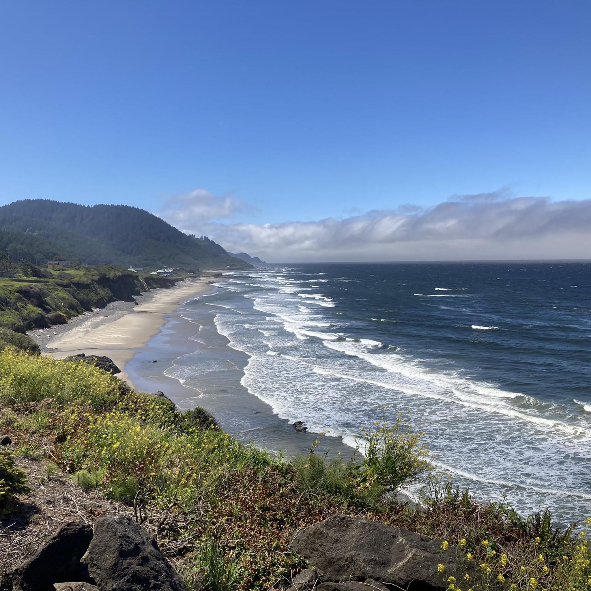
Jogging routes in Rock Creek Wilderness are characterized by a remote and undeveloped natural landscape within the Siuslaw National Forest on the Oregon Coast. The area features rugged topography with steep slopes, dense forests, and thick brush, traversed by Rock Creek and Big Creek. While lacking developed trails, the region offers a challenging environment for experienced runners prepared for cross-country navigation. The landscape includes lush coniferous rainforests with old-growth Douglas-fir and Sitka Spruce, alongside pristine waterways.
Best jogging routes in…
Last updated: July 8, 2026
1
runners
3.92km
00:33
150m
150m
Moderate 2.4-mile jog through coastal forests to the Heceta Head Lighthouse, with 506 feet of elevation gain.
1
runners
6.56km
00:49
90m
90m
Jog the Valley and China Creek Loop Trail, a moderate 4.1-mile route through a mossy Oregon Coast Range forest with diverse wildlife.

Sign up for free
5
runners
20.3km
02:45
680m
680m
Hard run. Very good fitness required. Mostly paved surfaces. Suitable for all skill levels.
10
runners
9.54km
01:19
320m
330m
Challenge yourself on the Cooks Ridge and Gwynn Creek Loop Trail, a difficult 5.9-mile jog through old-growth forests and lush creek-sides.
3
runners
4.84km
00:36
210m
210m
Jog the Saint Perpetua Trail for a moderate 3.0-mile workout with 687 feet of elevation gain and panoramic ocean views.
Our route recommendations are based on thousands of hikes, rides, and runs completed by other people on komoot.
Start today with a free account
Your next adventure awaits.
Login or Signup
Popular around Rock Creek Wilderness
Tips from the Community


Getting to and from Cape Mountain gives you a real feel of being in the middle of a temperate rainforest. Distant views can be obscured by the trees but that's kind of the point, it's real quiet out here and be aware that bears and mountains have been spotted nearby.
0
0

The views are amazing if you take the trail to go a little higher and pass the actual light house.
0
0

Heceta Head Light is a lighthouse on the Oregon Coast. It is located at the Heceta Head Lighthouse State Scenic Viewpoint, a state park, halfway up a 205-foot (62 m) land drive. Built in 1894, the 55-foot (17 m) lighthouse shines a beam visible for 21 nautical miles (39 kilometers; 24 mi), making it the most powerful light on the Oregon Coast.
0
0

On a clear day, observers standing at the crest of Cape Perpetua can see as far as 37 miles (60 km) out to sea.
0
0
A magical trail through otherworldly trees ends in a tunnel of thick shrubbery before opening onto a classic Oregon coast beach.
0
0
Camping and day-use areas are open year round at this state park. Trails through coastal forest lead to miles of sandy ocean beach.
0
0
Heceta Head lighthouse sits 1,056 feet above sea level. Its beacon can be seen by ships up to 21 miles away. Guided tours of the lighthouse grounds and ground floor run from 11 a.m. - 3 p.m. in the summer and 11 a.m. - 2 p.m. in the winter, weather and staff permitting.
1
0
Frequently Asked Questions
How many running routes are available in the Rock Creek Wilderness area?
There are 5 running routes documented on komoot for the Rock Creek Wilderness area. These routes offer a range of experiences, from moderate paths to more challenging trails, catering to different fitness levels.
What is the general terrain like for running in the Rock Creek Wilderness region?
The Rock Creek Wilderness region is characterized by rugged topography, steep slopes, dense forests, and thick brush. While the wilderness itself lacks developed trails, the documented running routes in the surrounding area feature varied terrain. For example, the Cape Mountain loop from Cape Mountain is a difficult route with significant elevation gain, while the Heceta Head Trail is considered moderate.
Are there any challenging running trails for experienced runners?
Yes, for experienced runners seeking a challenge, the Cape Mountain loop from Cape Mountain is a difficult 12.6-mile (20.3 km) route with an elevation gain of 2237 feet (682 meters). Another difficult option is the Cooks Ridge and Gwynn Creek Loop Trail, spanning 5.9 miles (9.5 km) with over 1000 feet (320 meters) of elevation gain.
What kind of natural features can I expect to see while running in this area?
The Rock Creek Wilderness area is known for its lush coniferous rainforests, featuring old-growth Douglas-fir and immense Sitka Spruce. You'll also encounter pristine waterways like Rock Creek and Big Creek, which flow through rainforest canyons. The undergrowth is dense with Salal, Salmonberry, Western Swordfern, and rhododendron, offering a shaded, mossy, and rainforest-like atmosphere.
Are there any circular running routes in the Rock Creek Wilderness region?
Yes, several routes offer a circular experience. The Valley and China Creek Loop Trail is a moderate 4.1-mile (6.6 km) loop. For a longer, more challenging option, consider the Cape Mountain loop from Cape Mountain, which is a 12.6-mile (20.3 km) difficult route. The Cooks Ridge and Gwynn Creek Loop Trail also provides a circular path.
What is the best time of year for running in the Rock Creek Wilderness area?
The climate typically features cool, foggy summers, making it pleasant for running during those months. Winters are largely snow-free, but the dense undergrowth and potentially wet conditions might make some routes more challenging. May brings vibrant pink blooms from the rhododendrons, adding to the scenic beauty.
Is the Rock Creek Wilderness suitable for casual or beginner runners?
The Rock Creek Wilderness itself is profoundly remote and undeveloped, lacking typical trails, and is generally not suitable for casual jogging. However, the surrounding region offers routes like the Heceta Head Trail, which is a moderate 2.4-mile (3.9 km) path, and the Valley and China Creek Loop Trail, a moderate 4.1-mile (6.6 km) route, which might be more accessible for those with some running experience.
What kind of wildlife might I encounter on a run?
The wilderness provides critical habitat for the endangered Oregon silverspot butterfly, particularly on the ridge separating Rock Creek and Big Creek. Evidence of other large forest inhabitants, such as elk, coyote, and bear, has also been observed, indicating a rich biodiversity. Keep an eye out for these animals, especially during quieter times of day.
Are there any specific points of interest or landmarks along the running routes?
While the Rock Creek Wilderness is known for its untamed natural beauty rather than man-made landmarks, the routes often traverse areas with significant natural features. You'll experience dense old-growth forests, pristine creek canyons, and potentially viewpoints offering expansive natural vistas. The Saint Perpetua Trail, for instance, is known for its scenic views.
What makes the Rock Creek Wilderness region unique for running?
The region offers a truly wild and remote experience, appealing to individuals seeking solitude and the challenge of off-trail navigation within the wilderness itself. For those using the documented running routes, the unique blend of lush coniferous rainforests, pristine waterways, and rugged topography provides a distinctive and immersive outdoor running environment.
How long do the running routes typically take to complete?
The duration varies significantly by route and individual pace. For example, the moderate Heceta Head Trail typically takes about 33 minutes. The longer and more challenging Cape Mountain loop from Cape Mountain can take approximately 2 hours and 45 minutes.
Most popular routes in Rock Creek Wilderness

Get inspired with the komoot mobile app


Explore more
Browse the best Running Trails & Routes in other regions.
