The best walks and hikes in Santiam State Forest
4.9
(151)
1,646
hikers
66
hikes
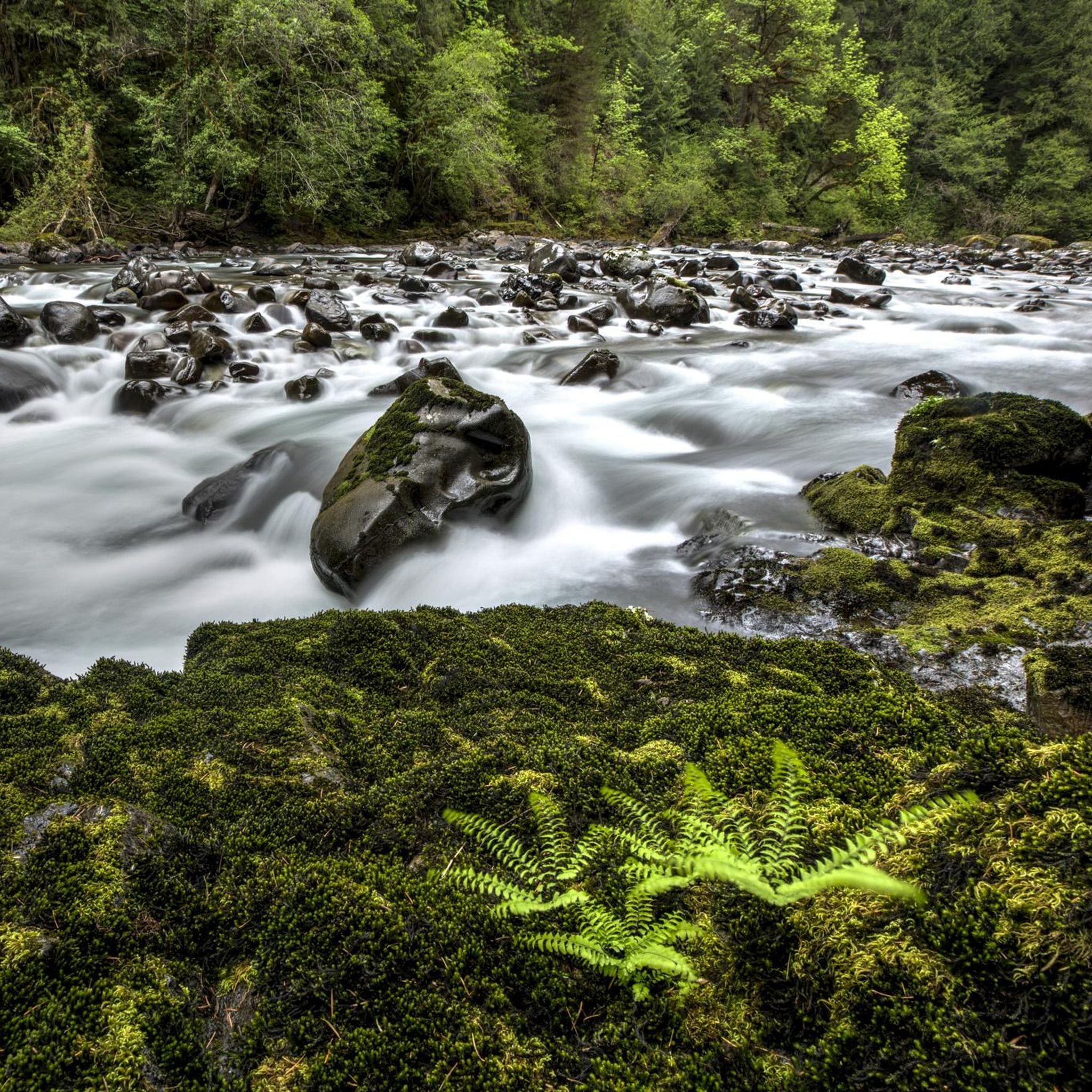
Hiking in Santiam State Forest offers a diverse range of landscapes, characterized by towering old-growth trees, serene waterways, and lush greenery. The forest features numerous waterfalls, including Shellburg Falls and Butte Creek Falls, which are central to many popular hiking routes. Its terrain includes varied ecosystems with Douglas-fir, western hemlock, and cedar trees, alongside rivers and streams like the North Santiam River.
Best hiking trails in Santiam State Forest
- The most popular hiking route is Abiqua Falls Trail — Scotts Mills, a 3.8 miles (6.2 km) trail that takes 2 hours 2 minutes to complete. This difficult path leads to the 92-foot Abiqua Falls.
- Another top favourite among local hikers is Butte Creek Falls Trail loop — Santiam State Forest, an easy 0.7 miles (1.2 km) path. This route winds through old-growth forest to two distinct waterfalls.
- Local hikers also love the Shellburg Falls Trail loop — Santiam State Forest, a 3.2 miles (5.2 km) trail leading through forested areas to the 100-foot Shellburg Falls, often completed in about 1 hour 35 minutes.
- Hiking in Santiam State Forest is defined by its impressive collection of waterfalls, old-growth forests, and tranquil rivers. The extensive trail network offers options for various ability levels, from easy walks to more strenuous hikes.
- The routes in Santiam State Forest are highly rated by the komoot community with an average score of 4.8 stars from over 100 reviews. More than 1,300 hikers have used komoot to explore Santiam State Forest's varied terrain.
Last updated: October 10, 2026
3
hikers
3.14km
00:57
10m
220m
Embark on the Abiqua Falls Trail, a difficult 2.0-mile (3.1 km) hike that leads you through lush evergreen forests. As you navigate the route, you will gain 21 feet (6 metres) in elevation, a journey that typically takes around 57 minutes to complete. The trail culminates at the majestic 92-foot Abiqua Falls, where water plunges into an emerald green pool, surrounded by a dramatic amphitheater of towering hexagonal basalt columns.
Planning your visit requires some preparation, as accessing the trailhead involves driving on a notoriously rough and unpaved road; a high-clearance vehicle is often recommended. The trail is situated on private property, generously opened to the public by the Mt. Angel Abbey, but it is not officially maintained and lacks clear signage. While you can hike here year-round, be aware that winter and spring bring higher water flow to the falls, but also more challenging and hazardous conditions due to mud and slippery sections.
This unique trail offers a glimpse into the geological wonders of the Pacific Northwest, with its distinctive basalt columns forming a natural amphitheater around the waterfall. The combination of dense, moss-covered trees and the powerful cascade creates an almost otherworldly atmosphere. It is a rewarding experience for those prepared for its rugged terrain and the adventure of reaching this hidden gem.
1.69km
00:30
70m
10m
Embark on the Shellberg Falls Trail, an easy 1.1-mile (1.7 km) hike that takes you through a landscape actively recovering from recent wildfires. You will gain 236 feet (72 metres) of elevation over approximately 29 minutes, making it a quick and rewarding outdoor experience. The highlight is the impressive 100-foot Shellburg Falls, where water plunges over a deeply recessed cliff, creating a memorable sight.
When planning your visit, be aware that while the trail is generally easy, some sections can be steep. During wet periods, the path may become muddy and slippery, so sturdy hiking boots are highly recommended for your comfort and safety. The waterfall is most spectacular in spring or after heavy rains; it can reduce to a trickle in late summer, so time your trip accordingly for the best views.
This route offers a unique opportunity to witness nature's resilience, with charred tree trunks standing alongside vibrant new growth and wildflowers. As you hike, you will cross Shellburg Creek on newly constructed footbridges and encounter striking basalt outcroppings that add to the trail's geological interest. Keep an eye out for openings that provide partial views of the majestic Mt. Jefferson.

30
hikers
6.17km
02:02
240m
240m
Embark on the Abiqua Falls Trail, a difficult hike through a thick, lush forest where moss-covered trees and vibrant green canyon walls create a truly immersive Pacific Northwest experience. This rugged path leads you to the spectacular Abiqua Falls, a 92-foot waterfall cascading over dramatic hexagonal basalt columns into a clear pool. The journey covers 3.8 miles (6.2 km) with a significant elevation gain of 783 feet (239 metres), typically taking around 2 hours and 2 minutes to complete. Be prepared for steep, muddy, and potentially slippery sections, which often require ropes for assistance, adding to the adventure.
When planning your visit to Abiqua Falls, consider that the total hike length and elevation gain can vary based on your parking spot. If you have a high-clearance, 4WD vehicle, you can access a lower trailhead for a shorter route. Remember that the trail is located on private property; however, the owners graciously permit public access. It is especially important to be ready for muddy and slippery conditions during wet seasons, as this can make the descent more challenging.
The unique geological formation of Abiqua Falls, with its hexagonal basalt columns, creates a visually striking natural amphitheater that sets it apart. This dramatic backdrop makes the destination truly memorable for hikers seeking a distinctive waterfall experience. The trail offers a deep dive into the region's natural beauty, showcasing the raw, untamed character of western Oregon's wilderness.
1
hikers
1.19km
00:20
30m
30m
The Butte Creek Falls Trail offers a delightful, easy 0.7-mile (1.2 km) loop through a lush, moss-draped old-growth forest in Oregon's Santiam State Forest. You'll experience the serene sound of Butte Creek as you wander past towering Douglas-fir trees, leading to two spectacular waterfalls. The unique Upper Butte Creek Falls allows you to walk behind its curtain, while the Lower Butte Creek Falls plunges an impressive 70-78 feet, making for a truly memorable 20-minute hike with only 90 feet (27 metres) of gentle gain.
To plan your visit, be aware that the drive to the trailhead includes several miles on gravel roads. Dogs are welcome to join you on the trail, provided they are kept on a leash. Spring and early summer are ideal times to hike, offering the best chance to see wildflowers, but always exercise caution near the waterfall viewpoints due to potentially slippery surfaces and sheer drop-offs.
This trail is a prime example of a "low effort to high reward" hike, delivering stunning natural beauty for a relatively short distance. Beyond the main attractions, you might even spot the
5.23km
01:35
180m
170m
Embark on the Shellburg Falls and August Mountain Loop, an easy hiking route spanning 3.2 miles (5.2 km) with an elevation gain of 599 feet (182 metres). You can expect to complete this loop in about 1 hour and 35 minutes. The trail guides you through a forest landscape that is actively recovering from a past wildfire, where you will see charred trees standing alongside vibrant new growth and seasonal wildflowers. A highlight is the impressive 100-foot Shellburg Falls, found within a canyon featuring striking basalt outcroppings.
Planning your visit to this area is straightforward, as the Shellburg Falls Recreation Area welcomes you without any entry fees or passes. If you enjoy hiking with your dog, you will be pleased to know that leashed canine companions are welcome on the trail. For your convenience, you will find picnic areas and restrooms readily available near the trailhead, making it easy to prepare for your hike or relax afterward.
This loop offers a unique perspective on the Santiam State Forest, showcasing its resilience and natural beauty. As you traverse the August Mountain section, you will gain views of the surrounding hills through the recovering tree canopy. The presence of both the main Shellburg Falls and the 40-foot Lower Shellburg Falls, visible from a bridge, adds to the distinctive character of this trail, highlighting the area's geological features and ongoing ecological story.
Get access to more routes and recommendations from other explorers.
Already have an account?
Our route recommendations are based on thousands of hikes, rides, and runs completed by other people on komoot.
Start today with a free account
Your next adventure awaits.
Popular around Santiam State Forest
Tips from the Community

The trail accesses the namesake falls, which is a beautiful 100 ft. tall waterfall, with a large cavern carved out behind it. The falls are formed where Shelburg Creek drops over a basalt ledge into a small, misty pool. This trail is currently scheduled to reopen in the Spring of 2024!
1
0

Abiqua Falls is a stunning 92-foot waterfall in Scott Mills. The waterfall is on private property, but the landowners have graciously allowed people to hike here. Just before the waterfall, there is a steep section with ropes you can hang onto. This hike is best done in dry conditions with durable footwear.
0
0
The Upper Butte Creek Waterfall is unique in the fact that the water is running off of a sort of shelf that allows you to opportunity to walk behind the water.
0
0
This is the lower of the two waterfalls in the area. The trails to get here are in great condition and very scenic as you hike into the valley. There are temporary logging closures on this trail, so please check the status before making the drive out here.
0
0
Frequently Asked Questions
How many hiking trails are available in Santiam State Forest?
Santiam State Forest offers a wide network of trails, with over 50 hiking routes available. These trails cater to various skill levels, from easy walks to more challenging treks, ensuring there's something for everyone.
What kind of terrain and difficulty levels can I expect on hikes in Santiam State Forest?
The terrain in Santiam State Forest is diverse, featuring towering old-growth trees, serene waterways, and lush greenery. You'll find paths ranging from easy, relatively flat walks to more difficult routes with significant elevation changes. For instance, the Abiqua Falls Trail is considered difficult, while the Butte Creek Falls Trail loop is an easy option.
Are there many waterfalls to see in Santiam State Forest?
Yes, Santiam State Forest is renowned for its stunning waterfalls. Key attractions include Shellburg Falls, a 100-foot waterfall with trails leading behind it, and Butte Creek Falls, which features both upper and lower cascades. Abiqua Falls and Stasel Falls are also notable, offering impressive natural beauty.
What are some notable viewpoints or natural landmarks in the forest?
Beyond the numerous waterfalls, hikers can seek out panoramic views from the summit of Rocky Top, which offers spectacular sights of Mount Jefferson, Three Sisters, and Three-Fingered Jack on clear days. The forest itself is a landmark, with diverse ecosystems featuring old-growth Douglas-fir, western hemlock, and cedar trees, and serene waterways like the North Santiam River.
Are there family-friendly hiking options in Santiam State Forest?
Absolutely. Many trails in Santiam State Forest are suitable for families. Easy paths like the Butte Creek Falls Trail loop, which is less than a mile long and leads to two waterfalls, are perfect for all ages. These routes often wind through peaceful old-growth groves, providing an accessible natural experience.
Can I bring my dog on the trails in Santiam State Forest?
Yes, dogs are generally welcome on trails in Santiam State Forest. However, it's always best to keep them on a leash and ensure you follow all local regulations and leave no trace principles to protect the wildlife and natural environment.
Are there any good circular hiking routes in the area?
Yes, Santiam State Forest offers several excellent circular routes. The Shellburg Falls Trail loop is a popular 3.2-mile option that takes you through forested areas to the impressive 100-foot Shellburg Falls. Another great loop is the Bobblehead Trail to Lost Creek Trail loop, offering a pleasant walk through the forest.
What is the best time of year to hike in Santiam State Forest?
The best time to hike in Santiam State Forest is typically during the spring, summer, and fall months. Spring brings lush greenery and wildflowers, while summer offers warm, sunny days ideal for exploring. Fall showcases vibrant foliage. Some trails may be accessible in winter, but conditions can be wet or snowy, especially at higher elevations.
What do other hikers enjoy the most about hiking in Santiam State Forest?
The area is highly rated by the komoot community, with an average score of 4.8 stars from over 100 reviews. Hikers often praise the impressive collection of waterfalls, the tranquility of the old-growth forests, and the diverse trail network that caters to various ability levels.
Is parking available at the trailheads in Santiam State Forest?
Yes, parking is generally available at the main trailheads and recreation areas within Santiam State Forest. It's advisable to arrive early during peak seasons to secure a spot, especially at popular locations like Shellburg Falls Recreation Area or Butte Creek Falls.
Are there opportunities for wildlife spotting in Santiam State Forest?
The diverse habitats of Santiam State Forest support abundant wildlife. Hikers often have opportunities to spot deer and various bird species. The serene waterways and high elevation lakes within the Butte Creek Basin also provide important habitats for local fauna.
Are there any permits required for hiking in Santiam State Forest?
Generally, day-use hiking in Santiam State Forest does not require specific permits. However, it's always a good practice to check the official Oregon Department of Forestry website or local signage for any updated regulations or specific requirements for certain areas or activities, especially if you plan to camp or engage in other recreational pursuits.
Most popular routes in Santiam State Forest
Most popular attractions in Santiam State Forest

Get inspired with the komoot mobile app


Explore more
Browse the best Hikes in other regions.
