The best MTB trails around Ardler
4.0
(12)
79
riders
27
rides
Mountain biking around Ardler offers a variety of terrain, characterized by rolling hills, reservoirs, and woodlands. The region features a mix of open landscapes and forested paths, providing diverse riding experiences. Elevation changes are generally moderate, with some routes including climbs to local viewpoints. The area's geography supports both leisurely rides and more challenging mountain bike trails.
Best mountain bike trails around Ardler
- The most popular mountain bike trail is Clatto Reservoir loop from Bridgefoot, a 5.7 miles (9.2 km) trail that takes 44 minutes to complete. This route offers views of the reservoir and surrounding countryside.
- Another top favourite among local mountain bikers is Craigowl Hill Summit – View of Strathmore Valley loop from Balluderon Stone, a moderate 7.6 miles (12.2 km) path. This trail features climbs to a summit with expansive valley views.
- Local mountain bikers also love the Tiso Outdoor Store Dundee – Templeton Woods loop from Dundee, a 19.6 miles (31.5 km) trail leading through varied urban and woodland landscapes, often completed in about 2 hours 20 minutes.
- Mountain biking around Ardler is defined by local hills, reservoirs, and dense woodlands. The network offers options for different ability levels, from easy loops to more challenging routes with significant elevation gain.
- The routes in Ardler are highly rated by the komoot community with an average score of 4.1 stars from more than 10 reviews. More than 80 mountain bikers have used komoot to explore Ardler's varied terrain.
Last updated: June 24, 2026
3.0
(1)
7
riders
8.35km
00:40
90m
90m
Moderate mountain bike ride. Great for any fitness level. Advanced riding skills necessary.
4.0
(1)
6
riders
Moderate mountain bike ride. Good fitness required. Advanced riding skills necessary.

Sign up for free
3.0
(1)
3
riders
31.5km
02:19
540m
540m
Moderate mountain bike ride. Good fitness required. Advanced riding skills necessary.
1
riders
23.0km
01:37
290m
290m
Moderate mountain bike ride. Great for any fitness level. Advanced riding skills necessary.
5
riders
29.7km
01:35
100m
100m
Easy mountain bike ride. Great for any fitness level. Suitable for all skill levels.
Get access to more routes and recommendations from other explorers.
Sign up for free
Already have an account?
Our route recommendations are based on thousands of hikes, rides, and runs completed by other people on komoot.
Start today with a free account
Your next adventure awaits.
Login or Signup
Tips from the Community


The V&A Dundee is the first design museum in Scotland and the first Victoria and Albert Museum outside London. It is also the first building in the United Kingdom designed by Japanese architect Kengo Kuma. It is open daily from 10 a.m. to 5 p.m., closed on Tuesdays from November to March. Admission is free. More information: https://www.vam.ac.uk/dundee
0
0


Kingoodie is a small settlement on the north bank of the Firth of Tay. The village was once an important harbour for the nearby quarries. NCN77 follows the coastal road here. This route is known as the Salmon Run, starting at Tay Bridge, Dundee and riding inland up the Tay to Pitlochry.
0
0

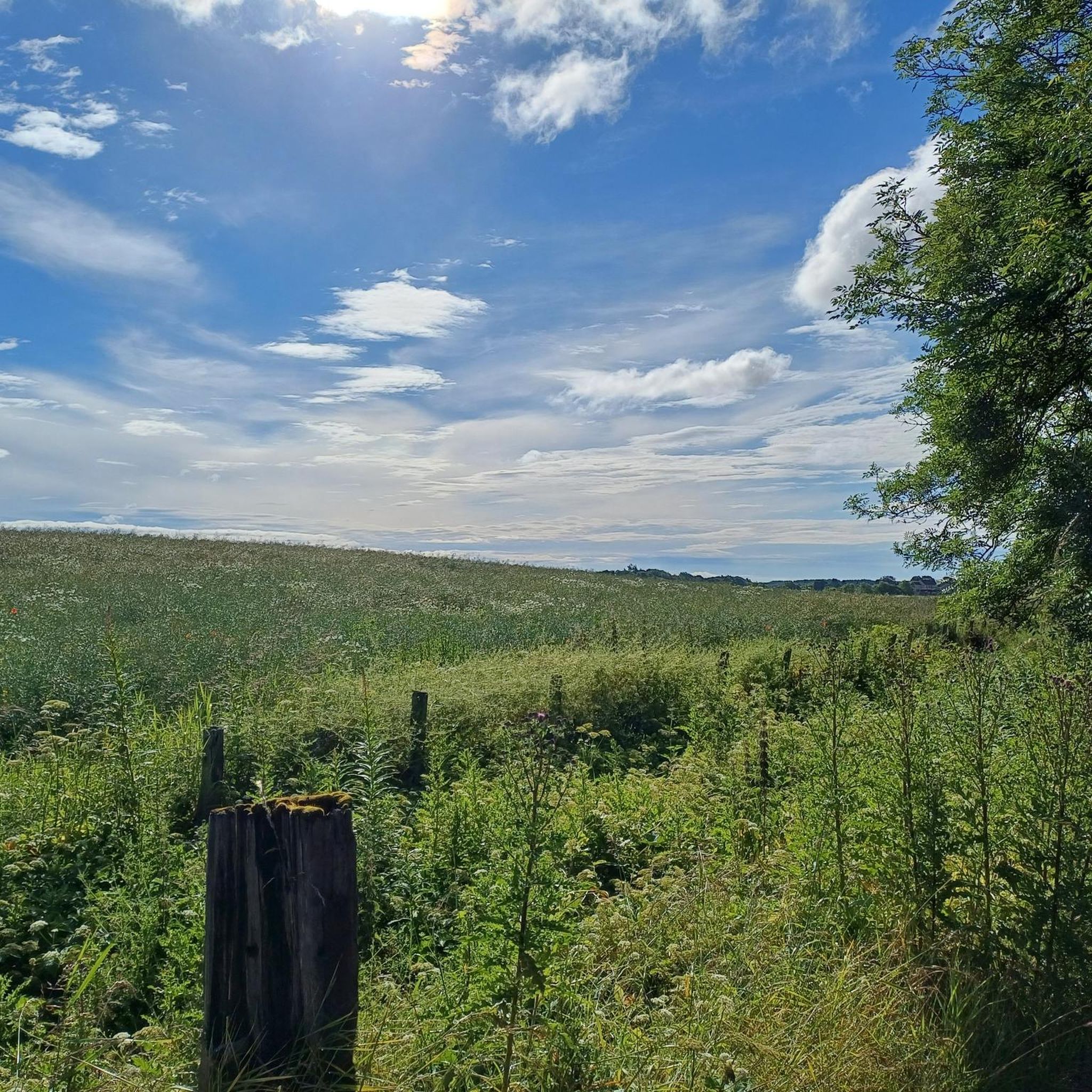
It wasnt a Mountain Bike , it was a hybrid, A Carerra Crossfire 2. It is a good route despite two stars. From Rosemill to Dronley that is usually the enjoyable bit for me, although its gettinv quite overgrown now with Hogweed, some of the track has been impacted by the winter flooding and there are worn channels on the path. other than that i quite enjoy the route. i was away to do the next stretch beyond the Dronley Car Park, but too much hogweed groeing across the gravel track, i turned aboot and went back onto the road taking me to Birkhill. it was a nice night, pretty windy, thankfully going up the Dronley Road It was sheltered. It was good to get out though, Just what the doctor ordered (and Ive not been to the Doctors, figure of speech 🤣) 👍
0
0

A plentiful supply and mix of dirt and gravel paths and tracks.
0
0
For Trail MTB explorers on an adventure. A selection of dirt tracks and paths through and around this community wood. There's a free car park at the northwest corner with an information board. After rain, there's plenty of mud for entertainment. If required, there's easy access south and west to the excellent path on the former Dundee and Newtyle Railway track.
0
0
In March 2024, the main track through the woods was well and truly blocked by fallen trees.
0
0
Frequently Asked Questions
How many mountain bike trails are there around Ardler?
There are over 30 mountain bike trails around Ardler listed on komoot, offering a variety of experiences across rolling hills, reservoirs, and woodlands.
Are there easy mountain bike trails suitable for beginners in Ardler?
Yes, Ardler offers several easy mountain bike trails perfect for beginners. For example, the Kingoodie Bay – View of the Tay Bridges loop from Invergowrie is an easy 18.5-mile (29.7 km) route that provides gentle terrain and scenic views without significant climbs.
What about more challenging mountain bike routes for experienced riders?
For experienced riders seeking a challenge, Ardler has routes with more significant elevation gain. The Craigowl Hill Summit – View of Strathmore Valley loop from Balluderon Stone is a moderate 7.6-mile (12.2 km) path featuring climbs to a summit with expansive valley views. There are 2 difficult routes among the 31 available.
Can I find circular mountain bike routes in Ardler?
Many of the mountain bike trails around Ardler are circular, allowing you to start and finish at the same point. An example is the Clatto Reservoir loop from Bridgefoot, a 5.7-mile (9.2 km) trail offering views of the reservoir and surrounding countryside.
Are there mountain bike trails suitable for families with children?
Yes, the region has easy routes that are suitable for families. These trails often feature less challenging terrain and shorter distances, allowing for a relaxed outing. Look for routes marked as 'easy' on komoot for the most family-friendly options.
Are dogs allowed on the mountain bike trails around Ardler?
Generally, dogs are welcome on mountain bike trails in the Ardler area, especially on public rights of way. However, it's always best to keep them under control, particularly near livestock or in nature reserves. Some trails may have specific signage regarding dogs, so pay attention to local notices.
What kind of views or landmarks can I expect to see on the trails?
Mountain biking around Ardler offers diverse scenery, including views of reservoirs, woodlands, and open landscapes. You can also encounter notable landmarks and viewpoints. For instance, the Craigowl Hill Summit offers panoramic views, and you might pass historical sites like Kinpurney Tower or Dundee Law Summit and War Memorial.
What is the typical duration of mountain bike rides in Ardler?
The duration of mountain bike rides in Ardler varies significantly depending on the route's length and your pace. Shorter, easy loops like the Clatto Reservoir loop from Bridgefoot can take under an hour, while longer routes such as the View of the Sidlaw Hills – Templeton Woods loop from Ardler (14.2 miles / 22.9 km) might take around 1 hour 35 minutes to complete.
When is the best time of year to go mountain biking in Ardler?
The best time for mountain biking in Ardler is typically from spring through autumn (April to October) when the weather is milder and trails are drier. While some trails are accessible year-round, winter conditions can make paths muddy or icy, especially at higher elevations.
What do other mountain bikers say about the trails in Ardler?
The mountain bike trails around Ardler are highly rated by the komoot community, with an average score of 4.1 stars from more than 10 reviews. Riders often praise the varied terrain, from open landscapes to forested paths, and the options available for different ability levels.
Are there any mountain bike trails that include pub stops or places to eat?
While specific pub stops are not always directly on the trails, many routes pass near villages or towns where you can find places to eat and drink. Planning your route with komoot allows you to identify nearby amenities and integrate them into your ride.
Where can I park when mountain biking in Ardler?
Parking availability varies by trailhead. Many popular starting points for mountain bike routes around Ardler, especially those near villages or recreational areas, offer designated parking. It's advisable to check the route details on komoot for specific parking information for your chosen trail.
Most popular attractions around Ardler

Get inspired with the komoot mobile app


Explore more
Browse the best MTB trails in other regions.
