The best cycling routes in the Grand Mesa
121
riders
22
rides
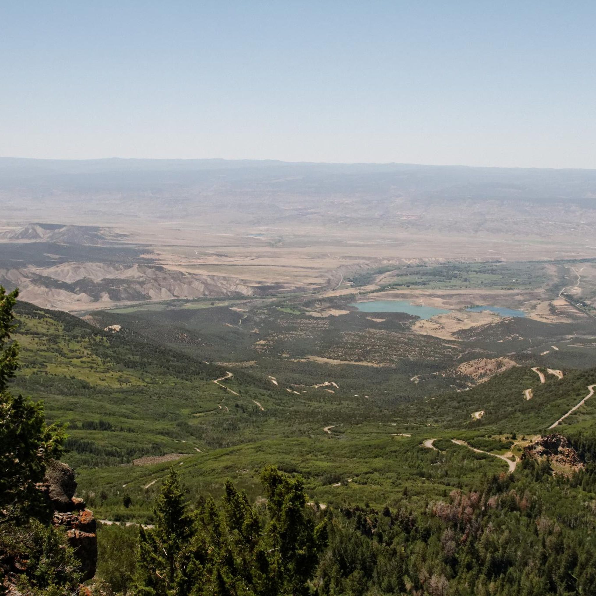
Touring cycling in the Grand Mesa offers routes across the world's largest flat-top mountain, characterized by its expansive plateau formed by ancient volcanic activity. The region features over 300 alpine lakes nestled within lush aspen and pine forests, providing picturesque views and diverse ecosystems. Cyclists can experience a range of landscapes, from desert sandstone canyons at its base to cool evergreen forests at higher elevations, with panoramic views extending across the Grand Valley. This unique geology and varied terrain make it a distinct destination for touring cyclists.
Best touring cycling routes in the Grand Mesa
- The most popular touring cycling route is Fruit and Wine Byway - East Orchard Loop, a 18.8 miles (30.3 km) trail that takes 1 hour 51 minutes to complete. This moderate route offers panoramic views of the Grand Valley and local vineyards.
- Another top favourite among local touring cyclists is Lands End Road, a difficult 23.3 miles (37.6 km) path. This route features significant elevation gain and leads to expansive vistas from Lands End Observatory.
- Local touring cyclists also love the Vega Reservoir Loop, a 7.1 miles (11.5 km) trail leading through areas near Vega Reservoir, often completed in about 42 minutes.
- Touring cycling in the Grand Mesa is defined by its flat-top mountain plateaus, abundant alpine lakes, and dense forests. The network offers options for different ability levels, from easy loops to challenging climbs.
- The guide includes highly-rated routes that showcase the best of the region's landscape. More than 80 touring cyclists have used komoot to explore Grand Mesa's varied terrain.
Last updated: August 31, 2026
14
riders
30.3km
01:52
160m
160m
Embark on the Fruit and Wine Byway - East Orchard Loop for a moderate touring cycling adventure. This route spans 18.8 miles (30.3 km) and includes a total elevation gain of 528 feet (161 metres), taking about 1 hour and 51 minutes to complete. You will experience a notable climb to a mesa, offering expansive panoramic views of the Grand Valley and its surrounding mesas. As you cycle, the trail winds through picturesque lavender fields, vibrant peach orchards, and numerous vineyards, truly immersing you in Colorado's wine country. Keep an eye out for the rugged beauty of the Colorado National Monument visible from James M. Robb Colorado River State Park.
When planning your ride, be aware that the route includes a vigorous climb to the mesa, which can last around 10 minutes. For this steep section, a dedicated bike sidewalk is available, providing a safer option away from traffic and a chance to rest. Due to several hills encountered throughout the ride, this loop is generally less suitable for young children unless they are comfortably in a bike trailer. Always check local conditions before you head out.
This particular loop is known as the most challenging of the Fruit and Wine Byway routes, offering a rewarding experience for cyclists seeking a bit more effort. It stands out for its significant elevation changes compared to other segments of the byway. The trail is part of the broader network that highlights Colorado's vibrant agricultural landscape, particularly its fruit-growing and wine-producing regions. You will find yourself surrounded by the natural beauty and agricultural heritage of the area.
14
riders
87.2km
05:11
650m
650m
Embark on the Fruit and Wine Byway Loop, a difficult touring bicycle route that promises a rewarding challenge. This 54.2-mile (87.2 km) journey involves a significant 2144 feet (653 metres) of elevation gain, typically taking around 5 hours and 11 minutes to complete. As you cycle, you'll discover a landscape often likened to Tuscany in the Rockies, with fragrant lavender fields, lush peach orchards, and sprawling vineyards. The dramatic Book Cliffs loom in the distance, providing a constant visual anchor while you follow the winding path of the Colorado River.
To best enjoy this touring bicycle adventure, plan your visit between August and late September, which coincides with the local peach season and numerous wine events. Spring and Fall also offer pleasant conditions, helping you avoid the intense summer heat that can push temperatures into the upper 90s. Be aware that the Byway is open to vehicular traffic; always prioritize your safety by wearing a helmet and riding in a single file.
This route offers a unique blend of agricultural beauty and high desert scenery, making it a standout experience in the region. You will find many farm stands along the way, perfect for picking up fresh local produce and sampling regional wines. The Fruit and Wine Byway Loop provides a deep dive into the vibrant agricultural heartland of Palisade, offering a memorable touring bicycle experience.

Sign up for free
8
riders
37.6km
04:10
1,050m
1,050m
Embark on the challenging Lands End Road touring bicycle route, a difficult journey spanning 23.3 miles (37.6 km) with a significant elevation gain of 3431 feet (1046 metres). As you pedal, you will witness the landscape transform from arid sagebrush to dense cedar and pine forests, offering a dynamic visual experience. This demanding ride typically takes around 4 hours and 10 minutes to complete, rewarding you with expansive views as you climb towards the Lands End Overlook.
Before you set out, be aware that the route offers no services like restrooms, water, or refueling stations, so you must be self-sufficient. The road is also known for its minimal shade, making sun protection essential, especially during warmer months. Keep in mind that Lands End Road is subject to seasonal closure due to snow, typically from December 1st to May 1st, so plan your visit accordingly to avoid disappointment.
The route is a highlight within Grand Mesa National Forest, renowned for its dramatic geological features and diverse ecosystems. From the Lands End Overlook, you can gaze upon distant landmarks such as the La Sal Mountains in Utah, the Colorado National Monument, and the vast Gunnison and Grand River valleys. Higher elevations of the mesa are adorned with vibrant wildflower meadows and thick pine forests, showcasing the region's natural beauty and making this a truly unique touring experience.
3
riders
22.4km
02:00
350m
350m
The Baron Lake Drive to Lakeshore Drive loop offers a delightful touring cycling experience through the heart of Grand Mesa National Forest. You'll pedal past the tranquil waters of Baron Lake and Eggleston Lake, winding through vibrant aspen and pine forests that give way to alpine meadows dotted with wildflowers. It's a largely paved route, making it a comfortable ride for most, though some sections might have narrower shoulders.
Planning your ride? Summer is prime time for this route, showcasing the Grand Mesa's natural beauty at its peak, but spring and fall offer their own charm; just be sure to check for snow conditions. You won't need permits or to pay fees for day use, but packing insect repellent is a smart move, especially near the lakes. This is a family-friendly option, but keep dogs leashed.
This moderate 13.9-mile (22.4 km) loop, with 1156 feet (352 metres) of elevation gain, typically takes around 1 hour and 59 minutes. It's a fantastic way to experience the unique geological scenery of the Grand Mesa, the world's largest flat-topped mountain, with common wildlife sightings like deer in the mornings and evenings.
4
riders
67.0km
04:24
780m
780m
The Red Canyon loop is a difficult 41.7-mile touring cycling route near Glenwood Springs, featuring 2554 feet of elevation gain.
2
riders
17.5km
01:01
90m
90m
Embark on an easy touring bicycle ride along the Fruit and Wine Byway - East Orchard Loop, a route that offers inspiring views of the Grand Valley and surrounding mesas. As you cycle, you will pass vibrant lavender fields and lush peach orchards, experiencing the rugged beauty of the high desert. This pleasant loop covers 10.9 miles (17.5 km) with a gentle elevation gain of 296 feet (90 metres), making it suitable for a relaxed outing. You can expect to complete the ride in about 1 hour and 1 minute, enjoying glimpses of award-winning Colorado wineries and numerous fruit stands along the way. In spring, especially mid-April, the fruit trees burst into a dazzling display of white and rose-tinted blooms, adding to the scenic charm.
When planning your visit, be aware that the roads on this loop are open to vehicles, so always practice proper biking etiquette, stay visible, and wear a helmet for your safety. The best time to experience the Fruit and Wine Byway is typically from August through late September, when peaches and other local fruits are in season and readily available at roadside stands. If you prefer a less strenuous ride, electric bikes are available for rent in the area, offering an easier way to explore the byway. Consider starting your ride in the morning to enjoy cooler temperatures and fewer cars on the road. This ensures a more comfortable and enjoyable touring cycling experience.
The Fruit and Wine Byway - East Orchard Loop is situated within the Tillman Bishop State Wildlife Area, offering a unique blend of agricultural landscapes and natural beauty. The region is renowned for its fertile Grand Valley, which supports a thriving fruit industry, particularly peaches, and a growing number of Colorado wineries. This route provides a wonderful opportunity to connect with the local agricultural heritage and enjoy the scenic backdrop of the high desert. You can combine your ride with visits to local farm stands for fresh produce or stop at a winery for a tasting, making it a truly immersive experience.
2
riders
25.0km
02:18
250m
250m
Flowing Park Road offers a truly scenic touring cycling experience high on the Grand Mesa, where you'll pedal through expansive meadows, dense aspen groves, and serene pine forests. The route provides continuous, breathtaking views overlooking Grand Junction, Delta, and Cedaredge, with distant glimpses of the La Sal Mountains and Sneffels. You'll also pass by the picturesque Flowing Park Reservoir, making for a visually rich journey.
This moderate 15.5-mile (25.0 km) cycling route involves 807 feet (246 metres) of elevation gain and typically takes about 2 hours and 17 minutes. The initial section is gravel, but it quickly transitions to a rougher dirt road, so be prepared for varied terrain. Given the high altitude, ranging up to 10,192 feet, it's wise to be acclimatized and carry plenty of water. Cell service is unreliable, so download maps and let someone know your itinerary.
Located within the Grand Mesa National Forest, this route is a fantastic way to experience the unique high-altitude ecosystem of Colorado. While the road itself is suitable for touring bicycles, it also serves as an access point to more challenging mountain biking trails, so ensure you stick to the main Flowing Park Road if you're on a touring bike. The area is known for its vibrant fall colors and abundant wildflowers in spring and summer, making it a seasonal favorite.
2
riders
11.5km
00:42
80m
80m
Embark on an easy touring bicycle ride around the Vega Reservoir Loop, a pleasant route that takes you through scenic meadows and aspen-covered slopes. You will cover 7.2 miles (11.5 km) with a gentle elevation gain of 251 feet (76 metres), making it a relaxed experience that typically takes about 42 minutes to complete. Look forward to beautiful views of the large alpine lake, especially from the Vega State Park Lake View highlight, which offers a serene high-mountain reservoir atmosphere.
When planning your visit, remember that the Vega Reservoir Loop primarily uses paved and gravel roads within Vega State Park. While specific cycling permits are not usually required, state parks often have entrance fees, so be prepared for that. The park also provides options for year-round camping and rustic cabins if you wish to extend your stay and explore more of the area.
This route is set at a high elevation of 8,000 feet, contributing to its unique alpine environment. As you cycle, keep an eye out for local wildlife such as marmots, chipmunks, and even larger animals like moose or bears. The seasonal changes bring vibrant colors to the aspen trees, making it a particularly picturesque ride during those times.
2
riders
43.9km
02:44
510m
510m
This difficult 27.3-mile touring cycling loop in Rifle Gap State Park offers challenging climbs and scenic views of Rifle Gap Reservoir.
2
riders
34.5km
03:03
890m
890m
The State Highway via Old Grand Mesa Road loop is a truly memorable touring cycling experience, taking you from arid desert landscapes up through lush aspen and pine forests to the high alpine meadows of Grand Mesa. As you ascend, you'll pass numerous alpine lakes, including the picturesque Baron Lake, and be treated to panoramic views that stretch for miles. This route offers a diverse terrain mix, from smooth pavement on State Highway 65 to the more rugged dirt of Old Grand Mesa Road, providing a varied and engaging ride.
Planning your visit requires careful consideration due to the route's challenging nature and high-altitude environment. The best time to tackle this loop is typically from late spring to early fall, when the weather is most favorable, though conditions can change quickly at elevation. Be prepared for remote sections with limited services; carrying ample water and food is crucial. While specific parking details aren't always highlighted, starting points for Grand Mesa cycling routes often include areas near Ward Lake Campground or other access points along the Scenic Byway.
This challenging bike route on Grand Mesa, Colorado, is notable for traversing the world's largest flat-top mountain, a designated National Scenic Byway. The sheer scale of the Grand Mesa and its unique geology make for a spectacular backdrop to your ride, with over 300 alpine lakes dotting the plateau. The significant elevation gain of 2921 feet (890 metres) over 21.4 miles (34.5 km) in about 3 hours and 2 minutes makes this a difficult undertaking, but the scenic overlooks and natural beauty are an incredible reward.
Get access to more routes and recommendations from other explorers.
Sign up for free
Already have an account?
Our route recommendations are based on thousands of hikes, rides, and runs completed by other people on komoot.
Start today with a free account
Your next adventure awaits.
Login or Signup
Other adventures in the Grand Mesa

Tips from the Community

This 350-acre reservoir is part of Rifle Gap State Park and provides some of Colorado's best boating, fishing, swimming and windsurfing. There is also a campground along the northern shore of the reservoir.
0
0
This one-room schoolhouse was used from 1888 to 1947. Originally called Coulter Creek School, but more recently referred to as the Upper Cattle Creek Schoolhouse. It makes for a great photo opportunity as you ride by.
0
0
Carbondale is a picturesque town located at the base of Mt. Sopris and confluence of the Crystal and Roaring Fork Rivers. National Geographic Adventure Magazine has ranked it as one of "The Top 10 Adventure Towns in the U.S.", so there is no shortage of outdoor activities. It is also a "Certified Colorado Creative District", so it has a vibrant art scene as well.
0
0

Ward Lake is surrounded by prime fishing spots, campgrounds, and a few restrooms. Misquitos tend to not stick around here compared to other lowly areas which is always a bonus!
0
0
Flowing Park Reservior is located in a prarie of sorts with sporadic tree clusters. If you wonder off just east from the water, there is a large cliff with stunning views. In these parts, cycling, hiking, and horseback riding are the top tire activities.
0
0
Barron Lake is surrounded by trails and a thick green apron of trees. There are some grassy shores if you want to enjoy a picnic!
0
0
Eggleston Lake is open year round and is a prime angler destination. This massive lake, surrounded by other great lakes, has still water and a treelined shore. Swimming is allowed here, so makes a great escape from the summer heat!
0
0
Vega is a large state park surrounding a vast alpine lake. Top attractions are boating, fishing, and the rustic cabins available for rent year round. While swimming is not allowed, you can still enjoy the views and utilize one of the many covered picnic spots available.
0
0
Frequently Asked Questions
How many touring cycling routes are available in the Grand Mesa?
The Grand Mesa offers a diverse selection of over 20 touring cycling routes. These routes cater to various skill levels, from easy loops to challenging climbs, allowing you to explore the world's largest flat-top mountain.
What kind of terrain can I expect on touring cycling routes in the Grand Mesa?
You'll encounter a remarkable range of terrain. Routes can take you from desert sandstone canyons at the base to cool evergreen forests at higher elevations. The defining characteristic is the expansive plateau, with many routes winding through lush aspen and pine forests, past alpine lakes, and offering panoramic views. Some routes, like the Grand Mesa Scenic and Historic Byway, feature significant climbs, while others, such as the Plateau Valley road ride, follow rivers through stunning canyons.
Are there touring cycling routes suitable for beginners in the Grand Mesa?
Yes, the Grand Mesa has several easy touring cycling routes perfect for beginners. For example, the Vega Reservoir Loop is a relatively short 7.1-mile (11.5 km) trail that leads through scenic areas near Vega Reservoir, often completed in about 42 minutes. Another easy option is the Fruit and Wine Byway - East Orchard Loop, which is 10.8 miles (17.5 km) long.
When is the best time of year for touring cycling in the Grand Mesa?
The Grand Mesa is an ideal summer cycling spot due to its cooler temperatures compared to the surrounding valleys, as it sits over 10,000 feet above sea level. Fall is also spectacular, with vibrant golden aspens contrasting against dark green pines, offering picturesque views. Always check local weather conditions before heading out, especially for higher elevations.
What are some challenging touring cycling routes for experienced riders?
For experienced riders seeking a challenge, the Grand Mesa offers routes with significant elevation gains. The Lands End Road is a difficult 23.3-mile (37.6 km) path featuring substantial elevation gain and leading to expansive vistas from Lands End Observatory. Another demanding option is the State Highway via Old Grand Mesa Road loop, a difficult 21.4-mile (34.5 km) route with challenging climbs and alpine scenery.
Are there family-friendly touring cycling routes in the Grand Mesa?
Yes, the Grand Mesa has several easy routes that are suitable for families. The Vega Reservoir Loop is a great choice, offering a relatively flat and scenic ride around the reservoir. These easier routes allow families to enjoy the natural beauty without overly strenuous climbs.
What natural features and landmarks can I see along the touring cycling routes?
The Grand Mesa is rich in natural beauty. You can expect to see over 300 alpine lakes, lush aspen and pine forests, and panoramic views of the Grand Valley. Specific highlights include Mesa Lake, Corn Lake, and Lost Lake. The Grand Mesa Scenic and Historic Byway itself is a major landmark, offering continuous vistas and geological formations. From viewpoints like Lands End Observatory, you can see distant mountain ranges like the La Sal Mountains of Utah.
Are there any circular touring cycling routes in the Grand Mesa?
Yes, many touring cycling routes in the Grand Mesa are designed as loops, offering a varied experience without retracing your path. Examples include the Fruit and Wine Byway Loop, a difficult 54.2-mile (87.2 km) route, and the Red Canyon loop, a difficult 41.6-mile (67 km) ride. The Baron Lake Drive to Lakeshore Drive loop is another moderate option.
Where can I find parking for touring cycling routes in the Grand Mesa?
Parking is generally available at various access points and trailheads throughout the Grand Mesa National Forest. For routes like those along the Grand Mesa Scenic and Historic Byway, designated parking areas and visitor centers can be found. Towns like Mesa and Cedaredge, which some routes pass through, also offer parking options. Specific parking details often accompany individual route descriptions.
What wildlife might I encounter while cycling in the Grand Mesa?
The Grand Mesa is teeming with wildlife, so keep an eye out! You might spot moose, deer, and elk, especially in the quieter, forested areas. The abundant lakes also attract various bird species. Observing wildlife adds to the natural allure of cycling through this unique environment.
Are there places to stop for food or water along the routes?
Yes, along many routes, you'll find opportunities for breaks and amenities. Cobbett Lake, for instance, offers campground amenities. Additionally, towns such as Mesa and Cedaredge, which are often part of or near touring cycling routes, provide options for food, water, and other supplies. It's always advisable to carry sufficient water and snacks, especially on longer or more remote sections.
What do other touring cyclists enjoy most about touring cycling in the Grand Mesa?
The komoot community frequently praises the Grand Mesa for its unique geology, diverse natural landscapes, and the refreshing escape it offers with cooler temperatures. Cyclists particularly enjoy the panoramic views, the abundance of alpine lakes, and the lush aspen and pine forests. The variety of routes, from challenging climbs to scenic, leisurely rides, also receives high marks, allowing riders of all levels to find an enjoyable experience.
Most popular routes in the Grand Mesa
Most popular attractions in the Grand Mesa

Get inspired with the komoot mobile app


Explore more
Browse the best Cycling routes in other regions.
