The best walks and hikes around Grüsch
4.5
(301)
2,678
hikers
30
hikes
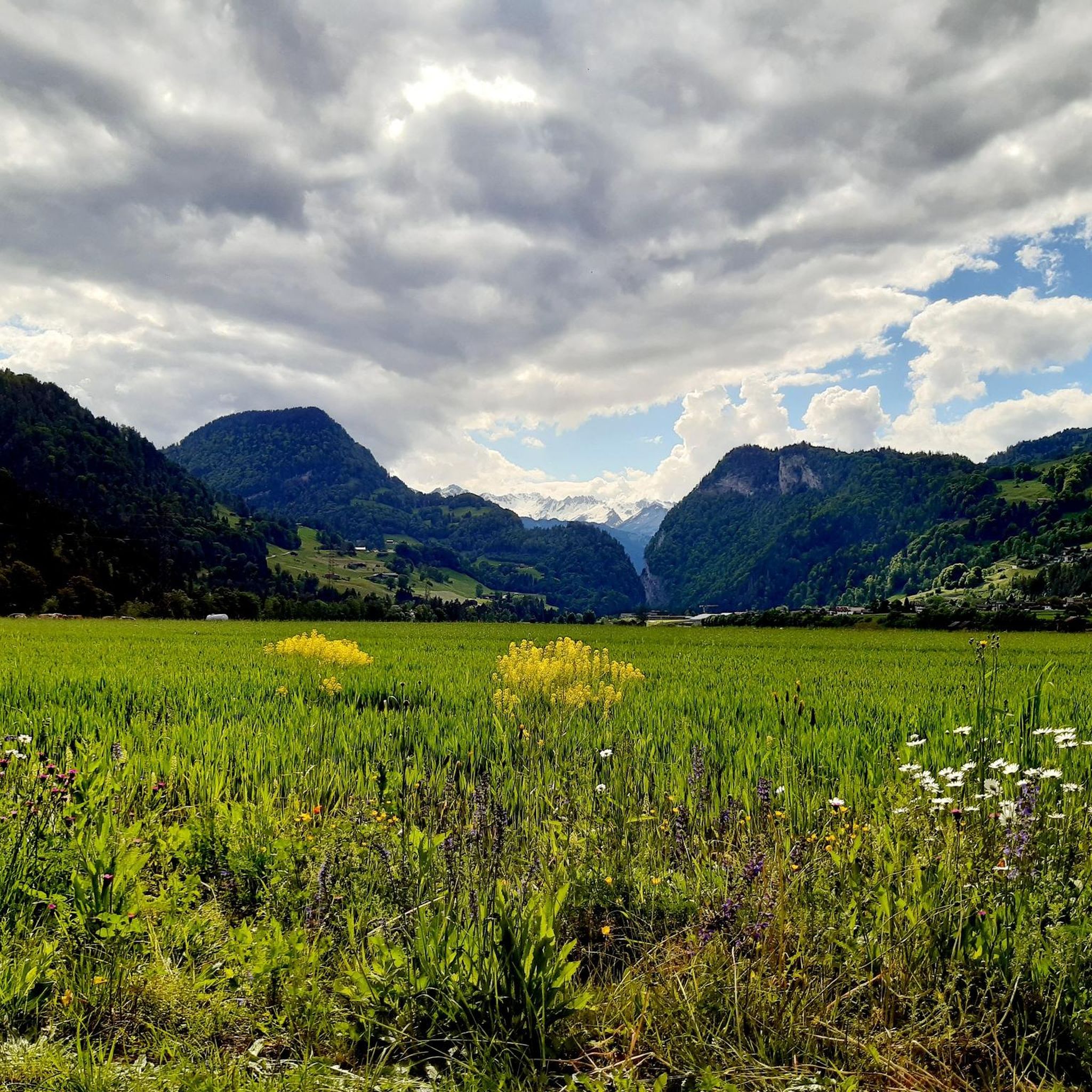
Hiking around Grüsch offers diverse landscapes within the Silvretta and Rätikon mountain ranges. The region features impressive limestone walls, lush alpine meadows, and panoramic mountain views, particularly from areas like Grüsch-Danusa. The Landquart river also provides opportunities for walks along its banks, complementing the higher-altitude trails.
Best hiking trails in Grüsch
- The most popular hiking route is Sassauna (2,307 m) – Sassauna Summit loop from Berggasthaus Sassauna, a 4.0 miles (6.5 km) trail that takes 2 hours 46 minutes…
Last updated: October 4, 2026
4.7
(10)
64
hikers
Moderate hike. Good fitness required. Easily-accessible paths. Suitable for all skill levels.
4.9
(9)
72
hikers
10.2km
04:38
980m
990m
Hard hike. Very good fitness required. Easily-accessible paths. Suitable for all skill levels.

3.0
(2)
56
hikers
10.5km
02:49
130m
130m
Moderate hike. Good fitness required. Easily-accessible paths. Suitable for all skill levels.
4.3
(10)
45
hikers
17.5km
06:08
780m
780m
Hard hike. Very good fitness required. Mostly accessible paths. Sure-footedness required.
4.8
(4)
26
hikers
11.1km
03:51
510m
510m
Moderate hike. Good fitness required. Mostly accessible paths. Sure-footedness required.
Get access to more routes and recommendations from other explorers.
Already have an account?
Our route recommendations are based on thousands of hikes, rides, and runs completed by other people on komoot.
Start today with a free account
Your next adventure awaits.
Tips from the Community

1164m high summit near Seewis im Prättigau
0
0

The village of Seewis is located on a sunny terrace on the south-facing slope of the 2,376-meter-high Vilans, at an altitude of around 950 meters. First documented in 1224 as "de Sevve", coin finds even indicate Roman settlement in the 1st and 3rd centuries. The protected location bestows upon the health resort a remarkably mild climate that attracts guests all year round.
2
0

We expected this to be a covered wooden bridge and were looking forward to sheltering from the rain in it, but alas, this modern wooden bridge does NOT provide cover from rain.
0
0

Tratt Bridge, Landquart, 1992 Tratt Bridge over the Landquart River, Malans GR – Igis Built in 1992 Project: Civil Engineering Department of the Canton of Graubünden
15
0

Ingenious ridge path for vertigo-free, sure-footed alpine hikers
0
0

Very beautiful wooden bridge over the Landquart in the Ganda.
1
0

Ideal for replenishing your water supply.
0
0
Great vantage point, everything up the mountain is rideable if you get the right 'slope'. For me, going downhill means pushing almost everything. Definitely S3, more like S4, narrow, rooty, sloping. And today it was wet on top of that. So be careful. 🙏
0
0
Frequently Asked Questions
How many hiking trails are available in Grüsch?
Grüsch offers a wide selection of hiking routes, with over 30 trails documented on komoot. These range from easy strolls to challenging high-altitude routes, catering to various skill levels.
What makes Grüsch a good hiking destination?
Grüsch is an excellent hiking destination due to its diverse landscapes, nestled within the Silvretta and Rätikon mountain ranges. Hikers can experience impressive limestone walls, lush alpine meadows, and panoramic mountain views. The region also offers accessible trails and amenities like mountain railways to enhance the experience.
When is the best time of year to go hiking in Grüsch?
The hiking season in Grüsch generally extends through spring, summer, and autumn for most trails. During winter, the area transforms into a winter hiking paradise with groomed paths and panoramic routes, some of which are suitable for families.
Are there easy hiking options suitable for beginners or leisurely strolls in Grüsch?
Yes, Grüsch offers several easy hiking options. You can enjoy gentle walks along the Landquart river or comfortable, easy hikes to destinations like the Eretsloch. There are 6 easy routes available, such as the Path Close to the Water – Calf Encounter loop from Grüsch, which is a moderate 10.4 km trail.
What kind of challenging hikes can I find in Grüsch?
For experienced hikers, Grüsch provides challenging high-altitude routes. An example is the Sassauna Summit – View from the Mountain Station loop from Fanas, a difficult 10.2 km path offering extensive mountain vistas. Another challenging option is the View of Crupspitz – View from Fadärastein loop from Grüsch, covering 16.8 km.
Are there circular hiking routes available in Grüsch?
Yes, many routes in Grüsch are designed as loops, allowing you to start and end at the same point. Popular circular options include the Sassauna (2,307 m) – Sassauna Summit loop from Berggasthaus Sassauna, and the View of Ilanz – Ruins of Obertagstein Castle loop from Grüsch.
Can I go hiking in Grüsch during winter?
Absolutely. Grüsch is known for its winter hiking opportunities, with groomed paths and panoramic winter hiking trails that offer wide-open views. Some winter trails are also suitable for families and can be shortened if needed.
Are there any natural attractions or landmarks to see while hiking in Grüsch?
Yes, the region around Grüsch features several notable natural attractions. You can explore impressive gorges like the Tamina Gorge, or discover the Kesselfall / Waterfall near Brand. For mountain enthusiasts, there are peaks such as Schesaplana Summit and Pizalun Summit and Viewpoint.
What do other hikers enjoy most about the trails in Grüsch?
The hiking trails in Grüsch are highly rated by the komoot community, with an average score of 4.5 stars from over 250 reviews. Hikers often praise the diverse landscapes, from alpine meadows to impressive limestone walls, and the breathtaking panoramic mountain views, especially from areas like Grüsch-Danusa.
Are there family-friendly hiking routes in Grüsch?
Grüsch is well-equipped for families, offering easy-to-walk paths. Some winter trails are also suitable for children and can be shortened. The Path Close to the Water – Calf Encounter loop from Grüsch, for example, offers a pleasant riverside experience.
Is it possible to access hiking trails in Grüsch using public transport?
While specific public transport details for each trailhead vary, Grüsch itself is generally accessible. The region's amenities, including mountain railways like Grüsch-Danusa and Fanas cable car, help hikers manage altitude gain, suggesting good connectivity to starting points for many routes.
Are there facilities or amenities available along the hiking trails?
Yes, to enhance the hiking experience, you can find restaurants with panorama terraces along many trails, perfect for a break. The Grüsch-Danusa mountain railway and Fanas cable car also assist with altitude gain, making more challenging routes accessible.
Most popular routes around Grüsch
Most popular attractions around Grüsch

Get inspired with the komoot mobile app


Explore more
Browse the best Hikes in other regions.
