The best MTB trails in Rokke Landskapsvernområde
56
riders
14
rides
Mountain biking in Rokke Landskapsvernområde offers diverse terrain characterized by its unique ice-marginal delta, known as the "raet," which provides varied topography and paths. The landscape protection area features two lakes, smaller tarns, and streams, often accompanied by lush banks that create scenic routes. Riders can expect to encounter wooded sections and varied elevations, making for engaging mountain bike trails. This combination of geological features and natural elements provides a compelling setting for mountain biking across different skill levels.
Best…
Last updated: July 12, 2026
4
riders
17.0km
01:53
220m
220m
Moderate mountain bike ride. Great for any fitness level. Advanced riding skills necessary.
16
riders
75.1km
06:08
970m
970m
Hard mountain bike ride. Very good fitness required. Advanced riding skills necessary.

Sign up for free
6
riders
28.7km
02:00
330m
340m
Moderate mountain bike ride. Good fitness required. Suitable for all skill levels.
5
riders
29.7km
02:00
280m
280m
Moderate mountain bike ride. Good fitness required. Advanced riding skills necessary.
3
riders
20.0km
01:48
320m
310m
Moderate mountain bike ride. Good fitness required. Advanced riding skills necessary.
Get access to more routes and recommendations from other explorers.
Sign up for free
Already have an account?
Our route recommendations are based on thousands of hikes, rides, and runs completed by other people on komoot.
Start today with a free account
Your next adventure awaits.
Login or Signup


Tips from the Community

The fortress, built between 1661 and 1701, was built to protect against Swedish attacks.
3
1

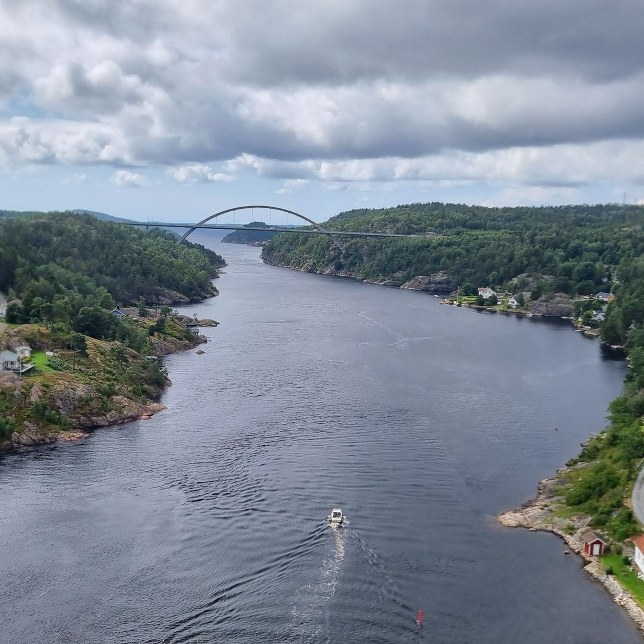
The opposite of Simon & Garfunkel's ballad, this is about as calm a scene as there is. Enjoy the peace and water views as you whizz across the bridge.
0
0

Halden is a pleasant town located right on the Iddefjord, close to the Swedish border. Its most prominent feature is the historic Fredriksten Fortress situated on a hill overlooking the town and water. In town, you can find nice streets and a harbourside area worth a stroll.
0
0

Fredriksten Fortress is Norway's largest and most important border fortress. It towers impressively over slag heaps and is visible from far away. The fortress was besieged several times but never taken and played an important role in Norway's independence. The complex is well worth seeing and offers various tours (e.g. ghost tour) at the information desk/café. All information boards are in Norwegian and English. Some paths are more difficult to walk, sturdy shoes are recommended.
0
0


One of the two highest points of the frescoes fortress! A great view, the climb is worth it!
0
1
Frequently Asked Questions
What kind of terrain can I expect when mountain biking in Rokke Landskapsvernområde?
Rokke Landskapsvernområde is characterized by its unique ice-marginal delta, known as the "raet," which creates varied topography. You'll find diverse paths, wooded sections, and varied elevations. The area also features serene lakes, smaller tarns, and streams with lush banks, adding to the scenic routes.
How many mountain bike trails are available in Rokke Landskapsvernområde?
There are 14 mountain bike trails available in Rokke Landskapsvernområde. These routes offer a range of experiences, from moderate to difficult, catering to different skill levels.
Are there any beginner-friendly mountain bike trails in Rokke Landskapsvernområde?
While there are no trails explicitly rated as 'easy' in our current selection, there are 11 routes categorized as 'moderate'. These routes require good fitness and sure-footedness but are generally more accessible than the 'difficult' options. For example, the View of Femsjøen – Seterhaugen loop from Asak kirke is a moderate 17.9-mile trail with varied terrain.
What are some challenging mountain bike routes for experienced riders?
Experienced riders looking for a challenge can explore routes like the Gørrtjern – Blytjernet loop from Gimle, a difficult 10.6-mile trail navigating through natural features. Another demanding option is the Halden – Fredriksten Fortress loop from Halden, an extensive 46.7-mile difficult path with significant elevation gain.
Are there any notable landmarks or viewpoints along the mountain bike trails?
Yes, some routes offer views of significant landmarks. For instance, the Halden – Fredriksten Fortress loop from Halden and the View of Fredriksten Fortress loop from Tistedal provide views of the historic Fredriksten Fortress. Additionally, the View of Femsjøen – Seterhaugen loop from Asak kirke offers scenic views of Femsjøen lake.
Can I find loop routes for mountain biking in Rokke Landskapsvernområde?
Yes, many of the mountain bike trails in Rokke Landskapsvernområde are designed as loops, allowing you to start and end at the same point. Examples include the Gørrtjern – Blytjernet loop from Gimle and the View of Femsjøen – Seterhaugen loop from Asak kirke.
What is the best time of year for mountain biking in Rokke Landskapsvernområde?
The best time for mountain biking in Rokke Landskapsvernområde is typically during the warmer months, from spring through autumn, when trails are clear of snow and ice. The varied terrain and natural features are most enjoyable in good weather. Winter mountain biking may be possible on some trails, but conditions can be challenging due to snow and ice.
Is Rokke Landskapsvernområde suitable for family mountain biking?
The area offers routes ranging from moderate to difficult. While there are no 'easy' trails, families with older children or those with good fitness levels might enjoy the moderate routes. Always check the specific trail difficulty and length before heading out with family.
Are dogs allowed on the mountain bike trails in Rokke Landskapsvernområde?
Rokke Landskapsvernområde is a landscape protection area, and generally, dogs are permitted on trails if kept on a leash. However, it's always advisable to check local regulations and signage at trailheads, especially during nesting seasons or in areas with grazing animals, to ensure compliance.
Where can I find parking for mountain biking in Rokke Landskapsvernområde?
Specific parking information for each trailhead is usually detailed on individual route pages. Many routes start from towns or villages like Halden, Gimle, Tistedal, or Asak kirke, where public parking might be available. It's recommended to check the starting point of your chosen route on komoot for precise parking suggestions.
Are there any cafes or amenities near the mountain bike trails?
While Rokke Landskapsvernområde itself is a natural area, routes often start or pass near towns such as Halden. In these larger towns, you can find cafes, restaurants, and other amenities. It's a good idea to plan your route to include stops in these areas if you require refreshments or facilities.
What makes mountain biking in Rokke Landskapsvernområde unique?
The unique geological feature of the 'raet' (ice-marginal delta) provides a distinct and varied topography for mountain biking. This, combined with serene lakes, streams, and extensive forest sections, offers a compelling mix of scenic beauty and diverse riding experiences that are characteristic of this Norwegian landscape protection area.
Most popular routes in Rokke Landskapsvernområde

Get inspired with the komoot mobile app


Explore more
Browse the best MTB trails in other regions.
