The best running trails in Sito D'Importanza Comunitaria ''Gessi Di Gessopalena''
5.0
(1)
47
runners
7
runs
Jogging in Sito D'Importanza Comunitaria ''Gessi Di Gessopalena'' offers challenging routes through a distinctive geological landscape. The region is characterized by significant elevation changes, deep gorges, and rugged terrain, indicative of its gypsum formations. Running trails often navigate through valleys and ascend to viewpoints, providing a demanding experience for runners. This area is ideal for those seeking a vigorous workout amidst natural, untamed scenery.
Best jogging routes in Sito D'Importanza Comunitaria ''Gessi Di Gessopalena''
- The most popular jogging route is…
Last updated: October 9, 2026
5.0
(1)
7
runners
5.50km
01:54
670m
670m
Hard run. Very good fitness required. Sure-footedness, sturdy shoes and alpine experience required.
9
runners
11.1km
01:12
170m
170m
Moderate run. Good fitness required. Mostly paved surfaces. Suitable for all skill levels.

8
runners
Hard run. Very good fitness required. Mostly paved surfaces. Suitable for all skill levels.
2
runners
7.79km
00:54
240m
240m
Moderate run. Good fitness required. Mostly paved surfaces. Suitable for all skill levels.
7
runners
11.7km
01:27
370m
370m
Hard run. Very good fitness required. Mostly paved surfaces. Suitable for all skill levels.
Get access to more routes and recommendations from other explorers.
Already have an account?
Our route recommendations are based on thousands of hikes, rides, and runs completed by other people on komoot.
Start today with a free account
Your next adventure awaits.
Popular around Sito D'Importanza Comunitaria ''Gessi Di Gessopalena''

Tips from the Community


Coming from the Fara San Martino gorges, the route becomes less narrow, even if it requires concentration and caution. We then arrive at the Vallone di Santo Spirito, where we find an area with tables and water fountains for resting.
0
0
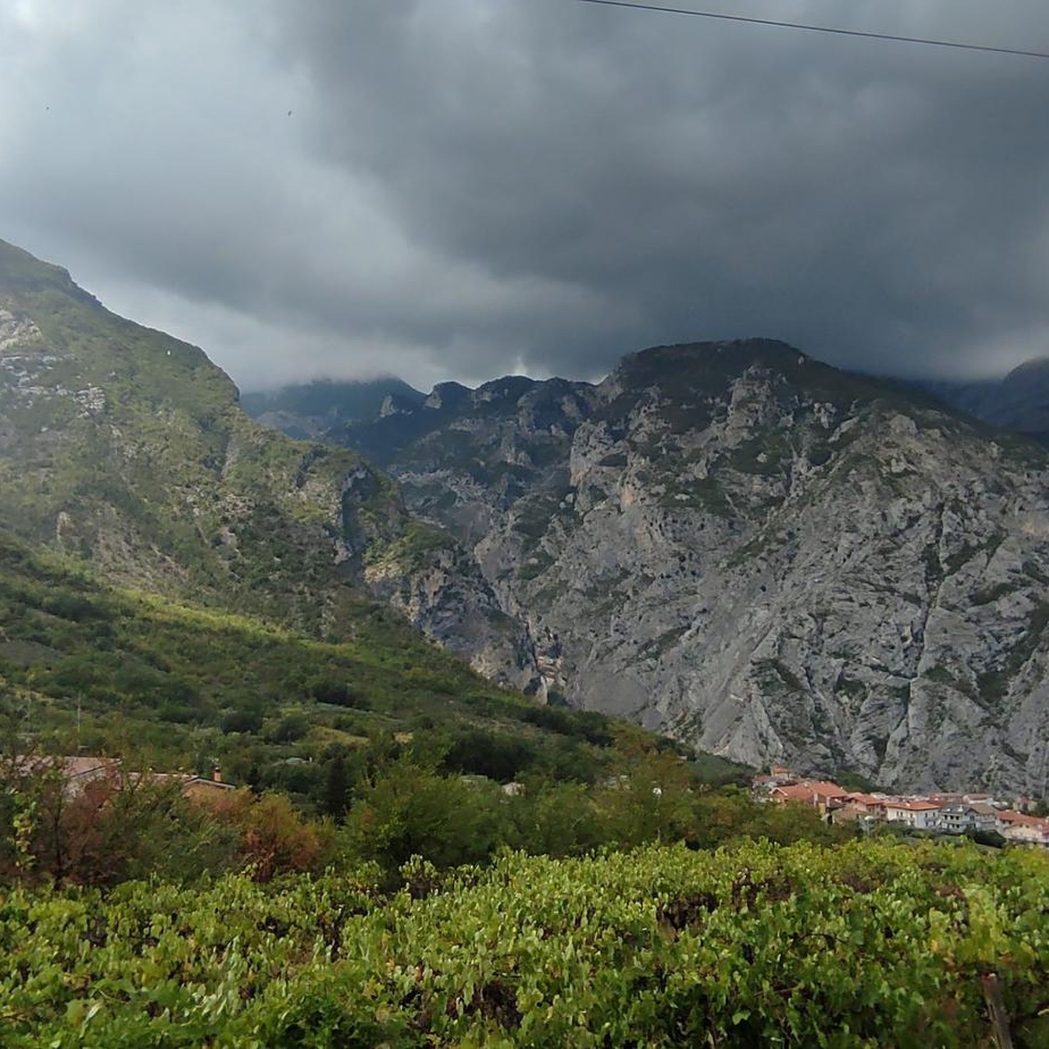
The Fara San Martino Gorges are one of the most fascinating places in the Majella, with a network of easy-to-follow paths.
0
0

Palena, in Abruzzo, is known for its historic Ducal Castle, dating back to the 12th century. Although affected by earthquakes and conflicts, the castle has been restored maintaining its majesty. Today it represents a symbol of resistance and beauty in the Maiella region.
0
0
Lama dei Peligni, located in the heart of the Maiella National Park in Abruzzo, is famous as the "country of chamois". Immersed in an environment rich in biodiversity, it boasts landscapes including oak groves, steep crags and high plains.
0
0

After passing the narrow gorges of Fara San Martino the path widens and opens onto the Santo Spirito Valley. Along the route there are wooden tables and frozen water fountains. Legend has it that Fra Martino opened the mountain with his elbows to create an opening and allow the local inhabitants to reach the grassy clearings at the top of the mountain. Walking in these places you perfectly understand the origin of the legend. Magical places!
2
0
The gorges of Fara San Martino are among the most evocative and accessible places of the Majella. The route inside the gorges is easy and suitable for families. It allows you to get to know the mountain from the inside, through its very high rocks. For those who love challenges, from here they can undertake the climb to the summit of Mount Amaro and face the highest altitude difference in the Apennines!
3
0

Anyway worth a visit to see an old ruin in the middle of Abruzzo. Take enough water with you on hot days. On the way to this place you can see a waterfall and linger in the park at the De Cecco (noodles) company.
1
0
Frequently Asked Questions
What is the general difficulty level of running routes in Sito D'Importanza Comunitaria ''Gessi Di Gessopalena''?
The running routes in Sito D'Importanza Comunitaria ''Gessi Di Gessopalena'' are primarily designed for experienced runners. All available routes are rated as difficult, featuring significant elevation changes and rugged terrain due to the distinctive gypsum formations and deep gorges.
Are there any circular running routes available in the region?
Yes, several routes offer a circular experience. For example, the Gole di Fara San Martino loop from Fara San Martino is a challenging 20.7-mile (33.3 km) path exploring dramatic gorges. Another option is the Cartello cima Macirenelle loop from Fara San Martino, which is 10.5 miles (16.9 km) through hilly terrain.
What kind of terrain can I expect on the running trails in Sito D'Importanza Comunitaria ''Gessi Di Gessopalena''?
You can expect rugged, natural landscapes characterized by deep gorges, significant elevation changes, and challenging ascents. The region's gypsum formations create a distinctive and demanding environment for runners, often navigating through valleys and ascending to scenic viewpoints.
How long do the running trails typically take to complete?
The duration varies significantly depending on the route's length and elevation. For instance, the Race from Fara San Martino to Vallone di Santo Spirito, a 3.4-mile (5.5 km) trail, takes approximately 1 hour 54 minutes. Longer routes like the Grotta Sant'Angelo loop from Eremo di Sant'Angelo di Palombaro, at 12.1 miles (19.4 km), can take over 3 hours.
Are the running routes in Sito D'Importanza Comunitaria ''Gessi Di Gessopalena'' suitable for families or children?
Given the difficult rating and rugged terrain of all routes, they are generally not recommended for families with young children or those seeking an easy, leisurely jog. The trails are best suited for experienced runners looking for a vigorous workout.
What should I wear or bring when running in this region?
Due to the challenging and rugged terrain, it's advisable to wear sturdy trail running shoes with good grip. Layers of clothing are recommended to adapt to changing weather conditions, and always carry sufficient water, especially on longer routes with significant ascents.
Are there any viewpoints or scenic spots along the running trails?
Yes, many routes in Sito D'Importanza Comunitaria ''Gessi Di Gessopalena'' ascend to viewpoints, offering panoramic vistas of the distinctive geological landscape, deep gorges, and surrounding natural beauty. The challenging climbs are often rewarded with stunning scenery.
What do other runners enjoy most about jogging in Sito D'Importanza Comunitaria ''Gessi Di Gessopalena''?
The komoot community highly rates the routes, with an average score of 5.0 stars. Runners often praise the unique, untamed natural scenery and the challenging, rewarding experience provided by the significant elevation gains and rugged terrain.
How many running routes are available in Sito D'Importanza Comunitaria ''Gessi Di Gessopalena''?
There are 6 dedicated running routes available in Sito D'Importanza Comunitaria ''Gessi Di Gessopalena'', all of which are rated as difficult due to the challenging terrain and elevation changes.
Is there a less-trafficked or 'hidden gem' running route in the area?
While all routes offer a unique experience, the Running loop from Lama dei Peligni might offer a slightly different perspective. It's a difficult 17.6-mile (28.3 km) loop that provides a substantial workout away from the more frequently mentioned Fara San Martino starting points.
What is the best time of year to go running in Sito D'Importanza Comunitaria ''Gessi Di Gessopalena''?
Given the rugged and exposed nature of the terrain, spring and autumn generally offer the most pleasant conditions for running, with milder temperatures. Summer can be very hot, and winter may present challenges with snow or ice, especially at higher elevations and in the gorges.
Most popular routes in Sito D'Importanza Comunitaria ''Gessi Di Gessopalena''

Get inspired with the komoot mobile app


Explore more
Browse the best Running Trails & Routes in other regions.
