The best walks and hikes in Sooke Hills Wilderness Regional Park
4.5
(281)
2,561
hikers
118
hikes
Hiking in Sooke Hills Wilderness Regional Park offers an extensive network of trails across 4,090 hectares, featuring diverse natural attractions. The park is characterized by numerous mountain peaks, including Mount Braden (471 meters) and Mount McDonald (439 meters), providing panoramic views. Trails wind through varied forest lands, from young plantations to second-growth and old-growth remnants, and include significant water features like Waugh Creek Falls. The terrain encompasses steep sections, narrow paths, and rocky surfaces, catering to a range of hiking experiences.
Best hiking trails in Sooke Hills Wilderness Regional Park
- The most popular hiking route is Mount Braden Summit – Castle Peak loop from Esquimalt—Saanich—Sooke, a 6.9 miles (11.1 km) trail that takes 3 hours 34 minutes to complete. This route ascends to Mount Braden, offering expansive views of the surrounding hills.
- Another top favourite among local hikers is Sugarloaf loop from Esquimalt—Saanich—Sooke, a moderate 4.3 miles (6.9 km) path. This trail leads to Sugarloaf Mountain, known for its scenic vistas.
- Local hikers also love the Mount Finlayson Trail – Mount Finlayson summit loop from Goldstream Provincial Park, a 4.4 miles (7.1 km) trail leading through challenging ascents to a prominent summit, often completed in about 2 hours 48 minutes.
- Hiking in Sooke Hills Wilderness Regional Park is defined by mountain peaks, dense woodlands, and significant water features like Waugh Creek Falls. The network offers options for varying ability levels, from easy walks to difficult climbs.
- The routes in Sooke Hills Wilderness Regional Park are highly rated by the komoot community with an average score of 4.6 stars from over 250 reviews. More than 2,300 hikers have used komoot to explore Sooke Hills Wilderness Regional Park's varied terrain.
Last updated: July 17, 2026
4.5
(2)
16
hikers
2.50km
00:41
40m
40m
Easy hike. Great for any fitness level. Easily-accessible paths. Suitable for all skill levels.
4.8
(5)
48
hikers
Hard hike. Good fitness required. Sure-footedness, sturdy shoes and alpine experience required.

Sign up for free
4.5
(2)
38
hikers
6.96km
02:12
270m
270m
Moderate hike. Good fitness required. Easily-accessible paths. Suitable for all skill levels.
5.0
(5)
33
hikers
11.1km
03:34
340m
340m
Moderate hike. Good fitness required. Mostly accessible paths. Sure-footedness required.
5.0
(2)
19
hikers
3.68km
01:10
130m
130m
Easy hike. Great for any fitness level. Easily-accessible paths. Suitable for all skill levels.
Get access to more routes and recommendations from other explorers.
Sign up for free
Already have an account?
Our route recommendations are based on thousands of hikes, rides, and runs completed by other people on komoot.
Start today with a free account
Your next adventure awaits.
Login or Signup
Tips from the Community

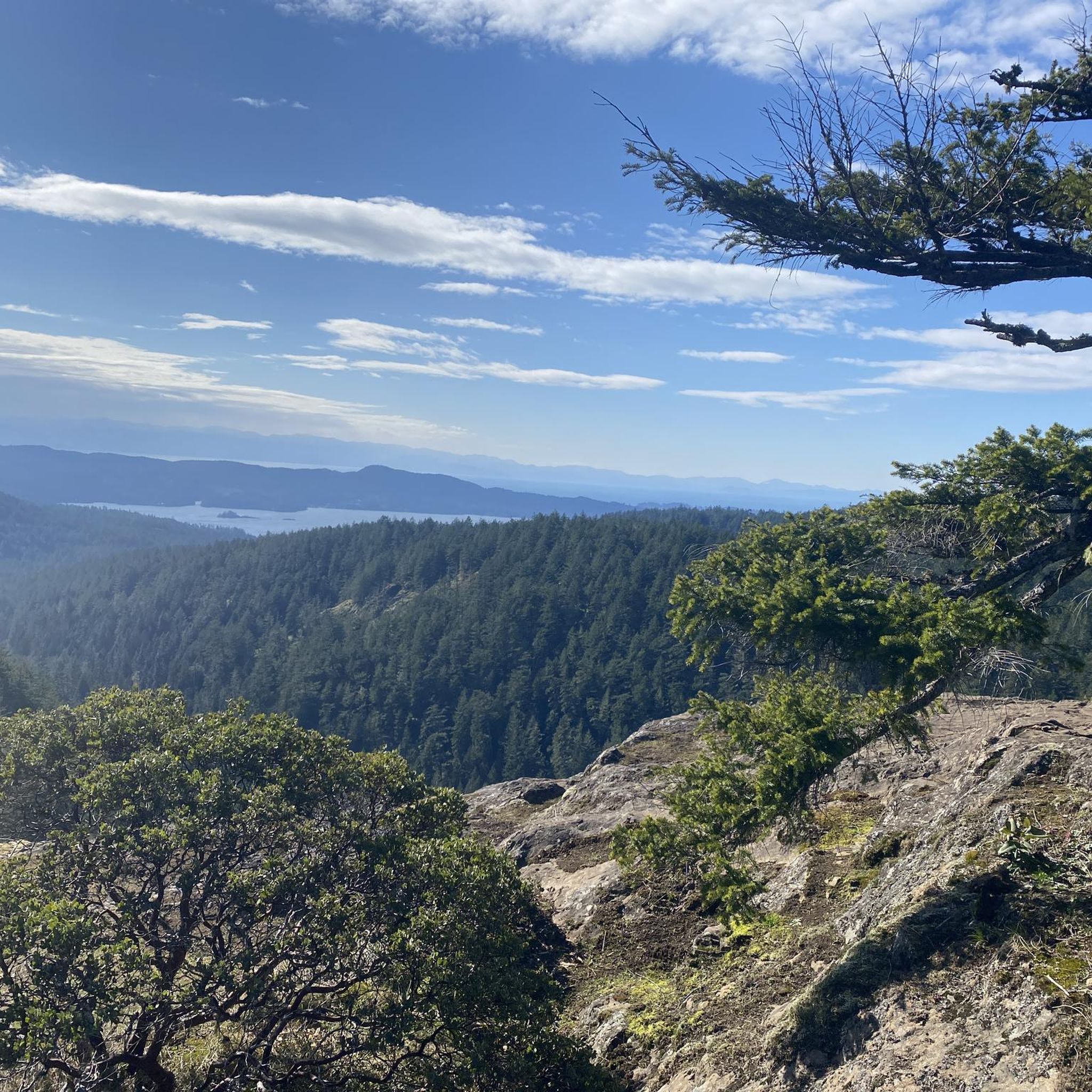
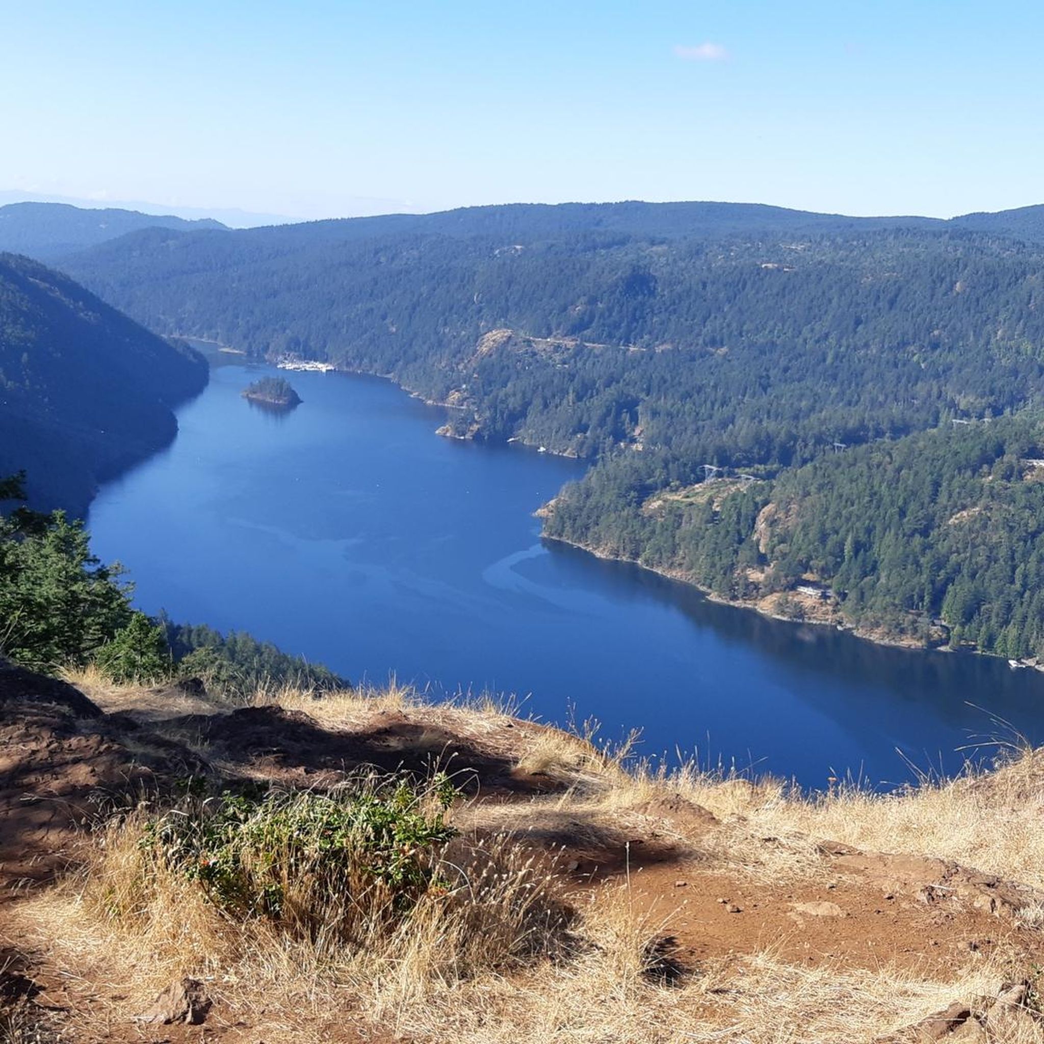
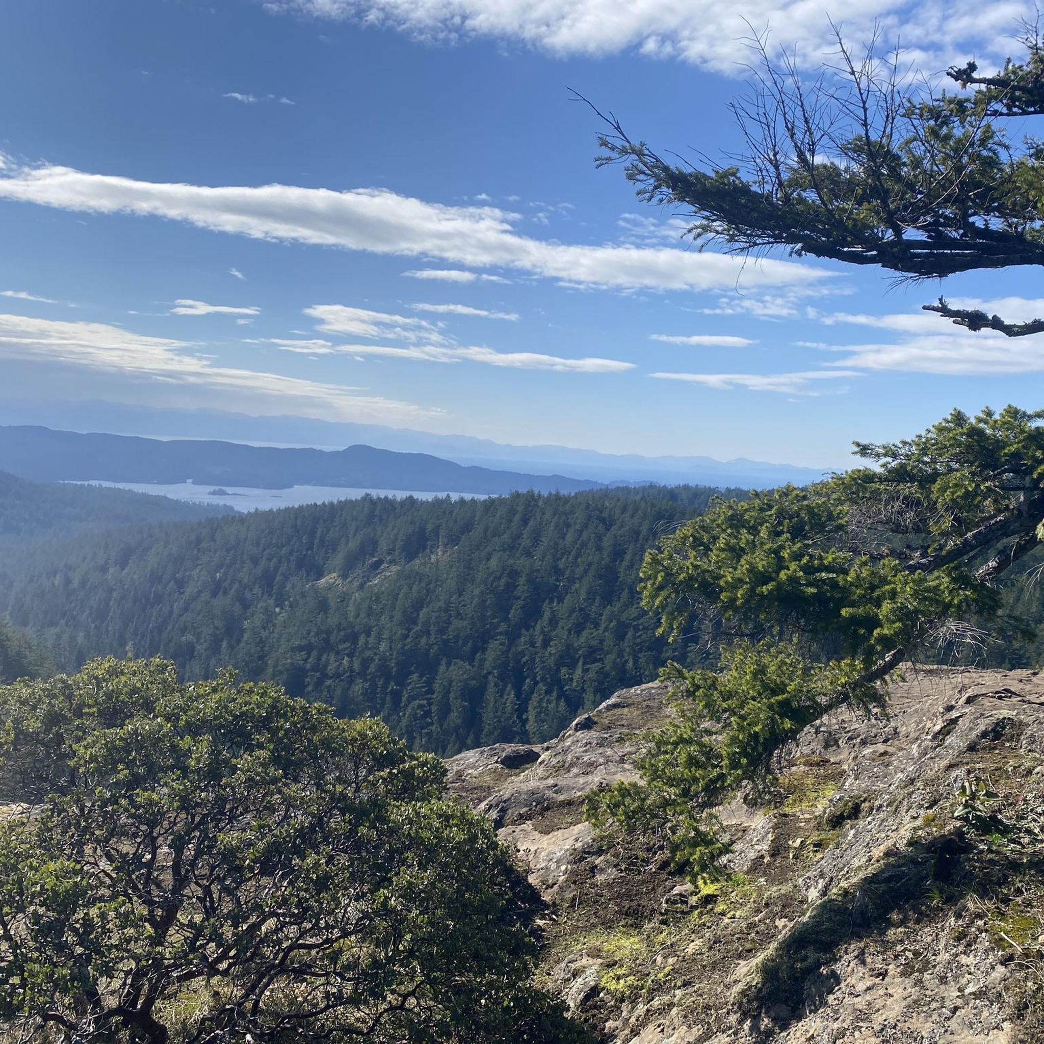
Mount Finlayson, at roughly 419 metres, is one of the most recognizable landmarks along the Saanich Inlet, towering above Goldstream Provincial Park and the Malahat. From here, panoramic views stretch across Greater Victoria, the Strait of Juan de Fuca, the Olympic Mountains, and Mount Baker, making the climb to get here well worth the effort. This exposed, rocky summit is a great place to take a long, well-deserved break to enjoy the scenery before heading back down the trail.
0
0

This River runs parallel to the Upper Goldstream Trail for its duration. At this point you are close to the river with a clear view. A bit further along, you will reach Goldstream Falls at the end of the trail.
0
0
This trailhead sits on the east end of the Goldstream Provincial Park campground and leads to the Upper Goldstream Trail. From here, the route follows the Goldstream River through old-growth cedar and fir, reaching a seasonal waterfall and small pool at the end of the trail. The trailhead has parking nearby and easy access from the campground road.
0
0

The 454-meter-high Castle Peak lies directly adjacent to Mount Braden; the two rocky peaks are separated by a depression. The Mount Braden Summit Loop Trail also leads over its summit. https://www.peakbagger.com/peak.aspx?pid=-115645
2
0
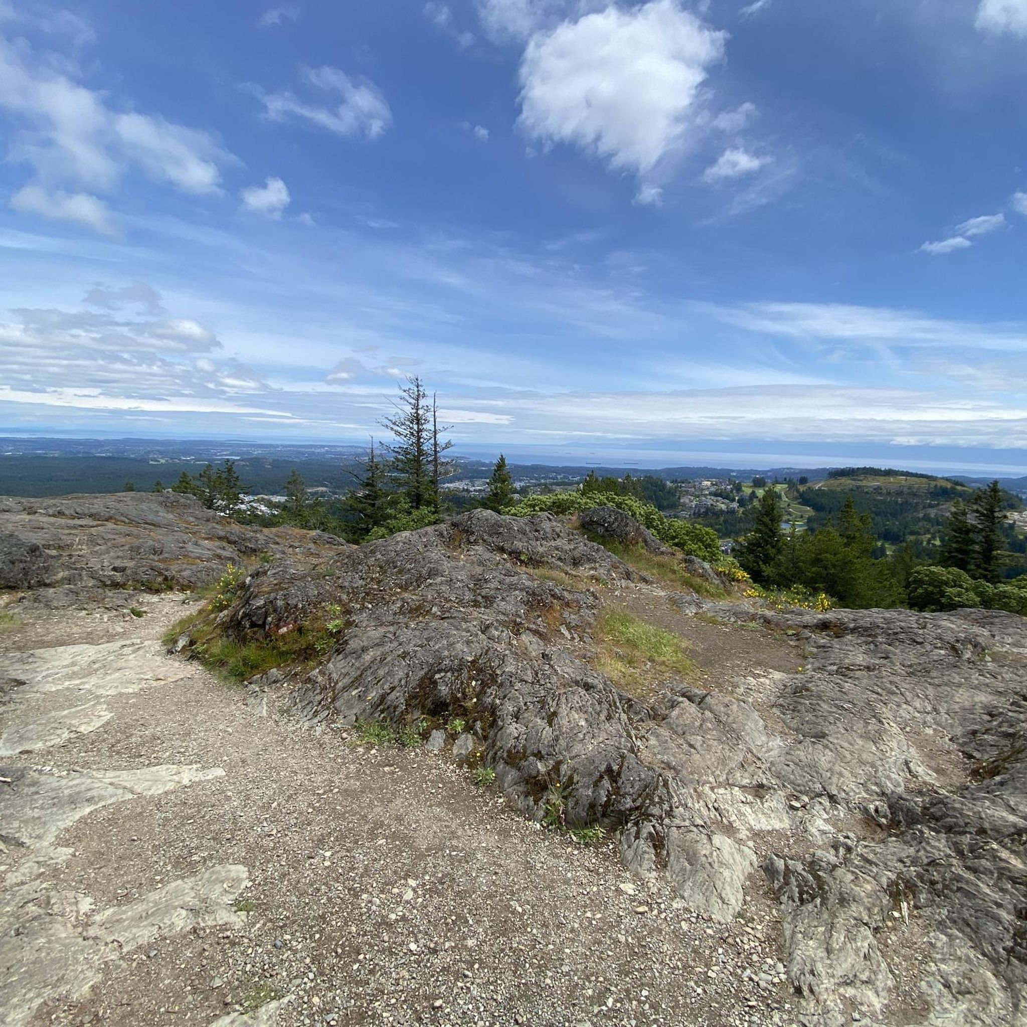
Mount Braden in the Sooke Hills Wilderness Regional Park has an elevation of 479 meters. From the rocky summit ridge, you have excellent views in all directions except to the east. To the west, the Strait of Juan de Fuca is clearly visible. https://www.peakbagger.com/peak.aspx?pid=31180
2
0
The Mount Finlayson Trail leads from the Goldstream Day Use Parking Lot to the mountain summit at 419 meters. Our ascent takes us along a steep path through a dense forest of old-growth Douglas firs and giant cedars, mixed with hemlocks, red alders, maples, and black cottonwood. From about 250 meters up, only sparse vegetation remains between steep rock formations. At times, we need to scramble as we continue our ascent along the well-marked route to the summit.
1
0
The summit of Mount Finlayson is 419 meters high; the ascent is on a well-marked route, first through forest and later with scrambling over rocks. https://www.peakbagger.com/peak.aspx?pid=31207
3
0

Old railway bridge. Actually not described or signposted
0
0
Frequently Asked Questions
How many hiking trails are available in Sooke Hills Wilderness Regional Park?
Sooke Hills Wilderness Regional Park features over 110 hiking routes. These trails range in difficulty, with more than 50 considered easy, 48 moderate, and 15 challenging, ensuring options for various experience levels.
Are there easy trails suitable for families in Sooke Hills Wilderness Regional Park?
Yes, the park offers over 50 easy hiking routes. While the Sooke Hills Wilderness Trail itself can be challenging, specific sections and other trails are suitable for families. For example, the trail to Waugh Creek Falls from the Humpback Reservoir is a moderately difficult 5.6 km option that includes a suspension bridge, making it an engaging experience for families.
Can I bring my dog on the trails in Sooke Hills Wilderness Regional Park?
Yes, dogs are permitted in Sooke Hills Wilderness Regional Park, but they must be kept on a leash at all times. This rule helps protect the park's wildlife and ensures a safe experience for all visitors.
Are there any waterfalls or significant water features to see?
A notable water feature is Waugh Creek Falls, which is particularly impressive during winter and spring. You can reach a viewing platform for the falls approximately 2.5 kilometers from the Humpback trailhead. Just 0.5 kilometers further, you'll find a scenic suspension bridge over the Goldstream River.
What kind of views can I expect from the mountain peaks?
The park boasts 16 named peaks, including Mount Braden (471 meters) and Mount McDonald (439 meters). From summits like Mount Braden or Sugarloaf, you can enjoy panoramic views of green hills, the Saanich Peninsula, Georgia Strait, the Gulf Islands, the B.C. mainland, and even the dormant Mount Baker volcano in Washington State. A popular route to experience these views is the Mount Braden Summit – Castle Peak loop.
Are there any circular hiking routes available?
Yes, Sooke Hills Wilderness Regional Park offers several loop trails. A popular moderate option is the Sugarloaf loop from Esquimalt—Saanich—Sooke, which leads to scenic vistas. For a more challenging experience, consider the Mount Finlayson Trail – Mount Finlayson summit loop.
Where can I park when visiting Sooke Hills Wilderness Regional Park?
Parking is available at various trailheads around the park. Specific parking locations depend on your chosen starting point, such as the Humpback trailhead for access to Waugh Creek Falls and the suspension bridge, or Goldstream Provincial Park for trails like the Mount Finlayson summit loop.
What do other hikers enjoy most about Sooke Hills Wilderness Regional Park?
The area is highly rated by the komoot community, with an average score of 4.6 stars from over 250 reviews. Hikers often praise the diverse terrain, from challenging mountain ascents to tranquil woodlands, and the rewarding panoramic views from the peaks. The variety of trails catering to different skill levels is also frequently highlighted.
What is the best time of year to hike in Sooke Hills Wilderness Regional Park?
The park offers rewarding experiences year-round. Waugh Creek Falls is particularly impressive in winter and spring. However, trails can be challenging with steep sections and rocky surfaces, so always check local conditions before heading out, especially during wet or snowy periods.
Are there any challenging hikes for experienced hikers?
Yes, the park offers 15 difficult routes for experienced hikers. The Sooke Hills Wilderness Trail, part of the Trans Canada Trail, features steep sections, narrow paths, and rocky surfaces. The Mount Finlayson summit loop from Goldstream Provincial Park is another challenging option with significant elevation gain.
Are there any restrictions or permits required for hiking in the park?
Public access to the Drinking Water Protection Zone and the Greater Victoria Water Supply Area within the park is not permitted. Always stay on marked trails and respect park regulations to help safeguard this vital resource. No specific permits are generally required for day hiking on public trails.
What kind of forests and natural landscapes will I encounter?
You'll hike through varied forest lands, including young plantations, maturing second-growth forests, and some old-growth remnants. The park is situated at an ecological border, meaning you might see trees like arbutus and Garry oak on some slopes, alongside the more common Douglas fir.
Most popular routes in Sooke Hills Wilderness Regional Park

Get inspired with the komoot mobile app


Explore more
Browse the best Hikes in other regions.
