Easy hikes and walks in Tettegouche State Park
5.0
(14)
322
hikers
17
hikes
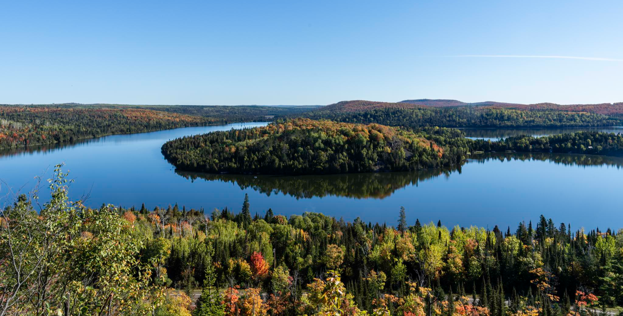
Easy hiking trails in Tettegouche State Park traverse a diverse landscape featuring a rugged Lake Superior shoreline, inland forests, and impressive waterfalls. The park encompasses 9,346 acres with semi-mountainous terrain, steep bluffs, and several tranquil inland lakes. This varied environment provides a range of easy hiking opportunities, from coastal paths to routes leading to scenic waterfalls and through northern hardwood forests.
Best easy hiking trails in Tettegouche State Park
- The most popular easy hiking route is Shovel Point Trail, a 1.1 miles (1.8 km) trail that takes 29 minutes to complete. This route leads to an iconic rocky promontory offering panoramic views of Lake Superior.
- Another top favourite among local hikers is Mic Mac Lake Trail, an easy 1.7 miles (2.7 km) path. This trail offers a serene experience around one of the park's quiet inland lakes.
- Local hikers also love the High Falls Trail - East, a 1.3 miles (2.1 km) trail leading through forested areas to the impressive High Falls, often completed in about 36 minutes.
- Hiking in Tettegouche State Park is defined by dramatic Lake Superior vistas, powerful waterfalls, and serene inland lakes. The network offers options for different ability levels, with a focus on easy hiking trails.
- The routes in Tettegouche State Park are highly rated by the komoot community with an average score of 4.97 stars from over 17 reviews. More than 360 hikers have used komoot to explore Tettegouche State Park's varied terrain.
Last updated: July 8, 2026
9
hikers
2.74km
00:48
80m
90m
Embark on the Mic Mac Lake Trail for an easy hike through a lush green forest, where you'll discover the calm waters of Mic Mac Lake. This route offers a peaceful escape, providing views of both Mic Mac Lake and Nipisiquit Lake as you make your way. You'll cover 1.7 miles (2.7 km) with an elevation gain of 257 feet (78 metres), a journey that typically takes around 48 minutes. Expect a serene atmosphere, away from the more bustling parts of the park, though be mindful of potentially slippery boardwalks and gentle hilly sections along the path.
The trail is conveniently located within Tettegouche State Park, making it an accessible option for a quick outdoor adventure. While no specific warnings are highlighted, it's always wise to check park conditions before you go, especially regarding weather that might affect trail surfaces. For your convenience, you will find vault toilets and a water pump available at Tettegouche Camp, which is situated near the lake.
This trail stands out for its unique opportunity to experience the park's natural beauty in a quieter setting. Unlike some of the park's more frequented areas, Mic Mac Lake Trail offers a sense of solitude amidst dense summer vegetation. You can even rent a canoe from Tettegouche Camp to paddle on the lake, adding another dimension to your visit and allowing you to explore the water from a different perspective.
4
hikers
4.39km
01:25
230m
120m
Embark on an easy hike to Fantasia Overlook via the Superior Hiking Trail, a rewarding 2.7-mile (4.4 km) route that promises stunning vistas. You will gain 763 feet (233 metres) in elevation, with an estimated duration of 1 hour and 24 minutes, making it a perfect shorter adventure. The trail features varied and rugged terrain, including some steep sections and switchbacks, leading you through beautiful natural surroundings to the overlook.
When planning your visit, remember that the trail can be muddy in spots, so wear appropriate footwear to navigate the conditions, though boardwalks are often in place to assist. Parking is conveniently available at the Superior Hiking Trail Trailhead located on Minnesota State Highway 1. Consider visiting during the fall months when the maple trees along the route transform into a vibrant display of reds, yellows, and oranges, enhancing the scenic beauty.
Once you reach Fantasia Overlook, you are treated to expansive 270-degree panoramic views of Lake Superior, a truly memorable sight. Beyond the main overlook, a short spur trail extends further north, offering additional perspectives of distant maple hillsides, dramatic cliffs, and serene, unnamed ponds. On clear days, you might even be able to spot notable landmarks like Palisade Head in the distance, adding another layer to the already impressive scenery.

Sign up for free
3
hikers
1.81km
00:29
30m
20m
Embark on the Shovel Point Trail for an easy 1.1-mile (1.8 km) hike that takes approximately 29 minutes to complete. You will experience a gentle ascent of 91 feet (28 metres) as you navigate rocky cliffs and wooded areas, rich with evergreens and birch trees. The route features numerous wooden steps, guiding you towards a viewing platform at the very tip of Shovel Point. From here, you can take in expansive vistas of Lake Superior. Keep an eye out for the unique geological feature of a collapsed granite stack viewpoint along the way.
Accessing the Shovel Point Trail is straightforward, as the trailhead is located directly behind the Tettegouche Visitor Center. You will find parking generally available at the visitor center, making it a convenient starting point for your outdoor adventure. This easy route is ideal for a quick outing, perfect for fitting into a busy day or as a warm-up for longer explorations in the park. Consider starting your hike earlier in the day to enjoy the tranquility and potentially fewer crowds, especially during peak seasons.
This trail offers a concise yet impactful way to experience the North Shore's natural beauty, showcasing dramatic views of Lake Superior. It provides an excellent opportunity to observe the unique geological formations of the area, including the remnants of ancient granite stacks. The Shovel Point Trail stands out as an accessible option for those seeking a short, rewarding outdoor experience within Tettegouche State Park.
2.61km
00:44
30m
80m
Embark on an easy hike to discover the impressive High Falls and Two Step Falls along the Superior Hiking Trail. This route guides you through heavily wooded areas, including beautiful birch forests, as it meanders beside the Baptism River. You will cover 1.6 miles (2.6 km) with a gentle elevation gain of 113 feet (34 metres), making for a pleasant journey that takes around 43 minutes to complete. Look for the swing bridge offering dramatic views of High Falls, Minnesota's tallest waterfall, and glimpses of Lake Superior.
To access this trail, you will need a Minnesota State Park vehicle permit, as it is located within Tettegouche State Park. While the path to the falls includes wooden steps and boardwalks, be prepared for some steeper sections, especially the 175 stairs leading to Two Step Falls. The High Falls bridge, which was previously damaged, has been reopened since November 2025, ensuring full access to all viewing areas.
This trail offers a unique opportunity to experience two distinct waterfalls, including the powerful High Falls, which holds the title of Minnesota's tallest. The journey provides diverse scenery and a chance to connect with the natural environment of the North Shore. It is a rewarding short adventure perfect for those looking to enjoy the beauty of the park without a strenuous climb.
2.11km
00:36
80m
0m
Embark on an easy hike along the High Falls Trail - East, a pleasant route that takes you through the natural landscape of Tettegouche State Park. You will cover 1.3 miles (2.1 km) with a gentle elevation gain of 268 feet (82 metres), making it a perfect quick escape. The trail offers scenic views, including glimpses of the beautiful Baptism River as it winds through the park. You can expect to complete this journey in about 36 minutes, enjoying the serene atmosphere and natural surroundings.
Before you head out, remember that the High Falls Trail - East is located within Tettegouche State Park. The park typically provides designated parking areas for visitors, but it is always a good idea to check their official website. You should look for current information on parking availability and any potential entrance fees to ensure a smooth visit. Planning ahead helps you focus on enjoying your hike.
This trail stands out as an accessible option within Tettegouche State Park, offering a chance to connect with nature without a strenuous effort. The route provides a great spot at the Baptism River Bridge View, allowing you to pause and take in the surroundings. It is an excellent choice if you are looking for a short, refreshing outdoor experience in the region.
Get access to more routes and recommendations from other explorers.
Sign up for free
Already have an account?
Our route recommendations are based on thousands of hikes, rides, and runs completed by other people on komoot.
Start today with a free account
Your next adventure awaits.
Login or Signup
Popular around Tettegouche State Park
Other adventures in Tettegouche State Park

Tips from the Community

The small parking lot provides convenient access to the Superior Hiking Trail in both directions.
0
0
Every time I walk past this cedar tree, I am amazed by its determination to thrive. From a certain angle, the tree appears to be sitting on a boulder, slumped down with its roots down like legs alongside it.
0
0
In years gone by, a column or stack of granite rose from the lake, connected to the mainland by a narrow bridge at its top. However, sometime before 2014, the bridge collapsed, and the entire stack fell into the lake in 2019. I have attached my most recent photo of the stack, taken on June 9, 2017, two years before its collapse in 2019.
0
0
The cliff face of Shovel Point is a popular destination for rock climbers. There are three sets of permanent climbing anchors affixed to the granite rock for climbers to secure their climbing ropes. This is the third set.
0
0
The cliff face of Shovel Point is a popular destination for rock climbers. There are three sets of permanent climbing anchors affixed to the granite rock for climbers to secure their climbing ropes. This is the second set.
0
0
The cliff face of Shovel Point is a popular destination for rock climbers. There are three sets of permanent climbing anchors affixed to the granite rock for climbers to secure their climbing ropes. This is the first set.
0
0

Great views from the bridge of the bay and the mouth of the Baptism River as it cascades down to Lake Superior.
0
0
Great views from the bridge of the bay and the mouth of the Baptism River as it cascades down to Lake Superior.
0
0
Frequently Asked Questions
How many easy hiking trails are available in Tettegouche State Park?
Tettegouche State Park offers a wide selection of easy hiking opportunities. Our guide features 12 easy routes, providing diverse experiences from coastal paths to inland forest trails and waterfall views.
What kind of terrain can I expect on easy hikes in Tettegouche State Park?
Easy hikes in Tettegouche State Park traverse a varied landscape. You'll find paths along the rugged Lake Superior shoreline, through serene inland forests, and leading to impressive waterfalls. While generally easy, some trails may have gentle elevation changes, typical of the park's semi-mountainous terrain.
When is the best time of year to enjoy easy hikes in Tettegouche State Park?
Tettegouche State Park is beautiful year-round. Spring brings lush greenery and flowing waterfalls, while summer offers pleasant temperatures for exploring. Autumn showcases stunning fall foliage, and winter provides a unique, serene experience for those prepared for snow and ice. Each season offers a different perspective on the park's natural beauty.
Are there any easy trails that lead to waterfalls in Tettegouche State Park?
Yes, several easy trails lead to the park's impressive waterfalls. For instance, the High Falls Trail - East is an easy 1.3-mile path that takes you to the magnificent High Falls. Another option is the High Falls and Two Step Falls via Superior Hiking Trail, which also visits Two Steps Falls.
Which easy trails offer scenic views of Lake Superior or other natural features?
For stunning Lake Superior views, the Shovel Point Trail is an excellent choice, leading to an iconic rocky promontory. You can also find panoramic vistas from the Fantasia Overlook via Superior Hiking Trail, which offers expansive views of the surrounding landscape.
Can I find easy trails around the inland lakes?
Absolutely. Tettegouche State Park features several tranquil inland lakes. The Mic Mac Lake Trail is an easy 1.7-mile path offering a serene experience around Mic Mac Lake, perfect for a peaceful walk.
Are the easy hiking trails in Tettegouche State Park suitable for families with children?
Many of the easy trails in Tettegouche State Park are well-suited for families. Paths like the Shovel Point Trail and the High Falls Trail - East are relatively short and offer engaging natural features like dramatic cliffs and waterfalls, making them enjoyable for various age groups.
Are dogs allowed on the easy hiking trails in Tettegouche State Park?
Yes, dogs are generally welcome on trails in Tettegouche State Park, provided they are kept on a leash no longer than six feet. Always remember to clean up after your pet to help keep the park beautiful for everyone.
Is there parking available for easy trail access in Tettegouche State Park?
Yes, Tettegouche State Park has designated parking areas, including at the Visitor Center, which provides convenient access to many popular trails. It's advisable to arrive early during peak seasons to secure a spot.
Are there any accessible trails for wheelchairs or strollers in Tettegouche State Park?
While many trails in Tettegouche State Park feature natural, uneven terrain, the park does offer some accessible options. The Visitor Center area and portions of the trails near it are generally more accessible. For specific details on ADA-compliant sections, it's best to check with the park office directly upon arrival.
What do other hikers enjoy the most about hiking in Tettegouche State Park?
The komoot community highly rates the trails in Tettegouche State Park, with an average score of 4.97 stars. Hikers frequently praise the dramatic Lake Superior vistas, the powerful waterfalls, and the serene experience of the inland lakes. The diverse terrain and well-maintained paths are also often highlighted as key attractions.
How can I get to Tettegouche State Park using public transport?
Tettegouche State Park is primarily accessed by private vehicle. Public transportation options directly to the park are limited. Visitors typically drive to the park, which is located on Minnesota's North Shore along Highway 61.
Most popular attractions in Tettegouche State Park

Get inspired with the komoot mobile app


Explore more
Browse the best Hikes in other regions.
