Easy hikes and walks around Paradisbakkerne
4.6
(1262)
5,409
hikers
23
hikes
Easy hiking trails around Paradisbakkerne navigate a unique post-glacial landscape on eastern Bornholm, Denmark. The region is characterized by rocky terrain, deep rift valleys, and serene forest areas. Hikers will encounter granite formations, erratic boulders, and tranquil forest lakes. The highest point, Midterpilt, is a hill at 113 meters above sea level.
Best easy hiking trails around Paradisbakkerne
- The most popular easy hiking route is Paradisbakkerne (yellow route) - Bornholm, a 4.1 miles (6.6 km) trail that takes 1…
Last updated: July 15, 2026
4.9
(297)
990
hikers
6.57km
01:44
60m
60m
Easy hike. Great for any fitness level. Easily-accessible paths. Suitable for all skill levels.
4.7
(58)
214
hikers
6.85km
01:49
70m
70m
Easy hike. Great for any fitness level. Easily-accessible paths. Suitable for all skill levels.

Sign up for free
4.9
(134)
438
hikers
5.32km
01:23
40m
40m
Easy hike. Great for any fitness level. Easily-accessible paths. Suitable for all skill levels.
4.9
(18)
125
hikers
3.17km
00:51
40m
40m
Easy hike. Great for any fitness level. Easily-accessible paths. Suitable for all skill levels.
4.7
(22)
79
hikers
2.29km
00:37
30m
30m
Easy hike. Great for any fitness level. Easily-accessible paths. Suitable for all skill levels.
Get access to more routes and recommendations from other explorers.
Sign up for free
Already have an account?
Our route recommendations are based on thousands of hikes, rides, and runs completed by other people on komoot.
Start today with a free account
Your next adventure awaits.
Login or Signup
Popular around Paradisbakkerne
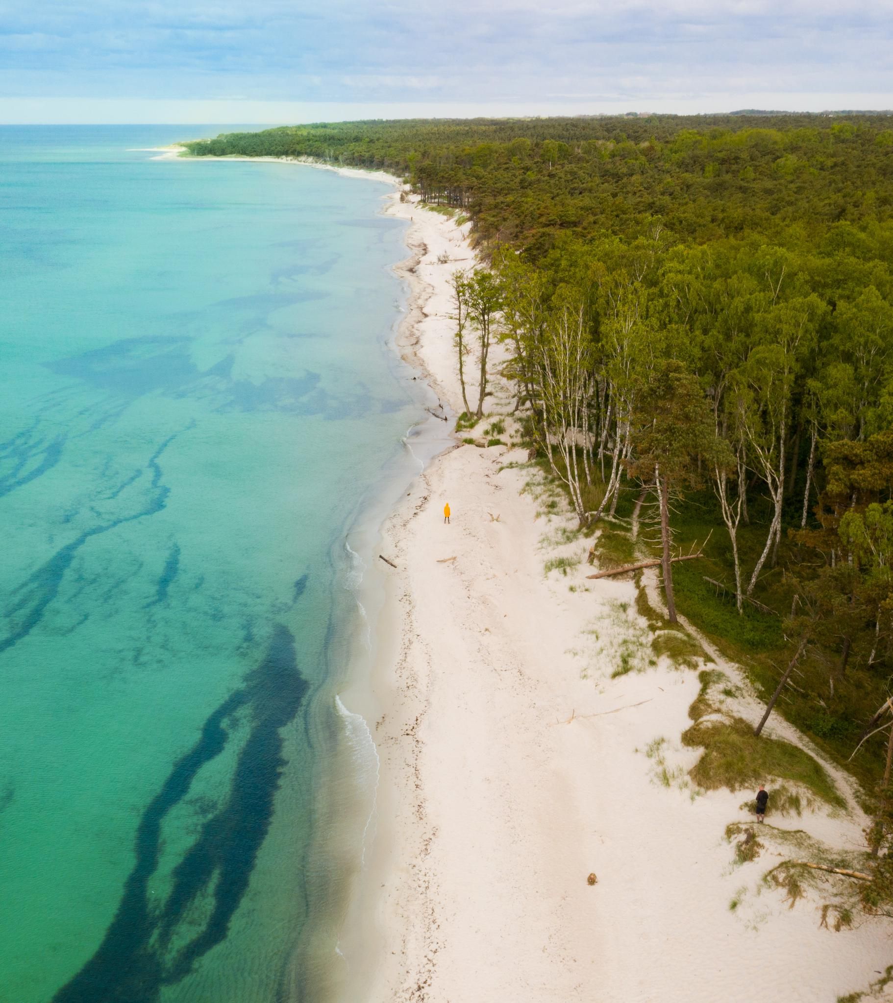
Other adventures around Paradisbakkerne

Tips from the Community

Don't be afraid of the goats. 🐐 They make way if you want to pass.
0
0


Midterpilt is a notable peak located within Paradisbakkerne, a hilly and rocky landscape in eastern Bornholm, Denmark. Standing at 113 meters above sea level, it is among the highest points in the area. The summit is marked by a large, distinctive stone cairn, known locally as a "pilt," a term derived from the Old Norse word "piltr," meaning "a little boy." Visitors can access Midterpilt via well-marked hiking trails that offer panoramic views of the surrounding landscape.
0
0

At 113m the highest point in the Paradiesbakkerne
0
0

Yes, it's really worth seeing. The yellow path leads along here. It's worth taking a break on one of the many stones to let your gaze wander over the lush heather.
1
0
Yes, the yellow dot leads along here
1
0

beautiful view, as if you are thousands of years back in time, not an easy path to it
0
0
Frequently Asked Questions
How many easy hiking trails are available in Paradisbakkerne?
Paradisbakkerne offers a wide selection of easy hiking trails, with 20 routes specifically categorized as easy. In total, there are 23 hiking tours available in the area.
What kind of terrain can I expect on easy hikes in Paradisbakkerne?
The easy hikes in Paradisbakkerne navigate a unique post-glacial landscape characterized by rocky terrain, deep rift valleys, and serene forest areas. You'll encounter granite formations, erratic boulders, and tranquil forest lakes. While generally easy, some sections might involve gentle ascents and descents due to the hilly nature of the area.
Are the easy trails in Paradisbakkerne suitable for families with children?
Yes, many of the easy trails in Paradisbakkerne are suitable for families. The diverse landscape with features like the Rokkestenen (Rocking Stone) and various forest lakes provides engaging points of interest for children. For example, the Rokkestenen Glacial Erratic loop from Klinteby is a shorter, easy option perfect for a family outing.
Can I bring my dog on the easy hiking trails in Paradisbakkerne?
Yes, dogs are generally welcome on the marked hiking trails in Paradisbakkerne. However, it's always recommended to keep them on a leash to protect the local wildlife and ensure a pleasant experience for all hikers. Please be mindful of any specific signage regarding pets in certain areas.
What natural landmarks can I see on an easy hike in Paradisbakkerne?
Easy hikes in Paradisbakkerne offer access to several notable natural landmarks. You can visit the famous Rokkestenen (the Rocking Stone), explore impressive rift valleys like Dybedal Gorge, and enjoy the tranquility of forest lakes such as Gamledam Pond and Grydesø. The Midterpilt Stone Cairn, marking the highest point, is also accessible on some easy routes.
Are there any circular easy routes in Paradisbakkerne?
Yes, Paradisbakkerne features several circular easy routes. A popular choice is the Paradisbakkerne (yellow route) - Bornholm, which is a 6.6 km loop. Another option is the Lily Pond in Danish Forest – Gamledam Pond loop from Årsdale, covering 5.3 km.
What are the typical distances and durations for easy hikes in Paradisbakkerne?
Easy hikes in Paradisbakkerne typically range from 2 to 7 kilometers in distance. For example, the Rokkestenen Glacial Erratic loop from Klinteby is about 2.3 km and takes around 37 minutes, while the Paradisbakkerne (the Paradise Hills): Blue Route is 6.9 km and can be completed in about 1 hour 49 minutes.
What do other hikers say about the easy trails in Paradisbakkerne?
The easy trails in Paradisbakkerne are highly regarded by the komoot community, with an average rating of 4.4 out of 5 stars from over 540 reviews. Hikers frequently praise the unique rocky landscape, the tranquility of the forest, and the well-marked paths that make navigation straightforward.
Is there parking available for easy trails in Paradisbakkerne?
Yes, parking is available at designated access points for Paradisbakkerne. You can typically find parking at Klintebygård or Gamleborg, which also offer access to facilities like toilets and water. Cars are not permitted within the nature area itself, so you'll need to park at the entrances.
Are there any historical sites accessible on easy trails in Paradisbakkerne?
Yes, hikers can explore the remains of Gamleborg, an ancient refuge site with earthworks and traces of Iron Age settlements. This historical site is often included in some of the longer easy routes, such as the Paradisbakkerne (the Paradise Hills): Blue Route.
What is the best time of year to visit Paradisbakkerne for easy hiking?
Paradisbakkerne is beautiful year-round, but the best time for easy hiking is generally during spring, summer, and early autumn. During these seasons, the weather is milder, and the trails are typically dry and well-maintained. The lush vegetation in spring and the vibrant colors of autumn enhance the hiking experience.
Can I pick mushrooms or berries while hiking in Paradisbakkerne?
Yes, visitors are permitted to pick mushrooms and berries for personal use while hiking in Paradisbakkerne. This is a traditional right, but please ensure you are familiar with local regulations and only pick what you need.
Most popular routes around Paradisbakkerne
Most popular attractions around Paradisbakkerne

Get inspired with the komoot mobile app


Explore more
Browse the best Hikes in other regions.
