Easy hikes and walks around Mottisfont
4.4
(622)
4,569
hikers
308
hikes
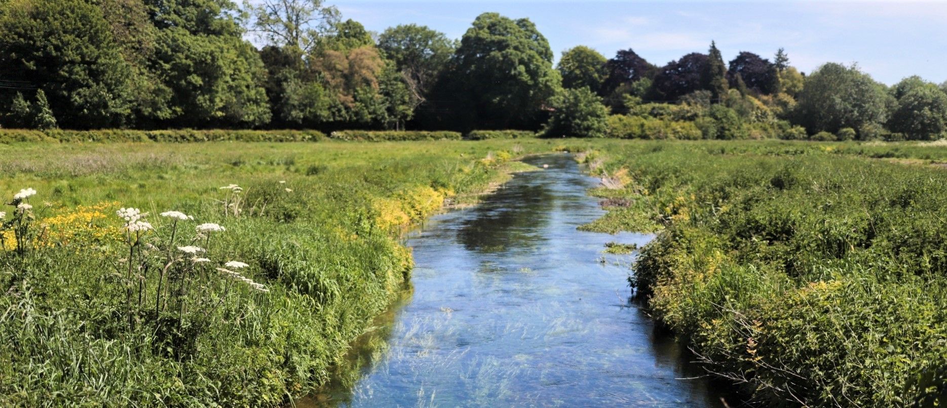
Hiking around Mottisfont offers access to diverse landscapes within the Test Valley. The region is characterized by the crystal-clear River Test and its tributaries, ancient woodlands, historic farmland, and open meadows. Notable features include the largest London Plane tree in Britain and the wider estate extending to Stockbridge Down and Curbridge Nature Reserve. These areas provide varied terrain for easy hiking trails.
Best easy hiking trails around Mottisfont
- The most popular easy hiking route is Horsebridge Station – Sprat and…
Last updated: September 27, 2026
4.0
(1)
2
hikers
1.64km
00:25
10m
10m
Easy hike. Great for any fitness level. Easily-accessible paths. Suitable for all skill levels.
5.0
(8)
84
hikers
Easy hike. Great for any fitness level. Easily-accessible paths. Suitable for all skill levels.

5.0
(7)
80
hikers
Easy hike. Great for any fitness level. Easily-accessible paths. Suitable for all skill levels.
3.0
(2)
7
hikers
Easy hike. Great for any fitness level. Easily-accessible paths. Suitable for all skill levels.
11
hikers
Easy hike. Great for any fitness level. Easily-accessible paths. Suitable for all skill levels.
Get access to more routes and recommendations from other explorers.
Already have an account?
Our route recommendations are based on thousands of hikes, rides, and runs completed by other people on komoot.
Other adventures around Mottisfont

Tips from the Community

Awbridge Nature Reserve is a hidden delight, definitely worth an explore! There is a stone circle here which was constructed in the millennium. The circle has 24 stones and surrounds a small barrow constructed of soil.
1
0
The Sprat and Winkle railway line operated between Redbridge (Southampton) and Andover Junction. The line opened in 1865 after converting an existing canal to railway. The line was closed in 1964 and is now a lovely flat walking and cycling trail, which forms part of the Test Way.
3
0

This stretch of National Cycle Network 246 (https://www.sustrans.org.uk/find-a-route-on-the-national-cycle-network/route-246) runs off-road along Monarch's Way and The Test Way (which in this section follow the same path). The Monarch's Way is a 625-mile (1,006 km) footpath in England that approximates the escape route taken by King Charles II in 1651 after being defeated in the Battle of Worcester. It runs from Worcester via Bristol and Yeovil to Shoreham, West Sussex, and is an approximation of the original route using available public rights of way, having been radically changed in the centuries by enclosure, mining, urbanisation and the building of roads, canals and railways. This particular stretch runs on a well-maintained gravelly path through the woods. Please cycle respectfully sharing the path with ramblers and walkers.
1
0

Mottisfont House is very near this and well worth a visit. If you go past this Phone box walking out of Mottisfont you can walk/ride along a lane which leads down to Mottisfont/Dunbridge train station which has a very nice pub next to it for refreshments.
0
0
Nice views and pub nearby next to Mottisfont and Dunbridge station
0
0

Scenic picnic spot near to Hatt Hill on the wider Mottisfont Estate.
0
0
Handy book swap stop in the pretty village of Mottisfont.
0
0

Frequently Asked Questions
How many easy hiking trails are available around Mottisfont?
Mottisfont offers a wide selection of easy hiking trails. There are 157 easy routes out of a total of 327 hiking tours in the area, providing plenty of options for a relaxed outdoor experience.
Are there any family-friendly easy walks in Mottisfont?
Yes, Mottisfont is an excellent destination for family-friendly walks. The estate features a wild play area, and many of the easy trails, such as the Mottisfont Phone Box Library – Hatt Lane Cycle Path loop, are designed to be accessible and enjoyable for all ages, winding through gentle countryside.
Can I bring my dog on the easy hiking trails in Mottisfont?
Mottisfont's wider estate, including areas like Stockbridge Down and Curbridge Nature Reserve, often welcomes dogs. However, specific rules may apply within the National Trust property itself, especially in sensitive areas or during certain seasons. It's always best to check local signage or the National Trust website for the most current dog-walking guidelines before your visit.
Are there circular easy hiking routes in Mottisfont?
Yes, many of the easy trails around Mottisfont are circular, allowing you to start and finish at the same point. An example is the Awbridge Nature Reserve loop, which offers a short, easy circular path through natural surroundings.
What kind of scenery can I expect on easy hikes around Mottisfont?
Easy hikes around Mottisfont offer diverse and picturesque scenery. You'll encounter the crystal-clear River Test and its tributaries, ancient woodlands, historic farmland, and open meadows. Keep an eye out for the largest London Plane tree in Britain within the estate, and enjoy the seasonal transformations from vibrant spring bulbs to rich autumn foliage.
What are some interesting landmarks or attractions I can see near the easy trails?
Beyond the trails, you can explore several interesting landmarks. The historic Mottisfont Abbey itself, an 18th-century house built upon a medieval priory, is a cultural highlight. You might also find the Test Way and Monarch's Way Junction, or visit the Testwood Lakes Nature Reserve for more natural beauty.
Is there public transport access to the easy hiking trails in Mottisfont?
While Mottisfont is primarily accessed by car, some routes may be reachable via local bus services to nearby villages. For specific trailheads, such as the Horsebridge Station – Sprat and Winkle Line Trail loop, checking local bus timetables for connections to Horsebridge or other starting points is advisable.
Where can I park when visiting Mottisfont for an easy hike?
Parking is generally available at Mottisfont National Trust property. For trails starting outside the main estate, such as the Mottisfont Phone Box Library loop, you may find roadside parking or small village car parks nearby. Always check for local parking restrictions.
What do other hikers say about the easy trails in Mottisfont?
The easy trails in Mottisfont are highly rated by the komoot community, with an average score of 4.3 stars from over 200 reviews. Hikers often praise the serene riverside paths, the peaceful immersion in nature, and the well-maintained routes through woodlands and open fields.
Are there cafes or facilities available near the easy hiking routes?
Yes, within the Mottisfont estate, you'll find cafes and a shop, providing refreshments and facilities. For routes extending into nearby villages, local pubs like the Lamb Inn, Nomansland, or small village shops might offer additional options.
What is the best time of year to enjoy easy walks in Mottisfont?
Mottisfont offers beautiful easy walks year-round. Spring brings vibrant displays of bulbs, while June is particularly special for the world-famous walled rose garden. Autumn showcases rich foliage, and the winter garden provides a unique, scented experience. Each season offers its own charm for easy exploration.
Are there any easy routes that follow historical paths or railway lines?
Yes, Mottisfont's history is woven into its landscape. A section of the Monarch's Way, a significant long-distance footpath, runs through the estate. Additionally, the Horsebridge Station – Sprat and Winkle Line Trail loop follows a historic railway line, offering a glimpse into the region's past.
What are the typical distances and durations for easy hikes in Mottisfont?
Easy hikes in Mottisfont typically range from 1 to 4 miles (1.6 to 6.4 km) and can take anywhere from 30 minutes to 2 hours to complete. For example, the Hatt Lane Cycle Path – Mottisfont Phone Box Library loop is about 2.7 miles (4.3 km) and takes approximately 1 hour 10 minutes.
Most popular routes around Mottisfont
Most popular attractions around Mottisfont

Get inspired with the komoot mobile app


Explore more
Browse the best Hikes in other regions.
