The best walks and hikes in the Laguna Mountains
4.8
(520)
5,780
hikers
206
hikes
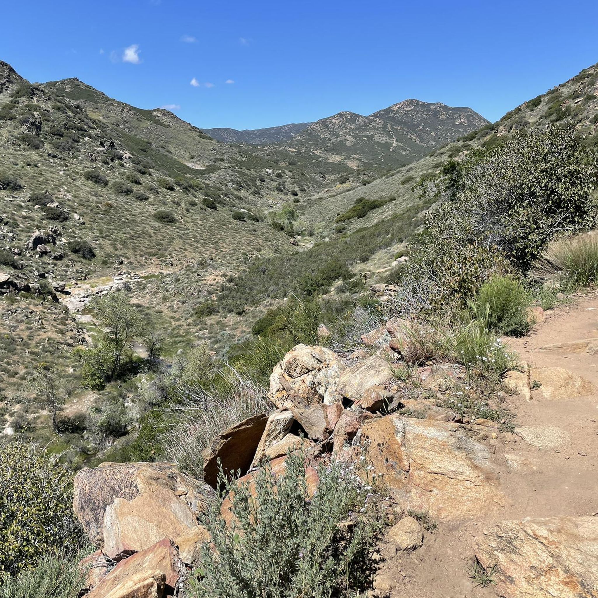
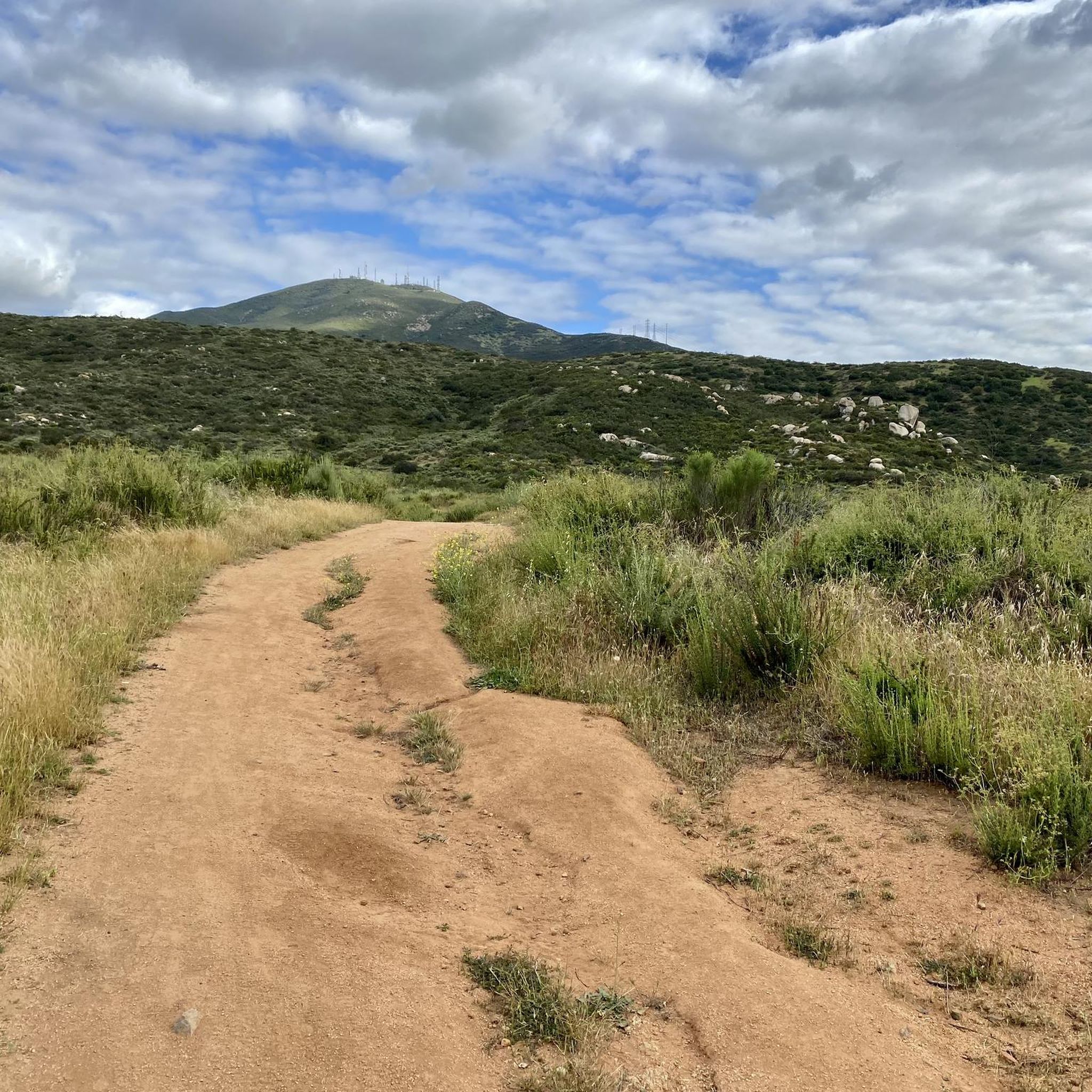
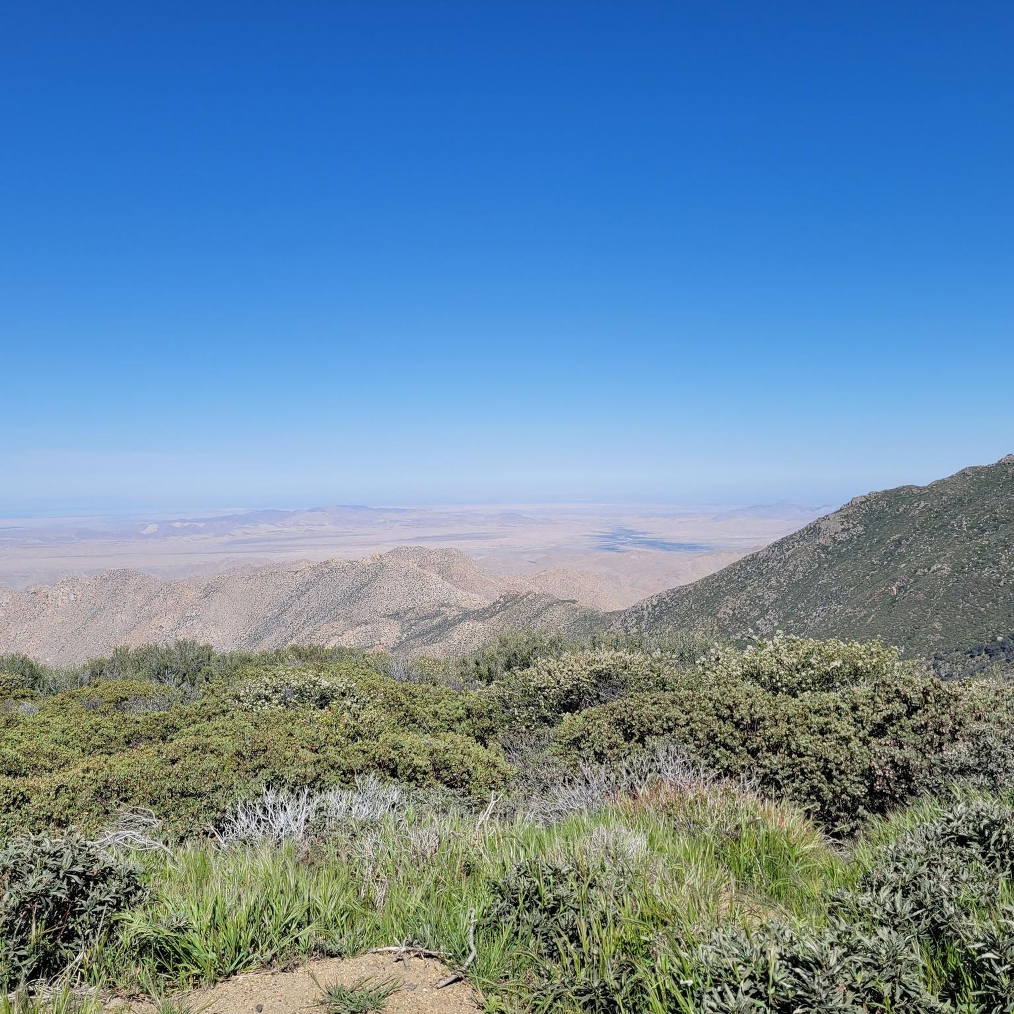
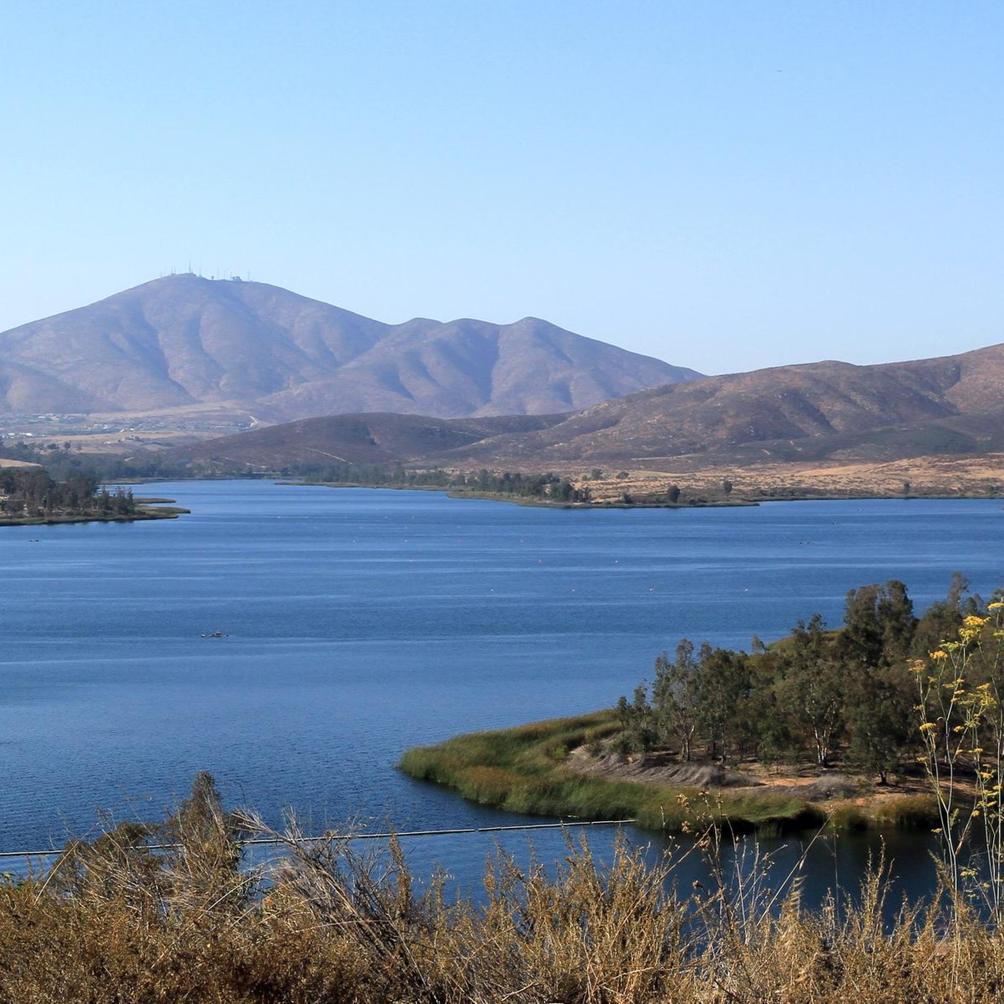
Hiking in the Laguna Mountains offers a diverse landscape characterized by a transition from forested alpine environments to the Anza-Borrego Desert. Elevations range between 4,000 and 6,400 feet, providing varied terrain from open pine and oak woodlands to dense forests and expansive meadows. The region features significant peaks like Garnet Peak and Monument Peak, offering panoramic views of the surrounding forest and desert.
Best hiking trails in the Laguna Mountains
- The most popular hiking route is Sunset and Big Laguna Trail Loop, a 8.3 miles (13.3 km) trail that takes 3 hours 37 minutes to complete. This moderate route is known for its diverse landscapes, including meadows and pine forests.
- Another top favourite among local hikers is Garnet Peak via PCT, an easy 4.1 miles (6.7 km) path. This trail leads to Garnet Peak, offering expansive views of the Anza-Borrego Desert.
- Local hikers also love the Big Laguna Lake Loop, a 5.1 miles (8.2 km) trail leading through varied forest and near the lake, often completed in about 2 hours 12 minutes.
- Hiking in the Laguna Mountains is defined by mountain to desert transitions, diverse forests, and expansive meadows. The network offers options for different ability levels, from easy strolls to challenging long-distance treks.
- The routes in Laguna Mountains are highly rated by the komoot community with an average score of 4.7 stars from over 120 reviews. More than 1400 hikers have used komoot to explore Laguna Mountains's varied terrain.
Last updated: October 11, 2026
5.0
(2)
58
hikers
29.4km
08:08
410m
730m
The Laguna Mountain Ridge via the PCT offers a diverse and rewarding hiking experience, showcasing the dramatic eastern escarpment of the Laguna Mountains. You'll traverse varied terrain from chaparral to pine forests, with nearly continuous, expansive views over the Anza-Borrego Desert. On clear days, you might even spot the Salton Sea from viewpoints like Storm Canyon Overlook, making this a visually rich and engaging route.
This difficult 18.2-mile (29.4 km) hike involves 1353 feet (412 metres) of elevation gain and typically takes around 8 hours and 8 minutes. Access is convenient via the Sunrise Scenic Byway, which runs parallel to the trail. Be aware that strong winds can add to the challenge, and snow is possible in winter and early spring at these higher elevations, so check conditions before you go.
What makes this section of the PCT truly notable are the stunning, high-elevation desert views, often described as 'Kodachrome gold and pink' at sunrise. It's considered one of the most accessible and rewarding parts of the Pacific Crest Trail in Southern California, offering a taste of long-distance hiking with the convenience of multiple entry points. Keep an eye out for local wildlife, including hawks and rabbits, as you explore this unique landscape.
5.0
(5)
53
hikers
6.67km
01:58
190m
190m
The Garnet Peak via PCT trail offers a taste of the famous Pacific Crest Trail before a dramatic ascent to a commanding summit. You'll start on a gentle, rolling path through recovering montane chaparral, with scattered Coulter pines and black oaks, enjoying the quiet of the Laguna Mountains. The real challenge and reward come with the final push to Garnet Peak, where the path becomes steep and rocky, demanding some bouldering. From the top, sweeping views stretch across the Anza-Borrego Desert floor and beyond, making the 4.1-mile (6.7 km) journey, with its 619 feet (189 metres) of elevation gain, feel incredibly worthwhile for an easy hike that takes just under 2 hours.
Access the trail from trailheads like Penny Pines, which provides ample parking. This route is particularly popular for sunrise views, so consider an early start to experience the desert light show. Remember to watch out for 'poodle dog bush' near the summit, as it can cause skin irritation similar to poison oak.
This trail is a local favorite for its accessible beauty, providing some of San Diego County's most spectacular panoramic views from around 6,000 feet elevation. It's a fantastic way to experience a segment of the PCT without committing to a long-distance trek, and on clear days, you might even spot Arizona in the distance.

4.0
(2)
45
hikers
13.9km
03:53
110m
580m
The Pacific Crest Trail: Thing Valley to Boulder Oaks offers a fascinating journey through Southern California's diverse backcountry. You'll traverse varied terrain, starting in chaparral and scrub oak before ascending into beautiful pine forests, a striking contrast that makes this section unique. The path winds through areas with large granite boulders and offers expansive views into canyons like Fred Canyon, providing a true taste of the region's natural beauty.
This moderate hike covers 8.6 miles (13.9 km) with a manageable 348 feet (106 metres) of elevation gain, typically taking around 3 hours and 52 minutes. Due to the desert environment, be prepared for potential heat and limited shade, especially if hiking after 9 AM. Water sources are scarce, so carrying ample water is essential for a comfortable and safe experience.
This segment is part of the larger Pacific Crest Trail Section A in San Diego County, known for its transition from desert scrub to mountainous pines. It provides an unexpected glimpse into San Diego's higher elevations, comparable to areas like Lake Tahoe. Hikers often appreciate the serenity and the opportunity to experience the unique flora and geology of this part of the PCT.
19
hikers
13.3km
03:38
210m
200m
Embark on the Sunset and Big Laguna Trail Loop, a moderate hike spanning 8.3 miles (13.3 km) with an elevation gain of 685 feet (209 metres), typically completed in 3 hours and 38 minutes. You'll journey through the diverse landscapes of Cleveland National Forest, transitioning from dense pine forests offering west-facing views to open meadows surrounding Big Laguna Lake. Experience the tranquility of the "Water of the Woods" and keep an eye out for distant views of Cuyamaca Peak or even the Pacific Ocean on clear days. The route offers a varied and engaging outdoor experience.
When planning your visit, you have a couple of parking options. You can park for free at the Penny Pines / Noble Canyon trailhead. Alternatively, paid parking is available at the Meadows trailhead along the S1 highway. If you plan to bring your canine companion, dogs are welcome on the trail, but remember to keep them on a leash at all times to ensure everyone's safety and enjoyment.
This trail stands out for its rich tapestry of landscapes within the Cleveland National Forest. You will encounter a dynamic environment, from the shade of towering pine trees to the wide-open spaces around Big Laguna Lake. The route's ability to offer glimpses of both Cuyamaca Peak and the distant Pacific Ocean on clear days highlights its unique position and varied vistas. It's a great way to experience the natural beauty of the region.
5.0
(2)
18
hikers
9.59km
02:36
140m
120m
Embark on the Sunset Trail and Big Laguna Trail Loop, a moderate hike spanning 6.0 miles (9.6 km) with an elevation gain of 450 feet (137 metres), typically taking you around 2 hours and 35 minutes to complete. As you hike, you will experience diverse landscapes, moving through expansive meadows and dense pine forests, featuring Jeffrey and yellow pines alongside California black and Englemann's oaks. A highlight of the route is Big Laguna Lake, where you might spot water lilies and ducks, especially during spring and early summer. The trail also offers lovely west-facing views from its ridges, perfect for catching a sunset, and on clear days, you might even glimpse the Pacific Ocean in the distance.
To begin your adventure, the Meadows Information Kiosk trailhead serves as a common starting point for this loop. The trail is accessible throughout the year, making it a flexible option for your outdoor plans. If you plan to bring your canine companion, leashed dogs are permitted on the route, making it a great choice for a family outing. No specific permits or fees are required to enjoy this area, allowing for straightforward access.
This loop offers a varied experience within the Laguna Mountains, nestled within the Cleveland National Forest. The combination of open meadows and shaded woodlands provides a dynamic environment for your hike. The presence of Big Laguna Lake adds a unique ecological feature, supporting local wildlife and flora. The trail's design ensures you encounter different aspects of the mountain landscape, from serene lakeside views to panoramic vistas, making it a notable option for exploring the region's natural beauty.
3.0
(1)
17
hikers
8.24km
02:11
100m
70m
Embark on the Big Laguna Lake Loop, a moderate hiking route spanning 5.1 miles (8.2 km) with an elevation gain of 315 feet (96 metres). You can expect to complete this journey in about 2 hours and 11 minutes, immersing yourself in varied scenery. As you hike, you will pass through serene open meadows and tranquil pine and oak forests, offering picturesque views of Big Laguna Lake, especially around the Laguna Meadow area. The trail provides a refreshing escape into nature, with a gentle challenge suitable for many.
When planning your visit, know that the Big Laguna Lake Loop is generally accessible year-round. You will find several parking areas conveniently located along Sunrise Highway. Be aware that some parking options may require a National Forest Adventure Pass, so it is wise to check beforehand. If you bring your dog, remember that they are welcome but must be kept on a leash throughout the trail.
This route is nestled within the Cleveland National Forest, offering more than just a walk; it is a chance to experience the region's natural beauty. From higher vantage points, you might catch glimpses of San Diego County's highest peaks, such as Cuyamaca Peak, and enjoy panoramic views stretching into the desert. In wetter seasons, keep an eye out for the ponds at
5.0
(2)
17
hikers
7.28km
02:04
170m
160m
The Red-Tailed Roost and Agua Dulce Trail Loop offers a refreshing escape into varied terrain, guiding you through dense woodlands and open meadows near San Diego. You'll find yourself immersed in a distinct forest atmosphere within Agua Dulce Canyon, characterized by towering black oaks and incense cedars, with expansive views of the Laguna Mountains. This moderate 4.5-mile (7.3 km) hike, featuring 544 feet (166 metres) of elevation gain, typically takes about 2 hours and 4 minutes, making it a perfect half-day adventure for nature lovers.
Starting at the Red-Tailed Roost Trailhead, parking is readily available. While generally moderate, be mindful that the elevation can feel more challenging in certain sections, especially if you tackle the loop clockwise. The trail is dog-friendly and particularly beautiful in winter when it transforms into a snowy landscape, though icy conditions can occur in wooded areas, so check conditions before you go.
This route is well-regarded for its peaceful, forest-like vibe and is a popular spot for birdwatching, with sightings of red-tailed hawks, acorn woodpeckers, and mountain chickadees. It's also part of the larger Big Laguna Trail complex, providing opportunities to connect with other routes for extended hiking. The diverse scenery and abundant wildlife make it a notable choice among the popular trails in the Cleveland National Forest.
18
hikers
7.11km
02:08
160m
390m
Embark on the Hauser Canyon Trail, a moderate hike spanning 4.4 miles (7.1 km) with a total elevation gain of 522 feet (159 metres). You can expect to complete this journey in about 2 hours and 8 minutes, moving through diverse scenery. As you hike, you will encounter everything from lush vegetation to rocky sections, with the ancient volcanic formation of Morena Butte often providing a dramatic backdrop. Look for vibrant wildflowers like California poppies and lupines in spring, adding splashes of color to the oak woodlands and chaparral.
To plan your visit, the trailhead is conveniently located near the entrance of Lake Morena County Park, where ample parking is available. Be aware that an Adventure Pass is generally required for parking within the Cleveland National Forest area. For your convenience, restrooms and picnic tables are also accessible nearby at the park, though a small entry fee applies for park access. It is always a good idea to check local conditions before heading out.
This trail offers a unique opportunity to experience the region's natural beauty without extreme challenges. It borders the Hauser Wilderness, providing expansive, remote views that stretch for miles across the landscape. The route showcases a blend of ecosystems, making it a great choice for those who appreciate varied terrain and the quiet solitude of the wilderness. It stands out as a gateway to the broader natural environment of the area.
14
hikers
9.52km
02:39
190m
150m
Embark on the PCT: Lake Morena to Boulder Oaks, a moderate hiking route that covers 5.9 miles (9.5 km) with an elevation gain of 610 feet (186 metres). You can expect to complete this section in about 2 hours and 38 minutes. The trail guides you through diverse terrain, featuring rocky paths, areas of loose sand, and gentle slopes, all while surrounded by dense chaparral and scrub oak. You will experience a significant descent into and climb out of Hauser Canyon, catching distant views of Lake Morena and passing under Interstate 8 near Boulder Oaks.
When planning your visit, be aware that this section is part of the Pacific Crest Trail's Section A, often serving as an early experience for thru-hikers. Both Lake Morena and Boulder Oaks provide important amenities for hikers. Boulder Oaks Campground, in particular, offers water spigots and restrooms. Given the desert environment, be prepared for potential water scarcity, especially if you are hiking during the summer months.
This segment of the Pacific Crest Trail offers a glimpse into the Cleveland National Forest's unique landscape. You will encounter the natural monument known as the Stone arch along the way, adding a distinctive feature to your hike. The route's passage underneath Interstate 8 near Boulder Oaks also provides a memorable and unusual landmark, highlighting the trail's journey through varied environments.
8
hikers
14.3km
04:20
480m
480m
The Mother Miguel Mountain and Sweetwater Reservoir Loop offers a moderate hiking experience with varied terrain. You will cover 8.9 miles (14.3 km) and ascend 1574 feet (480 metres), which typically takes around 4 hours and 19 minutes to complete. As you hike, you'll pass through rolling hills dotted with sagebrush and wild grasses. The route provides views of the Sweetwater Reservoir in its lower sections, gradually opening up to broader vistas as you climb. Reaching the Mother Miguel Mountain Summit Rockhouse marks a key point on your journey.
Before you set out, be aware that this trail involves significant elevation changes and some rocky, eroded sections. Wearing strong hiking footwear is highly recommended to navigate the varied ground comfortably. Parking is generally available near Mt. San Miguel Park, which can also provide access to restrooms and water fountains. Pay close attention to your route, as some portions of the trail may not always be clearly marked.
This loop takes you through the San Diego National Wildlife Refuge, offering a chance to experience the region's natural landscape. From higher elevations, you can enjoy expansive views that stretch across the San Diego area. On clear days, you might even spot distant landmarks like downtown San Diego, Point Loma, and parts of Mexico. The trail provides a rewarding workout with these far-reaching scenic rewards.
Get access to more routes and recommendations from other explorers.
Already have an account?
Our route recommendations are based on thousands of hikes, rides, and runs completed by other people on komoot.
Start today with a free account
Your next adventure awaits.
Popular around Laguna Mountains




Tips from the Community

Route 894 runs from the state park entrance to Campo. If you're planning a day trip on the PCT, you can park your car here at the end of the day. The parking fee is $5.
4
0
During our visit in May 2025, the creek was empty. Reportedly, there had been a little water flowing two days earlier. However, it seems unlikely that you'll find water here. So, plan your first day so you can walk as far as Lake Morena, just in case.
3
0


There is a very small site where you can squeeze your sleeping pad for a night under the stars. Some stacked rocks provide a little shelter from the wind. The view is exceptionally good.
3
0
The Pacific Crest Trail (PCT) leads along the Burnt Rancheria Campground. There are several loops of campsites and each site is equipped with a table and a campfire ring. You can reserve a site via http://www.recreation.gov for $35/Night for single unit. To get to Mount Laguna from the PCT, a popular place to eat and resupply, you can walk across the campground.
3
0
At this junction, the Pacific Crest Trail crosses the Thing Valley Road and Morris Ranch Road. The Star Party Trail – that leads to the Mount Laguna Observatory operated by the San Diego State University Department of Astronomy – branches off the PCT.
3
0
Just off the Pacific Crest Trail, there are some flat open spots to rest or pitch tents. There might be water in Long Canyon Creek.
3
0
Next to some old trees, there is enough room for at least five tents. There is some shade and maybe water in Long Canyon Creek. It is also a nice spot to rest.
3
0
Frequently Asked Questions
How many hiking trails are available in the Laguna Mountains?
The Laguna Mountains offer a wide variety of hiking experiences, with over 130 routes documented on komoot. These range from easy strolls to challenging long-distance treks, catering to all skill levels.
Are there easy hiking options suitable for families or beginners?
Yes, the Laguna Mountains feature many accessible trails. There are 43 easy routes, perfect for families or those seeking a relaxed walk. A great option is the Garnet Peak Trail to Garnet Peak, an easy 2.3-mile path offering expansive desert views. Another gentle choice is the Oakoasis loop, which is just over 3 miles and winds through pleasant oak woodlands.
What kind of views can I expect on the trails?
The Laguna Mountains are renowned for their dramatic scenery, offering a unique transition from forested alpine environments to the Anza-Borrego Desert. Many trails provide panoramic views that can stretch across the desert and even to the Salton Sea on clear days. Significant peaks like Garnet Peak and Monument Peak, along with overlooks such as Kwaaymii Point, offer breathtaking vistas of the surrounding forest and desert below. You can experience some of these views on the Stonewall Peak Trail Loop.
Are there any trails with waterfalls in the Laguna Mountains?
Yes, you can find trails that lead to beautiful waterfalls. The Green Valley Falls Loop – Cuyamaca Rancho State Park is a popular 4-mile trail that takes you through varied forest and near waterfalls. Another notable waterfall is Cedar Creek Falls, which can be accessed via the Cedar Creek Falls Trail.
Are there any challenging hikes for experienced trekkers?
Absolutely. For those seeking a more strenuous adventure, the Laguna Mountains offer 12 difficult routes. A notable challenging option is the El Cajon Mountain Trail — El Capitan County Preserve, which features significant elevation gain over its 11.6-mile length. Another demanding route is the Cuyamaca and Japacha Peak Loop, covering over 11 miles with substantial ascent.
What is the best time of year to go hiking in the Laguna Mountains?
Thanks to its higher elevation, the Laguna Mountains tend to have cooler temperatures year-round, making it an enjoyable destination in any season. Spring brings an abundance of wildflowers, while fall offers vibrant foliage. During winter, the area can receive snow, providing a unique hiking experience. Always check current weather and trail conditions before heading out.
Are there any circular hiking routes in the area?
Yes, many trails in the Laguna Mountains are designed as loops, allowing you to start and end at the same point without retracing your steps. The Big Laguna Trail loop — Cleveland National Forest is a popular moderate 10.1-mile circular route known for its diverse landscapes. Another excellent loop is the Cuyamaca Peak loop, offering a moderate 7.4-mile journey.
What are some interesting natural features or landmarks to look out for?
Beyond the stunning mountain-to-desert transition, the Laguna Mountains are home to diverse forests, expansive meadows like Laguna Meadow, and unique flora and fauna. You can visit Stonewall Peak for panoramic views or explore Mother Miguel Mountain Summit Rockhouse. The area is also part of the famous Pacific Crest Trail, offering a chance to experience a segment of this renowned national scenic trail.
Is public transport available to access the hiking trails?
Public transport options directly to the trailheads in the Laguna Mountains are limited. Most visitors access the area by car. The Laguna Mountain Visitor Center, located on Sunrise Highway, is a good resource for maps and information, but reaching it typically requires private transportation.
What do other hikers enjoy most about hiking in the Laguna Mountains?
The area is highly rated by the komoot community, with an average score of 4.7 stars from over 120 reviews. Reviewers often praise the diverse landscapes, from pine forests to desert vistas, and the well-maintained trails. The opportunity to experience the dramatic mountain-to-desert transition and the peaceful natural environment are frequently highlighted as favorite aspects.
Are dogs allowed on the hiking trails in the Laguna Mountains?
Many trails within the Cleveland National Forest and specific state parks in the Laguna Mountains are dog-friendly, usually requiring dogs to be on a leash. However, regulations can vary by specific trail or park area, so it's always best to check the local rules for the particular route you plan to hike. For example, the Rock House Trail to Mother Miguel Mountain is a moderate option where dogs are generally welcome.
Most popular routes in the Laguna Mountains
Most popular attractions in the Laguna Mountains

Get inspired with the komoot mobile app


Explore more
Browse the best Hikes in other regions.
