Top 2 Natural Monuments around Weinfelder Maar
Best natural monuments around Weinfelder Maar include a volcanic crater lake, formed by a steam explosion approximately 20,000 to 30,000 years ago. This maar is the youngest, deepest, and highest-lying of the three Daun Maars, situated at 487 meters above sea level. The lake itself is 51 meters deep and measures between 396 to 429 meters in diameter. The area is a protected nature reserve, known for its unique flora and fauna, and features historical landmarks like the St. Martin…
Last updated: October 14, 2026
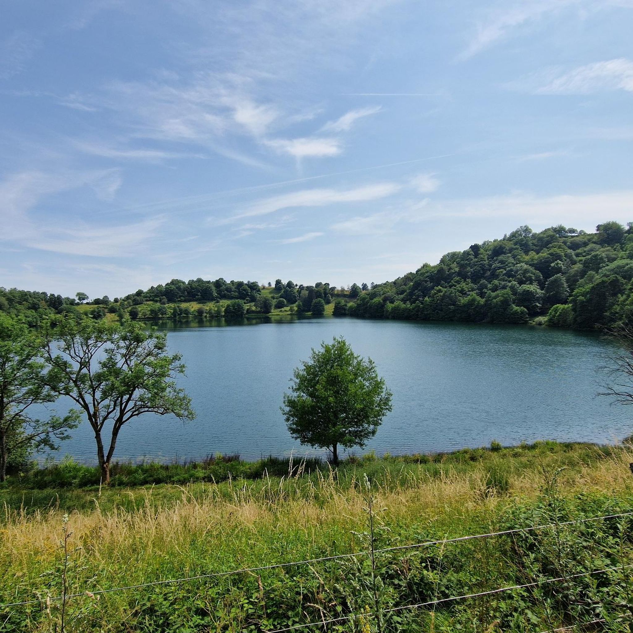
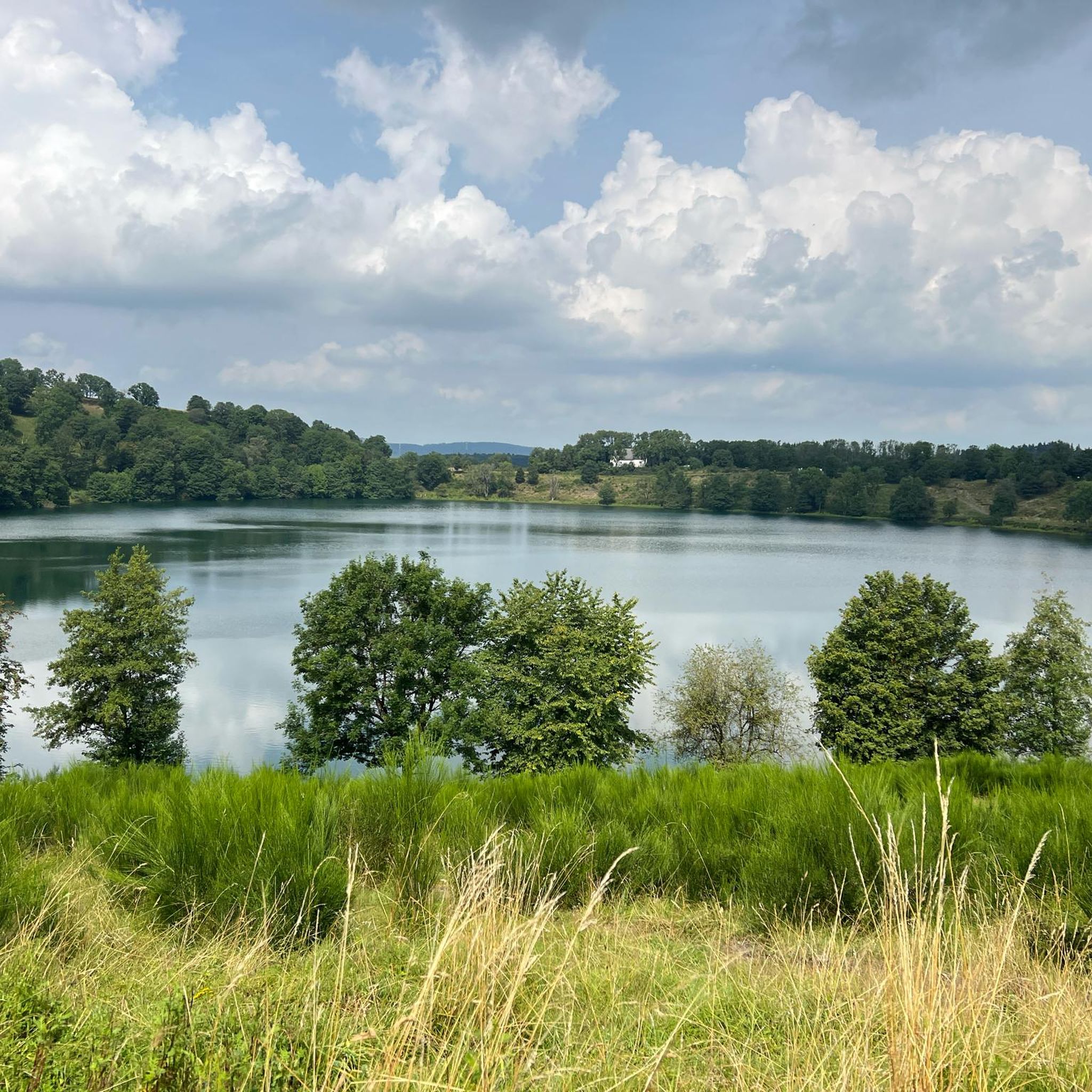
View of the Weinfelder Maar (Totenmaar)
Highlight • Lake
Translated by Google •
Tip by

View of the Weinfelder Maar
Highlight • Viewpoint
Translated by Google •
Tip by

Sign up now to discover places like this
Get recommendations on the best single tracks, peaks, & plenty of other exciting outdoor places.
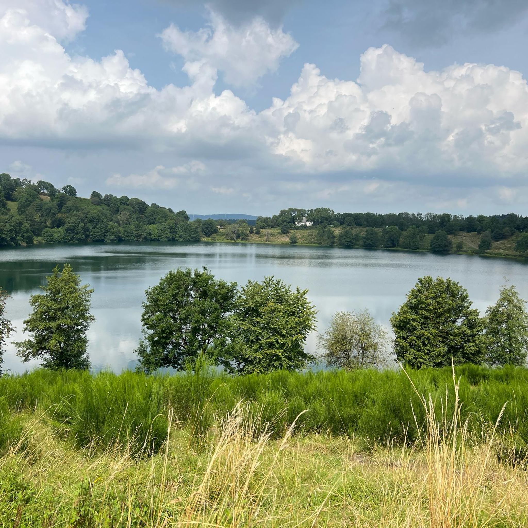
Lake of the Dead
Highlight • Lake
Showing Translation
Tip by

View of the Weinfelder Maar and the Weinfelder Chapel
Highlight • Viewpoint
Translated by Google •
Tip by

View of the Gemündener Maar from the Dronketurm
Highlight • Viewpoint
Translated by Google •
Tip by
Start today with a free account
Your next adventure awaits.
Tips from the Community

Numerous legends surround the quiet Totenmaar. According to one legend, a castle once stood at this spot, inhabited by a benevolent count with his servants, his hard-hearted wife, and their only child. One day, the count returned home from the hunt and found only a lake where his castle had stood. It had sunk into the earth with all its inhabitants, leaving behind a lake, the Totenmaar. As if by a miracle, a cradle appeared on the surface, in which his child drifted safely to shore. The count's horse dug out a spring from the ground during an exclamation by its master. The count later built a chapel out of gratitude for his child's rescue, which, like the spring, is still preserved today. Das Weinfelder Maar 1878 (Die Gartenlaube) The Eifel painter Richard Franzen from Mehren dedicated the following poem to this maar: Droben steht noch die Kapelle, hier im schönen Eifelland, wo vor ein paar hundert Jahren einst das Dörfchen Weinfeld stand. Pest und Armut, schlechte Zeiten, zwang die Menschen in der Not, ihre Heimstatt zu verlassen, letzter Zug im Abendrot. Doch nach Weinfeld kehren wieder Stille Schläfer Jahr für Jahr, um für immer auszuruhen auf dem Berg am Totenmaar
0
0

at this point now well hidden behind trees
1
0

The Daun Maars - 10,000-Year-Old Volcanic Lakes The Daun Maars were formed around 10,000 years ago from volcanic steam explosions. Hot lava rises from the Earth's interior and meets water, which suddenly evaporates. This blasts away entire mountain peaks. What remains is a deep crater that fills with water over the years and a wall of boulders surrounding the lake. The Daun Maars include the Gemünden Maar, the Weinfelder Maar, and the Schalkenmehrener Doppelmaar. One crater of the Schalkenmehren Maar has silted up over the millennia. The area is a nature reserve and a refuge for waterfowl and rare dragonfly species. Text / Source: deutschland-outdoor.der https://deutschland-outdoor.de/eifel/dauner-maare
13
0
Weinfelder Maar The Weinfelder Maar, formed by volcanic activity around 20,000 to 30,000 years ago, is the highest of the three Daun Maars at 487 meters above sea level. The lake is 51 meters deep and has a diameter of 396 to 429 meters. An almost melancholic atmosphere surrounds the maar. Many legends surround the tranquil Eifel eye. A castle is said to have once stood on the site of the crater, where a count lived with his wife and only child. After returning home from a hunt, the castle had sunk as punishment for the woman's nastiness, and he found only a lake where a cradle miraculously floated his child safely to the shore. If you look at the dark surface of the water long enough, it is said that you can make out the outline of the castle. The German landscape painter Fritz von Wille was so fascinated by the Weinfelder Maar that he repeatedly immortalized it in his paintings. Among his favorite motifs was the small chapel on the north bank, dedicated to Saint Martin. It was once the parish church of the village of Weinfeld, which was ravaged by the plague in the 16th century. Anyone who rings the bells inside by pulling the ropes can make a wish. To this day, the associated cemetery is maintained and used by the local community of Schalkenmehren. This is also where its second name, Totenmaar, comes from. Donkeys and goats have been introduced to the Weinfelder Maar to regulate vegetation. The maar's unique flora and fauna are protected. Swimming and other water sports are prohibited in the Weinfelder Maar, but a nearly two-kilometer-long path makes it a wonderful place to explore on foot. Parking: Guests can park along the L64 either in the parking lot at the Weinfelder Maar or on the Maarsattel between the Weinfelder Maar and the Schalkenmehrener Maar. Text / Source: GesundLand Vulkaneifel GmbH, Leopoldstr. 9 A, 54550 Daun https://www.eifel.info/a-weinfelder-maar
15
0

From the Dronketurm you have a beautiful panoramic view
0
0

On the circular path around the Weinfelder Maar you will repeatedly have fantastic views of the almost circular maar and of the Weinfelder Chapel, which is located a little above and looks down on the maar. A postcard idyll!
0
0

Great view over the Eifel and the Dauner Maare.
0
0

It is best to connect all three maars on one hike
1
0
Frequently Asked Questions
What are the main natural features to explore around Weinfelder Maar?
The central feature is the Weinfelder Maar lake itself, also known as Totenmaar, a volcanic crater lake. You can walk a nearly two-kilometer path encircling the lake. Other notable features include the Mäuseberg and Maarkreuz, which are elevated points along the embankment, and the Pilatusfelsen, a rock formation made of black lava lumps.
Are there historical or cultural sites near the Weinfelder Maar?
Yes, the St. Martin Chapel is a significant historical landmark located on the north bank of the maar. It was once the parish church of the abandoned village of Weinfeld. The chapel and its cemetery are still maintained and used by the local community, contributing to the maar's alternative name, Totenmaar. Visitors can ring the bells inside the chapel.
What kind of hiking trails can I find around Weinfelder Maar?
The area offers a variety of hiking trails, including a nearly two-kilometer-long path directly around the Weinfelder Maar. For longer excursions, you can explore routes like the "Dronke Tower on the Mäuseberg – Schalkenmehrener Maar loop" or the "Volcano Trail." Many trails offer views of the maar and the surrounding Eifel landscape. You can find more details on routes in the Hikes from bus stations around Weinfelder Maar guide.
Is the Weinfelder Maar area suitable for families with children?
Yes, the area is family-friendly. The circular path around the Weinfelder Maar is suitable for walks, and children might enjoy seeing the donkeys and goats that act as "natural lawnmowers" around the lake. There are also specific family-friendly hikes available, such as the "Weinfelder Maar viewpoint – Path along the Weinfelder Maar loop from Schalkenmehren" which is an easy route.
What is the best time of year to visit Weinfelder Maar?
The Weinfelder Maar is beautiful year-round. Spring and autumn offer pleasant temperatures for hiking and vibrant natural colors. Summer is ideal for enjoying the outdoors, though swimming in the maar is prohibited to protect its unique ecosystem. Winter can offer a tranquil, almost melancholic atmosphere, especially around the Totenmaar.
Are there any specific viewpoints offering panoramic views of the Weinfelder Maar?
Absolutely. The Dronke Tower, located on the edge of the maar, provides wonderful panoramic views over the Eifel landscape and the maar itself. Additionally, the Pilatusfelsen, with its summit cross, offers good views of the maar from a different perspective.
Where can I park when visiting the Weinfelder Maar?
Guests can park along the L64. There is a dedicated parking lot at the Weinfelder Maar or on the Maarsattel, which is situated between the Weinfelder Maar and the Schalkenmehrener Maar.
What makes the Weinfelder Maar geologically significant?
The Weinfelder Maar is a significant geological site, formed by a volcanic steam explosion approximately 20,000 to 30,000 years ago. It is the youngest, deepest, and highest-lying of the three Daun Maars, situated at 487 meters above sea level. The partially coarse-grained lava paths around the lake serve as a constant reminder of its spectacular volcanic origin and the Earth's explosive history.
Are there any unique local initiatives or animals to see around the Maar?
Yes, donkeys and goats have been introduced around the Weinfelder Maar. They act as "natural lawnmowers" to help regulate vegetation and contribute to the unique character of the landscape. They are often tame and can be petted, adding a charming element to your visit.
What outdoor activities, besides hiking, are available near Weinfelder Maar?
While hiking is very popular, the region also offers opportunities for cycling. You can find traffic-free bike rides around the area, such as the "View of the Schalkenmehrener Maar – Weinfelder Maar viewpoint loop from Daun." Explore more options in the Traffic-free bike rides around Weinfelder Maar guide.
Do I need a permit to hike or visit the natural monuments around Weinfelder Maar?
Generally, no specific permits are required to hike or visit the natural monuments around Weinfelder Maar. The area around the lake is a nature reserve, and while access is open, visitors are asked to respect the protected unique flora and fauna. Swimming and water sports are prohibited in the maar itself.
Are there facilities like cafes or accommodation nearby?
While the immediate vicinity of the Weinfelder Maar is primarily natural and protected, the nearby town of Daun and surrounding villages like Schalkenmehren offer various amenities including cafes, restaurants, and accommodation options for visitors.
Most popular routes around Weinfelder Maar
Most popular attractions around Weinfelder Maar

Get inspired with the komoot mobile app


Explore more
Extend your search for the best caves by checking out these guides of the top ones around Weinfelder Maar:
