Top 20 Natural Monuments around Sant Vicenç De Montalt
Best natural monuments around Sant Vicenç De Montalt offer a diverse landscape where coastal beauty meets mountainous terrain. The region is situated between the Mediterranean Sea and the foothills of the Serra del Corredor, providing a rich setting for outdoor activities. Visitors can explore various natural features, including peaks, rock formations, and forested parks. The area is characterized by its blend of geological interest and scenic views.
Best natural monuments around Sant Vicenç De Montalt
- The most popular natural monuments…
Last updated: July 15, 2026
Dolmen de Pedra Gentil
Highlight • Historical Site
Translated by Google •
Tip by

Dolmen de Ca l'Arenes
Highlight • Historical Site
Translated by Google •
Tip by

Sign up now to discover places like this
Get recommendations on the best single tracks, peaks, & plenty of other exciting outdoor places.
Sign up for free
Montalt
Highlight • Summit
Montalt is a mountain that belongs to the Catalan coastal range, within the Corredor mountain range and the …
Translated by Google •
Tip by

Horseshoe Stone
Highlight • Natural Monument
Translated by Google •
Tip by

Font del Ferro de Cabrera
Highlight • Natural Monument
Translated by Google •
Tip by

Sign up for free to discover even more natural monuments around Sant Vicenç De Montalt.
Sign up for free
Already have an account?
Start today with a free account
Your next adventure awaits.
Login or Signup

Tips from the Community

It's a megalithic tomb, approximately 5,000 years old, discovered in 1997 and restored in 2006-2007. Located in the heart of the Montnegre i el Corredor Natural Park, it's easy to miss, but it has a history: it belonged to a Neolithic community that used it as a collective grave. Interestingly, remains of the tumulus that covered it are still preserved, which is unusual, and its orientation seems related to astronomical events, like other dolmens in the area. It's an archaeological rarity in the middle of a prime cycling area, perfect for stopping and reflecting that humans once walked this path... but without helmets.
2
0

They've now built a staircase to access the Dolmen... With this staircase, just a few meters long... It seems they'll save the site from erosion... Sometimes the conservation and environmental councils are pitiful... It seems the only ones degrading the paths... are hikers and bikers... When we're fed up with seeing how the water destroys the paths to the point where we can't pass... 🙃
0
0
Megalithic structure Rebuilt in 1855, Where the original structure was a 4000 year old DOLMEN, which served As a chamber tomb Simple...🧐
1
0
Also known for the source of Dalt. the water was discovered in 1861 and to bring it closer to the holidaymakers, it was channeled to the source of Pau (Al torrent de la Salut), next to the Hotel Solé and which later (1923 ) was replaced by the current middle font. The Ferro spring became a competitor of the Picant spring and its water, also bicarbonated, carried more iron which was very useful to combat anemia and was administered by the same doctor of the Prats spa, finally at the end of the 19th century he made a simple house that would be replaced by the current one in the 1930s and restored by the Fund Group during the years 1994-1996, after a careful cleaning of the environment and a rehabilitation of the house, it was decide not to do the roof, since the fountain would remain open. Currently the ten is water with natural gas.
7
0

It belongs to the Montnegre Park and almost all the paths can be done either on foot or by bike (the dolmen path is quite broken "stones")
3
0

It is a large granite block located between Turó de Montalt (596 m) and Turó del Mig (550 m), a hill where the municipal limits of Arenys de Munt, Dosrius and Sant Vicenç de Montalt meet. Of the two stones, the smaller one has an engraving that seems to represent a horseshoe, although the meaning is unknown. It could be, for example, a mark to delimit the old parishes. Granite is a hard rock, with a granular texture, which in the Maresme has been used for construction. Fresh granite is known as "snake's eye" as it is made up of a black mica which, in contrast to the other components, is reminiscent of a snake's eye. In this environment and during the next section of the route, we will find small accumulations of granite blocks, disordered, heterometric and rounded, which accumulate in a horizontal or slightly inclined relief. These capricious formations have their origin in weathering. Later, the rainwater dissolves the feldspar and the large initial rock cracks and gives rise to rounded shapes and a kind of sand, called "sauló" in Catalan.
1
0
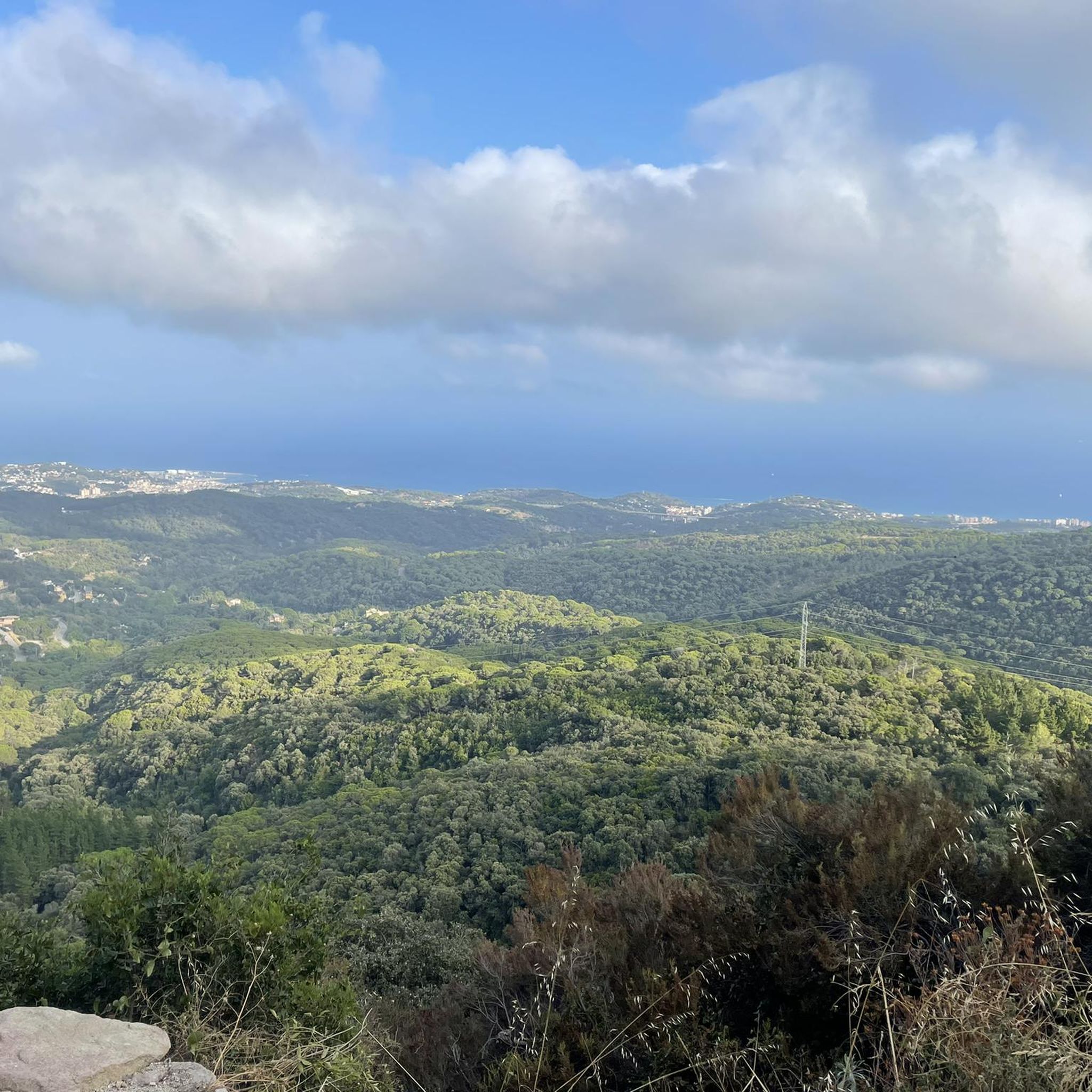
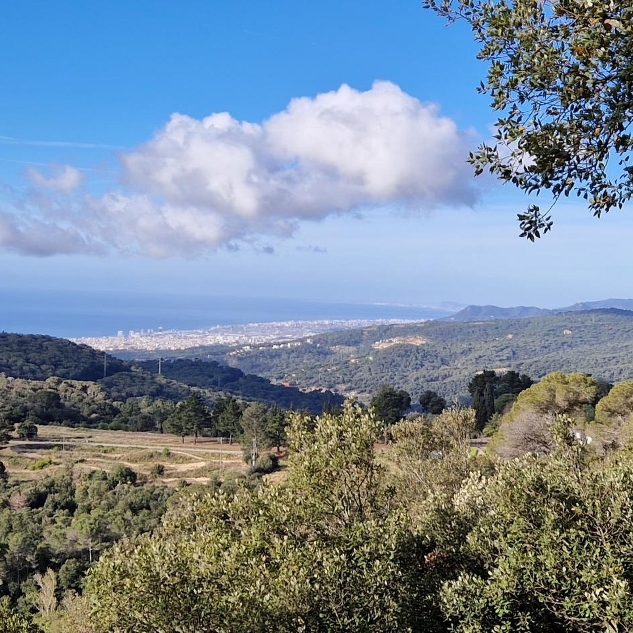
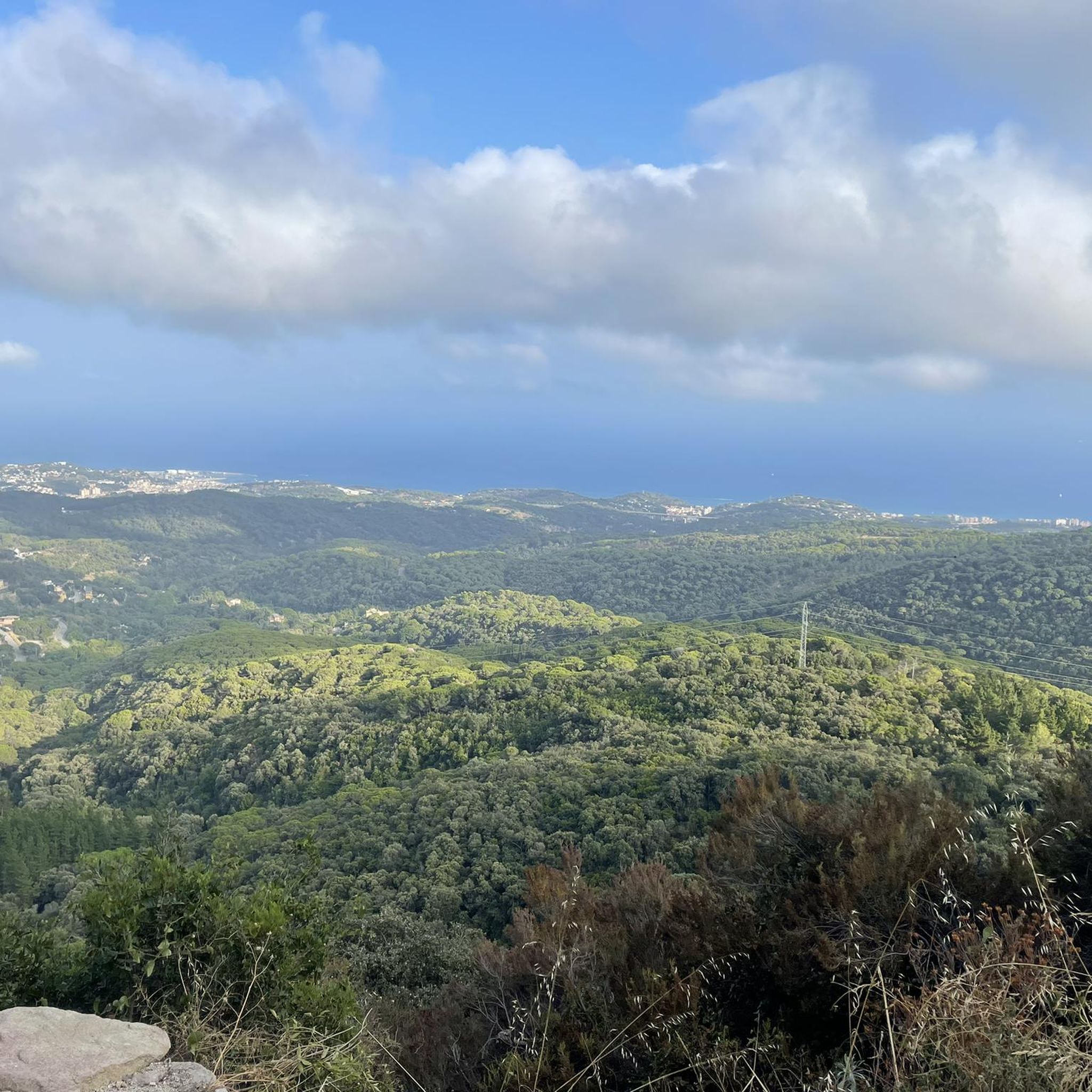
El Montalt is a mountain belonging to the Catalan coastal range, within the Sierra del Corredor and the protected natural area in which it is included. A few kilometers from the coast, the top is surrounded by forest. A common point to face the final meters of ascent is the Coll de la Ferradura, a pass located to the northeast. It is a crossroads of different paths and forest tracks and, from this point, the path to the summit is narrow and has a very steep slope. The northern slope enters completely into the natural park, with different plateaus, other peaks and the Creu de Rupit, an outstanding cross in the middle of the path. To the northeast is the Sanctuary of the Corridor, with a car park and a tourist service office. From this point, through forest tracks, To the south, we find two towns, Sant Andreu de Llavaneres and Sant Vicenç de Montalt, well connected by tracks and paths. In the same way possible starting points for the ascent, to the west is the municipality of Dosrius and its population center of Canyamars, while to the east is the town of Arenys de Munt. On the other hand, the first stage of the Camino del Norte, or GR 83 long-distance path, which begins in the town of Mataró, passes very close, along its northern slope. Its top houses a geodesic vertex and a mailbox, offering magnificent views of the entire Maresme coast.
1
0

In the surroundings of the "Pedra de la Ferradura" we can find small accumulations of granite blocks, disordered, heterometric and rounded, which accumulate in a horizontal or slightly inclined relief. These capricious formations have their origin in weathering. Later, the rainwater dissolves the feldspar and the large initial rock cracks and gives rise to rounded shapes and a kind of sand, called "sauló" in Catalan.
20
0
Frequently Asked Questions
What unique natural features can I explore in Sant Vicenç de Montalt?
Sant Vicenç de Montalt offers a diverse landscape where the mountains meet the sea. You can explore unique geological formations like the Horseshoe Stone, a large granite block with ancient engravings, or the distinctive rock formations at Rocs del Moro. The region is also home to the sulfur-ferruginous-bicarbonate waters of the Font del Ferro de Cabrera.
Are there any historical natural monuments in the area?
Yes, Sant Vicenç de Montalt is notable for its ancient megalithic structures. You can visit the Dolmen de Pedra Gentil, a historical site believed to have been built between 3500 B.C. and 2000 B.C., featuring seven vertical megaliths supporting a large horizontal block. Another significant site is the Dolmen de Ca l'Arenes, a megalithic tomb approximately 5,000 years old, located within the Montnegre Park.
Where can I find the best panoramic views of the coast and mountains?
For breathtaking panoramic views, head to Montalt, a prominent summit within the Catalan coastal range. From its peak, you can enjoy magnificent vistas of the entire Maresme coast and the Montseny mountains. The Doctor Roux Viewpoint also offers stunning sea views after a short hike.
What kind of outdoor activities can I do near these natural monuments?
The region provides excellent opportunities for various outdoor activities. You can enjoy extensive hiking trails, explore mountain biking routes, or go cycling. For detailed routes and guides, check out the hiking guide, MTB trails guide, and cycling guide around Sant Vicenç de Montalt.
Are there family-friendly natural attractions in Sant Vicenç de Montalt?
Yes, the Parc dels Germans Gabrielistes is an excellent family-friendly option. This picturesque park spans four hectares, featuring centenary trees, a small lake with ducks, picnic areas, and a children's play area. It's a tranquil environment perfect for relaxation and enjoying nature with children.
What are some popular hiking routes to natural monuments?
A popular hike is the route to Montalt, which offers diverse Mediterranean forests and rewarding views. Another option is the route to Rocs del Moro, which combines unique geological formations with historical elements. You can find more hiking routes in the hiking guide.
Can I bring my dog to the natural monuments and parks?
Many natural areas and trails in Sant Vicenç de Montalt are dog-friendly, especially those within the larger natural parks like the Serra del Corredor. However, it's always advisable to keep dogs on a leash and check specific park regulations or signage for any restrictions, particularly in protected areas or during certain seasons.
What is the best time of year to visit the natural monuments?
The spring and autumn months are generally ideal for visiting the natural monuments in Sant Vicenç de Montalt. The weather is milder, making hiking and outdoor exploration more comfortable. Spring brings lush greenery and blooming flora, while autumn offers pleasant temperatures and beautiful seasonal colors. Summer can be hot, especially for strenuous hikes, but the coastal proximity provides relief.
Are there any easy-access natural spots for a relaxed visit?
For an easy and relaxed visit, the Parc dels Germans Gabrielistes is highly recommended. It's close to town, offers paved paths, picnic areas, and a serene environment with a lake and historical watchtower. The Parc Forestal also provides picturesque walking trails and beautiful views for a leisurely stroll.
What should I wear for hiking to the natural monuments?
When hiking to the natural monuments, it's best to wear comfortable, layered clothing suitable for varying temperatures. Sturdy hiking shoes with good grip are essential, especially for routes with uneven terrain like those leading to Montalt or Rocs del Moro. Don't forget sun protection, water, and a map or GPS device.
What do visitors enjoy most about the natural monuments in Sant Vicenç de Montalt?
Visitors particularly appreciate the diverse landscapes, from the expansive coastal views to the tranquil forested peaks. The blend of natural beauty with historical elements, such as the ancient dolmens and unique rock formations, offers a rich and engaging experience. The well-maintained trails and opportunities for various outdoor activities are also highly valued.
Are there any circular walks available around the natural monuments?
Yes, there are several circular walks that allow you to experience the natural beauty of the area. For example, a moderate circular route from Sant Vicenç de Montalt leads to Montalt. Another popular option is the loop connecting the Horseshoe Stone and Montalt. You can find more details in the hiking guide.
Most popular routes around Sant Vicenç De Montalt
Most popular attractions around Sant Vicenç De Montalt

Get inspired with the komoot mobile app


Explore more
Extend your search for the best caves by checking out these guides of the top ones around Sant Vicenç De Montalt:
